


How to get from Ketelfontein (KwaZulu-Natal) to Ulundi (KwaZulu-Natal)
Calculate route from Ketelfontein (KwaZulu-Natal, South Africa) to Ulundi (KwaZulu-Natal, South Africa).
The flight distance (as the crow flies) between Ketelfontein and Ulundi is 173.6 km.
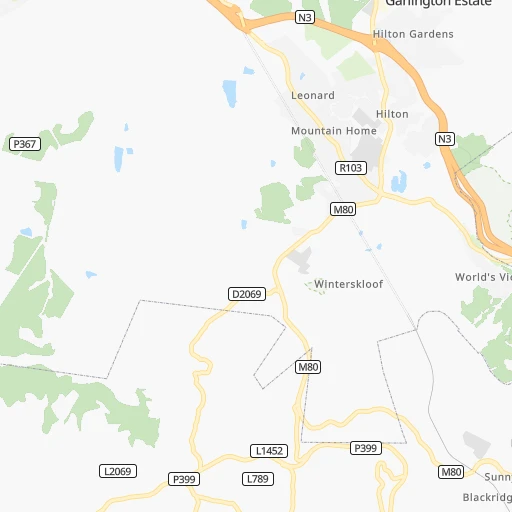
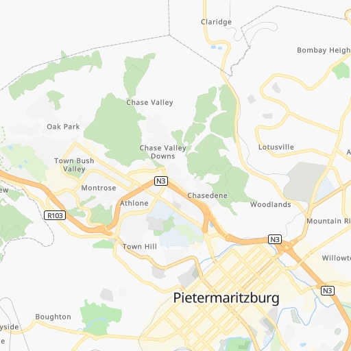
Roadmap (route) to go from Ketelfontein to Ulundi detailed above, you can also see the course layout on the map.
While doing trip Ketelfontein - Ulundi by car, the calculated route ends at a distance , or more straight.
Distance and duration of the route between Ketelfontein and Ulundi
Calculation of distance and route from Ulundi to Ketelfontein :
173.6254.7 km4h12mn
Continue onto N3 0h2mn 2.7 kmKeep left and take M80 toward Hilton 0h1mn 621 mTurn right onto Hilton Avenue 0h0mn 185 mTurn sharp right and take N3 toward Pietermaritzburg 0h9mn 12.7 kmKeep left and take R33, M70 toward Greytown 0h0mn 297 mKeep left and take R33 toward Northdale, Greytown 0h1mn 1.2 kmTurn right onto Bhambatha Road 1h50mn 59.9 kmTurn right onto P160 0h18mn 15.3 kmTurn right onto R74 0h17mn 18.6 kmKeep left 0h0mn 142 mTurn slight left onto P15-1 1h44mn 43.8 kmTurn left onto P50-2 1h41mn 41.3 kmTurn right onto P226 0h26mn 21.3 kmContinue onto R68 0h1mn 1.6 kmTurn left onto P225 0h20mn 10.0 kmTurn left onto P574 0h2mn 1.8 kmTurn sharp left onto R34, R66 0h4mn 7.0 kmTurn right onto R66 0h13mn 14.3 kmTurn right onto D1739 0h2mn 1.4 kmTurn right 0h0mn 156 mTurn left 0h1mn 272 mArrive at destination 0h0mn 0 m
Travel from Ketelfontein (KwaZulu-Natal) to a selection of major cities.
Distances from Ketelfontein to biggest cities in KwaZulu-Natal
Other major cities in country :
- Uitenhage [05], 228,912 inhabitants. 659 km
- Roodepoort [06], 225,000 inhabitants. 449 km
- Paarl [11], 190,000 inhabitants. 1,170 km
- Springs [06], 186,394 inhabitants. 415 km
- Carletonville [06], 182,304 inhabitants. 458 km
- Klerksdorp [10], 178,921 inhabitants. 468 km
- Midrand [06], 173,009 inhabitants. 453 km
- Westonaria [06], 156,831 inhabitants. 447 km
- Middelburg [07], 154,706 inhabitants. 430 km
- Orkney [10], 145,801 inhabitants. 459 km
- Kimberley [08], 142,089 inhabitants. 548 km
- eMbalenhle [07], 141,741 inhabitants. 359 km
- Nigel [06], 140,644 inhabitants. 393 km
- Bhisho [05], 137,287 inhabitants. 456 km
- Randfontein [06], 133,654 inhabitants. 456 km
- Worcester [11], 127,597 inhabitants. 1,125 km
- Rustenburg [10], 124,064 inhabitants. 529 km
- Polokwane [09], 123,749 inhabitants. 636 km
- Potchefstroom [10], 123,669 inhabitants. 448 km
- Virginia [03], 122,502 inhabitants. 374 km
Route from Ulundi to major cities (South Africa).
- Distance Ulundi Cape Town1,384 km
- Distance Ulundi Johannesburg410 km
- Distance Ulundi Soweto420 km
- Distance Ulundi Pretoria431 km
- Distance Ulundi Port Elizabeth835 km
- Distance Ulundi Benoni388 km
- Distance Ulundi Tembisa409 km
- Distance Ulundi East London620 km
- Distance Ulundi Vereeniging391 km
- Distance Ulundi Bloemfontein515 km
- Distance Ulundi Boksburg392 km
- Distance Ulundi Welkom461 km
- Distance Ulundi Krugersdorp439 km
- Distance Ulundi Diepsloot430 km
- Distance Ulundi Randburg420 km
- Distance Ulundi Botshabelo469 km
- Distance Ulundi Brakpan381 km
- Distance Ulundi Witbank349 km
- Distance Ulundi Vanderbijlpark397 km
- Distance Ulundi Centurion422 km
Nearest cities to Ketelfontein :
- Durban, 3,120,282 inhabitants. 76 km
- Pietermaritzburg, 750,845 inhabitants. 9 km
- Vereeniging, 474,681 inhabitants. 399 km
- Newcastle, 404,838 inhabitants. 205 km
- Richards Bay, 252,968 inhabitants. 189 km
- Vanderbijlpark, 246,754 inhabitants. 400 km
- Vryheid, 150,012 inhabitants. 205 km
- Mpumalanga, 140,121 inhabitants. 41 km
- Dundee, 84,413 inhabitants. 156 km
- Piet Retief, 84,349 inhabitants. 289 km
- Phuthaditjhaba, 84,258 inhabitants. 187 km
- Bethlehem, 83,654 inhabitants. 246 km
- Mthatha, 78,663 inhabitants. 269 km
- Sasolburg, 77,016 inhabitants. 392 km
- Standerton, 74,021 inhabitants. 311 km
- Parys, 71,319 inhabitants. 408 km
- KwaDukuza, 59,899 inhabitants. 98 km
- Heilbron, 55,196 inhabitants. 343 km
- Port Shepstone, 52,793 inhabitants. 131 km
- eSikhaleni, 49,265 inhabitants. 172 km
- Balfour, 46,008 inhabitants. 365 km
- Mondlo, 44,922 inhabitants. 181 km
- Volksrust, 43,378 inhabitants. 249 km
- Senekal, 39,584 inhabitants. 297 km
- Harrismith, 35,108 inhabitants. 185 km
- Margate, 34,407 inhabitants. 144 km
- Butterworth, 34,353 inhabitants. 371 km
- Richmond, 32,445 inhabitants. 34 km
- Howick, 28,725 inhabitants. 13 km
- Driefontein, 28,127 inhabitants. 284 km
- Empangeni, 28,093 inhabitants. 178 km
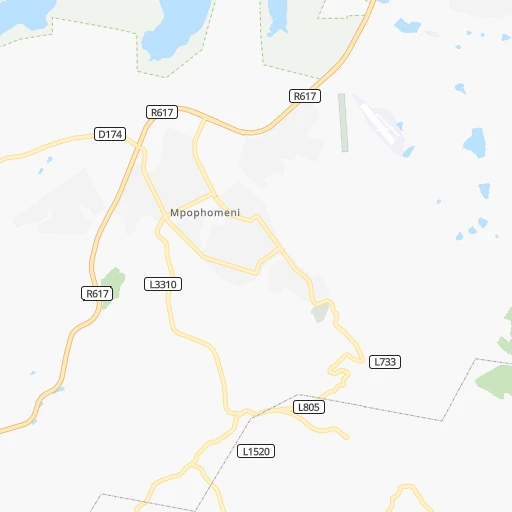
- Mpophomeni, 26,229 inhabitants. 13 km
- Kokstad, 25,373 inhabitants. 139 km
- Scottburgh, 23,949 inhabitants. 91 km
- Ulundi, 20,753 inhabitants. 174 km
- eMkhomazi, 20,410 inhabitants. 85 km
- Ladybrand, 17,228 inhabitants. 280 km
- Ballito, 17,218 inhabitants. 87 km
- Reitz, 16,637 inhabitants. 270 km
- Berea, 15,000 inhabitants. 73 km
- Eshowe, 14,786 inhabitants. 135 km
- Vrede, 14,622 inhabitants. 264 km
- Ekuvukeni, 14,331 inhabitants. 123 km
- Greytown, 13,912 inhabitants. 62 km
- Glencoe, 13,547 inhabitants. 155 km
- Sundumbili, 12,455 inhabitants. 115 km
- Deneysville, 12,397 inhabitants. 369 km
- Clocolan, 12,318 inhabitants. 277 km
- Lindley, 12,000 inhabitants. 301 km
- Elliot, 11,836 inhabitants. 308 km
Location Ketelfontein (KwaZulu-Natal) :
| Country flag |  |
| Location | Ketelfontein |
| State | KwaZulu-Natal |
| County | uMgungundlovu District Municipality |
| Country | South Africa |
| Country code / ISO 2 | ZA |
| Latitude | -29.5666700 |
| Longitude | 30.3166700 |
| Altitude | 0 meters |
| Time zone | Africa/Johannesburg |
Location Ulundi (KwaZulu-Natal) :
| Country flag | |
| Location | Ulundi |
| State | KwaZulu-Natal |
| County | Zululand District Municipality |
| Country | South Africa |
| Country code / ISO 2 | ZA |
| Latitude | -28.3352300 |
| Longitude | 31.4161700 |
| Altitude | 0 meters |
| Time zone | Africa/Johannesburg |