


How to get from Krugersdorp (Gauteng) to Kutloanong (Orange Free State)
Calculate route from Krugersdorp (Gauteng, South Africa) to Kutloanong (Orange Free State, South Africa).
The flight distance (as the crow flies) between Krugersdorp and Kutloanong is 216.6 km.
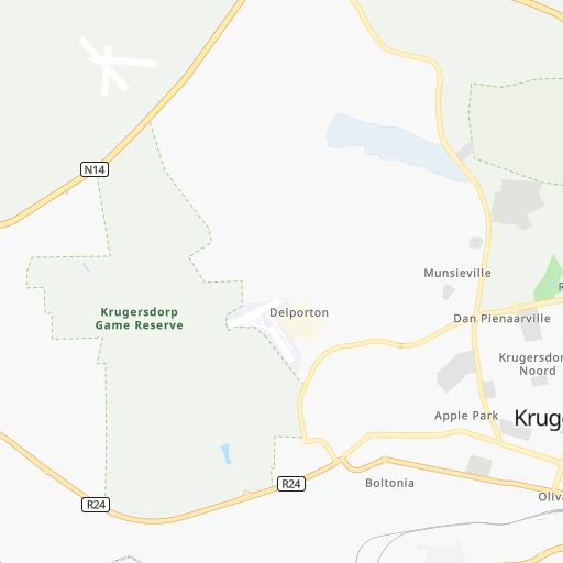
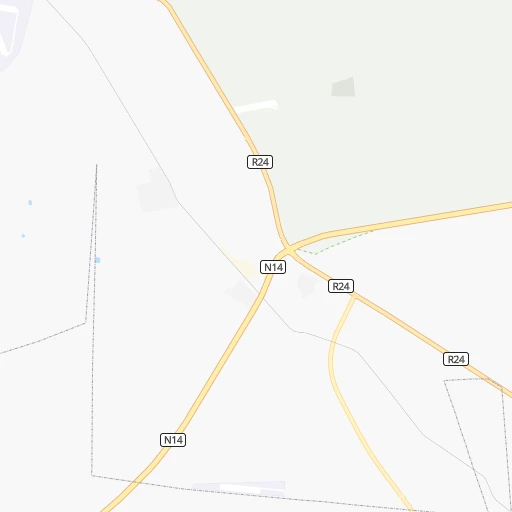
Roadmap (route) to go from Krugersdorp to Kutloanong detailed above, you can also see the course layout on the map.
While doing trip Krugersdorp - Kutloanong by car, the calculated route ends at a distance , or more straight.
Distance and duration of the route between Krugersdorp and Kutloanong
Calculation of distance and route from Kutloanong to Krugersdorp :
216.6255.8 km3h51mn
Continue 0h1mn 422 mTurn slight right onto Barclay Street 0h0mn 208 mKeep right 0h2mn 404 mTurn left 0h0mn 112 mKeep right 0h0mn 44 mTurn right onto Main Reef Road 0h26mn 29.2 kmContinue onto Randfontein Road 0h20mn 26.2 kmTurn right and take R28 toward Randfontein, Sebokeng 1h20mn 143.1 kmKeep right and take R34 toward Odendaalsrus, Welkom 1h32mn 47.9 kmKeep right 0h0mn 158 mContinue onto Athea Road 0h2mn 2.5 kmTurn right 0h4mn 3.4 kmAt roundabout, take exit 2 0h0mn 350 mTurn right 0h3mn 1.3 kmTurn slight left 0h1mn 331 mTurn right 0h0mn 62 mTurn left 0h0mn 187 mArrive at destination 0h0mn 0 m
Travel from Krugersdorp (Orange Free State) to a selection of major cities.
Distances from Krugersdorp to biggest cities in Gauteng
- Alberton,121,536 inhabitants.39 km
- Mabopane,97,417 inhabitants.76 km
- Heidelberg,64,199 inhabitants.73 km
- Edenvale,49,292 inhabitants.38 km
- Ekangala,37,650 inhabitants.108 km
- Bronkhorstspruit,27,343 inhabitants.103 km
- Cullinan,25,490 inhabitants.90 km
- Midstream,25,000 inhabitants.48 km
Other major cities in country :
- Bhisho [05], 137,287 inhabitants. 751 km
- Worcester [11], 127,597 inhabitants. 1,161 km
- Rustenburg [10], 124,064 inhabitants. 72 km
- Polokwane [09], 123,749 inhabitants. 299 km
- Potchefstroom [10], 123,669 inhabitants. 95 km
- Virginia [03], 122,502 inhabitants. 239 km
- Brits [10], 122,497 inhabitants. 53 km
- Nelspruit [07], 110,159 inhabitants. 328 km
- Phalaborwa [09], 109,468 inhabitants. 417 km
- Queenstown [05], 105,309 inhabitants. 650 km
- Kroonstad [03], 103,992 inhabitants. 180 km
- Bethal [07], 101,919 inhabitants. 174 km
- Mokopane [09], 101,090 inhabitants. 247 km
- Kutloanong [03], 95,008 inhabitants. 217 km
- Stellenbosch [11], 94,263 inhabitants. 1,222 km
- Stilfontein [10], 93,110 inhabitants. 129 km
- Delmas [07], 92,046 inhabitants. 91 km
- Grahamstown [05], 91,548 inhabitants. 810 km
- Warmbaths [09], 90,210 inhabitants. 146 km
- Louis Trichardt [09], 86,854 inhabitants. 404 km
Route from Kutloanong to major cities (South Africa).
- Distance Kutloanong Cape Town1,045 km
- Distance Kutloanong Durban474 km
- Distance Kutloanong Johannesburg222 km
- Distance Kutloanong Soweto206 km
- Distance Kutloanong Pretoria273 km
- Distance Kutloanong Port Elizabeth691 km
- Distance Kutloanong Pietermaritzburg407 km
- Distance Kutloanong Benoni240 km
- Distance Kutloanong Tembisa252 km
- Distance Kutloanong East London588 km
- Distance Kutloanong Vereeniging174 km
- Distance Kutloanong Boksburg234 km
- Distance Kutloanong Newcastle313 km
- Distance Kutloanong Krugersdorp220 km
- Distance Kutloanong Diepsloot246 km
- Distance Kutloanong Randburg230 km
- Distance Kutloanong Brakpan240 km
- Distance Kutloanong Witbank329 km
- Distance Kutloanong Richards Bay529 km
- Distance Kutloanong Vanderbijlpark165 km
Nearest cities to Krugersdorp :
- Johannesburg, 2,026,469 inhabitants. 29 km
- Soweto, 1,695,047 inhabitants. 20 km
- Pretoria, 1,619,438 inhabitants. 58 km
- Benoni, 605,344 inhabitants. 56 km
- Tembisa, 511,655 inhabitants. 47 km
- Vereeniging, 474,681 inhabitants. 65 km
- Boksburg, 445,168 inhabitants. 50 km
- Welkom, 431,944 inhabitants. 232 km
- Newcastle, 404,838 inhabitants. 282 km
- Krugersdorp, 378,821 inhabitants. 3 km
- Diepsloot, 350,000 inhabitants. 31 km
- Randburg, 337,053 inhabitants. 23 km
- Brakpan, 305,692 inhabitants. 62 km
- Witbank, 262,491 inhabitants. 149 km
- Vanderbijlpark, 246,754 inhabitants. 67 km
- Centurion, 233,386 inhabitants. 50 km
- Roodepoort, 225,000 inhabitants. 12 km
- Springs, 186,394 inhabitants. 65 km
- Carletonville, 182,304 inhabitants. 47 km
- Klerksdorp, 178,921 inhabitants. 138 km
- Midrand, 173,009 inhabitants. 38 km
- Westonaria, 156,831 inhabitants. 26 km
- Middelburg, 154,706 inhabitants. 174 km
- Orkney, 145,801 inhabitants. 146 km
- eMbalenhle, 141,741 inhabitants. 138 km
- Nigel, 140,644 inhabitants. 79 km
- Randfontein, 133,654 inhabitants. 11 km
- Rustenburg, 124,064 inhabitants. 72 km
- Polokwane, 123,749 inhabitants. 299 km
- Potchefstroom, 123,669 inhabitants. 95 km
- Virginia, 122,502 inhabitants. 239 km
- Brits, 122,497 inhabitants. 53 km
- Alberton, 121,536 inhabitants. 39 km
- Kroonstad, 103,992 inhabitants. 180 km
- Bethal, 101,919 inhabitants. 174 km
- Mokopane, 101,090 inhabitants. 247 km
- Mabopane, 97,417 inhabitants. 76 km
- Kutloanong, 95,008 inhabitants. 217 km
- Stilfontein, 93,110 inhabitants. 129 km
- Delmas, 92,046 inhabitants. 91 km
- Warmbaths, 90,210 inhabitants. 146 km
- Dundee, 84,413 inhabitants. 335 km
- Phuthaditjhaba, 84,258 inhabitants. 288 km
- Bethlehem, 83,654 inhabitants. 242 km
- Sasolburg, 77,016 inhabitants. 79 km
- Mmabatho, 76,754 inhabitants. 216 km
- Standerton, 74,021 inhabitants. 173 km
- Bothaville, 71,934 inhabitants. 183 km
- Parys, 71,319 inhabitants. 94 km
- Schweizer-Reneke, 70,214 inhabitants. 271 km
Location Krugersdorp (Gauteng) :
| Country flag |  |
| Location | Krugersdorp |
| State | Gauteng |
| County | West Rand District Municipality |
| Country | South Africa |
| Country code / ISO 2 | ZA |
| Latitude | -26.1095000 |
| Longitude | 27.7699800 |
| Altitude | 0 meters |
| Time zone | Africa/Johannesburg |
Location Kutloanong (Orange Free State) :
| Country flag | |
| Location | Kutloanong |
| State | Orange Free State |
| County | Lejweleputswa District Municipality |
| Country | South Africa |
| Country code / ISO 2 | ZA |
| Latitude | -27.8333300 |
| Longitude | 26.7500000 |
| Altitude | 0 meters |
| Time zone | Africa/Johannesburg |