

How to get from New Guelderland (KwaZulu-Natal) to Greytown (KwaZulu-Natal)
Calculate route from New Guelderland (KwaZulu-Natal, South Africa) to Greytown (KwaZulu-Natal, South Africa).
The flight distance (as the crow flies) between New Guelderland and Greytown is 77.2 km.
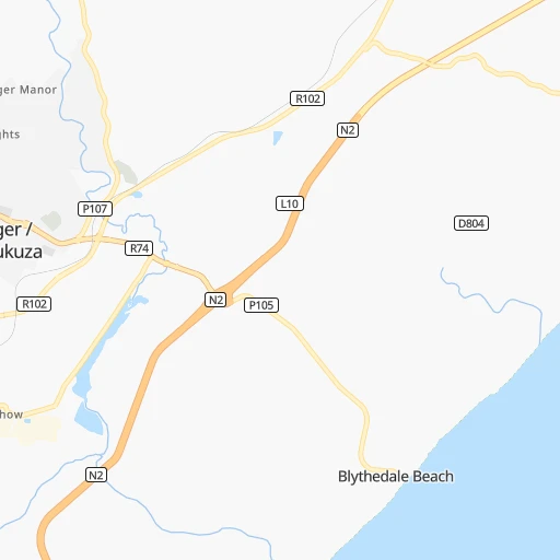
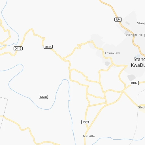
Roadmap (route) to go from New Guelderland to Greytown detailed above, you can also see the course layout on the map.
While doing trip New Guelderland - Greytown by car, the calculated route ends at a distance , or more straight.
Distance and duration of the route between New Guelderland and Greytown
Calculation of distance and route from Greytown to New Guelderland :
77.2108.5 km2h33mn
Continue 0h0mn 10 mKeep right 0h0mn 43 mTurn right onto R102 0h2mn 3.4 kmTurn right onto Voortrekker Street 2h30mn 104.9 kmTurn left onto Okes Street 0h0mn 132 mEnter roundabout 0h0mn 22 mArrive at destination 0h0mn 0 m
Travel from New Guelderland (KwaZulu-Natal) to a selection of major cities.
Distances from New Guelderland to biggest cities in KwaZulu-Natal
Other major cities in country :
- Uitenhage [05], 228,912 inhabitants. 749 km
- Roodepoort [06], 225,000 inhabitants. 490 km
- Paarl [11], 190,000 inhabitants. 1,270 km
- Springs [06], 186,394 inhabitants. 447 km
- Carletonville [06], 182,304 inhabitants. 508 km
- Klerksdorp [10], 178,921 inhabitants. 534 km
- Midrand [06], 173,009 inhabitants. 487 km
- Westonaria [06], 156,831 inhabitants. 493 km
- Middelburg [07], 154,706 inhabitants. 436 km
- Orkney [10], 145,801 inhabitants. 526 km
- Kimberley [08], 142,089 inhabitants. 643 km
- eMbalenhle [07], 141,741 inhabitants. 382 km
- Nigel [06], 140,644 inhabitants. 427 km
- Bhisho [05], 137,287 inhabitants. 540 km
- Randfontein [06], 133,654 inhabitants. 500 km
- Worcester [11], 127,597 inhabitants. 1,226 km
- Rustenburg [10], 124,064 inhabitants. 573 km
- Polokwane [09], 123,749 inhabitants. 631 km
- Potchefstroom [10], 123,669 inhabitants. 507 km
- Virginia [03], 122,502 inhabitants. 457 km
Route from Greytown to major cities (South Africa).
- Distance Greytown Cape Town1,274 km
- Distance Greytown Johannesburg406 km
- Distance Greytown Soweto412 km
- Distance Greytown Pretoria439 km
- Distance Greytown Port Elizabeth721 km
- Distance Greytown Benoni391 km
- Distance Greytown Tembisa414 km
- Distance Greytown East London509 km
- Distance Greytown Vereeniging374 km
- Distance Greytown Bloemfontein426 km
- Distance Greytown Boksburg392 km
- Distance Greytown Welkom396 km
- Distance Greytown Krugersdorp433 km
- Distance Greytown Diepsloot432 km
- Distance Greytown Randburg418 km
- Distance Greytown Botshabelo377 km
- Distance Greytown Brakpan384 km
- Distance Greytown Witbank380 km
- Distance Greytown Vanderbijlpark377 km
- Distance Greytown Centurion429 km
Nearest cities to New Guelderland :
- Durban, 3,120,282 inhabitants. 67 km
- Pietermaritzburg, 750,845 inhabitants. 97 km
- Newcastle, 404,838 inhabitants. 221 km
- Richards Bay, 252,968 inhabitants. 91 km
- Vryheid, 150,012 inhabitants. 181 km
- eMbalenhle, 141,741 inhabitants. 382 km
- Nigel, 140,644 inhabitants. 427 km
- Mpumalanga, 140,121 inhabitants. 87 km
- Bethal, 101,919 inhabitants. 368 km
- Dundee, 84,413 inhabitants. 167 km
- Piet Retief, 84,349 inhabitants. 263 km
- Phuthaditjhaba, 84,258 inhabitants. 261 km
- Mthatha, 78,663 inhabitants. 351 km
- Standerton, 74,021 inhabitants. 336 km
- Heidelberg, 64,199 inhabitants. 429 km
- KwaDukuza, 59,899 inhabitants. 4 km
- Port Shepstone, 52,793 inhabitants. 179 km
- eSikhaleni, 49,265 inhabitants. 75 km
- Balfour, 46,008 inhabitants. 400 km
- Mondlo, 44,922 inhabitants. 161 km
- Volksrust, 43,378 inhabitants. 260 km
- Ermelo, 41,124 inhabitants. 337 km
- Harrismith, 35,108 inhabitants. 244 km
- Margate, 34,407 inhabitants. 195 km
- Richmond, 32,445 inhabitants. 120 km
- Howick, 28,725 inhabitants. 108 km
- Driefontein, 28,127 inhabitants. 271 km
- Empangeni, 28,093 inhabitants. 83 km
- Mpophomeni, 26,229 inhabitants. 114 km
- Kokstad, 25,373 inhabitants. 229 km
- Scottburgh, 23,949 inhabitants. 121 km
- Ulundi, 20,753 inhabitants. 110 km
- Secunda, 20,418 inhabitants. 375 km
- eMkhomazi, 20,410 inhabitants. 111 km
- Ballito, 17,218 inhabitants. 27 km
- Reitz, 16,637 inhabitants. 331 km
- Berea, 15,000 inhabitants. 68 km
- Eshowe, 14,786 inhabitants. 50 km
- Vrede, 14,622 inhabitants. 299 km
- Ekuvukeni, 14,331 inhabitants. 149 km
- Greytown, 13,912 inhabitants. 77 km
- Glencoe, 13,547 inhabitants. 172 km
- Sundumbili, 12,455 inhabitants. 22 km
- Villiers, 11,240 inhabitants. 370 km
- Mooirivier, 10,132 inhabitants. 130 km
- Port Saint John's, 5,939 inhabitants. 308 km
- Utrecht, 3,575 inhabitants. 210 km
Location New Guelderland (KwaZulu-Natal) :
| Country flag |  |
| Location | New Guelderland |
| State | KwaZulu-Natal |
| County | iLembe District Municipality |
| Country | South Africa |
| Country code / ISO 2 | ZA |
| Latitude | -29.3208800 |
| Longitude | 31.3320500 |
| Altitude | 0 meters |
| Time zone | Africa/Johannesburg |
Location Greytown (KwaZulu-Natal) :
| Country flag | |
| Location | Greytown |
| State | KwaZulu-Natal |
| County | uMzinyathi District Municipality |
| Country | South Africa |
| Country code / ISO 2 | ZA |
| Latitude | -29.0641500 |
| Longitude | 30.5927900 |
| Altitude | 0 meters |
| Time zone | Africa/Johannesburg |