


How to get from Rolle (Limpopo) to Hendrina (Mpumalanga)
Calculate route from Rolle (Limpopo, South Africa) to Hendrina (Mpumalanga, South Africa).
The flight distance (as the crow flies) between Rolle and Hendrina is 221.2 km.
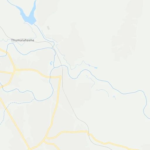
Roadmap (route) to go from Rolle to Hendrina detailed above, you can also see the course layout on the map.
While doing trip Rolle - Hendrina by car, the calculated route ends at a distance , or more straight.
Distance and duration of the route between Rolle and Hendrina
Calculation of distance and route from Hendrina to Rolle :
221.2301.5 km5h31mn
Continue 0h2mn 926 mKeep right 0h1mn 440 mContinue 0h4mn 3.2 kmTurn left 0h2mn 994 mTurn right 0h0mn 108 mTurn left 0h21mn 13.8 kmTurn right 0h17mn 14.2 kmTurn left 0h8mn 6.9 kmTurn left onto R40 0h12mn 13.6 kmContinue onto R538 0h13mn 11.3 kmAt roundabout, take exit 2 onto R538 0h4mn 3.0 kmAt roundabout, take exit 2 onto R538 0h18mn 18.3 kmAt roundabout, take exit 2 onto R40, R538 0h2mn 2.4 kmTurn right onto Tom Lawrence Street 0h1mn 1.2 kmTurn left onto Danie Joubert Street 0h0mn 267 mTurn right onto Chief Mgiyeni Khumalo Drive 0h13mn 15.1 kmTurn right onto R37 0h1mn 830 mAt roundabout, take exit 3 onto R37 0h0mn 389 mAt roundabout, take exit 1 onto Sabie Road 0h0mn 468 mTurn left 0h22mn 27.3 kmKeep left onto Montrose Interchange Ramp A 1h41mn 62.3 kmContinue onto N4 1h41mn 66.0 kmKeep left and drive toward Arnot 0h0mn 477 mTurn left 1h31mn 25.9 kmContinue 0h14mn 11.6 kmTurn right onto Beukes Street 0h0mn 432 mTurn right 0h0mn 51 mArrive at destination 0h0mn 0 m
Travel from Rolle (Mpumalanga) to a selection of major cities.
Distances from Rolle to biggest cities in Limpopo
Other major cities in country :
- Witbank [07], 262,491 inhabitants. 239 km
- Richards Bay [02], 252,968 inhabitants. 460 km
- Vanderbijlpark [06], 246,754 inhabitants. 407 km
- Centurion [06], 233,386 inhabitants. 332 km
- Uitenhage [05], 228,912 inhabitants. 1,155 km
- Roodepoort [06], 225,000 inhabitants. 374 km
- Paarl [11], 190,000 inhabitants. 1,555 km
- Springs [06], 186,394 inhabitants. 332 km
- Carletonville [06], 182,304 inhabitants. 427 km
- Klerksdorp [10], 178,921 inhabitants. 516 km
- Midrand [06], 173,009 inhabitants. 343 km
- Westonaria [06], 156,831 inhabitants. 402 km
- Middelburg [07], 154,706 inhabitants. 214 km
- Vryheid [02], 150,012 inhabitants. 343 km
- Orkney [10], 145,801 inhabitants. 522 km
- Kimberley [08], 142,089 inhabitants. 783 km
- eMbalenhle [07], 141,741 inhabitants. 297 km
- Nigel [06], 140,644 inhabitants. 336 km
- Mpumalanga [02], 140,121 inhabitants. 570 km
- Bhisho [05], 137,287 inhabitants. 978 km
Route from Hendrina to major cities (South Africa).
- Distance Hendrina Cape Town1,388 km
- Distance Hendrina Durban432 km
- Distance Hendrina Johannesburg167 km
- Distance Hendrina Soweto186 km
- Distance Hendrina Pretoria160 km
- Distance Hendrina Port Elizabeth954 km
- Distance Hendrina Pietermaritzburg391 km
- Distance Hendrina Benoni139 km
- Distance Hendrina Tembisa150 km
- Distance Hendrina East London783 km
- Distance Hendrina Vereeniging187 km
- Distance Hendrina Bloemfontein477 km
- Distance Hendrina Boksburg146 km
- Distance Hendrina Welkom358 km
- Distance Hendrina Newcastle179 km
- Distance Hendrina Krugersdorp194 km
- Distance Hendrina Diepsloot172 km
- Distance Hendrina Randburg171 km
- Distance Hendrina Botshabelo454 km
- Distance Hendrina Brakpan135 km
Nearest cities to Rolle :
- Benoni, 605,344 inhabitants. 336 km
- Boksburg, 445,168 inhabitants. 342 km
- Brakpan, 305,692 inhabitants. 334 km
- Witbank, 262,491 inhabitants. 239 km
- Springs, 186,394 inhabitants. 332 km
- Middelburg, 154,706 inhabitants. 214 km
- eMbalenhle, 141,741 inhabitants. 297 km
- Nigel, 140,644 inhabitants. 336 km
- Polokwane, 123,749 inhabitants. 201 km
- Nelspruit, 110,159 inhabitants. 89 km
- Phalaborwa, 109,468 inhabitants. 87 km
- Bethal, 101,919 inhabitants. 263 km
- Mokopane, 101,090 inhabitants. 233 km
- Delmas, 92,046 inhabitants. 302 km
- Warmbaths, 90,210 inhabitants. 299 km
- Louis Trichardt, 86,854 inhabitants. 230 km
- Piet Retief, 84,349 inhabitants. 259 km
- Standerton, 74,021 inhabitants. 318 km
- Barberton, 67,927 inhabitants. 121 km
- Heidelberg, 64,199 inhabitants. 351 km
- Balfour, 46,008 inhabitants. 343 km
- Thohoyandou, 44,046 inhabitants. 211 km
- Volksrust, 43,378 inhabitants. 324 km
- Ermelo, 41,124 inhabitants. 238 km
- Ekangala, 37,650 inhabitants. 273 km
- Giyani, 37,024 inhabitants. 166 km
- Lebowakgomo, 33,308 inhabitants. 185 km
- Nkowakowa, 30,138 inhabitants. 133 km
- Driefontein, 28,127 inhabitants. 268 km
- Bronkhorstspruit, 27,343 inhabitants. 279 km
- Siyabuswa, 26,236 inhabitants. 225 km
- Cullinan, 25,490 inhabitants. 293 km
- Duiwelskloof, 24,572 inhabitants. 159 km
- Lydenburg, 21,695 inhabitants. 90 km
- Modimolle, 20,527 inhabitants. 287 km
- Komatipoort, 20,508 inhabitants. 108 km
- Secunda, 20,418 inhabitants. 291 km
- Tzaneen, 16,954 inhabitants. 147 km
- White River, 15,954 inhabitants. 72 km
- Hendrina, 15,871 inhabitants. 222 km
- Kriel, 15,055 inhabitants. 266 km
- Vrede, 14,622 inhabitants. 366 km
- Ga-Kgapane, 13,000 inhabitants. 157 km
- Breyten, 12,550 inhabitants. 216 km
- Mankoeng, 12,499 inhabitants. 170 km
- Belfast, 11,916 inhabitants. 162 km
- Thulamahashi, 11,655 inhabitants. 4 km
- Villiers, 11,240 inhabitants. 369 km
- Graskop, 3,996 inhabitants. 47 km
- Utrecht, 3,575 inhabitants. 340 km
Location Rolle (Limpopo) :
| Country flag |  |
| Location | Rolle |
| State | Limpopo |
| County | |
| Country | South Africa |
| Country code / ISO 2 | ZA |
| Latitude | -24.7159700 |
| Longitude | 31.2344700 |
| Altitude | 0 meters |
| Time zone | Africa/Johannesburg |
Location Hendrina (Mpumalanga) :
| Country flag | |
| Location | Hendrina |
| State | Mpumalanga |
| County | Nkangala District Municipality |
| Country | South Africa |
| Country code / ISO 2 | ZA |
| Latitude | -26.1588100 |
| Longitude | 29.7152800 |
| Altitude | 0 meters |
| Time zone | Africa/Johannesburg |