

Home
››
Stantsiya Dniprodzerzhyns’k-Livoberezhnyy
››
Roadmap from Stantsiya Dniprodzerzhyns’k-Livoberezhnyy to Kupjansk
How to get from Stantsiya Dniprodzerzhyns’k-Livoberezhnyy (Dnipropetrovsk) to Kupjansk (Kharkiv)
Calculate route from Stantsiya Dniprodzerzhyns’k-Livoberezhnyy (Dnipropetrovsk, Ukraine) to Kupjansk (Kharkiv, Ukraine).
The flight distance (as the crow flies) between Stantsiya Dniprodzerzhyns’k-Livoberezhnyy and Kupjansk is 249.6 km.
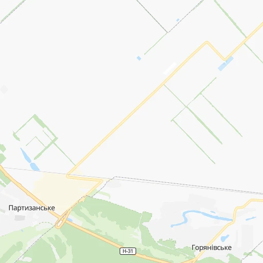
Roadmap (route) to go from Stantsiya Dniprodzerzhyns’k-Livoberezhnyy to Kupjansk detailed above, you can also see the course layout on the map.
While doing trip Stantsiya Dniprodzerzhyns’k-Livoberezhnyy - Kupjansk by car, the calculated route ends at a distance , or more straight.
Distance and duration of the route between Stantsiya Dniprodzerzhyns’k-Livoberezhnyy and Kupjansk
Calculation of distance and route from Kupjansk to Stantsiya Dniprodzerzhyns’k-Livoberezhnyy :
249.6337.2 km5h8mn
Continue 0h5mn 1.5 kmContinue 0h1mn 470 mTurn slight left 0h1mn 586 mKeep right onto Т-04-14 0h6mn 6.2 kmAt roundabout, take exit 1 onto Н-31 0h14mn 19.2 kmKeep right 0h13mn 10.3 kmTurn left onto Донецьке шосе 0h8mn 8.9 kmKeep right onto О040410 0h0mn 50 mKeep left onto Шосейна вулиця 0h5mn 4.3 kmKeep right and drive toward Харків 0h0mn 407 mTurn right onto М-29 and take М-29, Е-105 toward Харків 0h17mn 23.4 kmKeep right onto М-29 1h36mn 59.6 kmKeep right 0h0mn 429 mContinue onto Р-79 0h9mn 12.7 kmTurn left onto Т-21-20 0h10mn 10.1 kmTurn right onto вулиця Захисників України 0h2mn 1.6 kmTurn left onto вулиця Енергетиків 0h1mn 1.2 kmTurn right onto Т-21-18 0h1mn 1.2 kmTurn left onto Т-21-18 0h4mn 4.0 kmKeep left onto Перемоги вулиця 0h15mn 14.5 kmTurn right onto Т-21-10 0h1mn 1.2 kmTurn left onto Т-21-10 0h14mn 14.2 kmTurn left onto Польова вулиця 0h2mn 1.9 kmTurn right onto Р-51, Т-21-10 0h1mn 1.1 kmTurn right 0h0mn 42 mTurn right onto Харківська вулиця 0h1mn 1.1 kmAt roundabout, take exit 3 onto Соборна вулиця 0h11mn 11.3 kmTurn left onto Т-21-10 0h30mn 30.0 kmTurn left onto С-210103 0h5mn 4.4 kmTurn right 0h5mn 4.4 kmTurn right 0h2mn 530 mKeep left 0h8mn 2.0 kmTurn left 0h0mn 59 mKeep right 0h0mn 122 mTurn right onto вулиця Ярослава Мудрого 0h0mn 78 mTurn left 0h1mn 513 mTurn right onto вулиця Перемоги 0h5mn 5.6 kmTurn left onto вулиця Новоселівка 0h2mn 2.1 kmContinue onto Харківська вулиця 0h21mn 21.0 kmTurn right onto Т-21-10 0h17mn 17.0 kmTurn right onto Н-26 0h28mn 35.8 kmTurn right 0h0mn 146 mTurn left onto Крута вулиця 0h2mn 931 mTurn left onto Студентська вулиця 0h0mn 479 mTurn right onto Сватівська вулиця 0h0mn 191 mTurn sharp left onto Центральна площа 0h0mn 17 mKeep right onto Центральна площа 0h0mn 52 mArrive at destination 0h0mn 0 m
Travel from Stantsiya Dniprodzerzhyns’k-Livoberezhnyy (Kharkiv) to a selection of major cities.
Distances from Stantsiya Dniprodzerzhyns’k-Livoberezhnyy to biggest cities in Dnipropetrovsk
Other major cities in country :
- Horlivka [05], 278,550 inhabitants. 254 km
- Rivne [19], 255,106 inhabitants. 647 km
- Kropyvnytskyi [10], 249,454 inhabitants. 176 km
- Chernivtsi [03], 236,250 inhabitants. 643 km
- Ternopil [22], 235,676 inhabitants. 668 km
- Kremenchuk [18], 227,494 inhabitants. 104 km
- Lutsk [24], 213,661 inhabitants. 711 km
- Ivano-Frankivsk [06], 204,200 inhabitants. 729 km
- Bila Tserkva [13], 199,163 inhabitants. 356 km
- Kramators'k [05], 173,700 inhabitants. 215 km
- Melitopol [26], 158,000 inhabitants. 201 km
- Kerch [11], 148,932 inhabitants. 386 km
- Syevyerodonets'k [14], 130,000 inhabitants. 285 km
- Sloviansk [05], 124,800 inhabitants. 221 km
- Berdyansk [26], 118,284 inhabitants. 260 km
- Uzhgorod [25], 117,878 inhabitants. 907 km
- Alchevs'k [14], 116,000 inhabitants. 308 km
- Lysychans'k [14], 111,600 inhabitants. 281 km
- Yevpatoriya [11], 106,202 inhabitants. 389 km
- Yenakiyeve [05], 104,101 inhabitants. 267 km
Route from Kupjansk to major cities (Ukraine).
- Distance Kupjansk Kyiv513 km
- Distance Kupjansk Dnipro234 km
- Distance Kupjansk Donetsk188 km
- Distance Kupjansk Odessa625 km
- Distance Kupjansk Zaporizhia275 km
- Distance Kupjansk Lviv976 km
- Distance Kupjansk Kryvyi Rih369 km
- Distance Kupjansk Mykolayiv516 km
- Distance Kupjansk Mariupol291 km
- Distance Kupjansk Luhansk178 km
- Distance Kupjansk Sevastopol649 km
- Distance Kupjansk Khmelnytskyi767 km
- Distance Kupjansk Makiyivka186 km
- Distance Kupjansk Vinnytsia662 km
- Distance Kupjansk Simferopol591 km
- Distance Kupjansk Kherson503 km
- Distance Kupjansk Poltava222 km
- Distance Kupjansk Chernihiv490 km
- Distance Kupjansk Cherkasy402 km
- Distance Kupjansk Sumy241 km
Nearest cities to Stantsiya Dniprodzerzhyns’k-Livoberezhnyy :
- Kharkiv, 1,430,885 inhabitants. 194 km
- Dnipro, 1,032,822 inhabitants. 33 km
- Zaporizhia, 796,217 inhabitants. 95 km
- Kryvyi Rih, 652,380 inhabitants. 120 km
- Mykolayiv, 510,840 inhabitants. 268 km
- Mariupol, 481,626 inhabitants. 273 km
- Kherson, 320,477 inhabitants. 263 km
- Poltava, 317,847 inhabitants. 112 km
- Cherkasy, 297,568 inhabitants. 210 km
- Sumy, 294,456 inhabitants. 260 km
- Kropyvnytskyi, 249,454 inhabitants. 176 km
- Kamianske, 248,575 inhabitants. 9 km
- Kremenchuk, 227,494 inhabitants. 104 km
- Kramators'k, 173,700 inhabitants. 215 km
- Melitopol, 158,000 inhabitants. 201 km
- Nikopol, 130,500 inhabitants. 115 km
- Sloviansk, 124,800 inhabitants. 221 km
- Berdyansk, 118,284 inhabitants. 260 km
- Pavlohrad, 115,932 inhabitants. 91 km
- Oleksandriya, 103,000 inhabitants. 112 km
- Konotop, 91,798 inhabitants. 312 km
- Nizhyn, 75,499 inhabitants. 337 km
- Novomoskovs'k, 73,100 inhabitants. 45 km
- Pokrovsk, 68,263 inhabitants. 190 km
- Smila, 67,530 inhabitants. 213 km
- Pryluky, 62,823 inhabitants. 276 km
- Druzhkivka, 62,315 inhabitants. 214 km
- Lozova, 62,311 inhabitants. 128 km
- Energodar, 55,800 inhabitants. 122 km
- Izyum, 53,778 inhabitants. 203 km
- Lubny, 52,600 inhabitants. 199 km
- Horishni Plavni, 51,740 inhabitants. 87 km
- Zhovti Vody, 51,559 inhabitants. 88 km
- Nova Kakhovka, 50,672 inhabitants. 226 km
- Marhanets', 50,443 inhabitants. 106 km
- Okhtyrka, 49,818 inhabitants. 192 km
- Myrnohrad, 49,646 inhabitants. 196 km
- Romny, 48,570 inhabitants. 255 km
- Svitlovods'k, 47,946 inhabitants. 114 km
- Dzhankoy, 41,731 inhabitants. 321 km
- Myrhorod, 41,377 inhabitants. 171 km
- Kakhovka, 36,816 inhabitants. 216 km
- Chuhuyiv, 36,519 inhabitants. 204 km
- Dobropillya, 35,977 inhabitants. 181 km
- Tokmak, 34,926 inhabitants. 169 km
- Dolyns'ka, 34,267 inhabitants. 149 km
- Kupjansk, 32,449 inhabitants. 250 km
- Synel'nykove, 31,900 inhabitants. 71 km
- Balakliya, 31,156 inhabitants. 189 km
- Krasnoperekops'k, 30,700 inhabitants. 300 km
Location Stantsiya Dniprodzerzhyns’k-Livoberezhnyy (Dnipropetrovsk) :
| Country flag |  |
| Location | Stantsiya Dniprodzerzhyns’k-Livoberezhnyy |
| State | Dnipropetrovsk |
| County | |
| Country | Ukraine |
| Country code / ISO 2 | UA |
| Latitude | 48.5900600 |
| Longitude | 34.6390300 |
| Altitude | 0 meters |
| Time zone | Europe/Kiev |
Location Kupjansk (Kharkiv) :
| Country flag | |
| Location | Kupjansk |
| State | Kharkiv |
| County | |
| Country | Ukraine |
| Country code / ISO 2 | UA |
| Latitude | 49.7105500 |
| Longitude | 37.6151700 |
| Altitude | 0 meters |
| Time zone | Europe/Kiev |