
How to get from Westleigh (Orange Free State) to Allanridge (Orange Free State)
Calculate route from Westleigh (Orange Free State, South Africa) to Allanridge (Orange Free State, South Africa).
The flight distance (as the crow flies) between Westleigh and Allanridge is 67.5 km.
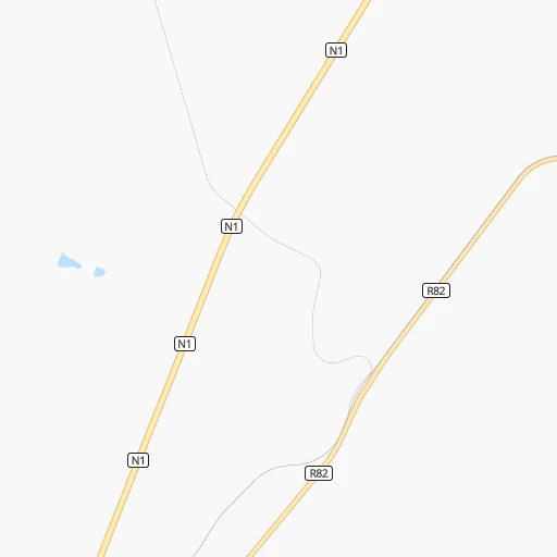
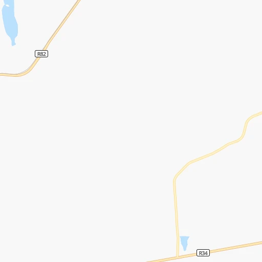
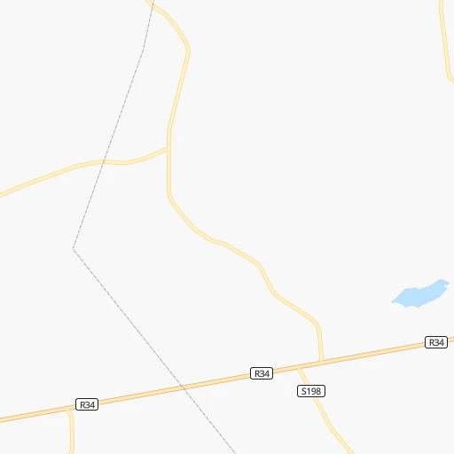
Roadmap (route) to go from Westleigh to Allanridge detailed above, you can also see the course layout on the map.
While doing trip Westleigh - Allanridge by car, the calculated route ends at a distance , or more straight.
Distance and duration of the route between Westleigh and Allanridge
Calculation of distance and route from Allanridge to Westleigh :
67.591.5 km1h9mn
Continue onto R82 0h5mn 5.6 kmTurn slight right onto R34 0h1mn 1.3 kmKeep left and take N1 toward Bloemfontein, Odendaalsrus, Welkom 0h5mn 8.4 kmKeep right and take R34 toward Odendaalsrus, Welkom 1h32mn 47.9 kmKeep right 0h0mn 158 mContinue onto Athea Road 0h8mn 10.5 kmAt roundabout, take exit 3 0h0mn 424 mAt roundabout, take exit 1 onto Odendaal Street 0h2mn 1.7 kmTurn right onto R30 0h13mn 13.9 kmKeep left 0h0mn 242 mTurn slight left onto Buffalo Road 0h0mn 347 mTurn sharp right onto Hout Street 0h0mn 114 mTurn left onto Brak Street 0h0mn 60 mTurn right onto Indwe Street 0h0mn 144 mTurn sharp left onto Waterval Street 0h1mn 671 mTurn left onto Kafue Street 0h0mn 68 mArrive at destination 0h0mn 0 m
Travel from Westleigh (Orange Free State) to a selection of major cities.
Distances from Westleigh to biggest cities in Orange Free State
Other major cities in country :
- Centurion [06], 233,386 inhabitants. 211 km
- Uitenhage [05], 228,912 inhabitants. 711 km
- Roodepoort [06], 225,000 inhabitants. 168 km
- Paarl [11], 190,000 inhabitants. 1,050 km
- Springs [06], 186,394 inhabitants. 184 km
- Carletonville [06], 182,304 inhabitants. 136 km
- Klerksdorp [10], 178,921 inhabitants. 103 km
- Midrand [06], 173,009 inhabitants. 195 km
- Westonaria [06], 156,831 inhabitants. 145 km
- Middelburg [07], 154,706 inhabitants. 295 km
- Vryheid [02], 150,012 inhabitants. 345 km
- Orkney [10], 145,801 inhabitants. 92 km
- Kimberley [08], 142,089 inhabitants. 280 km
- eMbalenhle [07], 141,741 inhabitants. 210 km
- Nigel [06], 140,644 inhabitants. 173 km
- Mpumalanga [02], 140,121 inhabitants. 409 km
- Bhisho [05], 137,287 inhabitants. 586 km
- Randfontein [06], 133,654 inhabitants. 161 km
- Worcester [11], 127,597 inhabitants. 1,010 km
- Rustenburg [10], 124,064 inhabitants. 213 km
Route from Allanridge to major cities (South Africa).
- Distance Allanridge Cape Town1,043 km
- Distance Allanridge Durban488 km
- Distance Allanridge Johannesburg222 km
- Distance Allanridge Soweto205 km
- Distance Allanridge Pretoria271 km
- Distance Allanridge Port Elizabeth698 km
- Distance Allanridge Pietermaritzburg421 km
- Distance Allanridge Benoni241 km
- Distance Allanridge Tembisa251 km
- Distance Allanridge East London598 km
- Distance Allanridge Vereeniging175 km
- Distance Allanridge Boksburg235 km
- Distance Allanridge Newcastle324 km
- Distance Allanridge Krugersdorp217 km
- Distance Allanridge Diepsloot244 km
- Distance Allanridge Randburg229 km
- Distance Allanridge Brakpan240 km
- Distance Allanridge Witbank332 km
- Distance Allanridge Richards Bay541 km
- Distance Allanridge Vanderbijlpark166 km
Nearest cities to Westleigh :
- Johannesburg, 2,026,469 inhabitants. 170 km
- Soweto, 1,695,047 inhabitants. 157 km
- Pretoria, 1,619,438 inhabitants. 223 km
- Benoni, 605,344 inhabitants. 185 km
- Tembisa, 511,655 inhabitants. 199 km
- Vereeniging, 474,681 inhabitants. 119 km
- Bloemfontein, 463,064 inhabitants. 202 km
- Boksburg, 445,168 inhabitants. 180 km
- Welkom, 431,944 inhabitants. 71 km
- Newcastle, 404,838 inhabitants. 260 km
- Krugersdorp, 378,821 inhabitants. 173 km
- Diepsloot, 350,000 inhabitants. 197 km
- Randburg, 337,053 inhabitants. 180 km
- Botshabelo, 309,714 inhabitants. 196 km
- Brakpan, 305,692 inhabitants. 184 km
- Witbank, 262,491 inhabitants. 271 km
- Vanderbijlpark, 246,754 inhabitants. 111 km
- Centurion, 233,386 inhabitants. 211 km
- Roodepoort, 225,000 inhabitants. 168 km
- Springs, 186,394 inhabitants. 184 km
- Carletonville, 182,304 inhabitants. 136 km
- Klerksdorp, 178,921 inhabitants. 103 km
- Midrand, 173,009 inhabitants. 195 km
- Westonaria, 156,831 inhabitants. 145 km
- Middelburg, 154,706 inhabitants. 295 km
- Orkney, 145,801 inhabitants. 92 km
- Kimberley, 142,089 inhabitants. 280 km
- eMbalenhle, 141,741 inhabitants. 210 km
- Nigel, 140,644 inhabitants. 173 km
- Randfontein, 133,654 inhabitants. 161 km
- Rustenburg, 124,064 inhabitants. 213 km
- Potchefstroom, 123,669 inhabitants. 99 km
- Virginia, 122,502 inhabitants. 72 km
- Brits, 122,497 inhabitants. 222 km
- Alberton, 121,536 inhabitants. 168 km
- Kroonstad, 103,992 inhabitants. 10 km
- Bethal, 101,919 inhabitants. 248 km
- Mabopane, 97,417 inhabitants. 245 km
- Kutloanong, 95,008 inhabitants. 61 km
- Stilfontein, 93,110 inhabitants. 98 km
- Delmas, 92,046 inhabitants. 211 km
- Warmbaths, 90,210 inhabitants. 316 km
- Dundee, 84,413 inhabitants. 296 km
- Phuthaditjhaba, 84,258 inhabitants. 182 km
- Bethlehem, 83,654 inhabitants. 122 km
- Sasolburg, 77,016 inhabitants. 100 km
- Mmabatho, 76,754 inhabitants. 255 km
- Standerton, 74,021 inhabitants. 205 km
- Bothaville, 71,934 inhabitants. 71 km
- Parys, 71,319 inhabitants. 77 km
Location Westleigh (Orange Free State) :
| Country flag |  |
| Location | Westleigh |
| State | Orange Free State |
| County | Fezile Dabi District Municipality |
| Country | South Africa |
| Country code / ISO 2 | ZA |
| Latitude | -27.5833600 |
| Longitude | 27.3023400 |
| Altitude | 0 meters |
| Time zone | Africa/Johannesburg |
Location Allanridge (Orange Free State) :
| Country flag | |
| Location | Allanridge |
| State | Orange Free State |
| County | Lejweleputswa District Municipality |
| Country | South Africa |
| Country code / ISO 2 | ZA |
| Latitude | -27.7543100 |
| Longitude | 26.6438200 |
| Altitude | 0 meters |
| Time zone | Africa/Johannesburg |