


How to get from Orapa (Central) to Nata (Central)
Calculate route from Orapa (Central, Botswana) to Nata (Central, Botswana).
The flight distance (as the crow flies) between Orapa and Nata is 147.8 km.
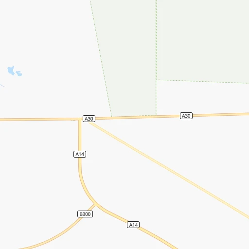
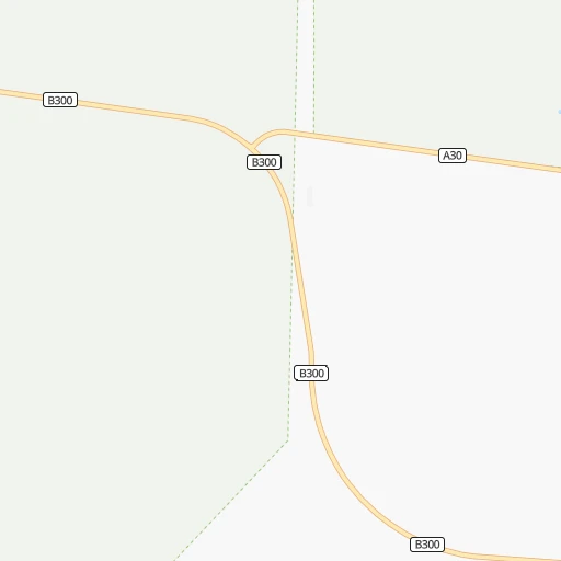
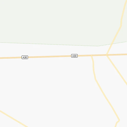
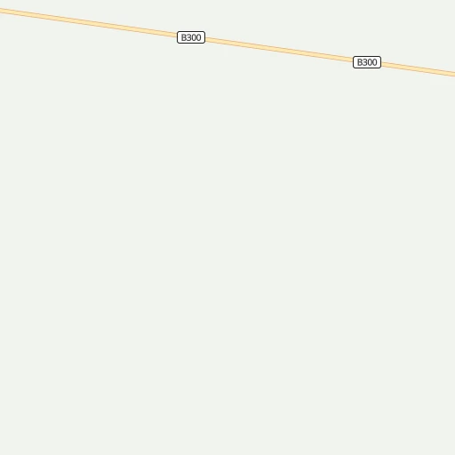
Roadmap (route) to go from Orapa to Nata detailed above, you can also see the course layout on the map.
While doing trip Orapa - Nata by car, the calculated route ends at a distance , or more straight.
Distance and duration of the route between Orapa and Nata
Calculation of distance and route from Nata to Orapa :
147.8192.5 km5h6mn
Continue 0h1mn 512 mKeep right 0h1mn 344 mTurn left 0h2mn 797 mTurn right 0h1mn 396 mAt roundabout, take exit 1 0h0mn 351 mTurn left 0h1mn 790 mAt roundabout, take exit 1 0h1mn 765 mTurn right 0h1mn 796 mTurn left 0h1mn 433 mTurn left 0h12mn 6.0 kmTurn left 0h0mn 58 mTurn right onto A30 0h8mn 14.1 kmTurn left 0h0mn 37 mTurn slight left 1h13mn 51.3 kmKeep left 3h14mn 97.6 kmTurn right onto A3 0h10mn 17.2 kmTurn right onto A3 0h0mn 520 mTurn right 0h0mn 114 mTurn left 0h0mn 41 mTurn right 0h1mn 298 mArrive at destination 0h0mn 0 m
Travel from Orapa (Central) to a selection of major cities.
Distances from Orapa to biggest cities in Central
Other major cities in country :
Route from Nata to major cities (Botswana).
Nearest cities to Orapa :
- Francistown, 89,979 inhabitants. 222 km
- Selebi-Phikwe, 53,727 inhabitants. 266 km
- Maun, 49,945 inhabitants. 252 km
- Serowe, 47,419 inhabitants. 183 km
- Mahalapye, 44,471 inhabitants. 249 km
- Palapye, 30,650 inhabitants. 227 km
- Letlhakane, 18,136 inhabitants. 25 km
- Tonota, 17,759 inhabitants. 217 km
- Orapa, 9,189 inhabitants. 0 km
- Letlhakeng, 6,781 inhabitants. 312 km
- Rakops, 5,222 inhabitants. 110 km
- Nata, 4,794 inhabitants. 148 km
- Gweta, 4,689 inhabitants. 126 km
- Mathambgwane, 4,675 inhabitants. 206 km
- Kang, 4,229 inhabitants. 374 km
- Sefophe, 4,114 inhabitants. 285 km
- Ramokgonami, 3,681 inhabitants. 273 km
- Masunga, 3,639 inhabitants. 229 km
- Maunatlala, 3,361 inhabitants. 273 km
- Mopipi, 3,301 inhabitants. 53 km
- Sua, 3,141 inhabitants. 165 km
- Sebina, 3,030 inhabitants. 201 km
Location Orapa (Central) :
| Country flag |  |
| Location | Orapa |
| State | Central |
| County | |
| Country | Botswana |
| Country code / ISO 2 | BW |
| Latitude | -21.3115000 |
| Longitude | 25.3764200 |
| Altitude | 0 meters |
| Time zone | Africa/Gaborone |
Location Nata (Central) :
| Country flag |  |
| Location | Nata |
| State | Central |
| County | |
| Country | Botswana |
| Country code / ISO 2 | BW |
| Latitude | -20.2166700 |
| Longitude | 26.1833300 |
| Altitude | 0 meters |
| Time zone | Africa/Gaborone |