


How to get from Taquipirenda (airport) (Santa Cruz) to Bermejo (Tarija)
Calculate route from Taquipirenda (airport) (Santa Cruz, Bolivia) to Bermejo (Tarija, Bolivia).
The flight distance (as the crow flies) between Taquipirenda (airport) and Bermejo is 293.5 km.
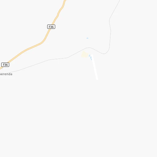
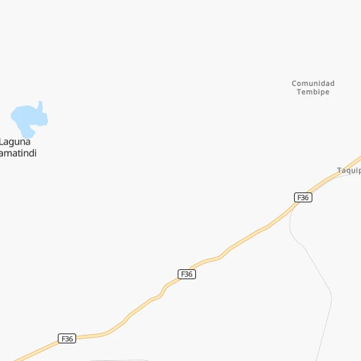
Roadmap (route) to go from Taquipirenda Airport to Bermejo detailed above, you can also see the course layout on the map.
While doing trip Taquipirenda (airport) - Bermejo by car, the calculated route ends at a distance , or more straight.
Distance and duration of the route between Taquipirenda (airport) and Bermejo
Calculation of distance and route from Bermejo to Taquipirenda (airport) :
293.5378.5 km7h23mn
Continue 0h2mn 391 mTurn right 0h0mn 162 mTurn left 0h1mn 598 mKeep right 0h5mn 2.4 kmTurn left onto RN36: Abapó-Boyuibe 0h26mn 12.9 kmTurn left 0h5mn 2.3 kmKeep right 0h0mn 63 mTurn slight left onto RN36: Abapó-Boyuibe 0h7mn 3.7 kmTurn slight right onto RN9: Boyuibe-Cruce Ipati 1h22mn 98.9 kmAt roundabout, take exit 2 onto Avenida Montenegro 0h1mn 1.1 kmContinue onto F9 0h1mn 1.1 kmAt roundabout, take exit 2 onto RN9: Villamontes-Yacuiba 1h2mn 74.0 kmTurn right 0h6mn 3.0 kmTurn left 0h1mn 744 mTurn right onto RN29: Carapari-Campo Pajoso 0h14mn 16.5 kmKeep left onto F33 and drive toward F29, Campo Pajoso, Las Sidras 1h7mn 41.1 kmTurn left onto RN33: Carapari-Las Sidras 1h42mn 23.7 kmKeep left 0h12mn 6.2 kmTurn left onto RN33: Bermejo-Sidras 2h48mn 88.8 kmAt roundabout, take exit 1 onto Avenida Bolívar 0h1mn 890 mMake a U-turn onto Avenida Bolívar 0h0mn 50 mArrive at destination 0h0mn 0 m
Travel from Taquipirenda (airport) (Tarija) to a selection of major cities.
Distances from Taquipirenda Airport to biggest cities in Santa Cruz
Other major cities in country :
Route from Bermejo to major cities (Bolivia).
- Distance Bermejo Santa Cruz de la Sierra564 km
- Distance Bermejo Cochabamba624 km
- Distance Bermejo La Paz801 km
- Distance Bermejo Sucre423 km
- Distance Bermejo Oruro605 km
- Distance Bermejo Potosi380 km
- Distance Bermejo Sacaba620 km
- Distance Bermejo Montero611 km
- Distance Bermejo Quillacollo628 km
- Distance Bermejo Trinidad881 km
- Distance Bermejo Riberalta1,318 km
- Distance Bermejo Tiquipaya632 km
Nearest cities to Taquipirenda (airport) :
- Santa Cruz de la Sierra, 1,364,389 inhabitants. 284 km
- Sucre, 224,838 inhabitants. 266 km
- Tarija, 159,269 inhabitants. 212 km
- Potosi, 141,251 inhabitants. 286 km
- Sacaba, 107,628 inhabitants. 447 km
- Montero, 88,616 inhabitants. 334 km
- Yacuiba, 82,803 inhabitants. 195 km
- Bermejo, 35,411 inhabitants. 294 km
- Mizque, 30,481 inhabitants. 353 km
- Villazon, 30,253 inhabitants. 321 km
- Camiri, 27,961 inhabitants. 52 km
- Tupiza, 22,233 inhabitants. 295 km
- Warnes, 22,036 inhabitants. 314 km
- Villamontes, 18,761 inhabitants. 109 km
- Cotoca, 18,347 inhabitants. 281 km
- Villa Yapacani, 18,187 inhabitants. 335 km
- Santiago del Torno, 15,543 inhabitants. 263 km
- Punata, 15,194 inhabitants. 421 km
- Portachuelo, 11,485 inhabitants. 333 km
- Pailon, 9,304 inhabitants. 302 km
- Cliza, 8,654 inhabitants. 424 km
- Vallegrande, 8,422 inhabitants. 229 km
- Monteagudo, 8,289 inhabitants. 104 km
- Aiquile, 8,224 inhabitants. 320 km
- Tarata, 8,043 inhabitants. 429 km
- San Julian, 7,706 inhabitants. 286 km
- La Belgica, 5,501 inhabitants. 310 km
- Betanzos, 4,847 inhabitants. 257 km
- Camargo, 4,715 inhabitants. 218 km
- Comarapa, 4,445 inhabitants. 307 km
- Mairana, 4,298 inhabitants. 261 km
- Buena Vista, 4,282 inhabitants. 325 km
- San Carlos, 4,180 inhabitants. 333 km
- Jorochito, 4,013 inhabitants. 256 km
- Colomi, 3,921 inhabitants. 439 km
- Arani, 3,906 inhabitants. 414 km
- San Juan del Surutu, 3,707 inhabitants. 323 km
- Limoncito, 3,622 inhabitants. 258 km
- Samaipata, 3,500 inhabitants. 252 km
- Boyuibe, 3,075 inhabitants. 18 km
- Los Negros, 3,046 inhabitants. 291 km
- Charagua, 3,025 inhabitants. 61 km
Location Taquipirenda (airport) (Santa Cruz) :
| Country flag |  |
| Location | Taquipirenda (airport) |
| State | Santa Cruz |
| County | |
| Country | Bolivia |
| Country code / ISO 2 | BO |
| Latitude | -20.3370200 |
| Longitude | -63.1408300 |
| Altitude | 0 meters |
| Time zone | America/La_Paz |
Location Bermejo (Tarija) :
| Country flag | |
| Location | Bermejo |
| State | Tarija |
| County | |
| Country | Bolivia |
| Country code / ISO 2 | BO |
| Latitude | -22.7320600 |
| Longitude | -64.3372400 |
| Altitude | 0 meters |
| Time zone | America/La_Paz |

