

How to get from Torreón (airport) (Biobío) to Lautaro (Araucanía)
Calculate route from Torreón (airport) (Biobío, Chile) to Lautaro (Araucanía, Chile).
The flight distance (as the crow flies) between Torreón (airport) and Lautaro is 226.8 km.
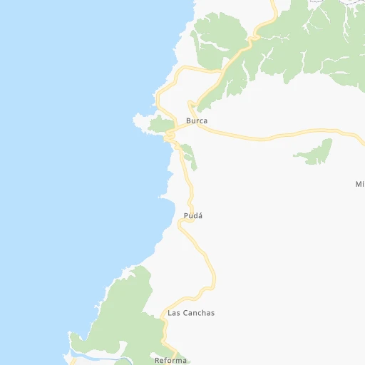
Roadmap (route) to go from Torreón Airport to Lautaro detailed above, you can also see the course layout on the map.
While doing trip Torreón (airport) - Lautaro by car, the calculated route ends at a distance , or more straight.
Distance and duration of the route between Torreón (airport) and Lautaro
Calculation of distance and route from Lautaro to Torreón (airport) :
226.8274.5 km3h20mn
Continue onto Ruta N-104 1h39mn 43.4 kmKeep right 0h1mn 564 mKeep left onto Cayumanqui 0h0mn 480 mTurn left onto Arturo Prat 0h0mn 380 mTurn right onto Paulino Flores 0h0mn 255 mTurn left onto 18 de Septiembre 0h24mn 26.4 kmTurn left onto Ruta Q-510 0h11mn 11.9 kmTurn left onto Florida 0h0mn 112 mTurn right onto Manuel Palacios 0h1mn 868 mAt roundabout, take exit 3 onto Rotonda Enlace Cabrero 0h2mn 2.9 kmKeep right and take 5 toward Los Ángeles, Temuco 0h23mn 40.4 kmKeep right and drive toward Los Ángeles norte, Rarinco, Los Tilos 0h1mn 519 mKeep right and drive toward Los Ángeles norte 0h0mn 105 mTurn slight right onto Acceso Norte a Los Ángeles 0h1mn 419 mTurn right onto Avenida Las Industrias 0h13mn 15.9 kmAt roundabout, take exit 1 onto Ruta 177 0h1mn 675 mKeep right toward 5 0h20mn 34.6 kmKeep left onto Ruta 5 Sur 1h55mn 90.4 kmKeep right and take S-10 toward Galvarino 0h0mn 285 mTurn sharp left onto Ruta S-10 0h2mn 2.5 kmTurn left onto Martínez de Rosas 0h0mn 141 mTurn right onto San Martín 0h0mn 140 mTurn left onto Avenida Pedro Aguirre Cerda 0h0mn 119 mTurn right onto Ramón Freire 0h0mn 119 mTurn left onto Galvarino 0h0mn 121 mTurn right onto José Manuel Balmaceda 0h1mn 587 mTurn left onto Valdivia 0h0mn 118 mTurn left onto Manuel Rodríguez 0h0mn 47 mArrive at destination 0h0mn 0 m
Travel from Torreón (airport) (Araucanía) to a selection of major cities.
Distances from Torreón Airport to biggest cities in Biobío
Other major cities in country :
- Punta Arenas [10], 117,430 inhabitants. 1,859 km
- Lo Prado [12], 104,316 inhabitants. 384 km
- Curico [11], 102,438 inhabitants. 213 km
- Villa Alemana [01], 97,320 inhabitants. 403 km
- San Antonio [01], 85,651 inhabitants. 338 km
- Ovalle [07], 77,138 inhabitants. 671 km
- Linares [11], 69,535 inhabitants. 122 km
- Quillota [01], 67,779 inhabitants. 423 km
- Penaflor [12], 65,495 inhabitants. 362 km
- Melipilla [12], 63,100 inhabitants. 340 km
- San Felipe [01], 59,294 inhabitants. 454 km
- Los Andes [01], 56,859 inhabitants. 450 km
- Buin [12], 55,441 inhabitants. 355 km
- Talagante [12], 51,764 inhabitants. 354 km
Route from Lautaro to major cities (Chile).
- Distance Lautaro Santiago587 km
- Distance Lautaro Puente Alto573 km
- Distance Lautaro Antofagasta1,668 km
- Distance Lautaro Vina del Mar618 km
- Distance Lautaro Valparaiso616 km
- Distance Lautaro Talcahuano210 km
- Distance Lautaro San Bernardo572 km
- Distance Lautaro Iquique2,051 km
- Distance Lautaro Concepcion197 km
- Distance Lautaro Rancagua508 km
- Distance Lautaro La Pintana574 km
- Distance Lautaro Talca352 km
- Distance Lautaro Arica2,242 km
- Distance Lautaro Coquimbo960 km
- Distance Lautaro Puerto Montt330 km
- Distance Lautaro La Serena966 km
- Distance Lautaro Chillan216 km
- Distance Lautaro Calama1,820 km
- Distance Lautaro Osorno235 km
- Distance Lautaro Valdivia159 km
Nearest cities to Torreón (airport) :
- Puente Alto, 510,417 inhabitants. 374 km
- Talcahuano, 252,968 inhabitants. 46 km
- San Bernardo, 249,858 inhabitants. 371 km
- Temuco, 238,129 inhabitants. 250 km
- Concepcion, 215,413 inhabitants. 49 km
- Rancagua, 212,695 inhabitants. 313 km
- La Pintana, 201,178 inhabitants. 374 km
- Talca, 197,479 inhabitants. 151 km
- Chillan, 150,396 inhabitants. 53 km
- Los Angeles, 125,430 inhabitants. 112 km
- Curico, 102,438 inhabitants. 213 km
- Coronel, 92,940 inhabitants. 72 km
- San Antonio, 85,651 inhabitants. 338 km
- Chiguayante, 82,545 inhabitants. 57 km
- Linares, 69,535 inhabitants. 122 km
- Penaflor, 65,495 inhabitants. 362 km
- Melipilla, 63,100 inhabitants. 340 km
- Buin, 55,441 inhabitants. 355 km
- Talagante, 51,764 inhabitants. 354 km
- Lota, 49,763 inhabitants. 78 km
- Tome, 46,698 inhabitants. 28 km
- Penco, 46,091 inhabitants. 39 km
- Angol, 44,856 inhabitants. 144 km
- Rengo, 38,100 inhabitants. 286 km
- Constitucion, 37,917 inhabitants. 132 km
- Santa Cruz, 33,283 inhabitants. 239 km
- Paine, 32,766 inhabitants. 348 km
- Villarrica, 31,602 inhabitants. 313 km
- San Carlos, 31,517 inhabitants. 65 km
- Cauquenes, 31,362 inhabitants. 67 km
- Curanilahue, 30,611 inhabitants. 124 km
- San Vicente de Tagua Tagua, 29,560 inhabitants. 272 km
- Molina, 28,775 inhabitants. 199 km
- Machali, 27,595 inhabitants. 317 km
- Pucon, 26,953 inhabitants. 316 km
- Parral, 26,904 inhabitants. 86 km
- Arauco, 24,659 inhabitants. 101 km
- Victoria, 24,555 inhabitants. 195 km
- Graneros, 23,301 inhabitants. 324 km
- El Monte, 23,090 inhabitants. 350 km
- San Vicente, 22,572 inhabitants. 272 km
- San Javier, 22,427 inhabitants. 132 km
- Lebu, 22,345 inhabitants. 151 km
- Mulchen, 22,170 inhabitants. 141 km
- Lautaro, 21,579 inhabitants. 227 km
- Nacimiento, 21,220 inhabitants. 112 km
- Canete, 20,158 inhabitants. 158 km
- Nueva Imperial, 18,777 inhabitants. 251 km
- Cabrero, 18,327 inhabitants. 64 km
- Chimbarongo, 17,356 inhabitants. 248 km
Location Torreón (airport) (Biobío) :
| Country flag |  |
| Location | Torreón (airport) |
| State | Biobío |
| County | Provincia de Ñuble |
| Country | Chile |
| Country code / ISO 2 | CL |
| Latitude | -36.4987400 |
| Longitude | -72.6807800 |
| Altitude | 0 meters |
| Time zone | America/Santiago |
Location Lautaro (Araucanía) :
| Country flag | |
| Location | Lautaro |
| State | Araucanía |
| County | Provincia de Cautín |
| Country | Chile |
| Country code / ISO 2 | CL |
| Latitude | -38.5306600 |
| Longitude | -72.4365200 |
| Altitude | 0 meters |
| Time zone | America/Santiago |
