
How to get from Grassdale (Victoria) to Brisbane (Queensland)
Calculate route from Grassdale (Victoria, Australia) to Brisbane (Queensland, Australia).
The flight distance (as the crow flies) between Grassdale and Brisbane is 1,563.3 km.
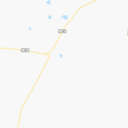
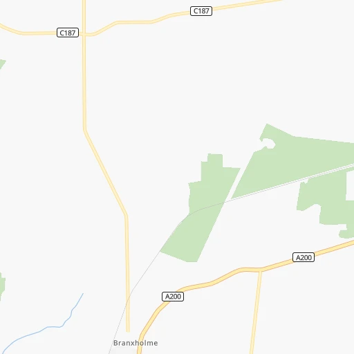
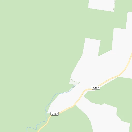
Roadmap (route) to go from Grassdale to Brisbane detailed above, you can also see the course layout on the map.
While doing trip Grassdale - Brisbane by car, the calculated route ends at a distance , or more straight.
Distance and duration of the route between Grassdale and Brisbane
Calculation of distance and route from Brisbane to Grassdale :
1,563.31,873.6 km21h29mn
Continue onto Dartmoor - Hamilton Road 0h26mn 35.0 kmTurn right onto Mount Baimbridge Road 0h0mn 62 mKeep left onto C187 0h0mn 68 mTurn slight left onto Scoresby Street 0h1mn 639 mAt roundabout, take exit 2 onto Glenelg Highway 0h0mn 233 mAt roundabout, take exit 2 onto Glenelg Highway 0h0mn 223 mAt roundabout, take exit 3 onto Glenelg Highway 0h0mn 244 mAt roundabout, take exit 2 onto Glenelg Highway 0h0mn 40 mTurn slight left onto Cox Street 0h0mn 123 mKeep left onto Glenelg Highway 1h32mn 43.9 kmTurn left onto Burnside Lane 0h6mn 8.4 kmTurn left onto Maroona - Glenthompson Road 0h23mn 34.1 kmTurn left onto Mortlake - Ararat Road 1h58mn 81.0 kmTurn sharp left onto High Street and drive toward St Arnaud 0h1mn 746 mTurn right onto North Street 0h11mn 15.1 kmTurn right onto Maryborough-Saint Arnaud Road 0h0mn 732 mTurn left onto Dunolly-Avoca Road 0h14mn 20.3 kmTurn left onto Broadway 0h0mn 418 mTurn right onto Tweeddale Street 0h14mn 19.6 kmTurn left onto Bridgewater - Dunolly Road 0h12mn 17.6 kmTurn left onto Bridgewater - Serpentine Road 0h0mn 54 mTurn slight left onto Serpentine Road 0h21mn 21.2 kmTurn left onto Loddon Valley Highway 0h0mn 143 mTurn right onto Treloar Street 0h13mn 18.5 kmTurn left onto Pyramid-Yarraberb Road 0h0mn 473 mTurn right onto Prairie West Road 0h1mn 565 mTurn left onto Echuca - Serpentine Road 0h13mn 11.1 kmTurn left onto Bendigo - Pyramid Road 0h0mn 94 mTurn right onto Echuca - Serpentine Road 0h5mn 3.8 kmKeep right onto Echuca - Mitiamo Road 0h1mn 1.3 kmKeep left onto Mount Terrick Road 1h32mn 44.2 kmContinue 0h0mn 19 mTurn right onto Murray Valley Highway 0h0mn 173 mAt roundabout, take exit 1 onto Warren Street 0h1mn 1.5 kmAt roundabout, take exit 1 onto Cobb Highway 0h10mn 12.9 kmTurn left onto Mathoura Line Road 0h15mn 23.1 kmTurn right onto Crump Road 0h0mn 728 mTurn left onto Cobb Highway 0h25mn 35.4 kmTurn right onto Crispe Street 0h0mn 61 mTurn left onto Crispe Street 0h1mn 815 mTurn left onto Henry Street 0h0mn 228 mTurn right onto Junction Street 0h0mn 342 mTurn left onto Mann Street 0h0mn 235 mTurn right onto Wellington Street 0h0mn 192 mTurn left onto Harrison Street 0h1mn 463 mTurn right onto Napier Street 0h0mn 171 mAt roundabout, take exit 2 onto Napier Street 0h0mn 133 mAt roundabout, take exit 2 onto Napier Street 0h0mn 110 mTurn right onto Davidson Street 0h2mn 1.7 kmAt roundabout, take exit 3 onto Finley Road 0h0mn 118 mTurn left onto Wanderer Street 0h22mn 31.7 kmTurn right onto Conargo Road 1h36mn 52.7 kmContinue onto Jerilderie Street 1h6mn 106.1 kmTurn right onto Newell Highway 0h1mn 676 mKeep left onto Newell Highway 0h5mn 4.1 kmTurn left onto Barellan Road 0h6mn 8.1 kmTurn right onto Bulloak Tank Road 0h3mn 5.1 kmTurn left onto Lismoyle Road 0h11mn 17.0 kmTurn left onto Newell Highway 1h0mn 99.5 kmTurn right onto Main Street 1h11mn 105.2 kmTurn right onto Dowling Street 0h21mn 30.5 kmKeep right and drive toward Hospital, Morrisey Way 0h0mn 38 mTurn left 0h2mn 1.2 kmTurn slight right onto Hartigan Avenue 0h2mn 1.6 kmTurn slight left onto Clarinda Street 1h18mn 117.7 kmContinue onto Erskine Street 0h1mn 515 mTurn left onto Brisbane Street 0h2mn 1.9 kmTurn left onto Bourke Street 0h4mn 5.4 kmTurn right onto Burraway Street 0h3mn 3.3 kmTurn right onto Mendooran Road 1h41mn 61.5 kmContinue onto Castlereagh Highway 0h1mn 709 mContinue onto Yalcogran Street 0h1mn 482 mTurn right onto Coonabarabran Road 1h37mn 54.9 kmTurn right onto Newell Highway 0h12mn 15.8 kmAt roundabout, take exit 2 onto John Street 0h1mn 847 mContinue onto Newell Highway 0h4mn 4.3 kmKeep left onto Newell Highway 0h0mn 89 mTurn slight left onto Newell Highway 1h7mn 110.6 kmAt roundabout, take exit 2 onto Newell Highway 0h1mn 486 mAt roundabout, take exit 2 onto Cooma Road 0h4mn 2.8 kmKeep left onto Newell Highway 0h0mn 88 mTurn slight left onto Tibbereena Street 0h0mn 313 mTurn right onto Lloyd Street 0h0mn 71 mAt roundabout, take exit 1 onto Maitland Street 0h0mn 238 mTurn right onto Killarney Street 0h0mn 164 mTurn slight left onto Barwan Street 2h13mn 214.1 kmTurn left onto Newell Highway 0h5mn 6.7 kmTurn left onto Gunsynd Way 0h1mn 1.8 kmTurn left onto McLean Street 0h0mn 167 mTurn sharp left onto Bowen Street 0h0mn 230 mTurn right onto Herbert Street 0h0mn 133 mAt roundabout, take exit 2 onto Herbert Street 0h0mn 142 mAt roundabout, take exit 1 onto Russell Street 0h1mn 532 mAt roundabout, take exit 2 onto Russell Street 0h3mn 2.0 kmTurn right onto Barwon Highway 0h1mn 854 mContinue onto Leichhardt Highway 1h27mn 136.7 kmTurn left onto Gore Highway 1h42mn 62.2 kmKeep right onto Toowoomba - Athol Road 0h14mn 17.7 kmAt roundabout, take exit 3 onto Anzac Avenue 0h0mn 142 mKeep right onto Herries Street 0h4mn 3.2 kmAt roundabout, take exit 2 onto Herries Street 0h1mn 536 mAt roundabout, take exit 2 onto Herries Street 0h0mn 239 mAt roundabout, take exit 2 onto Herries Street 0h0mn 246 mTurn left onto Cohoe Street 1h10mn 99.3 kmContinue onto Ipswich Motorway 0h3mn 4.2 kmKeep left and take M5 toward Jindalee, Northern Suburbs 0h6mn 8.6 kmKeep left toward 33 0h0mn 322 mKeep right toward 33 0h0mn 38 mTurn right onto Moggill Road 0h5mn 4.4 kmTurn left onto Benson Street 0h4mn 3.8 kmKeep right onto M3 0h2mn 1.1 kmTurn left onto Creek Street 0h0mn 57 mTurn left onto Edison Lane 0h0mn 72 mArrive at destination 0h0mn 0 m
Travel from Grassdale (Queensland) to a selection of major cities.
Distances from Grassdale to biggest cities in Victoria
- Wodonga,31,605 inhabitants.502 km
- Mill Park,30,517 inhabitants.302 km
- Mildura,30,016 inhabitants.405 km
- Sunbury,29,925 inhabitants.272 km
- Preston,29,925 inhabitants.297 km
- Narre Warren South,28,594 inhabitants.321 km
- Noble Park,28,377 inhabitants.310 km
- Doncaster East,27,047 inhabitants.308 km
- Croydon,26,946 inhabitants.320 km
- Richmond,26,121 inhabitants.295 km
- Narre Warren,25,882 inhabitants.322 km
- Bundoora,25,709 inhabitants.301 km
- Endeavour Hills,25,000 inhabitants.318 km
- Coburg,24,977 inhabitants.292 km
- Dandenong,24,919 inhabitants.313 km
- Ferntree Gully,24,724 inhabitants.321 km
- Kew,23,876 inhabitants.298 km
- Hampton Park,23,767 inhabitants.318 km
- Glen Iris,23,270 inhabitants.300 km
- Northcote,22,920 inhabitants.295 km
Other major cities in country :
- Maitland [02], 67,132 inhabitants. 1,062 km
- Armadale [08], 62,296 inhabitants. 2,413 km
- Rockhampton [04], 61,724 inhabitants. 1,813 km
- Adelaide Hills [05], 60,394 inhabitants. 415 km
- South Brisbane [04], 60,000 inhabitants. 1,565 km
Route from Brisbane to major cities (Australia).
- Distance Brisbane Sydney733 km
- Distance Brisbane Melbourne1,376 km
- Distance Brisbane Perth3,610 km
- Distance Brisbane Adelaide1,603 km
- Distance Brisbane Canberra945 km
- Distance Brisbane Newcastle620 km
- Distance Brisbane Wollongong801 km
- Distance Brisbane Geelong1,437 km
- Distance Brisbane Hobart1,791 km
- Distance Brisbane Darwin2,851 km
- Distance Brisbane Rockingham3,622 km
- Distance Brisbane Launceston1,646 km
- Distance Brisbane Bendigo1,321 km
- Distance Brisbane Ballarat1,415 km
- Distance Brisbane Mandurah3,622 km
- Distance Brisbane Bunbury3,629 km
- Distance Brisbane Maitland603 km
- Distance Brisbane Armadale3,596 km
- Distance Brisbane Adelaide Hills1,593 km
Nearest cities to Grassdale :
- Geelong, 226,034 inhabitants. 241 km
- Bendigo, 100,617 inhabitants. 260 km
- Ballarat, 97,937 inhabitants. 196 km
- Adelaide Hills, 60,394 inhabitants. 415 km
- Melton, 35,490 inhabitants. 259 km
- Warrnambool, 33,982 inhabitants. 98 km
- Mount Gambier, 23,209 inhabitants. 76 km
- Murray Bridge, 19,577 inhabitants. 366 km
- Highton, 17,793 inhabitants. 238 km
- Wyndham Vale, 17,304 inhabitants. 262 km
- Lara, 15,520 inhabitants. 244 km
- Grovedale, 14,308 inhabitants. 241 km
- Horsham, 14,285 inhabitants. 130 km
- Bacchus Marsh, 13,575 inhabitants. 246 km
- Geelong West, 12,121 inhabitants. 240 km
- Melton West, 10,381 inhabitants. 258 km
- Hamilton, 10,104 inhabitants. 34 km
- Kangaroo Flat, 9,492 inhabitants. 256 km
- Athelstone, 9,290 inhabitants. 419 km
- Swan Hill, 9,276 inhabitants. 323 km
- Colac, 9,089 inhabitants. 180 km
- Melton South, 8,916 inhabitants. 258 km
- Portland, 8,841 inhabitants. 61 km
- Mount Barker, 8,357 inhabitants. 393 km
- Hope Valley, 8,223 inhabitants. 423 km
- Golden Square, 8,170 inhabitants. 257 km
- Ararat, 8,076 inhabitants. 127 km
- Sebastopol, 8,045 inhabitants. 195 km
- Clifton Springs, 7,413 inhabitants. 258 km
- Maryborough, 7,046 inhabitants. 203 km
- Campbelltown, 7,005 inhabitants. 420 km
- Kurunjang, 6,728 inhabitants. 260 km
- Castlemaine, 6,604 inhabitants. 241 km
- Paradise, 6,327 inhabitants. 421 km
- Leopold, 6,120 inhabitants. 251 km
- Hamlyn Heights, 6,075 inhabitants. 238 km
- Kennington, 5,830 inhabitants. 261 km
- Stawell, 5,737 inhabitants. 130 km
- Naracoorte, 5,674 inhabitants. 123 km
- Ballarat Central, 5,645 inhabitants. 196 km
- Modbury, 5,570 inhabitants. 423 km
- Millicent, 5,551 inhabitants. 116 km
- Bell Park, 5,286 inhabitants. 239 km
- Ballarat East, 4,995 inhabitants. 197 km
- Bell Post Hill, 4,919 inhabitants. 237 km
- Strathalbyn, 4,731 inhabitants. 375 km
- East Geelong, 3,834 inhabitants. 243 km
- Nairne, 3,648 inhabitants. 393 km
- Hectorville, 3,477 inhabitants. 420 km
- Bridgewater, 3,469 inhabitants. 405 km
Location Grassdale (Victoria) :
| Country flag |  |
| Location | Grassdale |
| State | Victoria |
| County | Glenelg |
| Country | Australia |
| Country code / ISO 2 | AU |
| Latitude | -37.7962500 |
| Longitude | 141.6454200 |
| Altitude | 0 meters |
| Time zone | Australia/Melbourne |
Location Brisbane (Queensland) :
| Country flag | |
| Location | Brisbane |
| State | Queensland |
| County | Brisbane |
| Country | Australia |
| Country code / ISO 2 | AU |
| Latitude | -27.4679400 |
| Longitude | 153.0280900 |
| Altitude | 0 meters |
| Time zone | Australia/Brisbane |


