

How to get from Kolbu stasjon (Oppland) to Grimstad (Aust-Agder)
Calculate route from Kolbu stasjon (Oppland, Norway) to Grimstad (Aust-Agder, Norway).
The flight distance (as the crow flies) between Kolbu stasjon and Grimstad is 284.1 km.
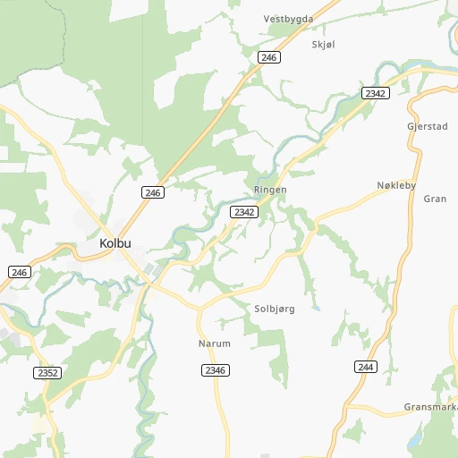
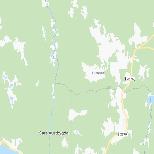
Roadmap (route) to go from Kolbu stasjon to Grimstad detailed above, you can also see the course layout on the map.
While doing trip Kolbu stasjon - Grimstad by car, the calculated route ends at a distance , or more straight.
Distance and duration of the route between Kolbu stasjon and Grimstad
Calculation of distance and route from Grimstad to Kolbu stasjon :
284.1362.8 km5h40mn
Continue onto Lundevegen 0h0mn 142 mTurn left onto Skaugerudvegen 0h1mn 817 mTurn right onto Nyvegen 0h2mn 1.8 kmTurn left onto Vestvegen 0h5mn 4.7 kmTurn slight right onto Kolbulinna 0h6mn 6.4 kmTurn left onto Einavegen 0h27mn 33.6 kmKeep right onto E 16, 4 0h0mn 235 mAt roundabout, take exit 1 onto Sandkrysset 0h0mn 145 mAt roundabout, take exit 2 onto E 16 0h13mn 15.9 kmKeep right onto E 16 0h0mn 160 mAt roundabout, take exit 2 onto Hadelandsveien 0h0mn 242 mAt roundabout, take exit 1 onto Hadelandsveien 0h14mn 12.3 kmAt roundabout, take exit 2 onto Osloveien 0h0mn 98 mTurn slight right onto Osloveien 0h18mn 20.2 kmKeep right onto Ringeriksveien and drive toward Drammen 0h0mn 185 mContinue onto Skarveien 0h1mn 1.1 kmAt roundabout, take exit 1 onto Lierveien 0h19mn 20.8 kmAt roundabout, take exit 2 onto Ringeriksveien 0h4mn 3.7 kmKeep right onto Ringeriksveien 0h1mn 1.0 kmAt roundabout, take exit 2 onto Ringeriksveien 0h2mn 1.5 kmAt roundabout, take exit 2 onto E 18 2h3mn 182.3 kmAt roundabout, take exit 1 onto E 18 1h38mn 53.5 kmKeep right onto E 18 and take 420 toward Grimstad 0h0mn 247 mTurn right onto Arendalsveien 0h2mn 1.4 kmTurn slight right onto Voss gate 0h1mn 368 mTurn right onto Storgaten 0h0mn 20 mTurn right onto Vestregate 0h0mn 4 mTurn right onto Storgaten 0h0mn 6 mArrive at destination 0h0mn 0 m
Travel from Kolbu stasjon (Aust-Agder) to a selection of major cities.
Distances from Kolbu stasjon to biggest cities in Oppland
Other major cities in country :
Route from Grimstad to major cities (Norway).
- Distance Grimstad Oslo214 km
- Distance Grimstad Bergen294 km
- Distance Grimstad Trondheim575 km
- Distance Grimstad Stavanger180 km
- Distance Grimstad Drammen181 km
- Distance Grimstad Fredrikstad166 km
- Distance Grimstad Kristiansand41 km
- Distance Grimstad Sandnes175 km
- Distance Grimstad Tromso1,352 km
- Distance Grimstad Sarpsborg179 km
- Distance Grimstad Skien113 km
Nearest cities to Kolbu stasjon :
- Oslo, 580,000 inhabitants. 82 km
- Trondheim, 147,139 inhabitants. 310 km
- Drammen, 90,722 inhabitants. 106 km
- Fredrikstad, 72,760 inhabitants. 160 km
- Kristiansand, 63,814 inhabitants. 319 km
- Sarpsborg, 52,159 inhabitants. 154 km
- Skien, 50,595 inhabitants. 173 km
- Sandefjord, 42,654 inhabitants. 172 km
- Tonsberg, 38,914 inhabitants. 155 km
- Moss, 34,492 inhabitants. 136 km
- Porsgrunn, 34,377 inhabitants. 179 km
- Arendal, 30,916 inhabitants. 268 km
- Hamar, 29,479 inhabitants. 24 km
- Larvik, 23,113 inhabitants. 182 km
- Halden, 21,970 inhabitants. 174 km
- Lillehammer, 19,096 inhabitants. 54 km
- Kongsberg, 17,667 inhabitants. 125 km
- Horten, 17,660 inhabitants. 138 km
- Gjovik, 17,596 inhabitants. 16 km
- Lillestrom, 14,000 inhabitants. 79 km
- Honefoss, 13,678 inhabitants. 60 km
- Ski, 12,513 inhabitants. 104 km
- Elverum, 12,490 inhabitants. 51 km
- Askim, 12,482 inhabitants. 121 km
- Jessheim, 12,365 inhabitants. 62 km
- Stjordalshalsen, 11,416 inhabitants. 313 km
- Drobak, 11,363 inhabitants. 110 km
- Kongsvinger, 11,181 inhabitants. 86 km
- Vennesla, 10,931 inhabitants. 308 km
- Nesoddtangen, 10,911 inhabitants. 88 km
- Grimstad, 9,561 inhabitants. 285 km
- Sogne, 9,000 inhabitants. 331 km
- Raholt, 8,593 inhabitants. 48 km
- Brumunddal, 8,441 inhabitants. 27 km
- Notodden, 8,306 inhabitants. 147 km
- As, 7,961 inhabitants. 110 km
- Fetsund, 6,441 inhabitants. 84 km
- Malvik, 6,419 inhabitants. 309 km
- Holmestrand, 6,135 inhabitants. 132 km
- Lillesand, 6,081 inhabitants. 299 km
- Raufoss, 6,052 inhabitants. 11 km
- Klofta, 5,942 inhabitants. 68 km
- Stavern, 5,593 inhabitants. 188 km
- Tranby, 5,552 inhabitants. 98 km
- Mysen, 5,516 inhabitants. 127 km
- Vestby, 5,330 inhabitants. 117 km
- Kragero, 5,158 inhabitants. 212 km
- Fevik, 4,989 inhabitants. 279 km
- Rotnes, 4,705 inhabitants. 67 km
- Tjome, 4,663 inhabitants. 173 km
Location Kolbu stasjon (Oppland) :
| Country flag |  |
| Location | Kolbu stasjon |
| State | Oppland |
| County | Østre Toten |
| Country | Norway |
| Country code / ISO 2 | NO |
| Latitude | 60.6533700 |
| Longitude | 10.7428800 |
| Altitude | 0 meters |
| Time zone | Europe/Oslo |
Location Grimstad (Aust-Agder) :
| Country flag | |
| Location | Grimstad |
| State | Aust-Agder |
| County | Grimstad |
| Country | Norway |
| Country code / ISO 2 | NO |
| Latitude | 58.3405000 |
| Longitude | 8.5934300 |
| Altitude | 0 meters |
| Time zone | Europe/Oslo |


