
How to get from Santa Barbara Regional (airport) (Guerrero) to Monterrey (Nuevo León)
Calculate route from Santa Barbara Regional (airport) (Guerrero, Mexico) to Monterrey (Nuevo León, Mexico).
The flight distance (as the crow flies) between Santa Barbara Regional (airport) and Monterrey is 904.1 km.
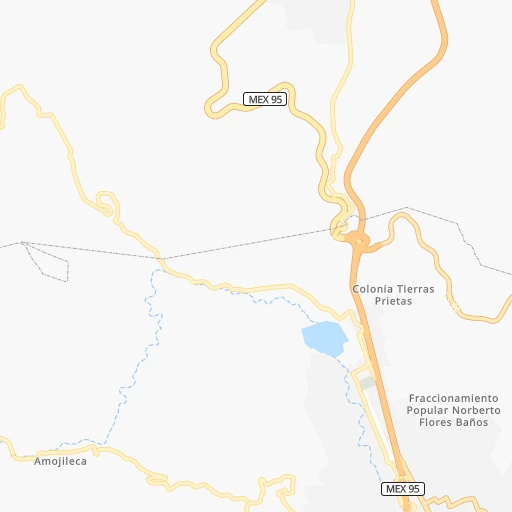
Roadmap (route) to go from Santa Barbara Regional Airport to Monterrey detailed above, you can also see the course layout on the map.
While doing trip Santa Barbara Regional (airport) - Monterrey by car, the calculated route ends at a distance , or more straight.
Distance and duration of the route between Santa Barbara Regional (airport) and Monterrey
Calculation of distance and route from Monterrey to Santa Barbara Regional (airport) :
904.11,148.7 km13h5mn
Continue onto Avenida Llano Grande 0h1mn 1.2 kmTurn right onto Calle 7 0h0mn 386 mTurn left onto Carretera Antigua México-Acapulco 0h1mn 466 mTurn sharp right 0h0mn 45 mTurn slight right onto Chilpancingo-Chichihualco 0h0mn 125 mTurn left 2h32mn 150.6 kmContinue onto Autopista de Peaje Cuernavaca-México 0h14mn 22.9 kmKeep right and take MEX 95 toward Cuernavaca Centro 0h1mn 1.3 kmContinue onto Avenida Morelos Sur 0h2mn 1.6 kmTurn slight right onto Avenida José María Morelos y Pavón 0h6mn 5.0 kmAt roundabout, take exit 2 onto Avenida Emiliano Zapata 0h2mn 1.7 kmContinue onto Carretera Federal México-Cuernavaca 0h2mn 2.6 kmKeep right onto Calle Nacional 0h1mn 346 mKeep left onto Callejón Tejocote 0h0mn 59 mTurn left onto Callejón Tejocote 0h0mn 17 mTurn left onto Calle Tejocote 0h0mn 25 mTurn right onto Calle Tejocote 0h0mn 67 mTurn right onto Calle Tejocote 0h0mn 28 mTurn left onto Carretera Federal México-Cuernavaca 0h0mn 61 mKeep left onto Avenida Nacional 0h1mn 434 mKeep left onto Carretera Federal México-Cuernavaca 0h0mn 161 mTurn left onto Nacional 0h1mn 402 mTurn right onto Carretera Federal México-Cuernavaca 0h1mn 983 mKeep left onto MEX 95 0h2mn 2.6 kmTurn right onto Calle Hidalgo 0h1mn 970 mTurn left onto Calle Lázaro Cárdenas 0h0mn 14 mTurn sharp right onto Calle Lázaro Cárdenas 0h4mn 4.0 kmContinue onto Avenida Zempoala 0h1mn 1.1 kmTurn right onto Calle Benito Juárez 0h0mn 65 mTurn right onto Tianguis de alimentos 0h0mn 53 mTurn left 0h24mn 29.4 kmKeep right 0h0mn 180 mTurn right 0h0mn 4 mTurn left 0h4mn 4.7 kmKeep right 0h0mn 130 mKeep left and drive toward Cuernavaca 0h0mn 162 mKeep left 0h4mn 3.2 kmKeep right 0h0mn 52 mTurn left onto Avenida San Fernando 0h0mn 149 mKeep right onto Avenida Insurgentes Sur 0h1mn 636 mKeep right onto Avenida Insurgentes Sur 0h0mn 219 mKeep right and drive toward Picacho Ajusco, Periférico Poniente 0h0mn 60 mKeep left and take EJE CENTRAL toward Sala Nezahualcóyotl 0h0mn 102 mKeep left and drive toward Ciudad Universitaria 0h0mn 96 mKeep right onto Avenida Insurgentes Sur and drive toward Sala Nezahualcóyotl, Ciudad Universitaria 0h2mn 2.0 kmKeep right 0h0mn 50 mKeep left 0h2mn 1.6 kmKeep left toward EJE 10 SUR 0h0mn 326 mTurn sharp right onto Avenida Revolución 0h4mn 2.8 kmTurn left onto Calle Barranca del Muerto 0h0mn 165 mKeep right and drive toward Molinos, Periférico Norte 0h1mn 859 mKeep left and drive toward San Antonio 0h0mn 599 mKeep right 0h0mn 618 mKeep left onto Autopista Urbana Norte 0h0mn 27 mContinue onto Autopista Urbana Norte 0h19mn 30.6 kmKeep left and take MEX 57 toward Queretaro, Tepotzotlan 1h18mn 114.9 kmKeep left onto Autopista de Peaje México-Querétaro 0h1mn 1.2 kmKeep right onto Autopista de Peaje México-Querétaro 1h30mn 44.6 kmKeep right and take MEX 57D, QRO 100 toward Pena de Bernal 0h0mn 69 mKeep left and take MEX 57D toward San Luis Potosi, San Miguel de Allende 0h23mn 37.6 kmKeep right 2h45mn 157.2 kmKeep right and take MEX 57D toward Matehuala, Zacatecas 0h0mn 178 mKeep right and take MEX 57D toward Matehuala, Zacatecas 2h16mn 190.4 kmKeep right onto Libramiento de Matehuala 2h17mn 206.4 kmKeep right onto Autopista de Peaje Puerto México-Ojo Caliente 1h33mn 54.9 kmKeep right 0h5mn 5.7 kmKeep right and take 40 toward Monterrey 1h31mn 50.6 kmKeep right onto Boulevard Licenciado Gustavo Díaz Ordaz 0h2mn 1.4 kmKeep right onto Calzada San Jerónimo 0h1mn 1.2 kmKeep left and take MEX 85, 210, 9, 22-A toward Obispado 0h0mn 237 mKeep right toward 22-A 0h2mn 1.9 kmTurn left onto Avenida Venustiano Carranza 0h0mn 298 mTurn right onto Calle Mariano Matamoros 0h1mn 621 mTurn left onto Calle Porfirio Díaz 0h0mn 63 mTurn right onto Calle Juan Ignacio Ramón 0h1mn 786 mTurn left onto Avenida Cuauhtémoc 0h0mn 407 mArrive at destination 0h0mn 0 m
Travel from Santa Barbara Regional (airport) (Nuevo León) to a selection of major cities.
Distances from Santa Barbara Regional Airport to biggest cities in Guerrero
Other major cities in country :
- Aguascalientes [01], 658,179 inhabitants. 560 km
- Coyoacan [09], 628,063 inhabitants. 201 km
- Santiago de Queretaro [22], 626,495 inhabitants. 348 km
- Saltillo [07], 621,250 inhabitants. 887 km
- Tlalpan [09], 607,545 inhabitants. 195 km
- Mexicali [02], 597,099 inhabitants. 2,316 km
- Hermosillo [26], 595,811 inhabitants. 1,735 km
- Morelia [16], 592,797 inhabitants. 295 km
- Veracruz [30], 568,313 inhabitants. 399 km
- Cancun [23], 542,043 inhabitants. 1,389 km
- Santa Maria Chimalhuacan [15], 525,389 inhabitants. 214 km
- Torreon [07], 524,066 inhabitants. 975 km
- Cuauhtemoc [09], 521,348 inhabitants. 212 km
- Ciudad Lopez Mateos [15], 521,034 inhabitants. 223 km
- Toluca [15], 505,881 inhabitants. 191 km
- Reynosa [28], 498,654 inhabitants. 955 km
- Tlaquepaque [14], 493,646 inhabitants. 524 km
- Tuxtla [05], 481,128 inhabitants. 687 km
- Cuautitlan Izcalli [15], 475,179 inhabitants. 233 km
- Victoria de Durango [10], 457,140 inhabitants. 895 km
Route from Monterrey to major cities (Mexico).
- Distance Monterrey Mexico City706 km
- Distance Monterrey Iztapalapa715 km
- Distance Monterrey Ecatepec de Morelos688 km
- Distance Monterrey Guadalajara640 km
- Distance Monterrey Puebla770 km
- Distance Monterrey Juarez901 km
- Distance Monterrey Tijuana1,789 km
- Distance Monterrey Ciudad Nezahualcoyotl711 km
- Distance Monterrey Gustavo Adolfo Madero699 km
- Distance Monterrey Leon de los Aldama525 km
- Distance Monterrey Zapopan634 km
- Distance Monterrey Naucalpan de Juarez699 km
- Distance Monterrey Chihuahua660 km
- Distance Monterrey Alvaro Obregon712 km
- Distance Monterrey Merida1,212 km
- Distance Monterrey Tlalnepantla693 km
- Distance Monterrey San Luis Potosi398 km
- Distance Monterrey Culiacan719 km
- Distance Monterrey Aguascalientes467 km
- Distance Monterrey Acapulco de Juarez983 km
Nearest cities to Santa Barbara Regional (airport) :
- Mexico City, 12,294,193 inhabitants. 211 km
- Iztapalapa, 1,820,888 inhabitants. 204 km
- Ecatepec de Morelos, 1,806,226 inhabitants. 231 km
- Puebla, 1,590,256 inhabitants. 214 km
- Ciudad Nezahualcoyotl, 1,232,220 inhabitants. 210 km
- Gustavo Adolfo Madero, 1,193,161 inhabitants. 218 km
- Naucalpan de Juarez, 846,185 inhabitants. 214 km
- Alvaro Obregon, 727,034 inhabitants. 201 km
- Tlalnepantla, 715,767 inhabitants. 222 km
- Acapulco de Juarez, 652,136 inhabitants. 91 km
- Coyoacan, 628,063 inhabitants. 201 km
- Tlalpan, 607,545 inhabitants. 195 km
- Morelia, 592,797 inhabitants. 295 km
- Santa Maria Chimalhuacan, 525,389 inhabitants. 214 km
- Cuauhtemoc, 521,348 inhabitants. 212 km
- Ciudad Lopez Mateos, 521,034 inhabitants. 223 km
- Toluca, 505,881 inhabitants. 191 km
- Cuautitlan Izcalli, 475,179 inhabitants. 233 km
- Venustiano Carranza, 447,459 inhabitants. 213 km
- Azcapotzalco, 425,298 inhabitants. 216 km
- Xalapa de Enriquez, 425,148 inhabitants. 350 km
- Xochimilco, 404,458 inhabitants. 192 km
- Iztacalco, 384,326 inhabitants. 208 km
- Xico, 365,777 inhabitants. 198 km
- Benito Juarez, 355,017 inhabitants. 207 km
- Miguel Hidalgo, 353,534 inhabitants. 210 km
- Ixtapaluca, 351,001 inhabitants. 205 km
- Tlahuac, 344,106 inhabitants. 198 km
- Cuernavaca, 343,769 inhabitants. 154 km
- Pachuca de Soto, 319,581 inhabitants. 295 km
- Coacalco, 313,405 inhabitants. 233 km
- Celaya, 305,901 inhabitants. 356 km
- Oaxaca, 262,566 inhabitants. 302 km
- Los Reyes Acaquilpan, 251,168 inhabitants. 207 km
- Colonia del Valle, 250,000 inhabitants. 205 km
- Nicolas Romero, 245,383 inhabitants. 231 km
- Ojo de Agua, 242,272 inhabitants. 241 km
- Tehuacan, 241,429 inhabitants. 245 km
- Uruapan, 237,308 inhabitants. 337 km
- Magdalena Contreras, 228,927 inhabitants. 198 km
- Buenavista, 206,081 inhabitants. 229 km
- Poza Rica de Hidalgo, 174,526 inhabitants. 394 km
- Delegacion Cuajimalpa de Morelos, 173,625 inhabitants. 201 km
- San Pablo de las Salinas, 173,557 inhabitants. 237 km
- Metepec, 172,982 inhabitants. 188 km
- Chilpancingo, 165,250 inhabitants. 3 km
- Chalco, 163,996 inhabitants. 199 km
- Jiutepec, 162,427 inhabitants. 150 km
- Cholula, 151,667 inhabitants. 210 km
- Cuautla, 146,178 inhabitants. 151 km
Location Santa Barbara Regional (airport) (Guerrero) :
| Country flag |  |
| Location | Santa Barbara Regional (airport) |
| State | Guerrero |
| County | Chilpancingo de los Bravo |
| Country | Mexico |
| Country code / ISO 2 | MX |
| Latitude | 17.5732600 |
| Longitude | -99.5151500 |
| Altitude | 0 meters |
| Time zone | America/Mexico_City |
Location Monterrey (Nuevo León) :
| Country flag | |
| Location | Monterrey |
| State | Nuevo León |
| County | Monterrey |
| Country | Mexico |
| Country code / ISO 2 | MX |
| Latitude | 25.6750700 |
| Longitude | -100.3184700 |
| Altitude | 0 meters |
| Time zone | America/Monterrey |


