

How to get from Zvishavane (airport) (Midlands) to Kadoma (Mashonaland West)
Calculate route from Zvishavane (airport) (Midlands, Zimbabwe) to Kadoma (Mashonaland West, Zimbabwe).
The flight distance (as the crow flies) between Zvishavane (airport) and Kadoma is 218.3 km.
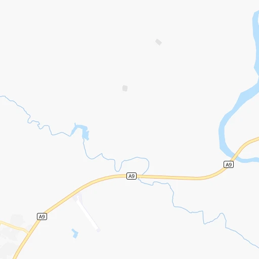
Roadmap (route) to go from Zvishavane Airport to Kadoma detailed above, you can also see the course layout on the map.
While doing trip Zvishavane (airport) - Kadoma by car, the calculated route ends at a distance , or more straight.
Distance and duration of the route between Zvishavane (airport) and Kadoma
Calculation of distance and route from Kadoma to Zvishavane (airport) :
218.3257.3 km3h23mn
Continue 0h4mn 1.1 kmTurn left onto Masvingo-Mbalabala Road 0h2mn 2.0 kmTurn right 0h1mn 1.1 kmKeep right 0h1mn 342 mTurn slight left 0h2mn 1.0 kmTurn left 0h0mn 71 mTurn right 0h1mn 444 mTurn right onto A18 1h10mn 81.7 kmTurn left onto A18 0h27mn 31.8 kmAt roundabout, take exit 2 onto A18 0h1mn 911 mAt roundabout, take exit 2 onto A18 0h1mn 1.1 kmAt roundabout, take exit 2 onto 7th Street 0h1mn 855 mTurn right onto Lobengula Avenue 0h1mn 2.0 kmAt roundabout, take exit 2 onto R2 1h33mn 60.0 kmAt roundabout, take exit 1 onto R2 0h1mn 781 mAt roundabout, take exit 2 onto R2 1h53mn 68.9 kmKeep left onto Robert Mugabe Road 0h4mn 3.0 kmTurn left 0h0mn 65 mTurn right 0h0mn 127 mArrive at destination 0h0mn 0 m
Travel from Zvishavane (airport) (Mashonaland West) to a selection of major cities.
Distances from Zvishavane Airport to biggest cities in Midlands
Other major cities in country :
Route from Kadoma to major cities (Zimbabwe).
- Distance Kadoma Harare133 km
- Distance Kadoma Bulawayo246 km
- Distance Kadoma Chitungwiza128 km
- Distance Kadoma Mutare299 km
- Distance Kadoma Gweru125 km
- Distance Kadoma Epworth139 km
- Distance Kadoma Kwekwe67 km
- Distance Kadoma Masvingo215 km
- Distance Kadoma Marondera174 km
Nearest cities to Zvishavane (airport) :
- Harare, 1,542,813 inhabitants. 292 km
- Bulawayo, 699,385 inhabitants. 158 km
- Chitungwiza, 340,360 inhabitants. 274 km
- Mutare, 184,205 inhabitants. 308 km
- Gweru, 146,073 inhabitants. 98 km
- Epworth, 123,250 inhabitants. 289 km
- Kwekwe, 99,149 inhabitants. 154 km
- Kadoma, 79,174 inhabitants. 219 km
- Masvingo, 76,290 inhabitants. 81 km
- Chinhoyi, 61,739 inhabitants. 326 km
- Marondera, 57,082 inhabitants. 280 km
- Norton, 52,054 inhabitants. 276 km
- Chegutu, 47,294 inhabitants. 241 km
- Bindura, 37,423 inhabitants. 357 km
- Zvishavane, 35,896 inhabitants. 5 km
- Redcliff, 33,197 inhabitants. 144 km
- Rusape, 29,292 inhabitants. 290 km
- Chiredzi, 28,205 inhabitants. 185 km
- Beitbridge, 26,459 inhabitants. 215 km
- Gokwe, 18,942 inhabitants. 262 km
- Chipinge, 18,860 inhabitants. 265 km
- Shurugwi, 17,075 inhabitants. 70 km
- Gwanda, 14,450 inhabitants. 134 km
- Mashava, 12,994 inhabitants. 50 km
- Chivhu, 10,369 inhabitants. 164 km
- Shamva, 10,317 inhabitants. 367 km
- Mazowe, 9,966 inhabitants. 324 km
- Glendale, 9,768 inhabitants. 343 km
- Banket, 9,641 inhabitants. 325 km
- Mutoko, 9,532 inhabitants. 393 km
- Murehwa, 8,559 inhabitants. 345 km
- Inyati, 8,402 inhabitants. 147 km
- Penhalonga, 7,681 inhabitants. 315 km
- Chakari, 6,472 inhabitants. 249 km
- Concession, 4,983 inhabitants. 336 km
- Nyanga, 4,852 inhabitants. 363 km
- Mvuma, 4,331 inhabitants. 122 km
- Binga, 4,327 inhabitants. 415 km
- Shangani, 3,835 inhabitants. 94 km
- Macheke, 3,642 inhabitants. 303 km
- Odzi, 3,438 inhabitants. 284 km
Location Zvishavane (airport) (Midlands) :
| Country flag |  |
| Location | Zvishavane (airport) |
| State | Midlands |
| County | |
| Country | Zimbabwe |
| Country code / ISO 2 | ZW |
| Latitude | -20.2905800 |
| Longitude | 30.0890400 |
| Altitude | 0 meters |
| Time zone | Africa/Harare |
Location Kadoma (Mashonaland West) :
| Country flag | |
| Location | Kadoma |
| State | Mashonaland West |
| County | |
| Country | Zimbabwe |
| Country code / ISO 2 | ZW |
| Latitude | -18.3332800 |
| Longitude | 29.9153400 |
| Altitude | 0 meters |
| Time zone | Africa/Harare |
