

Home
››
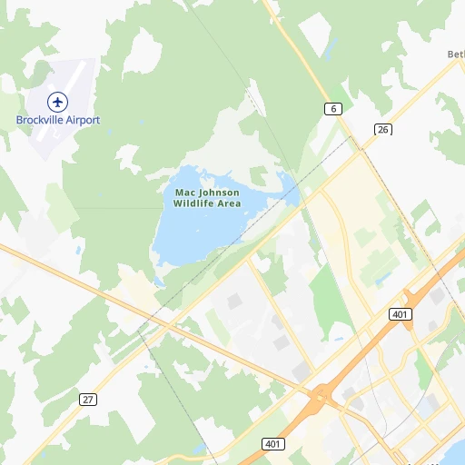
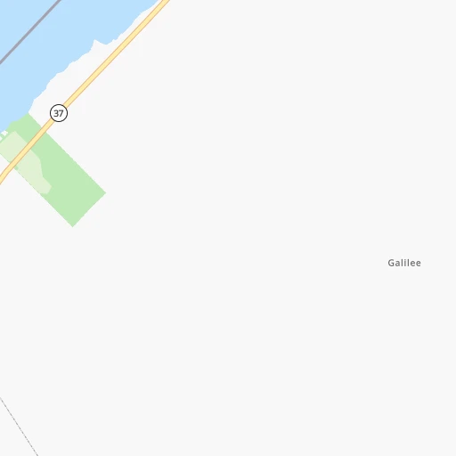
Brockville Regional Tackaberry Airport
››
Roadmap from Brockville Regional Tackaberry Airport to Beloeil
How to get from Brockville Regional Tackaberry (airport) (Ontario) to Beloeil (Quebec)
Calculate route from Brockville Regional Tackaberry (airport) (Ontario, Canada) to Beloeil (Quebec, Canada).
The flight distance (as the crow flies) between Brockville Regional Tackaberry (airport) and Beloeil is 224.7 km.
Roadmap (route) to go from Brockville Regional Tackaberry Airport to Beloeil detailed above, you can also see the course layout on the map.
While doing trip Brockville Regional Tackaberry (airport) - Beloeil by car, the calculated route ends at a distance , or more straight.
Distance and duration of the route between Brockville Regional Tackaberry (airport) and Beloeil
Calculation of distance and route from Beloeil to Brockville Regional Tackaberry (airport) :
224.7243.1 km3h5mn
Continue 0h1mn 264 mTurn right onto Airport Road 0h3mn 1.9 kmTurn right onto Debruge Road 0h0mn 67 mTurn sharp left onto County Road 29 0h5mn 4.9 kmTurn right 0h15mn 22.9 kmContinue onto Highway 401 2h41mn 147.2 kmKeep right and drive toward Sainte-Anne-de-Bellevue, Boulevard des Anciens-Combattants 0h22mn 28.8 kmKeep right onto 20 0h1mn 597 mKeep right onto 20 0h3mn 2.8 kmKeep right 0h0mn 378 mTurn left onto Avenue Atwater 0h0mn 219 mKeep right 0h0mn 57 mAt roundabout, take exit 2 onto Rue Thomas-Keefer 0h0mn 222 mTurn right onto Rue Saint-Patrick 0h3mn 1.6 kmTurn right onto Rue Bridge 0h2mn 1.1 kmKeep right onto Rue Bridge 0h0mn 95 mKeep left onto Rue Bridge 0h0mn 15 mContinue onto Rue Bridge 0h3mn 2.7 kmContinue onto Boulevard Sir-Wilfrid-Laurier 0h2mn 1.2 kmTurn slight right onto Rue Saint-Louis 0h22mn 25.3 kmKeep right onto Rue Brunelle 0h0mn 188 mTurn left onto Rue Richelieu 0h0mn 183 mTurn left onto Rue Jeannotte 0h0mn 188 mTurn right onto Rue Laurier 0h0mn 47 mTurn left onto Rue Brodeur 0h0mn 261 mArrive at destination 0h0mn 0 m
Travel from Brockville Regional Tackaberry (airport) (Quebec) to a selection of major cities.
Distances from Brockville Regional Tackaberry Airport to biggest cities in Ontario
- St. Catharines,131,989 inhabitants.324 km
- Cambridge,120,372 inhabitants.392 km
- Guelph,115,760 inhabitants.380 km
- East York,115,365 inhabitants.305 km
- Kingston,114,195 inhabitants.74 km
- Thunder Bay,99,334 inhabitants.1,113 km
- Waterloo,97,475 inhabitants.403 km
- Ajax,90,167 inhabitants.276 km
- Pickering,87,838 inhabitants.282 km
- Brantford,87,759 inhabitants.399 km
- Milton,84,362 inhabitants.353 km
- Sarnia,82,998 inhabitants.565 km
- Niagara Falls,82,000 inhabitants.316 km
- Willowdale,79,440 inhabitants.307 km
- Peterborough,75,877 inhabitants.207 km
- Sault Ste. Marie,74,948 inhabitants.700 km
- Newmarket,74,295 inhabitants.303 km
- Norfolk County,60,847 inhabitants.423 km
- Welland,50,331 inhabitants.336 km
- North Bay,50,170 inhabitants.345 km
Other major cities in country :
- Sherbrooke [10], 129,447 inhabitants. 315 km
- Anmore [02], 126,456 inhabitants. 3,556 km
- Levis [10], 126,396 inhabitants. 429 km
- Kelowna [02], 125,109 inhabitants. 3,307 km
- Trois-Rivieres [10], 119,693 inhabitants. 314 km
- Coquitlam [02], 114,565 inhabitants. 3,550 km
- Sydney [07], 105,968 inhabitants. 1,226 km
- Delta [02], 101,668 inhabitants. 3,563 km
- Dartmouth [07], 101,343 inhabitants. 963 km
- St. John's [05], 99,182 inhabitants. 1,801 km
- Terrebonne [10], 94,703 inhabitants. 203 km
- Saint John [04], 87,857 inhabitants. 766 km
- Moncton [04], 87,467 inhabitants. 871 km
- Nanaimo [02], 84,905 inhabitants. 3,637 km
- Saint-Laurent [10], 77,391 inhabitants. 190 km
- Chilliwack [02], 77,000 inhabitants. 3,494 km
- Repentigny [10], 76,237 inhabitants. 218 km
- Fort McMurray [01], 76,000 inhabitants. 2,806 km
- La Haute-Saint-Charles [10], 74,070 inhabitants. 422 km
- Red Deer [01], 73,593 inhabitants. 2,897 km
Route from Beloeil to major cities (Canada).
- Distance Beloeil Toronto534 km
- Distance Beloeil Calgary3,046 km
- Distance Beloeil Ottawa195 km
- Distance Beloeil Edmonton2,995 km
- Distance Beloeil Mississauga557 km
- Distance Beloeil North York531 km
- Distance Beloeil Winnipeg1,847 km
- Distance Beloeil Scarborough519 km
- Distance Beloeil Vancouver3,714 km
- Distance Beloeil Hamilton588 km
- Distance Beloeil Brampton560 km
- Distance Beloeil Surrey3,696 km
- Distance Beloeil Halifax763 km
- Distance Beloeil Etobicoke547 km
- Distance Beloeil London701 km
- Distance Beloeil Okanagan3,424 km
- Distance Beloeil Victoria3,753 km
- Distance Beloeil Windsor866 km
- Distance Beloeil Markham515 km
- Distance Beloeil Oshawa483 km
Nearest cities to Brockville Regional Tackaberry (airport) :
- Montreal, 1,600,000 inhabitants. 196 km
- Ottawa, 812,129 inhabitants. 86 km
- Laval, 376,845 inhabitants. 192 km
- Gatineau, 242,124 inhabitants. 93 km
- Longueuil, 229,330 inhabitants. 202 km
- Nepean, 180,000 inhabitants. 79 km
- Kingston, 114,195 inhabitants. 74 km
- Terrebonne, 94,703 inhabitants. 203 km
- Saint-Laurent, 77,391 inhabitants. 190 km
- Repentigny, 76,237 inhabitants. 218 km
- Peterborough, 75,877 inhabitants. 207 km
- Saint-Leonard, 73,423 inhabitants. 200 km
- Saint-Jean-sur-Richelieu, 71,613 inhabitants. 210 km
- Brossard, 69,575 inhabitants. 201 km
- Notre-Dame-de-Grace, 67,000 inhabitants. 192 km
- Saint-Jerome, 54,948 inhabitants. 187 km
- Saint-Hyacinthe, 50,326 inhabitants. 246 km
- Belleville, 49,454 inhabitants. 140 km
- Dollard-Des Ormeaux, 48,930 inhabitants. 179 km
- Cornwall, 48,821 inhabitants. 91 km
- Blainville, 46,493 inhabitants. 186 km
- Chateauguay, 42,786 inhabitants. 178 km
- Quinte West, 42,697 inhabitants. 153 km
- Saint-Eustache, 42,062 inhabitants. 178 km
- Boucherville, 39,062 inhabitants. 210 km
- Salaberry-de-Valleyfield, 38,662 inhabitants. 144 km
- Joliette, 34,772 inhabitants. 238 km
- Mascouche, 34,626 inhabitants. 209 km
- Mirabel, 34,626 inhabitants. 173 km
- Cote-Saint-Luc, 31,395 inhabitants. 188 km
- Pointe-Claire, 30,161 inhabitants. 177 km
- Sainte-Julie, 29,019 inhabitants. 217 km
- Boisbriand, 26,483 inhabitants. 186 km
- Vaudreuil-Dorion, 25,789 inhabitants. 159 km
- Prince Edward, 25,496 inhabitants. 139 km
- Sainte-Therese, 25,224 inhabitants. 188 km
- Saint-Bruno-de-Montarville, 24,388 inhabitants. 213 km
- Saint-Constant, 23,957 inhabitants. 190 km
- Brockville, 23,886 inhabitants. 7 km
- Chambly, 22,608 inhabitants. 214 km
- La Prairie, 21,763 inhabitants. 197 km
- Varennes, 20,950 inhabitants. 216 km
- Clarence-Rockland, 20,790 inhabitants. 108 km
- Westmount, 20,494 inhabitants. 193 km
- Kirkland, 20,491 inhabitants. 174 km
- Lindsay, 20,354 inhabitants. 239 km
- Beaconsfield, 19,194 inhabitants. 173 km
- Mont-Royal, 18,933 inhabitants. 192 km
- Beloeil, 18,927 inhabitants. 225 km
- Cobourg, 18,099 inhabitants. 207 km
Location Brockville Regional Tackaberry (airport) (Ontario) :
| Country flag |  |
| Location | Brockville Regional Tackaberry (airport) |
| State | Ontario |
| County | |
| Country | Canada |
| Country code / ISO 2 | CA |
| Latitude | 44.6394700 |
| Longitude | -75.7502200 |
| Altitude | 0 meters |
| Time zone | America/Toronto |
Location Beloeil (Quebec) :
| Country flag | |
| Location | Beloeil |
| State | Quebec |
| County | Montérégie |
| Country | Canada |
| Country code / ISO 2 | CA |
| Latitude | 45.5683900 |
| Longitude | -73.2056800 |
| Altitude | 0 meters |
| Time zone | America/Toronto |


