


How to get from Dream Catcher Ranch (airport) (New Mexico) to Anthony (New Mexico)
Calculate route from Dream Catcher Ranch (airport) (New Mexico, United States) to Anthony (New Mexico, United States).
The flight distance (as the crow flies) between Dream Catcher Ranch (airport) and Anthony is 305.0 km.
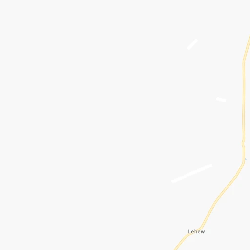
Roadmap (route) to go from Dream Catcher Ranch Airport to Anthony detailed above, you can also see the course layout on the map.
While doing trip Dream Catcher Ranch (airport) - Anthony by car, the calculated route ends at a distance , or more straight.
Distance and duration of the route between Dream Catcher Ranch (airport) and Anthony
Calculation of distance and route from Anthony to Dream Catcher Ranch (airport) :
305.0383.0 km6h23mn
Continue 0h10mn 5.2 kmTurn right 0h6mn 2.9 kmTurn sharp left 0h10mn 5.1 kmTurn right 0h1mn 600 mTurn sharp left 0h0mn 126 mTurn right 0h9mn 4.7 kmTurn slight left 0h1mn 592 mTurn right 0h3mn 1.7 kmContinue 0h1mn 362 mTurn right onto Forest Road 6A 0h21mn 10.6 kmTurn left onto US 60 1h52mn 56.6 kmTurn right onto Old State Highway 52 0h28mn 13.8 kmTurn left onto Forest 52 Road 0h5mn 2.7 kmTurn slight right onto Forest 52 Road 0h25mn 12.3 kmTurn slight left onto Forest 52 Road 0h1mn 418 mTurn left onto Forest 52 Road 0h15mn 6.6 kmTurn right onto NM 107 1h7mn 38.9 kmTurn right onto I-25 2h2mn 215.7 kmKeep right and take NM 404 toward Anthony, Chaparral 0h0mn 391 mTurn right onto East Ohara Road 0h1mn 1.4 kmTurn left onto Anthony Drive 0h2mn 2.3 kmTurn left onto Lopez Street 0h0mn 65 mTurn right 0h0mn 71 mArrive at destination 0h0mn 0 m
Travel from Dream Catcher Ranch (airport) (New Mexico) to a selection of major cities.
Distances from Dream Catcher Ranch Airport to biggest cities in New Mexico
Other major cities in country :
- Charlotte [NC], 827,097 inhabitants. 2,477 km
- Seattle [WA], 684,451 inhabitants. 1,885 km
- Denver [CO], 682,545 inhabitants. 645 km
- El Paso [TX], 681,124 inhabitants. 335 km
- Detroit [MI], 677,116 inhabitants. 2,338 km
- Boston [MA], 667,137 inhabitants. 3,313 km
- Memphis [TN], 655,770 inhabitants. 1,643 km
- New South Memphis [TN], 641,608 inhabitants. 1,643 km
- Portland [OR], 632,309 inhabitants. 1,747 km
- Oklahoma City [OK], 631,346 inhabitants. 965 km
- Las Vegas [NV], 623,747 inhabitants. 672 km
- Baltimore [MD], 621,849 inhabitants. 2,834 km
- Washington, D.C. [DC], 601,723 inhabitants. 2,796 km
- Milwaukee [WI], 600,155 inhabitants. 1,983 km
- South Boston [MA], 571,281 inhabitants. 3,314 km
- Tucson [AZ], 531,641 inhabitants. 368 km
- Nashville [TN], 530,852 inhabitants. 1,935 km
- Fresno [CA], 520,052 inhabitants. 1,091 km
- Sacramento [CA], 490,712 inhabitants. 1,286 km
- Kansas City [MO], 475,378 inhabitants. 1,303 km
Route from Anthony to major cities (United States).
- Distance Anthony New York City3,059 km
- Distance Anthony Los Angeles1,109 km
- Distance Anthony Chicago2,005 km
- Distance Anthony Brooklyn3,062 km
- Distance Anthony Houston1,102 km
- Distance Anthony Queens3,072 km
- Distance Anthony Philadelphia2,950 km
- Distance Anthony Phoenix537 km
- Distance Anthony Manhattan3,063 km
- Distance Anthony San Antonio828 km
- Distance Anthony San Diego996 km
- Distance Anthony The Bronx3,072 km
- Distance Anthony Dallas925 km
- Distance Anthony San Jose1,518 km
- Distance Anthony Austin866 km
- Distance Anthony Jacksonville2,379 km
- Distance Anthony San Francisco1,578 km
- Distance Anthony Columbus2,295 km
- Distance Anthony Fort Worth876 km
- Distance Anthony Indianapolis2,030 km
Nearest cities to Dream Catcher Ranch (airport) :
- El Paso, 681,124 inhabitants. 335 km
- Albuquerque, 559,121 inhabitants. 143 km
- Tucson, 531,641 inhabitants. 368 km
- Las Cruces, 101,643 inhabitants. 268 km
- Enchanted Hills, 87,521 inhabitants. 163 km
- Rio Rancho, 87,521 inhabitants. 151 km
- Santa Fe, 84,099 inhabitants. 234 km
- Casas Adobes, 66,795 inhabitants. 365 km
- Catalina Foothills, 50,796 inhabitants. 362 km
- Oro Valley, 43,565 inhabitants. 358 km
- Sierra Vista, 43,355 inhabitants. 388 km
- Farmington, 42,871 inhabitants. 251 km
- South Valley, 40,976 inhabitants. 137 km
- Socorro, 33,222 inhabitants. 353 km
- Alamogordo, 30,753 inhabitants. 260 km
- Socorro Mission Number 1 Colonia, 28,637 inhabitants. 355 km
- Drexel Heights, 27,749 inhabitants. 381 km
- Sahuarita, 25,707 inhabitants. 391 km
- Gallup, 23,240 inhabitants. 134 km
- Green Valley, 21,391 inhabitants. 402 km
- Horizon City, 19,288 inhabitants. 354 km
- Durango, 18,006 inhabitants. 312 km
- Tanque Verde, 16,901 inhabitants. 353 km
- Flowing Wells, 16,419 inhabitants. 368 km
- Sunland Park, 15,940 inhabitants. 328 km
- Los Lunas, 15,336 inhabitants. 124 km
- Chaparral, 14,631 inhabitants. 313 km
- Deming, 14,522 inhabitants. 247 km
- Las Vegas, 13,386 inhabitants. 285 km
- Los Alamos, 12,019 inhabitants. 222 km
- North Valley, 11,333 inhabitants. 150 km
- Show Low, 10,860 inhabitants. 185 km
- Espanola, 10,224 inhabitants. 245 km
- Vail, 10,208 inhabitants. 368 km
- Silver City, 10,004 inhabitants. 191 km
- Alamosa, 9,819 inhabitants. 386 km
- Safford, 9,683 inhabitants. 240 km
- Saddle Brooke, 9,614 inhabitants. 341 km
- Winslow, 9,600 inhabitants. 251 km
- Anthony, 9,293 inhabitants. 306 km
- Grants, 9,239 inhabitants. 76 km
- San Elizario, 8,999 inhabitants. 361 km
- Bernalillo, 8,843 inhabitants. 163 km
- Socorro, 8,722 inhabitants. 115 km
- Cortez, 8,715 inhabitants. 324 km
- Fort Bliss, 8,591 inhabitants. 333 km
- Corrales, 8,502 inhabitants. 155 km
- Shiprock, 8,295 inhabitants. 264 km
- Fabens, 8,257 inhabitants. 374 km
- Kirtland, 7,875 inhabitants. 253 km
Location Dream Catcher Ranch (airport) (New Mexico) :
| Country flag |  |
| Location | Dream Catcher Ranch (airport) |
| State | New Mexico |
| County | Catron County |
| Country | United States |
| Country code / ISO 2 | US |
| Latitude | 34.4766300 |
| Longitude | -108.0317300 |
| Altitude | 2291 meters |
| Time zone | America/Denver |
Location Anthony (New Mexico) :
| Country flag | |
| Location | Anthony |
| State | New Mexico |
| County | Doña Ana County |
| Country | United States |
| Country code / ISO 2 | US |
| Latitude | 32.0039900 |
| Longitude | -106.6058300 |
| Altitude | 1159 meters |
| Time zone | America/Denver |