


How to get from Pichilemu Aerodrome (O'Higgins Region) to Talagante (Santiago Metropolitan)
Calculate route from Pichilemu Aerodrome (O'Higgins Region, Chile) to Talagante (Santiago Metropolitan, Chile).
The flight distance (as the crow flies) between Pichilemu Aerodrome and Talagante is 129.1 km.
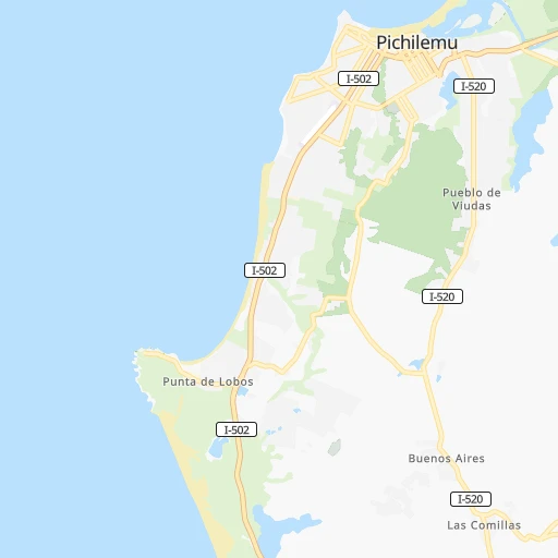
Roadmap (route) to go from Pichilemu Aerodrome to Talagante detailed above, you can also see the course layout on the map.
While doing trip Pichilemu Aerodrome - Talagante by car, the calculated route ends at a distance , or more straight.
Distance and duration of the route between Pichilemu Aerodrome and Talagante
Calculation of distance and route from Talagante to Pichilemu Aerodrome :
129.1169.0 km3h35mn
Continue onto Avenida Comercio 0h0mn 211 mTurn right onto Los Aromos 0h0mn 122 mTurn left onto Evaristo Merino 0h0mn 53 mTurn right onto Santa Teresita 0h2mn 1.4 kmTurn right onto Daniel Ortúzar 0h0mn 47 mTurn slight left onto Daniel Ortúzar 1h32mn 34.5 kmTurn left onto Ruta I-80-G 0h25mn 25.1 kmKeep right onto Hermanos Carrera 1h42mn 43.6 kmKeep left onto Ruta de la Fruta 0h0mn 41 mContinue onto Ruta G-60 0h0mn 143 mTurn left onto Ruta G-60 1h36mn 37.9 kmKeep right and take 78 toward Santiago 0h15mn 24.0 kmKeep right and drive toward Talagante, Isla de Maipo 0h0mn 316 mAt roundabout, take exit 4 onto Camino Isla de Maipó 0h0mn 238 mAt roundabout, take exit 2 onto Avenida 21 de Mayo 0h1mn 509 mTurn right onto Avenida Tala Canta Ilabe 0h0mn 118 mTurn left onto Francisco Chacón 0h0mn 343 mTurn right onto Julio Vrancken 0h0mn 167 mTurn left onto José Leyan 0h0mn 273 mArrive at destination 0h0mn 0 m
Travel from Pichilemu Aerodrome (Santiago Metropolitan) to a selection of major cities.
Distances from Pichilemu Aerodrome to biggest cities in O'Higgins Region
Other major cities in country :
- Quilpue [01], 130,263 inhabitants. 159 km
- Copiapo [05], 129,280 inhabitants. 799 km
- Los Angeles [06], 125,430 inhabitants. 344 km
- Punta Arenas [10], 117,430 inhabitants. 2,090 km
- Lo Prado [12], 104,316 inhabitants. 159 km
- Curico [11], 102,438 inhabitants. 97 km
- Villa Alemana [01], 97,320 inhabitants. 162 km
- Coronel [06], 92,940 inhabitants. 311 km
- San Antonio [01], 85,651 inhabitants. 97 km
- Chiguayante [06], 82,545 inhabitants. 296 km
- Ovalle [07], 77,138 inhabitants. 429 km
- Linares [11], 69,535 inhabitants. 166 km
- Quillota [01], 67,779 inhabitants. 183 km
- Penaflor [12], 65,495 inhabitants. 137 km
- Melipilla [12], 63,100 inhabitants. 108 km
- San Felipe [01], 59,294 inhabitants. 219 km
- Los Andes [01], 56,859 inhabitants. 218 km
- Buin [12], 55,441 inhabitants. 139 km
- Talagante [12], 51,764 inhabitants. 129 km
Route from Talagante to major cities (Chile).
- Distance Talagante Antofagasta1,116 km
- Distance Talagante Vina del Mar92 km
- Distance Talagante Valparaiso96 km
- Distance Talagante Talcahuano395 km
- Distance Talagante Temuco585 km
- Distance Talagante Iquique1,499 km
- Distance Talagante Concepcion401 km
- Distance Talagante Rancagua59 km
- Distance Talagante Talca207 km
- Distance Talagante Arica1,692 km
- Distance Talagante Coquimbo415 km
- Distance Talagante Puerto Montt887 km
- Distance Talagante La Serena420 km
- Distance Talagante Chillan345 km
- Distance Talagante Calama1,263 km
- Distance Talagante Osorno794 km
- Distance Talagante Valdivia715 km
- Distance Talagante Quilpue84 km
- Distance Talagante Copiapo703 km
- Distance Talagante Los Angeles443 km
Nearest cities to Pichilemu Aerodrome :
- Santiago, 4,837,295 inhabitants. 164 km
- Puente Alto, 510,417 inhabitants. 159 km
- Vina del Mar, 294,551 inhabitants. 158 km
- Valparaiso, 282,448 inhabitants. 155 km
- Talcahuano, 252,968 inhabitants. 278 km
- San Bernardo, 249,858 inhabitants. 151 km
- Concepcion, 215,413 inhabitants. 286 km
- Rancagua, 212,695 inhabitants. 120 km
- La Pintana, 201,178 inhabitants. 156 km
- Talca, 197,479 inhabitants. 120 km
- Chillan, 150,396 inhabitants. 246 km
- Quilpue, 130,263 inhabitants. 159 km
- Lo Prado, 104,316 inhabitants. 159 km
- Curico, 102,438 inhabitants. 97 km
- Villa Alemana, 97,320 inhabitants. 162 km
- Coronel, 92,940 inhabitants. 311 km
- San Antonio, 85,651 inhabitants. 97 km
- Chiguayante, 82,545 inhabitants. 296 km
- Linares, 69,535 inhabitants. 166 km
- Quillota, 67,779 inhabitants. 183 km
- Penaflor, 65,495 inhabitants. 137 km
- Melipilla, 63,100 inhabitants. 108 km
- San Felipe, 59,294 inhabitants. 219 km
- Los Andes, 56,859 inhabitants. 218 km
- Buin, 55,441 inhabitants. 139 km
- Talagante, 51,764 inhabitants. 129 km
- Lota, 49,763 inhabitants. 317 km
- Hacienda La Calera, 49,106 inhabitants. 194 km
- Tome, 46,698 inhabitants. 262 km
- Penco, 46,091 inhabitants. 276 km
- Rengo, 38,100 inhabitants. 107 km
- Constitucion, 37,917 inhabitants. 111 km
- Limache, 35,876 inhabitants. 168 km
- Santa Cruz, 33,283 inhabitants. 66 km
- Paine, 32,766 inhabitants. 135 km
- San Carlos, 31,517 inhabitants. 226 km
- Cauquenes, 31,362 inhabitants. 177 km
- San Vicente de Tagua Tagua, 29,560 inhabitants. 86 km
- Lampa, 29,250 inhabitants. 162 km
- Molina, 28,775 inhabitants. 105 km
- Machali, 27,595 inhabitants. 128 km
- Parral, 26,904 inhabitants. 195 km
- La Ligua, 24,857 inhabitants. 228 km
- Arauco, 24,659 inhabitants. 338 km
- Graneros, 23,301 inhabitants. 124 km
- El Monte, 23,090 inhabitants. 124 km
- Illapel, 22,816 inhabitants. 317 km
- San Vicente, 22,572 inhabitants. 86 km
- San Javier, 22,427 inhabitants. 136 km
- Cabrero, 18,327 inhabitants. 296 km
Location Pichilemu Aerodrome (O'Higgins Region) :
| Country flag |  |
| Location | Pichilemu Aerodrome |
| State | O'Higgins Region |
| County | Provincia de Cardenal Caro |
| Country | Chile |
| Country code / ISO 2 | CL |
| Latitude | -34.3939500 |
| Longitude | -72.0177400 |
| Altitude | 10 meters |
| Time zone | America/Santiago |
Location Talagante (Santiago Metropolitan) :
| Country flag | |
| Location | Talagante |
| State | Santiago Metropolitan |
| County | Provincia de Talagante |
| Country | Chile |
| Country code / ISO 2 | CL |
| Latitude | -33.6638600 |
| Longitude | -70.9273400 |
| Altitude | 0 meters |
| Time zone | America/Santiago |