

How to get from Maillé Railway Station (Centre) to Gien (Centre)
Calculate route from Maillé Railway Station (Centre, France) to Gien (Centre, France).
The flight distance (as the crow flies) between Maillé Railway Station and Gien is 169.7 km.
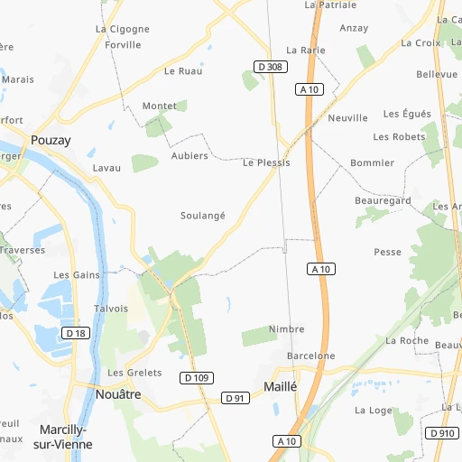
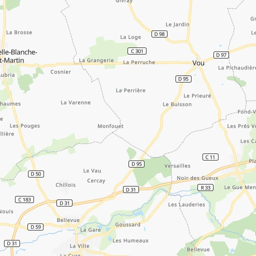
Roadmap (route) to go from Maillé Railway Station to Gien detailed above, you can also see the course layout on the map.
While doing trip Maillé Railway Station - Gien by car, the calculated route ends at a distance , or more straight.
Distance and duration of the route between Maillé Railway Station and Gien
Calculation of distance and route from Gien to Maillé Railway Station :
169.7197.5 km3h40mn
Continue onto Place de la Gare 0h0mn 72 mTurn left onto Rue des Jardins 0h0mn 124 mTurn left onto Rue de la Paix 0h9mn 7.4 kmTurn right onto Rue du 8 Mai 0h0mn 162 mTurn slight right onto Rue de la République 0h0mn 71 mTurn left onto Rue Alfred de Vigny 0h5mn 4.1 kmTurn right onto D 760 0h3mn 3.1 kmAt roundabout, take exit 2 onto Rue du Soleil Couchant 0h1mn 529 mAt roundabout, take exit 2 onto D 760 0h0mn 146 mTurn slight right onto Rue du Soleil Levant 0h5mn 5.2 kmAt roundabout, take exit 2 onto Route de Loches 0h0mn 225 mTurn left onto Rue du 11 Novembre 1918 0h0mn 134 mTurn slight right onto Rue du 11 Novembre 1918 0h0mn 84 mTurn right onto Rue des Charpes 0h0mn 22 mTurn left onto Rue du 8 Mai 1945 0h0mn 315 mTurn right onto Route de Bléré 0h9mn 11.3 kmAt roundabout, take exit 2 onto Route de Bléré 0h2mn 2.1 kmTurn right onto D 10 0h0mn 3 mTurn left onto D 58 0h4mn 3.9 kmTurn right onto Rue de Bléré 0h4mn 5.5 kmAt roundabout, take exit 4 0h0mn 567 mKeep right and drive toward Bourges, Vierzon 1h32mn 61.7 kmKeep right and take 14 toward Romorantin-Lanthenay 0h1mn 1.4 kmAt roundabout, take exit 2 onto D 922 0h1mn 1.2 kmAt roundabout, take exit 1 onto Avenue Pierre Mendès-France 0h1mn 846 mAt roundabout, take exit 1 onto Avenue de Villefranche 0h0mn 524 mAt roundabout, take exit 2 onto Avenue de Villefranche 0h0mn 363 mTurn right onto Rue Jules Guesde 0h1mn 1.0 kmTurn right onto Avenue de Salbris 0h18mn 18.9 kmAt roundabout, take exit 1 onto Route de Salbris 0h3mn 4.0 kmAt roundabout, take exit 3 0h3mn 2.1 kmTurn left onto Rue de l'Abbé Paul Gru 0h18mn 19.8 kmTurn left onto Route de Neuvy-sur-Barangeon 0h9mn 10.3 kmTurn left onto Rue de la Croix de Mauconseil 0h1mn 735 mTurn right onto Route de Sainte-Montaine 0h0mn 223 mKeep left onto Boulevard de la République 0h0mn 224 mTurn sharp left onto Rue du Pont Beaumont 0h0mn 209 mAt roundabout, take exit 4 onto Avenue Charles Lefèvre 0h1mn 806 mAt roundabout, take exit 2 onto D 940 0h5mn 5.7 kmAt roundabout, take exit 1 onto D 940 0h2mn 1.9 kmAt roundabout, take exit 2 onto Route de Gien 0h13mn 16.9 kmAt roundabout, take exit 2 onto Route de Bourges 0h1mn 952 mAt roundabout, take exit 2 onto Route de Bourges 0h1mn 1.2 kmAt roundabout, take exit 2 onto D 941 0h1mn 347 mTurn right onto Quai Maréchal Joffre 0h0mn 132 mTurn slight left onto Place Saint-Louis 0h1mn 308 mTurn right 0h0mn 24 mKeep right onto Rue de Paris 0h1mn 362 mTurn left onto Avenue Président Wilson 0h1mn 485 mArrive at destination 0h0mn 0 m
Travel from Maillé Railway Station (Centre) to a selection of major cities.
Distances from Maillé Railway Station to biggest cities in Centre
Other major cities in country :
- Aix-en-Provence [93], 146,821 inhabitants. 547 km
- Saint-Quentin-en-Yvelines [11], 146,598 inhabitants. 219 km
- Brest [53], 144,899 inhabitants. 408 km
- Le Mans [52], 144,515 inhabitants. 109 km
- Amiens [32], 143,086 inhabitants. 341 km
- Limoges [75], 141,176 inhabitants. 145 km
- Clermont-Ferrand [84], 138,681 inhabitants. 239 km
- Villeurbanne [84], 131,445 inhabitants. 360 km
- Besancon [27], 128,426 inhabitants. 412 km
- Metz [44], 123,914 inhabitants. 475 km
- Rouen [28], 112,787 inhabitants. 269 km
- Mulhouse [44], 111,430 inhabitants. 514 km
- Perpignan [76], 110,706 inhabitants. 518 km
- Caen [28], 110,624 inhabitants. 248 km
- Boulogne-Billancourt [11], 108,782 inhabitants. 234 km
- Nancy [44], 105,334 inhabitants. 456 km
- Argenteuil [11], 101,475 inhabitants. 245 km
- Saint-Denis [11], 96,128 inhabitants. 248 km
- Roubaix [32], 95,721 inhabitants. 447 km
- Tourcoing [32], 91,574 inhabitants. 450 km
Route from Gien to major cities (France).
- Distance Gien Paris131 km
- Distance Gien Marseille534 km
- Distance Gien Lyon275 km
- Distance Gien Toulouse464 km
- Distance Gien Nice572 km
- Distance Gien Nantes319 km
- Distance Gien Strasbourg393 km
- Distance Gien Montpellier465 km
- Distance Gien Bordeaux402 km
- Distance Gien Lille329 km
- Distance Gien Rennes325 km
- Distance Gien Reims202 km
- Distance Gien Le Havre273 km
- Distance Gien Cergy-Pontoise155 km
- Distance Gien Saint-Etienne285 km
- Distance Gien Toulon570 km
- Distance Gien Angers240 km
- Distance Gien Grenoble367 km
- Distance Gien Dijon184 km
- Distance Gien Nimes450 km
Nearest cities to Maillé Railway Station :
- Paris, 2,138,551 inhabitants. 240 km
- Nantes, 277,269 inhabitants. 163 km
- Bordeaux, 231,844 inhabitants. 262 km
- Rennes, 209,375 inhabitants. 206 km
- Le Havre, 185,972 inhabitants. 274 km
- Cergy-Pontoise, 183,430 inhabitants. 247 km
- Angers, 168,279 inhabitants. 97 km
- Saint-Quentin-en-Yvelines, 146,598 inhabitants. 219 km
- Le Mans, 144,515 inhabitants. 109 km
- Amiens, 143,086 inhabitants. 341 km
- Tours, 141,621 inhabitants. 39 km
- Limoges, 141,176 inhabitants. 145 km
- Clermont-Ferrand, 138,681 inhabitants. 239 km
- Orleans, 124,149 inhabitants. 137 km
- Rouen, 112,787 inhabitants. 269 km
- Caen, 110,624 inhabitants. 248 km
- Boulogne-Billancourt, 108,782 inhabitants. 234 km
- Argenteuil, 101,475 inhabitants. 245 km
- Saint-Denis, 96,128 inhabitants. 248 km
- Montreuil, 90,652 inhabitants. 245 km
- Asnieres-sur-Seine, 86,742 inhabitants. 243 km
- Nanterre, 86,719 inhabitants. 238 km
- Poitiers, 85,960 inhabitants. 56 km
- Versailles, 85,416 inhabitants. 227 km
- Courbevoie, 85,158 inhabitants. 240 km
- Creteil, 84,833 inhabitants. 239 km
- Colombes, 82,300 inhabitants. 242 km
- Vitry-sur-Seine, 81,001 inhabitants. 236 km
- Aulnay-sous-Bois, 80,615 inhabitants. 254 km
- La Rochelle, 76,810 inhabitants. 165 km
- Champigny-sur-Marne, 76,726 inhabitants. 243 km
- Rueil-Malmaison, 76,616 inhabitants. 236 km
- Saint-Maur-des-Fosses, 75,402 inhabitants. 241 km
- Aubervilliers, 70,914 inhabitants. 247 km
- Merignac, 69,791 inhabitants. 265 km
- Bourges, 67,987 inhabitants. 138 km
- Saint-Nazaire, 67,054 inhabitants. 212 km
- Drancy, 62,488 inhabitants. 250 km
- Noisy-le-Grand, 62,420 inhabitants. 249 km
- Levallois-Perret, 62,178 inhabitants. 241 km
- Issy-les-Moulineaux, 61,447 inhabitants. 234 km
- Neuilly-sur-Seine, 61,300 inhabitants. 240 km
- Antony, 59,845 inhabitants. 228 km
- La Roche-sur-Yon, 59,410 inhabitants. 159 km
- Sarcelles, 57,979 inhabitants. 255 km
- Pessac, 57,944 inhabitants. 267 km
- Ivry-sur-Seine, 57,897 inhabitants. 238 km
- Evreux, 57,795 inhabitants. 223 km
- Cergy, 57,576 inhabitants. 247 km
- Clichy, 57,467 inhabitants. 243 km
Location Maillé Railway Station (Centre) :
| Country flag |  |
| Location | Maillé Railway Station |
| State | Centre |
| County | Département d'Indre-et-Loire |
| Country | France |
| Country code / ISO 2 | FR |
| Latitude | 47.0529600 |
| Longitude | 0.5830100 |
| Altitude | 0 meters |
| Time zone | Europe/Paris |
Location Gien (Centre) :
| Country flag | |
| Location | Gien |
| State | Centre |
| County | Loiret |
| Country | France |
| Country code / ISO 2 | FR |
| Latitude | 47.6933200 |
| Longitude | 2.6309400 |
| Altitude | 0 meters |
| Time zone | Europe/Paris |


