


How to get from Stantsiya Koroleve (Transcarpathia) to Terebovlya (Ternopil)
Calculate route from Stantsiya Koroleve (Transcarpathia, Ukraine) to Terebovlya (Ternopil, Ukraine).
The flight distance (as the crow flies) between Stantsiya Koroleve and Terebovlya is 227.3 km.
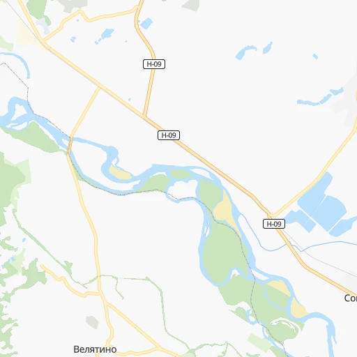
Roadmap (route) to go from Stantsiya Koroleve to Terebovlya detailed above, you can also see the course layout on the map.
While doing trip Stantsiya Koroleve - Terebovlya by car, the calculated route ends at a distance , or more straight.
Distance and duration of the route between Stantsiya Koroleve and Terebovlya
Calculation of distance and route from Terebovlya to Stantsiya Koroleve :
227.3308.6 km6h31mn
Continue 0h0mn 28 mTurn left 0h0mn 69 mTurn right onto вулиця Гренджі-Донського 0h0mn 4 mTurn left onto Весняна вулиця 0h1mn 318 mTurn left onto Центральна вулиця 0h5mn 3.8 kmAt roundabout, take exit 1 onto вулиця Дружби 0h0mn 75 mContinue onto О-070306 0h2mn 1.8 kmKeep right 0h0mn 78 mTurn slight right onto Персикова вулиця 0h7mn 3.3 kmKeep left onto вулиця Шевченка 0h1mn 461 mTurn left onto Буковинська вулиця 0h1mn 728 mKeep right onto Буковинська вулиця 0h0mn 197 mTurn right onto вулиця Вайди 0h1mn 274 mContinue onto вулиця Вайди 0h0mn 82 mContinue onto вулиця Вайди 0h0mn 49 mTurn slight left onto Центральна вулиця 0h1mn 786 mTurn right onto М-23 0h12mn 14.4 kmTurn slight right onto вулиця Августина Волошина 0h1mn 820 mAt roundabout, take exit 2 onto Н-09 0h4mn 4.0 kmAt roundabout, take exit 4 onto Р-21 1h7mn 60.1 kmTurn right onto Р-21 1h9mn 68.0 kmKeep right 0h1mn 783 mAt roundabout, take exit 3 onto вулиця Адама Міцкевича 0h30mn 25.8 kmKeep left 0h0mn 18 mKeep left 0h0mn 21 mKeep right onto Долинська вулиця 0h3mn 3.0 kmTurn slight right onto вулиця Степана Бандери 0h5mn 4.7 kmAt roundabout, take exit 2 onto Івано-Франківська вулиця 0h8mn 8.1 kmKeep left onto Галицька вулиця 0h20mn 18.5 kmKeep right onto Галицька вулиця 0h1mn 866 mAt roundabout, take exit 3 onto Н-09 0h1mn 1.1 kmTurn right onto вулиця Богдана Хмельницького 0h0mn 59 mTurn left onto вулиця Івана Мазепи 0h0mn 166 mTurn right onto вулиця Сотника Чорноти 0h1mn 525 mTurn right onto вулиця Дмитра Вітовського 0h5mn 4.8 kmTurn right onto Т-09-03 1h35mn 35.5 kmAt roundabout, take exit 1 onto Т-09-03, Т-20-04 0h0mn 272 mTurn left onto Т-09-03 0h18mn 17.7 kmAt roundabout, take exit 2 onto Т-09-03 0h25mn 24.9 kmTurn right onto вулиця 22 Січня 0h1mn 563 mTurn right onto вулиця Князя Василька 0h1mn 446 mTurn left onto Глещавецька вулиця 0h0mn 92 mTurn right onto Глещавецька вулиця 0h0mn 15 mTurn left onto вулиця Довбуша 0h1mn 441 mKeep left onto вулиця Коцюбинського 0h1mn 574 mArrive at destination 0h0mn 0 m
Travel from Stantsiya Koroleve (Ternopil) to a selection of major cities.
Distances from Stantsiya Koroleve to biggest cities in Transcarpathia
Other major cities in country :
- Sumy [21], 294,456 inhabitants. 896 km
- Zhytomyr [27], 282,192 inhabitants. 466 km
- Horlivka [05], 278,550 inhabitants. 1,104 km
- Rivne [19], 255,106 inhabitants. 354 km
- Kropyvnytskyi [10], 249,454 inhabitants. 676 km
- Kamianske [04], 248,575 inhabitants. 848 km
- Chernivtsi [03], 236,250 inhabitants. 208 km
- Ternopil [22], 235,676 inhabitants. 237 km
- Kremenchuk [18], 227,494 inhabitants. 763 km
- Lutsk [24], 213,661 inhabitants. 331 km
- Ivano-Frankivsk [06], 204,200 inhabitants. 144 km
- Bila Tserkva [13], 199,163 inhabitants. 541 km
- Kramators'k [05], 173,700 inhabitants. 1,065 km
- Melitopol [26], 158,000 inhabitants. 930 km
- Kerch [11], 148,932 inhabitants. 1,062 km
- Nikopol [04], 130,500 inhabitants. 842 km
- Syevyerodonets'k [14], 130,000 inhabitants. 1,133 km
- Sloviansk [05], 124,800 inhabitants. 1,069 km
- Berdyansk [26], 118,284 inhabitants. 1,038 km
- Alchevs'k [14], 116,000 inhabitants. 1,159 km
Route from Terebovlya to major cities (Ukraine).
- Distance Terebovlya Kyiv368 km
- Distance Terebovlya Kharkiv763 km
- Distance Terebovlya Dnipro689 km
- Distance Terebovlya Donetsk899 km
- Distance Terebovlya Odessa489 km
- Distance Terebovlya Zaporizhia717 km
- Distance Terebovlya Lviv136 km
- Distance Terebovlya Kryvyi Rih585 km
- Distance Terebovlya Mykolayiv534 km
- Distance Terebovlya Mariupol911 km
- Distance Terebovlya Luhansk997 km
- Distance Terebovlya Sevastopol792 km
- Distance Terebovlya Khmelnytskyi94 km
- Distance Terebovlya Makiyivka908 km
- Distance Terebovlya Vinnytsia201 km
- Distance Terebovlya Simferopol798 km
- Distance Terebovlya Kherson593 km
- Distance Terebovlya Poltava640 km
- Distance Terebovlya Chernihiv465 km
- Distance Terebovlya Cherkasy461 km
Nearest cities to Stantsiya Koroleve :
- Lviv, 717,803 inhabitants. 198 km
- Chernivtsi, 236,250 inhabitants. 208 km
- Ternopil, 235,676 inhabitants. 237 km
- Lutsk, 213,661 inhabitants. 331 km
- Ivano-Frankivsk, 204,200 inhabitants. 144 km
- Uzhgorod, 117,878 inhabitants. 81 km
- Chervonohrad, 83,000 inhabitants. 261 km
- Mukacheve, 81,633 inhabitants. 45 km
- Drohobych, 79,406 inhabitants. 136 km
- Kalush, 67,698 inhabitants. 132 km
- Kolomyia, 61,781 inhabitants. 146 km
- Stryi, 61,404 inhabitants. 134 km
- Novovolyns'k, 57,800 inhabitants. 296 km
- Volodymyr-Volynskyi, 38,256 inhabitants. 312 km
- Dubno, 37,690 inhabitants. 314 km
- Boryslav, 36,704 inhabitants. 128 km
- Sambir, 35,197 inhabitants. 152 km
- Chortkiv, 28,855 inhabitants. 218 km
- Novoyavorivs'k, 28,807 inhabitants. 200 km
- Khust, 27,999 inhabitants. 12 km
- Vynohradiv, 27,600 inhabitants. 9 km
- Truskavets', 26,600 inhabitants. 128 km
- Berehove, 25,741 inhabitants. 37 km
- Brody, 23,239 inhabitants. 260 km
- Zolochiv, 22,608 inhabitants. 224 km
- Sokal', 21,451 inhabitants. 271 km
- Kremenets, 21,000 inhabitants. 287 km
- Dolyna, 20,696 inhabitants. 111 km
- Nadvirna, 20,154 inhabitants. 118 km
- Stebnyk, 20,087 inhabitants. 131 km
- Berezhani, 16,962 inhabitants. 195 km
- Kivertsi, 16,509 inhabitants. 342 km
- Svalyava, 16,507 inhabitants. 45 km
- Horodok, 15,993 inhabitants. 185 km
- Burshtyn, 14,729 inhabitants. 164 km
- Rakhiv, 14,674 inhabitants. 80 km
- Mykolaiv, 14,251 inhabitants. 164 km
- Rozhyshche, 13,280 inhabitants. 344 km
- Terebovlya, 13,153 inhabitants. 228 km
- Yavoriv, 13,008 inhabitants. 199 km
- Zhovkva, 12,973 inhabitants. 220 km
- Zbarazh, 12,736 inhabitants. 256 km
- Buchach, 12,082 inhabitants. 194 km
- Mostys'ka, 11,000 inhabitants. 183 km
- Borshchiv, 10,959 inhabitants. 226 km
- Bolekhiv, 10,590 inhabitants. 115 km
- Khodoriv, 10,172 inhabitants. 164 km
- Sniatyn, 10,089 inhabitants. 183 km
- Mizhhirya, 10,000 inhabitants. 49 km
- Mizhhir'ya, 10,000 inhabitants. 49 km
Location Stantsiya Koroleve (Transcarpathia) :
| Country flag |  |
| Location | Stantsiya Koroleve |
| State | Transcarpathia |
| County | |
| Country | Ukraine |
| Country code / ISO 2 | UA |
| Latitude | 48.1545800 |
| Longitude | 23.1422000 |
| Altitude | 0 meters |
| Time zone | Europe/Uzhgorod |
Location Terebovlya (Ternopil) :
| Country flag | |
| Location | Terebovlya |
| State | Ternopil |
| County | |
| Country | Ukraine |
| Country code / ISO 2 | UA |
| Latitude | 49.3018700 |
| Longitude | 25.7099700 |
| Altitude | 0 meters |
| Time zone | Europe/Kiev |