
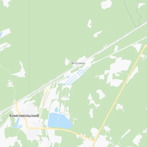
How to get from Stantsiya Igotino (Kirov) to Yaransk (Kirov)
Calculate route from Stantsiya Igotino (Kirov, Russia) to Yaransk (Kirov, Russia).
The flight distance (as the crow flies) between Stantsiya Igotino and Yaransk is 99.6 km.
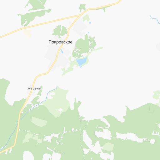
Roadmap (route) to go from Stantsiya Igotino to Yaransk detailed above, you can also see the course layout on the map.
While doing trip Stantsiya Igotino - Yaransk by car, the calculated route ends at a distance , or more straight.
Distance and duration of the route between Stantsiya Igotino and Yaransk
Calculation of distance and route from Yaransk to Stantsiya Igotino :
99.6147.2 km2h20mn
Continue 0h1mn 257 mTurn left 0h0mn 153 mKeep left 0h6mn 3.2 kmTurn left 0h3mn 2.4 kmTurn left 0h22mn 18.1 kmTurn right 0h0mn 33 mTurn slight right onto «Вятка» 1h33mn 38.9 kmTurn right onto «Вятка» 1h10mn 80.3 kmTurn left onto «Вятка» 0h1mn 1.4 kmTurn left 0h1mn 578 mTurn right onto Садовая улица 0h1mn 678 mTurn left onto улица Революции 0h0mn 348 mTurn right onto улица Карла Маркса 0h0mn 255 mTurn left onto улица Радина 0h1mn 495 mTurn left onto улица Радина 0h0mn 97 mArrive at destination 0h0mn 0 m
Travel from Stantsiya Igotino (Kirov) to a selection of major cities.
Distances from Stantsiya Igotino to biggest cities in Kirov
Other major cities in country :
- Yaroslavl [88], 606,730 inhabitants. 486 km
- Barnaul [04], 599,579 inhabitants. 2,272 km
- Vladivostok [59], 587,022 inhabitants. 5,737 km
- Irkutsk [20], 586,695 inhabitants. 3,522 km
- Khabarovsk [30], 579,000 inhabitants. 5,469 km
- Khabarovsk Vtoroy [30], 578,303 inhabitants. 5,475 km
- Orenburg [55], 550,204 inhabitants. 845 km
- Novokuznetsk [29], 539,616 inhabitants. 2,447 km
- Ryazan' [62], 520,173 inhabitants. 649 km
- Tyumen [78], 519,119 inhabitants. 1,045 km
- Lipetsk [43], 515,655 inhabitants. 820 km
- Penza [57], 512,602 inhabitants. 588 km
- Naberezhnyye Chelny [73], 509,870 inhabitants. 382 km
- Kalininskiy [42], 504,641 inhabitants. 1,025 km
- Astrakhan [07], 502,533 inhabitants. 1,319 km
- Makhachkala [17], 497,959 inhabitants. 1,695 km
- Tomsk [75], 485,519 inhabitants. 2,199 km
- Kemerovo [29], 477,090 inhabitants. 2,311 km
- Tula [76], 468,825 inhabitants. 783 km
- Cheboksary [16], 446,781 inhabitants. 235 km
Route from Yaransk to major cities (Russia).
- Distance Yaransk Moscow653 km
- Distance Yaransk Saint Petersburg1,056 km
- Distance Yaransk Novosibirsk2,162 km
- Distance Yaransk Yekaterinburg770 km
- Distance Yaransk Nizhniy Novgorod260 km
- Distance Yaransk Samara479 km
- Distance Yaransk Omsk1,591 km
- Distance Yaransk Kazan185 km
- Distance Yaransk Rostov-na-Donu1,249 km
- Distance Yaransk Chelyabinsk870 km
- Distance Yaransk Ufa577 km
- Distance Yaransk Volgograd982 km
- Distance Yaransk Perm504 km
- Distance Yaransk Krasnoyarsk2,705 km
- Distance Yaransk Saratov653 km
- Distance Yaransk Voronezh841 km
- Distance Yaransk Tol'yatti430 km
- Distance Yaransk Krasnodar1,497 km
- Distance Yaransk Ulyanovsk333 km
- Distance Yaransk Izhevsk326 km
Nearest cities to Stantsiya Igotino :
- Kazan, 1,104,738 inhabitants. 276 km
- Kirov, 457,383 inhabitants. 105 km
- Cheboksary, 446,781 inhabitants. 235 km
- Yoshkar-Ola, 279,100 inhabitants. 174 km
- Novocheboksarsk, 128,468 inhabitants. 235 km
- Zelenodolsk, 99,600 inhabitants. 264 km
- Kirovo-Chepetsk, 90,252 inhabitants. 124 km
- Chistopol', 62,200 inhabitants. 353 km
- Volzhsk, 58,000 inhabitants. 260 km
- Kanash, 49,886 inhabitants. 301 km
- Shumerlya, 35,220 inhabitants. 316 km
- Velikiy Ustyug, 32,642 inhabitants. 302 km
- Slobodskoy, 32,361 inhabitants. 138 km
- Shar'ya, 29,800 inhabitants. 149 km
- Kotel'nich, 27,600 inhabitants. 22 km
- Lyskovo, 23,570 inhabitants. 301 km
- Koz'modem'yansk, 22,700 inhabitants. 225 km
- Shakhun'ya, 22,400 inhabitants. 102 km
- Sergach, 22,361 inhabitants. 335 km
- Yaransk, 19,557 inhabitants. 100 km
- Sovetsk, 17,869 inhabitants. 87 km
- Arsk, 17,243 inhabitants. 259 km
- Vasil'yevo, 16,800 inhabitants. 265 km
- Kukmor, 16,795 inhabitants. 283 km
- Medvedevo, 16,407 inhabitants. 174 km
- Tsivil'sk, 13,252 inhabitants. 261 km
- Vetluzhskiy, 13,229 inhabitants. 152 km
- Lyangasovo, 12,626 inhabitants. 90 km
- Zvenigovo, 12,484 inhabitants. 247 km
- Uren', 12,311 inhabitants. 157 km
- Luza, 11,935 inhabitants. 275 km
- Kozlovka, 11,700 inhabitants. 262 km
- Belaya Kholunitsa, 11,658 inhabitants. 179 km
- Kugesi, 11,547 inhabitants. 245 km
- Urzhum, 11,333 inhabitants. 168 km
- Vurnary, 10,825 inhabitants. 308 km
- Raduzhnyy, 10,792 inhabitants. 100 km
- Yadrin, 10,735 inhabitants. 274 km
- Sovetskiy, 10,674 inhabitants. 162 km
- Vakhrushi, 10,330 inhabitants. 128 km
- Nolinsk, 10,282 inhabitants. 133 km
- Mariinskiy Posad, 10,199 inhabitants. 233 km
- Alekseyevskoye, 9,738 inhabitants. 346 km
- Morki, 9,568 inhabitants. 205 km
- Raduzhnyy, 9,514 inhabitants. 171 km
- Vetluga, 9,497 inhabitants. 138 km
- Ibresi, 9,113 inhabitants. 328 km
- Malmyzh, 8,990 inhabitants. 245 km
- Sernur, 8,921 inhabitants. 156 km
- Nikol'sk, 8,487 inhabitants. 210 km
Location Stantsiya Igotino (Kirov) :
| Country flag |  |
| Location | Stantsiya Igotino |
| State | Kirov |
| County | |
| Country | Russia |
| Country code / ISO 2 | RU |
| Latitude | 58.1965200 |
| Longitude | 48.0340100 |
| Altitude | 0 meters |
| Time zone | Europe/Kirov |
Location Yaransk (Kirov) :
| Country flag | |
| Location | Yaransk |
| State | Kirov |
| County | |
| Country | Russia |
| Country code / ISO 2 | RU |
| Latitude | 57.3033100 |
| Longitude | 47.8861100 |
| Altitude | 0 meters |
| Time zone | Europe/Kirov |