
How to get from Cook (airport) (Missouri) to Cape Girardeau (Missouri)
Calculate route from Cook (airport) (Missouri, United States) to Cape Girardeau (Missouri, United States).
The flight distance (as the crow flies) between Cook (airport) and Cape Girardeau is 445.5 km.
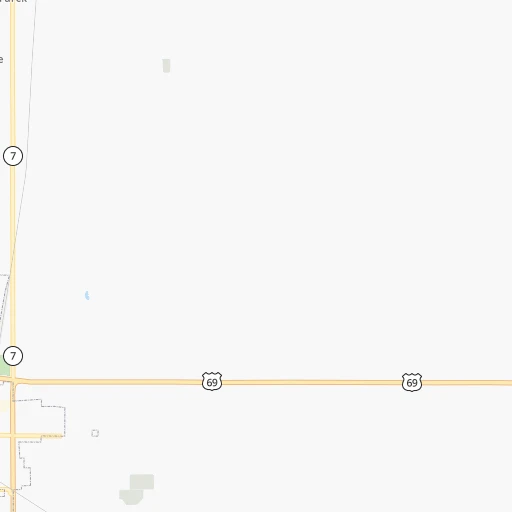
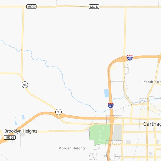
Roadmap (route) to go from Cook Airport to Cape Girardeau detailed above, you can also see the course layout on the map.
While doing trip Cook (airport) - Cape Girardeau by car, the calculated route ends at a distance , or more straight.
Distance and duration of the route between Cook (airport) and Cape Girardeau
Calculation of distance and route from Cape Girardeau to Cook (airport) :
445.5523.9 km6h26mn
Continue onto Ivy Road 0h1mn 442 mTurn right onto MO 171 0h5mn 6.4 kmAt roundabout, take exit 2 onto Demott Drive 0h4mn 4.7 kmAt roundabout, take exit 2 onto I 49 Bus, MO 171 0h1mn 1.0 kmKeep right and take MO 249 South toward Joplin 0h4mn 6.5 kmKeep right toward MO 66, I 44 Business 0h0mn 423 mKeep left and take MO 66 East, I 44 Business toward Duenweg 0h0mn 34 mTurn left onto East 7th Street 0h4mn 4.6 kmKeep right onto I 44 Business and take I 44 East, I 49 North, US 71 North toward Springfield, Kansas City 1h51mn 86.4 kmKeep right toward MO 360 East 2h40mn 154.3 kmKeep left onto US 60 and take US 60 East toward Mountain View, Poplar Bluff 1h5mn 99.2 kmTurn left onto MO 21, MO 34 0h5mn 5.4 kmKeep right onto MO 34 0h9mn 9.8 kmTurn sharp left onto MO HH Spur 0h2mn 1.5 kmTurn right onto MO HH 0h22mn 18.7 kmTurn slight left onto South Main Street 0h3mn 2.9 kmKeep right 0h0mn 51 mTurn slight right onto MO 34 1h6mn 72.3 kmTurn left onto West Main Street 0h1mn 799 mTurn right onto MO 34 0h25mn 27.0 kmKeep right onto MO 34 and take MO 34 East, MO 72 East toward Jackson, Cape Girardeau 0h5mn 5.5 kmTurn slight right onto West Jackson Boulevard 0h12mn 12.8 kmTurn left onto Broadway Street 0h3mn 3.3 kmArrive at destination 0h0mn 0 m
Travel from Cook (airport) (Missouri) to a selection of major cities.
Distances from Cook Airport to biggest cities in Missouri
- University City,35,058 inhabitants.407 km
- Ballwin,30,577 inhabitants.385 km
- Liberty,30,450 inhabitants.230 km
- Raytown,29,401 inhabitants.203 km
- Mehlville,28,380 inhabitants.400 km
- Kirkwood,27,750 inhabitants.396 km
- Maryland Heights,27,389 inhabitants.400 km
- Gladstone,26,861 inhabitants.225 km
- Hazelwood,25,661 inhabitants.407 km
- Grandview,25,256 inhabitants.189 km
- Webster Groves,23,177 inhabitants.400 km
- Belton,23,168 inhabitants.181 km
- Sedalia,21,516 inhabitants.205 km
- Arnold,21,357 inhabitants.392 km
- Ferguson,21,059 inhabitants.411 km
- Nixa,20,984 inhabitants.113 km
- Raymore,20,374 inhabitants.180 km
- Affton,20,307 inhabitants.401 km
- Rolla,20,019 inhabitants.260 km
Other major cities in country :
- Charlotte [NC], 827,097 inhabitants. 1,249 km
- Seattle [WA], 684,451 inhabitants. 2,542 km
- Denver [CO], 682,545 inhabitants. 952 km
- El Paso [TX], 681,124 inhabitants. 1,249 km
- Detroit [MI], 677,116 inhabitants. 1,138 km
- Boston [MA], 667,137 inhabitants. 2,083 km
- Memphis [TN], 655,770 inhabitants. 464 km
- New South Memphis [TN], 641,608 inhabitants. 467 km
- Portland [OR], 632,309 inhabitants. 2,511 km
- Oklahoma City [OK], 631,346 inhabitants. 327 km
- Las Vegas [NV], 623,747 inhabitants. 1,838 km
- Baltimore [MD], 621,849 inhabitants. 1,583 km
- Washington, D.C. [DC], 601,723 inhabitants. 1,545 km
- Milwaukee [WI], 600,155 inhabitants. 862 km
- South Boston [MA], 571,281 inhabitants. 2,084 km
- Albuquerque [NM], 559,121 inhabitants. 1,112 km
- Tucson [AZ], 531,641 inhabitants. 1,595 km
- Nashville [TN], 530,852 inhabitants. 703 km
- Fresno [CA], 520,052 inhabitants. 2,237 km
- Sacramento [CA], 490,712 inhabitants. 2,364 km
Route from Cape Girardeau to major cities (United States).
- Distance Cape Girardeau New York City1,392 km
- Distance Cape Girardeau Los Angeles2,612 km
- Distance Cape Girardeau Chicago531 km
- Distance Cape Girardeau Brooklyn1,396 km
- Distance Cape Girardeau Houston999 km
- Distance Cape Girardeau Queens1,406 km
- Distance Cape Girardeau Philadelphia1,281 km
- Distance Cape Girardeau Phoenix2,087 km
- Distance Cape Girardeau Manhattan1,397 km
- Distance Cape Girardeau San Antonio1,210 km
- Distance Cape Girardeau San Diego2,562 km
- Distance Cape Girardeau The Bronx1,407 km
- Distance Cape Girardeau Dallas833 km
- Distance Cape Girardeau San Jose2,852 km
- Distance Cape Girardeau Austin1,091 km
- Distance Cape Girardeau Jacksonville1,063 km
- Distance Cape Girardeau San Francisco2,889 km
- Distance Cape Girardeau Columbus639 km
- Distance Cape Girardeau Fort Worth875 km
- Distance Cape Girardeau Indianapolis401 km
Nearest cities to Cook (airport) :
- Oklahoma City, 631,346 inhabitants. 327 km
- Kansas City, 475,378 inhabitants. 213 km
- Tulsa, 403,505 inhabitants. 172 km
- Wichita, 389,965 inhabitants. 253 km
- Little Rock, 197,992 inhabitants. 340 km
- Overland Park, 186,515 inhabitants. 200 km
- Springfield, 166,810 inhabitants. 111 km
- Kansas City, 151,306 inhabitants. 215 km
- Olathe, 134,305 inhabitants. 190 km
- Topeka, 127,265 inhabitants. 230 km
- Norman, 120,284 inhabitants. 339 km
- Columbia, 119,108 inhabitants. 276 km
- Independence, 117,255 inhabitants. 212 km
- East Independence, 110,675 inhabitants. 213 km
- Broken Arrow, 106,563 inhabitants. 168 km
- Lee's Summit, 95,094 inhabitants. 193 km
- Lawrence, 93,917 inhabitants. 208 km
- Edmond, 90,092 inhabitants. 313 km
- Fort Smith, 88,194 inhabitants. 201 km
- Fayetteville, 82,830 inhabitants. 130 km
- Springdale, 77,859 inhabitants. 118 km
- Saint Joseph, 76,780 inhabitants. 289 km
- North Little Rock, 66,504 inhabitants. 339 km
- Shawnee, 65,046 inhabitants. 207 km
- Conway, 64,980 inhabitants. 301 km
- Rogers, 63,159 inhabitants. 103 km
- Moore, 60,451 inhabitants. 334 km
- Midwest City, 57,249 inhabitants. 320 km
- Manhattan, 56,308 inhabitants. 284 km
- Blue Springs, 54,148 inhabitants. 205 km
- Lenexa, 52,490 inhabitants. 197 km
- Joplin, 51,818 inhabitants. 12 km
- Stillwater, 48,967 inhabitants. 254 km
- Pine Bluff, 44,772 inhabitants. 402 km
- Bentonville, 44,499 inhabitants. 96 km
- Jefferson City, 43,169 inhabitants. 260 km
- Muskogee, 38,456 inhabitants. 176 km
- Bartlesville, 36,595 inhabitants. 136 km
- Leavenworth, 35,980 inhabitants. 239 km
- Hot Springs, 35,635 inhabitants. 328 km
- Hot Springs National Park, 35,193 inhabitants. 325 km
- Leawood, 34,579 inhabitants. 198 km
- Owasso, 34,542 inhabitants. 155 km
- Benton, 34,177 inhabitants. 341 km
- Shawnee, 31,286 inhabitants. 297 km
- Sherwood, 30,517 inhabitants. 337 km
- Liberty, 30,450 inhabitants. 230 km
- Raytown, 29,401 inhabitants. 203 km
- Russellville, 29,166 inhabitants. 248 km
- Jacksonville, 28,643 inhabitants. 339 km
Location Cook (airport) (Missouri) :
| Country flag |  |
| Location | Cook (airport) |
| State | Missouri |
| County | Jasper County |
| Country | United States |
| Country code / ISO 2 | US |
| Latitude | 37.1861700 |
| Longitude | -94.5522700 |
| Altitude | 279 meters |
| Time zone | America/Chicago |
Location Cape Girardeau (Missouri) :
| Country flag | |
| Location | Cape Girardeau |
| State | Missouri |
| County | Cape Girardeau County |
| Country | United States |
| Country code / ISO 2 | US |
| Latitude | 37.3058800 |
| Longitude | -89.5181500 |
| Altitude | 108 meters |
| Time zone | America/Chicago |


