
Home
››
Blessings Landing Air Ranch Airport
››
Roadmap from Blessings Landing Air Ranch Airport to Decatur
How to get from Blessings Landing Air Ranch (airport) (Alabama) to Decatur (Alabama)
Calculate route from Blessings Landing Air Ranch (airport) (Alabama, United States) to Decatur (Alabama, United States).
The flight distance (as the crow flies) between Blessings Landing Air Ranch (airport) and Decatur is 391.4 km.
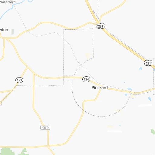
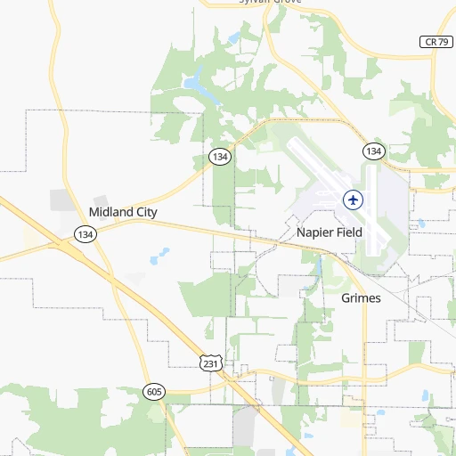
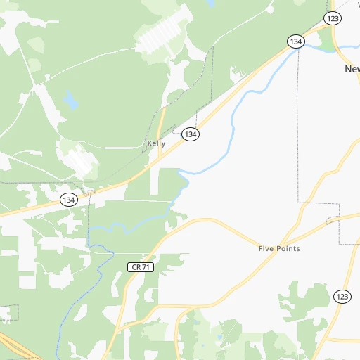
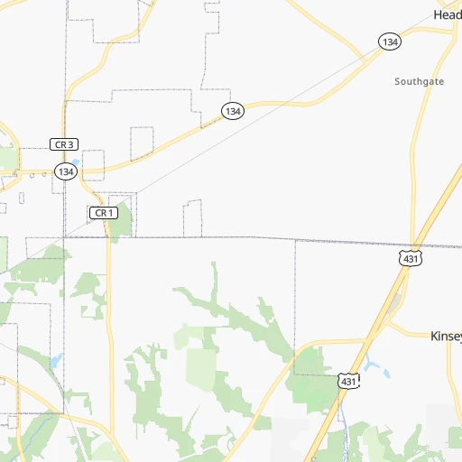
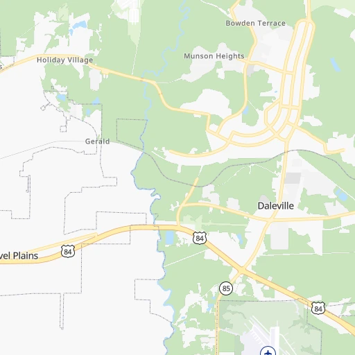
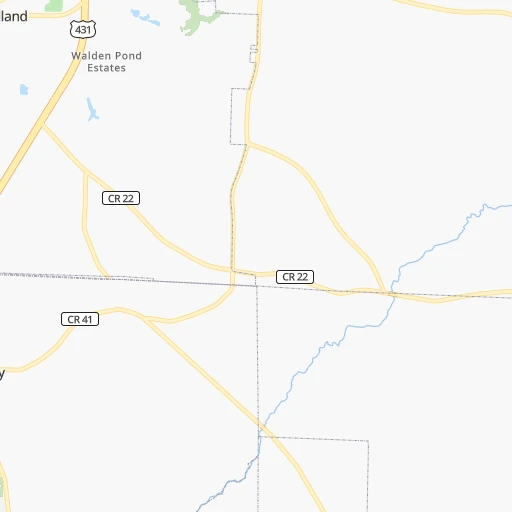
Roadmap (route) to go from Blessings Landing Air Ranch Airport to Decatur detailed above, you can also see the course layout on the map.
While doing trip Blessings Landing Air Ranch (airport) - Decatur by car, the calculated route ends at a distance , or more straight.
Distance and duration of the route between Blessings Landing Air Ranch (airport) and Decatur
Calculation of distance and route from Decatur to Blessings Landing Air Ranch (airport) :
391.4423.6 km5h46mn
Continue 0h3mn 672 mTurn left onto AL 134 0h1mn 811 mTurn right onto Lees Bridge Road 0h4mn 2.1 kmTurn left onto US 231 2h35mn 138.7 kmTurn slight right onto McGehee Road 0h3mn 2.3 kmTurn right onto Carter Hill Road 0h2mn 1.7 kmTurn left onto Carter Hill Road 0h4mn 3.7 kmTurn right onto South Decatur Street 0h1mn 589 mTurn left onto East South Street 0h1mn 837 mKeep left 0h1mn 864 mKeep right and take I-65 North toward Birmingham 2h23mn 236.5 kmKeep right and take US 31 toward Lacon, Vinemont 0h0mn 394 mKeep left toward US 31 North 0h0mn 36 mTurn left onto 2nd Avenue 0h24mn 29.5 kmTurn slight right onto 6th Avenue Southeast 0h4mn 3.9 kmTurn left onto Gordon Drive Southeast 0h0mn 252 mTurn right onto 4th Avenue Southeast 0h1mn 680 mTurn left onto Lee Street Northeast 0h0mn 85 mTurn right 0h0mn 25 mArrive at destination 0h0mn 0 m
Travel from Blessings Landing Air Ranch (airport) (Alabama) to a selection of major cities.
Distances from Blessings Landing Air Ranch Airport to biggest cities in Alabama
- Homewood,25,708 inhabitants.270 km
- Athens,24,966 inhabitants.412 km
- Daphne,24,896 inhabitants.240 km
- Northport,24,772 inhabitants.289 km
- Dixiana,22,940 inhabitants.291 km
- Pelham,22,885 inhabitants.252 km
- Prichard,22,351 inhabitants.252 km
- Anniston,22,347 inhabitants.264 km
- Albertville,21,462 inhabitants.336 km
- Oxford,21,249 inhabitants.259 km
- Trussville,21,023 inhabitants.277 km
- Mountain Brook,20,691 inhabitants.271 km
Other major cities in country :
- Charlotte [NC], 827,097 inhabitants. 617 km
- Seattle [WA], 684,451 inhabitants. 3,599 km
- Denver [CO], 682,545 inhabitants. 1,992 km
- El Paso [TX], 681,124 inhabitants. 1,987 km
- Detroit [MI], 677,116 inhabitants. 1,247 km
- Boston [MA], 667,137 inhabitants. 1,777 km
- Memphis [TN], 655,770 inhabitants. 601 km
- New South Memphis [TN], 641,608 inhabitants. 596 km
- Portland [OR], 632,309 inhabitants. 3,564 km
- Oklahoma City [OK], 631,346 inhabitants. 1,206 km
- Las Vegas [NV], 623,747 inhabitants. 2,783 km
- Baltimore [MD], 621,849 inhabitants. 1,201 km
- Washington, D.C. [DC], 601,723 inhabitants. 1,144 km
- Milwaukee [WI], 600,155 inhabitants. 1,323 km
- South Boston [MA], 571,281 inhabitants. 1,776 km
- Albuquerque [NM], 559,121 inhabitants. 2,008 km
- Tucson [AZ], 531,641 inhabitants. 2,401 km
- Nashville [TN], 530,852 inhabitants. 554 km
- Fresno [CA], 520,052 inhabitants. 3,200 km
- Sacramento [CA], 490,712 inhabitants. 3,358 km
Route from Decatur to major cities (United States).
- Distance Decatur New York City1,328 km
- Distance Decatur Los Angeles2,863 km
- Distance Decatur Chicago809 km
- Distance Decatur Brooklyn1,330 km
- Distance Decatur Houston955 km
- Distance Decatur Queens1,340 km
- Distance Decatur Philadelphia1,203 km
- Distance Decatur Phoenix2,312 km
- Distance Decatur Manhattan1,335 km
- Distance Decatur San Antonio1,229 km
- Distance Decatur San Diego2,794 km
- Distance Decatur The Bronx1,346 km
- Distance Decatur Dallas932 km
- Distance Decatur San Jose3,142 km
- Distance Decatur Austin1,119 km
- Distance Decatur Jacksonville690 km
- Distance Decatur San Francisco3,184 km
- Distance Decatur Columbus693 km
- Distance Decatur Fort Worth980 km
- Distance Decatur Indianapolis579 km
Nearest cities to Blessings Landing Air Ranch (airport) :
- Atlanta, 463,878 inhabitants. 293 km
- Birmingham, 212,461 inhabitants. 275 km
- Montgomery, 200,602 inhabitants. 139 km
- Columbus, 200,579 inhabitants. 139 km
- Mobile, 194,288 inhabitants. 250 km
- Tallahassee, 189,907 inhabitants. 153 km
- Athens, 116,714 inhabitants. 358 km
- Sandy Springs, 105,330 inhabitants. 311 km
- Spring Hill, 98,621 inhabitants. 427 km
- Tuscaloosa, 98,332 inhabitants. 287 km
- Roswell, 94,501 inhabitants. 322 km
- Macon, 91,351 inhabitants. 247 km
- Hoover, 84,848 inhabitants. 263 km
- Johns Creek, 83,335 inhabitants. 328 km
- Albany, 74,843 inhabitants. 134 km
- Warner Robins, 73,490 inhabitants. 231 km
- Dothan, 68,567 inhabitants. 16 km
- Alpharetta, 63,693 inhabitants. 330 km
- Auburn, 62,059 inhabitants. 146 km
- Marietta, 59,067 inhabitants. 309 km
- Smyrna, 56,146 inhabitants. 303 km
- Valdosta, 55,724 inhabitants. 220 km
- East Pensacola Heights, 54,104 inhabitants. 186 km
- Pensacola, 53,193 inhabitants. 189 km
- Brookhaven, 51,910 inhabitants. 305 km
- Stonecrest, 50,000 inhabitants. 298 km
- Dunwoody, 48,733 inhabitants. 315 km
- Peachtree Corners, 40,978 inhabitants. 321 km
- North Atlanta, 40,456 inhabitants. 306 km
- Gainesville, 38,712 inhabitants. 369 km
- Panama City, 38,286 inhabitants. 128 km
- Phenix City, 37,570 inhabitants. 139 km
- Milton, 37,547 inhabitants. 335 km
- Newnan, 37,291 inhabitants. 241 km
- Mableton, 37,115 inhabitants. 294 km
- Rome, 36,323 inhabitants. 331 km
- Gadsden, 36,084 inhabitants. 305 km
- East Point, 35,467 inhabitants. 284 km
- Prattville, 35,420 inhabitants. 157 km
- Peachtree City, 35,240 inhabitants. 249 km
- Vestavia Hills, 34,174 inhabitants. 267 km
- Kennesaw, 33,584 inhabitants. 315 km
- Redan, 33,015 inhabitants. 302 km
- Douglasville, 32,897 inhabitants. 282 km
- Alabaster, 32,707 inhabitants. 248 km
- Navarre, 31,378 inhabitants. 163 km
- Lawrenceville, 30,493 inhabitants. 329 km
- Woodstock, 29,898 inhabitants. 326 km
- LaGrange, 29,588 inhabitants. 199 km
- Opelika, 29,527 inhabitants. 150 km
Location Blessings Landing Air Ranch (airport) (Alabama) :
| Country flag |  |
| Location | Blessings Landing Air Ranch (airport) |
| State | Alabama |
| County | Dale County |
| Country | United States |
| Country code / ISO 2 | US |
| Latitude | 31.3024800 |
| Longitude | -85.5250500 |
| Altitude | 119 meters |
| Time zone | America/Chicago |
Location Decatur (Alabama) :
| Country flag | |
| Location | Decatur |
| State | Alabama |
| County | Morgan County |
| Country | United States |
| Country code / ISO 2 | US |
| Latitude | 34.6059300 |
| Longitude | -86.9833400 |
| Altitude | 171 meters |
| Time zone | America/Chicago |


