

How to get from Steinman (airport) (Indiana) to Kansas City (Missouri)
Calculate route from Steinman (airport) (Indiana, United States) to Kansas City (Missouri, United States).
The flight distance (as the crow flies) between Steinman (airport) and Kansas City is 856.3 km.
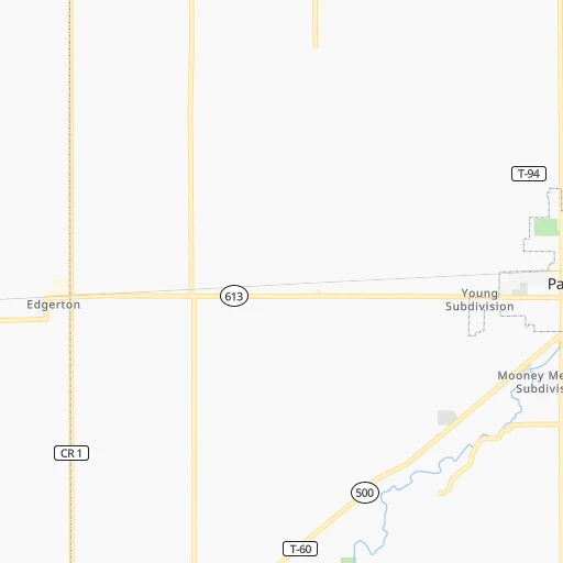
Roadmap (route) to go from Steinman Airport to Kansas City detailed above, you can also see the course layout on the map.
While doing trip Steinman (airport) - Kansas City by car, the calculated route ends at a distance , or more straight.
Distance and duration of the route between Steinman (airport) and Kansas City
Calculation of distance and route from Kansas City to Steinman (airport) :
856.3993.8 km10h19mn
Continue onto South Brobst Road 0h0mn 104 mTurn left onto Dawkins Road 0h12mn 12.2 kmTurn left onto South Doyle Road 0h1mn 1.1 kmTurn sharp right onto US 30 0h1mn 854 mKeep right 0h19mn 31.8 kmKeep right and take I 69 South toward Indianapolis 2h39mn 164.4 kmTurn slight right onto East Fall Creek Parkway North Drive 0h0mn 298 mKeep right onto East Fall Creek Parkway North Drive 0h4mn 3.7 kmContinue onto East Fall Creek Parkway North Drive 0h1mn 702 mTurn right onto East Fall Creek Parkway North Drive 0h2mn 1.6 kmTurn slight right onto Fall Creek Parkway North Drive 0h0mn 354 mTurn sharp left onto Dr Martin Luther King Jr Street 0h2mn 1.8 kmTurn right onto Oscar Robertson Boulevard 0h2mn 1.5 kmTurn left onto Saint Margaret's Drive 0h1mn 486 mTurn right onto West Michigan Street 0h1mn 972 mTurn left onto North Belmont Avenue 0h1mn 940 mTurn right onto West Washington Street 0h2mn 2.0 kmKeep left onto West Washington Street 0h0mn 537 mTurn left onto South Holt Road 0h1mn 852 mTurn right toward I 70 West 2h16mn 225.0 kmKeep right onto I 70 and take I 70 West toward Saint Louis 1h13mn 123.4 kmKeep right onto I 270 and take I 270 West, I 55 North toward Kansas City, Chicago 0h11mn 16.8 kmKeep right and take IL 203 toward Granite City 0h0mn 418 mKeep left 0h22mn 30.5 kmKeep right and take I 70 toward Saint Louis, Kansas City 0h1mn 1.2 kmKeep right and take I 70 West toward Kansas City 4h45mn 369.3 kmKeep left onto I 670, I 70 Alt and take I 670 West, I 70 Alternate, I 35 South toward Topeka, Wichita 0h0mn 376 mKeep right and drive toward 13th Street, Downtown 0h0mn 275 mContinue onto East 13th Street 0h0mn 400 mTurn right onto Oak Street 0h0mn 139 mArrive at destination 0h0mn 0 m
Travel from Steinman (airport) (Missouri) to a selection of major cities.
Distances from Steinman Airport to biggest cities in Indiana
- Columbus,46,690 inhabitants.228 km
- West Lafayette,45,550 inhabitants.189 km
- Portage,36,738 inhabitants.203 km
- Westfield,36,738 inhabitants.158 km
- New Albany,36,732 inhabitants.322 km
- Richmond,35,854 inhabitants.139 km
- Merrillville,35,224 inhabitants.214 km
- Goshen,32,983 inhabitants.101 km
- Valparaiso,32,626 inhabitants.191 km
- Michigan City,31,459 inhabitants.186 km
- Plainfield,30,590 inhabitants.202 km
- Granger,30,465 inhabitants.131 km
- Marion,29,081 inhabitants.90 km
- Crown Point,28,879 inhabitants.215 km
- Schererville,28,791 inhabitants.224 km
- East Chicago,28,699 inhabitants.228 km
- Hobart,28,404 inhabitants.209 km
- Zionsville,26,296 inhabitants.174 km
- Brownsburg,24,996 inhabitants.190 km
- Franklin,24,598 inhabitants.205 km
Other major cities in country :
- Seattle [WA], 684,451 inhabitants. 3,041 km
- Denver [CO], 682,545 inhabitants. 1,711 km
- El Paso [TX], 681,124 inhabitants. 2,191 km
- Detroit [MI], 677,116 inhabitants. 204 km
- Boston [MA], 667,137 inhabitants. 1,152 km
- Memphis [TN], 655,770 inhabitants. 802 km
- New South Memphis [TN], 641,608 inhabitants. 808 km
- Portland [OR], 632,309 inhabitants. 3,076 km
- Oklahoma City [OK], 631,346 inhabitants. 1,270 km
- Las Vegas [NV], 623,747 inhabitants. 2,677 km
- Baltimore [MD], 621,849 inhabitants. 727 km
- Washington, D.C. [DC], 601,723 inhabitants. 708 km
- Milwaukee [WI], 600,155 inhabitants. 335 km
- South Boston [MA], 571,281 inhabitants. 1,153 km
- Albuquerque [NM], 559,121 inhabitants. 2,018 km
- Tucson [AZ], 531,641 inhabitants. 2,518 km
- Nashville [TN], 530,852 inhabitants. 572 km
- Fresno [CA], 520,052 inhabitants. 3,043 km
- Sacramento [CA], 490,712 inhabitants. 3,123 km
- Kansas City [MO], 475,378 inhabitants. 858 km
Route from Kansas City to major cities (United States).
- Distance Kansas City New York City1,762 km
- Distance Kansas City Los Angeles2,182 km
- Distance Kansas City Chicago661 km
- Distance Kansas City Brooklyn1,767 km
- Distance Kansas City Houston1,042 km
- Distance Kansas City Queens1,776 km
- Distance Kansas City Philadelphia1,666 km
- Distance Kansas City Phoenix1,688 km
- Distance Kansas City Manhattan1,765 km
- Distance Kansas City San Antonio1,135 km
- Distance Kansas City San Diego2,150 km
- Distance Kansas City The Bronx1,773 km
- Distance Kansas City Dallas731 km
- Distance Kansas City San Jose2,388 km
- Distance Kansas City Austin1,025 km
- Distance Kansas City Jacksonville1,530 km
- Distance Kansas City San Francisco2,423 km
- Distance Kansas City Columbus998 km
- Distance Kansas City Fort Worth751 km
- Distance Kansas City Indianapolis728 km
Nearest cities to Steinman (airport) :
- Chicago, 2,720,546 inhabitants. 250 km
- Columbus, 850,106 inhabitants. 199 km
- Indianapolis, 829,718 inhabitants. 183 km
- Detroit, 677,116 inhabitants. 204 km
- Cincinnati, 296,943 inhabitants. 218 km
- Meads, 288,649 inhabitants. 348 km
- Ironville, 288,649 inhabitants. 344 km
- Toledo, 279,789 inhabitants. 126 km
- Fort Wayne, 260,326 inhabitants. 25 km
- Louisville, 243,639 inhabitants. 324 km
- Grand Rapids, 195,097 inhabitants. 221 km
- Dayton, 140,599 inhabitants. 156 km
- Warren, 134,056 inhabitants. 219 km
- Sterling Heights, 132,052 inhabitants. 225 km
- Ann Arbor, 117,070 inhabitants. 162 km
- Lansing, 115,056 inhabitants. 186 km
- South Bend, 101,516 inhabitants. 136 km
- Kenosha, 99,858 inhabitants. 299 km
- Clinton Township, 99,753 inhabitants. 232 km
- Flint, 98,310 inhabitants. 236 km
- Dearborn, 95,171 inhabitants. 196 km
- Livonia, 94,635 inhabitants. 190 km
- Carmel, 88,713 inhabitants. 163 km
- Canton, 86,825 inhabitants. 178 km
- West Town, 86,429 inhabitants. 254 km
- Near North Side, 85,711 inhabitants. 251 km
- Bloomington, 84,067 inhabitants. 257 km
- Cicero, 83,886 inhabitants. 258 km
- Troy, 83,280 inhabitants. 221 km
- Westland, 82,000 inhabitants. 183 km
- Farmington Hills, 81,330 inhabitants. 198 km
- Belmont Cragin, 79,159 inhabitants. 262 km
- Racine, 77,742 inhabitants. 306 km
- Hammond, 77,614 inhabitants. 230 km
- Gary, 77,156 inhabitants. 218 km
- Fishers, 76,794 inhabitants. 159 km
- Kalamazoo, 76,041 inhabitants. 149 km
- Waterford, 75,737 inhabitants. 216 km
- Evanston, 75,527 inhabitants. 261 km
- Wyoming, 75,275 inhabitants. 217 km
- Shelby, 74,099 inhabitants. 232 km
- South Lawndale, 73,826 inhabitants. 255 km
- Logan Square, 73,702 inhabitants. 257 km
- Rochester Hills, 73,424 inhabitants. 225 km
- Southfield, 73,156 inhabitants. 206 km
- West Ridge, 72,211 inhabitants. 259 km
- Lafayette, 71,111 inhabitants. 187 km
- Muncie, 70,087 inhabitants. 108 km
- Lincoln Park, 66,959 inhabitants. 253 km
- Portage Park, 64,841 inhabitants. 263 km
Location Steinman (airport) (Indiana) :
| Country flag |  |
| Location | Steinman (airport) |
| State | Indiana |
| County | Allen County |
| Country | United States |
| Country code / ISO 2 | US |
| Latitude | 41.0732700 |
| Longitude | -84.8364900 |
| Altitude | 231 meters |
| Time zone | America/Indiana/Indianapolis |
Location Kansas City (Missouri) :
| Country flag | |
| Location | Kansas City |
| State | Missouri |
| County | Jackson County |
| Country | United States |
| Country code / ISO 2 | US |
| Latitude | 39.0997300 |
| Longitude | -94.5785700 |
| Altitude | 274 meters |
| Time zone | America/Chicago |


