

How to get from Yoder (airport) (Indiana) to Franklin (Indiana)
Calculate route from Yoder (airport) (Indiana, United States) to Franklin (Indiana, United States).
The flight distance (as the crow flies) between Yoder (airport) and Franklin is 240.6 km.
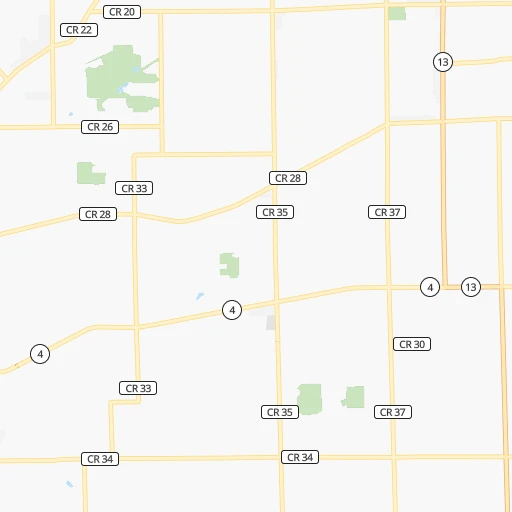
Roadmap (route) to go from Yoder Airport to Franklin detailed above, you can also see the course layout on the map.
While doing trip Yoder (airport) - Franklin by car, the calculated route ends at a distance , or more straight.
Distance and duration of the route between Yoder (airport) and Franklin
Calculation of distance and route from Franklin to Yoder (airport) :
240.6267.4 km4h54mn
Continue 0h0mn 57 mTurn left 0h0mn 23 mTurn left onto West 200 South 0h2mn 1.4 kmTurn left onto South 600 West 0h2mn 1.6 kmTurn right onto South 600 West 0h0mn 117 mTurn slight left onto South 600 West 0h12mn 15.7 kmTurn right onto US 6 0h3mn 4.1 kmTurn sharp left onto Lincolnway South 0h2mn 2.7 kmTurn right onto SR 5 0h12mn 13.2 kmTurn right onto West 200 South 0h6mn 4.8 kmTurn sharp left onto North Main Street 1h57mn 63.2 kmTurn left onto North Wabash Street 0h2mn 2.6 kmKeep right onto Southwood Drive 0h18mn 23.2 kmTurn right onto East Marion Street 0h1mn 668 mTurn left onto North 800 West 1h33mn 36.5 kmTurn right onto SR 37, SR 13 0h17mn 18.8 kmAt roundabout, take exit 2 onto SR 37 0h15mn 20.0 kmKeep left onto IN-37 toward I 69 South, SR 37 South 0h8mn 11.5 kmKeep left 0h1mn 1.0 kmTurn right onto Fall Creek Road 0h1mn 999 mContinue onto North Emerson Avenue 0h4mn 3.9 kmTurn right onto North Emerson Avenue 0h4mn 4.1 kmTurn right onto North Emerson Avenue 0h9mn 9.2 kmKeep left toward I 465 East, I 74 East 0h0mn 192 mTurn right 0h4mn 4.2 kmTurn slight right onto South Emerson Avenue 0h3mn 3.3 kmTurn left onto East County Line Road South 0h0mn 324 mKeep right toward I 65 South 0h6mn 9.8 kmKeep right and drive toward Whiteland 0h0mn 423 mKeep right and drive toward Whiteland 0h0mn 80 mTurn slight right onto Whiteland Road 0h1mn 1.4 kmAt roundabout, take exit 3 onto Graham Road 0h5mn 5.1 kmAt roundabout, take exit 2 onto Graham Road 0h3mn 2.5 kmTurn slight left onto North Main Street 0h1mn 558 mTurn left onto East Jefferson Street 0h0mn 17 mArrive at destination 0h0mn 0 m
Travel from Yoder (airport) (Indiana) to a selection of major cities.
Distances from Yoder Airport to biggest cities in Indiana
- Columbus,46,690 inhabitants.270 km
- West Lafayette,45,550 inhabitants.175 km
- Portage,36,738 inhabitants.137 km
- Westfield,36,738 inhabitants.181 km
- New Albany,36,732 inhabitants.371 km
- Richmond,35,854 inhabitants.205 km
- Merrillville,35,224 inhabitants.151 km
- Goshen,32,983 inhabitants.26 km
- Valparaiso,32,626 inhabitants.129 km
- Michigan City,31,459 inhabitants.114 km
- Plainfield,30,590 inhabitants.224 km
- Granger,30,465 inhabitants.51 km
- Marion,29,081 inhabitants.117 km
- Crown Point,28,879 inhabitants.155 km
- Schererville,28,791 inhabitants.161 km
- East Chicago,28,699 inhabitants.161 km
- Hobart,28,404 inhabitants.144 km
- Zionsville,26,296 inhabitants.195 km
- Brownsburg,24,996 inhabitants.210 km
- Franklin,24,598 inhabitants.241 km
Other major cities in country :
- Seattle [WA], 684,451 inhabitants. 2,963 km
- Denver [CO], 682,545 inhabitants. 1,652 km
- El Paso [TX], 681,124 inhabitants. 2,160 km
- Detroit [MI], 677,116 inhabitants. 220 km
- Boston [MA], 667,137 inhabitants. 1,198 km
- Memphis [TN], 655,770 inhabitants. 820 km
- New South Memphis [TN], 641,608 inhabitants. 826 km
- Portland [OR], 632,309 inhabitants. 3,001 km
- Oklahoma City [OK], 631,346 inhabitants. 1,246 km
- Las Vegas [NV], 623,747 inhabitants. 2,622 km
- Baltimore [MD], 621,849 inhabitants. 797 km
- Washington, D.C. [DC], 601,723 inhabitants. 781 km
- Milwaukee [WI], 600,155 inhabitants. 253 km
- South Boston [MA], 571,281 inhabitants. 1,199 km
- Albuquerque [NM], 559,121 inhabitants. 1,976 km
- Tucson [AZ], 531,641 inhabitants. 2,478 km
- Nashville [TN], 530,852 inhabitants. 616 km
- Fresno [CA], 520,052 inhabitants. 2,984 km
- Sacramento [CA], 490,712 inhabitants. 3,059 km
- Kansas City [MO], 475,378 inhabitants. 817 km
Route from Franklin to major cities (United States).
- Distance Franklin New York City1,034 km
- Distance Franklin Los Angeles2,917 km
- Distance Franklin Chicago296 km
- Distance Franklin Brooklyn1,039 km
- Distance Franklin Houston1,376 km
- Distance Franklin Queens1,048 km
- Distance Franklin Philadelphia933 km
- Distance Franklin Phoenix2,415 km
- Distance Franklin Manhattan1,038 km
- Distance Franklin San Antonio1,596 km
- Distance Franklin San Diego2,882 km
- Distance Franklin The Bronx1,047 km
- Distance Franklin Dallas1,219 km
- Distance Franklin San Jose3,115 km
- Distance Franklin Austin1,478 km
- Distance Franklin Jacksonville1,094 km
- Distance Franklin San Francisco3,147 km
- Distance Franklin Columbus267 km
- Distance Franklin Fort Worth1,260 km
- Distance Franklin Charlotte661 km
Nearest cities to Yoder (airport) :
- Chicago, 2,720,546 inhabitants. 179 km
- Columbus, 850,106 inhabitants. 281 km
- Indianapolis, 829,718 inhabitants. 212 km
- Detroit, 677,116 inhabitants. 220 km
- Milwaukee, 600,155 inhabitants. 253 km
- Cincinnati, 296,943 inhabitants. 289 km
- Toledo, 279,789 inhabitants. 164 km
- Fort Wayne, 260,326 inhabitants. 63 km
- Aurora, 200,661 inhabitants. 233 km
- Grand Rapids, 195,097 inhabitants. 151 km
- Joliet, 147,861 inhabitants. 213 km
- Naperville, 147,100 inhabitants. 219 km
- Dayton, 140,599 inhabitants. 235 km
- Warren, 134,056 inhabitants. 230 km
- Sterling Heights, 132,052 inhabitants. 233 km
- Ann Arbor, 117,070 inhabitants. 166 km
- Lansing, 115,056 inhabitants. 149 km
- Elgin, 112,111 inhabitants. 234 km
- Green Bay, 105,207 inhabitants. 382 km
- South Bend, 101,516 inhabitants. 61 km
- Kenosha, 99,858 inhabitants. 219 km
- Clinton Township, 99,753 inhabitants. 241 km
- Flint, 98,310 inhabitants. 218 km
- Dearborn, 95,171 inhabitants. 210 km
- Livonia, 94,635 inhabitants. 199 km
- Carmel, 88,713 inhabitants. 188 km
- Waukegan, 88,475 inhabitants. 210 km
- Canton, 86,825 inhabitants. 186 km
- West Town, 86,429 inhabitants. 181 km
- Champaign, 86,096 inhabitants. 283 km
- Near North Side, 85,711 inhabitants. 178 km
- Bloomington, 84,067 inhabitants. 285 km
- Cicero, 83,886 inhabitants. 187 km
- Troy, 83,280 inhabitants. 225 km
- Westland, 82,000 inhabitants. 193 km
- Farmington Hills, 81,330 inhabitants. 203 km
- Belmont Cragin, 79,159 inhabitants. 190 km
- Racine, 77,742 inhabitants. 224 km
- Hammond, 77,614 inhabitants. 164 km
- Gary, 77,156 inhabitants. 152 km
- Fishers, 76,794 inhabitants. 188 km
- Kalamazoo, 76,041 inhabitants. 76 km
- Arlington Heights, 75,926 inhabitants. 210 km
- Waterford, 75,737 inhabitants. 212 km
- Evanston, 75,527 inhabitants. 186 km
- Wyoming, 75,275 inhabitants. 146 km
- Schaumburg, 74,693 inhabitants. 217 km
- Bolingbrook, 74,306 inhabitants. 212 km
- Appleton, 74,139 inhabitants. 378 km
- Shelby, 74,099 inhabitants. 237 km
Location Yoder (airport) (Indiana) :
| Country flag |  |
| Location | Yoder (airport) |
| State | Indiana |
| County | LaGrange County |
| Country | United States |
| Country code / ISO 2 | US |
| Latitude | 41.6079300 |
| Longitude | -85.5257400 |
| Altitude | 274 meters |
| Time zone | America/Indiana/Indianapolis |
Location Franklin (Indiana) :
| Country flag | |
| Location | Franklin |
| State | Indiana |
| County | Johnson County |
| Country | United States |
| Country code / ISO 2 | US |
| Latitude | 39.4806100 |
| Longitude | -86.0549900 |
| Altitude | 221 meters |
| Time zone | America/Indiana/Indianapolis |
