
How to get from Bluebird (airport) (Oklahoma) to Mustang (Oklahoma)
Calculate route from Bluebird (airport) (Oklahoma, United States) to Mustang (Oklahoma, United States).
The flight distance (as the crow flies) between Bluebird (airport) and Mustang is 221.0 km.
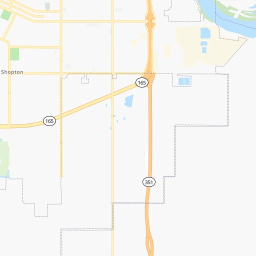
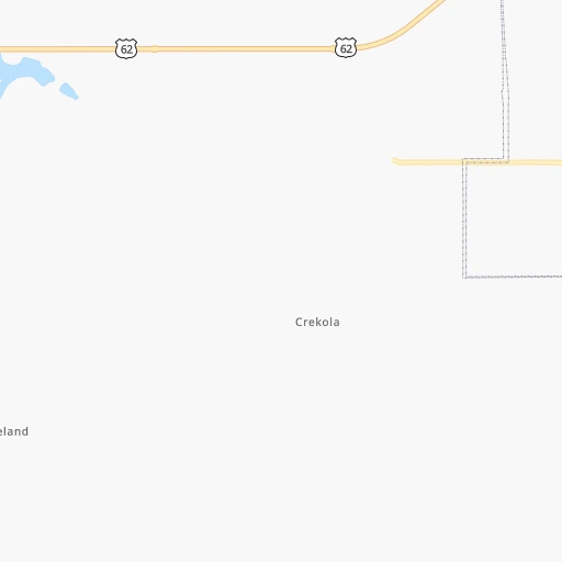
Roadmap (route) to go from Bluebird Airport to Mustang detailed above, you can also see the course layout on the map.
While doing trip Bluebird (airport) - Mustang by car, the calculated route ends at a distance , or more straight.
Distance and duration of the route between Bluebird (airport) and Mustang
Calculation of distance and route from Mustang to Bluebird (airport) :
221.0244.3 km3h32mn
Continue onto South 42nd Street East 0h1mn 621 mTurn right onto East Smith Ferry Road 0h10mn 8.2 kmTurn left onto South 32nd Street 0h18mn 29.8 kmKeep right and take I 40 West toward Oklahoma City 2h31mn 160.8 kmKeep right onto Southeast Expressway and take OK 3 West, I 240 West toward Lawton, Dallas 0h17mn 27.4 kmKeep right and drive toward Southwest 59th Street 0h1mn 829 mTurn left onto Southwest 59th Street 0h4mn 4.4 kmTurn left onto Regina Avenue 0h1mn 1.2 kmTurn right onto Southwest 59th Street 0h1mn 1.3 kmContinue onto Southwest 59th Street 0h2mn 1.9 kmTurn left onto Airport Road 0h6mn 7.0 kmTurn left onto South Mustang Road 0h1mn 830 mArrive at destination 0h0mn 0 m
Travel from Bluebird (airport) (Oklahoma) to a selection of major cities.
Distances from Bluebird Airport to biggest cities in Oklahoma
Other major cities in country :
- Charlotte [NC], 827,097 inhabitants. 1,312 km
- Seattle [WA], 684,451 inhabitants. 2,589 km
- Denver [CO], 682,545 inhabitants. 962 km
- El Paso [TX], 681,124 inhabitants. 1,123 km
- Detroit [MI], 677,116 inhabitants. 1,290 km
- Boston [MA], 667,137 inhabitants. 2,215 km
- Memphis [TN], 655,770 inhabitants. 481 km
- New South Memphis [TN], 641,608 inhabitants. 482 km
- Portland [OR], 632,309 inhabitants. 2,541 km
- Las Vegas [NV], 623,747 inhabitants. 1,785 km
- Baltimore [MD], 621,849 inhabitants. 1,696 km
- Washington, D.C. [DC], 601,723 inhabitants. 1,654 km
- Milwaukee [WI], 600,155 inhabitants. 1,035 km
- South Boston [MA], 571,281 inhabitants. 2,215 km
- Albuquerque [NM], 559,121 inhabitants. 1,031 km
- Tucson [AZ], 531,641 inhabitants. 1,491 km
- Nashville [TN], 530,852 inhabitants. 770 km
- Fresno [CA], 520,052 inhabitants. 2,194 km
- Sacramento [CA], 490,712 inhabitants. 2,337 km
- Kansas City [MO], 475,378 inhabitants. 384 km
Route from Mustang to major cities (United States).
- Distance Mustang New York City2,155 km
- Distance Mustang Los Angeles1,880 km
- Distance Mustang Chicago1,133 km
- Distance Mustang Brooklyn2,158 km
- Distance Mustang Houston664 km
- Distance Mustang Queens2,168 km
- Distance Mustang Philadelphia2,046 km
- Distance Mustang Phoenix1,334 km
- Distance Mustang Manhattan2,159 km
- Distance Mustang San Antonio667 km
- Distance Mustang San Diego1,814 km
- Distance Mustang The Bronx2,169 km
- Distance Mustang Dallas302 km
- Distance Mustang San Jose2,172 km
- Distance Mustang Austin570 km
- Distance Mustang Jacksonville1,602 km
- Distance Mustang San Francisco2,217 km
- Distance Mustang Columbus1,392 km
- Distance Mustang Fort Worth298 km
- Distance Mustang Indianapolis1,130 km
Nearest cities to Bluebird (airport) :
- Dallas, 1,300,092 inhabitants. 353 km
- Fort Worth, 833,319 inhabitants. 380 km
- Oklahoma City, 631,346 inhabitants. 201 km
- Tulsa, 403,505 inhabitants. 79 km
- Wichita, 389,965 inhabitants. 286 km
- Arlington, 388,125 inhabitants. 369 km
- Plano, 283,558 inhabitants. 325 km
- Garland, 236,897 inhabitants. 334 km
- Irving, 236,607 inhabitants. 355 km
- Grand Prairie, 187,809 inhabitants. 364 km
- Springfield, 166,810 inhabitants. 247 km
- McKinney, 162,898 inhabitants. 304 km
- Frisco, 154,407 inhabitants. 316 km
- Mesquite, 144,788 inhabitants. 348 km
- Carrollton, 133,168 inhabitants. 339 km
- Denton, 131,044 inhabitants. 324 km
- Norman, 120,284 inhabitants. 200 km
- Richardson, 110,815 inhabitants. 333 km
- Broken Arrow, 106,563 inhabitants. 58 km
- Lewisville, 104,039 inhabitants. 334 km
- Allen, 98,143 inhabitants. 315 km
- Edmond, 90,092 inhabitants. 196 km
- Fort Smith, 88,194 inhabitants. 90 km
- Fayetteville, 82,830 inhabitants. 112 km
- Springdale, 77,859 inhabitants. 119 km
- Flower Mound, 71,253 inhabitants. 341 km
- North Richland Hills, 69,204 inhabitants. 365 km
- Conway, 64,980 inhabitants. 269 km
- Rogers, 63,159 inhabitants. 128 km
- Moore, 60,451 inhabitants. 201 km
- Rowlett, 60,236 inhabitants. 332 km
- Midwest City, 57,249 inhabitants. 191 km
- Euless, 54,219 inhabitants. 358 km
- Joplin, 51,818 inhabitants. 170 km
- Enid, 51,776 inhabitants. 244 km
- Grapevine, 51,404 inhabitants. 348 km
- Bedford, 49,337 inhabitants. 360 km
- Stillwater, 48,967 inhabitants. 164 km
- Wylie, 46,708 inhabitants. 320 km
- Keller, 45,758 inhabitants. 356 km
- Bentonville, 44,499 inhabitants. 124 km
- Haltom City, 44,206 inhabitants. 370 km
- Rockwall, 42,566 inhabitants. 326 km
- The Colony, 41,779 inhabitants. 325 km
- Hutchinson, 41,569 inhabitants. 351 km
- Coppell, 41,159 inhabitants. 344 km
- Sherman, 40,667 inhabitants. 259 km
- Hurst, 39,016 inhabitants. 363 km
- Muskogee, 38,456 inhabitants. 7 km
- Little Elm, 38,341 inhabitants. 320 km
Location Bluebird (airport) (Oklahoma) :
| Country flag |  |
| Location | Bluebird (airport) |
| State | Oklahoma |
| County | Muskogee County |
| Country | United States |
| Country code / ISO 2 | US |
| Latitude | 35.7034200 |
| Longitude | -95.3116500 |
| Altitude | 166 meters |
| Time zone | America/Chicago |
Location Mustang (Oklahoma) :
| Country flag | |
| Location | Mustang |
| State | Oklahoma |
| County | Canadian County |
| Country | United States |
| Country code / ISO 2 | US |
| Latitude | 35.3842300 |
| Longitude | -97.7244900 |
| Altitude | 411 meters |
| Time zone | America/Chicago |


