


How to get from Shelby Air Service (Mississippi) to Poplar Bluff (Missouri)
Calculate route from Shelby Air Service (Mississippi, United States) to Poplar Bluff (Missouri, United States).
The flight distance (as the crow flies) between Shelby Air Service and Poplar Bluff is 311.9 km.
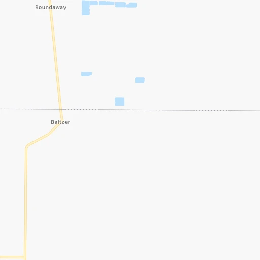
Roadmap (route) to go from Shelby Air Service to Poplar Bluff detailed above, you can also see the course layout on the map.
While doing trip Shelby Air Service - Poplar Bluff by car, the calculated route ends at a distance , or more straight.
Distance and duration of the route between Shelby Air Service and Poplar Bluff
Calculation of distance and route from Poplar Bluff to Shelby Air Service :
311.9378.1 km5h52mn
Continue onto Blue Cain Road 0h0mn 48 mTurn left onto North Broadway Street 0h1mn 638 mTurn left onto US 61, US 278 0h22mn 27.8 kmTurn left onto MS 161 0h10mn 10.1 kmTurn left onto US 49, US 61 1h9mn 102.6 kmTurn left onto Horn Lake Road 0h5mn 4.8 kmTurn left 0h5mn 6.9 kmKeep right onto W B Fowler Senior Expressway 0h8mn 11.9 kmKeep right onto Blues Highway 0h15mn 25.2 kmKeep right and take I 555, AR 77, US 63 toward Turrell, Marked Tree, Jonesboro 0h1mn 748 mKeep left and take I 555, US 63 toward Marked Tree, Jonesboro 1h35mn 57.7 kmKeep right 0h1mn 589 mKeep right 0h0mn 45 mTurn slight right onto Gum Point Road 0h14mn 11.8 kmTurn left onto Brookland Lester 0h0mn 128 mTurn sharp right onto East Johnson Avenue 0h22mn 24.2 kmTurn left onto AR 135 0h8mn 8.4 kmKeep right onto AR 135 0h21mn 21.2 kmKeep right onto AR 135 0h9mn 9.4 kmTurn slight left onto US 62 0h6mn 6.5 kmContinue onto North Missouri Avenue 1h33mn 39.3 kmKeep right onto US 67 Business and take MO M, US 67 Business toward Poplar Bluff 0h0mn 338 mTurn right onto South Westwood Boulevard 0h6mn 6.4 kmKeep right 0h0mn 108 mTurn slight right onto West Pine Street 0h1mn 1.3 kmArrive at destination 0h0mn 0 m
Travel from Shelby Air Service (Missouri) to a selection of major cities.
Distances from Shelby Air Service to biggest cities in Mississippi
- Pascagoula,22,126 inhabitants.452 km
Other major cities in country :
- Charlotte [NC], 827,097 inhabitants. 920 km
- Seattle [WA], 684,451 inhabitants. 3,033 km
- Denver [CO], 682,545 inhabitants. 1,418 km
- El Paso [TX], 681,124 inhabitants. 1,489 km
- Detroit [MI], 677,116 inhabitants. 1,149 km
- Boston [MA], 667,137 inhabitants. 1,955 km
- Memphis [TN], 655,770 inhabitants. 147 km
- New South Memphis [TN], 641,608 inhabitants. 141 km
- Portland [OR], 632,309 inhabitants. 2,993 km
- Oklahoma City [OK], 631,346 inhabitants. 640 km
- Las Vegas [NV], 623,747 inhabitants. 2,228 km
- Baltimore [MD], 621,849 inhabitants. 1,394 km
- Washington, D.C. [DC], 601,723 inhabitants. 1,345 km
- Milwaukee [WI], 600,155 inhabitants. 1,040 km
- South Boston [MA], 571,281 inhabitants. 1,955 km
- Albuquerque [NM], 559,121 inhabitants. 1,461 km
- Tucson [AZ], 531,641 inhabitants. 1,887 km
- Nashville [TN], 530,852 inhabitants. 438 km
- Fresno [CA], 520,052 inhabitants. 2,641 km
- Sacramento [CA], 490,712 inhabitants. 2,792 km
Route from Poplar Bluff to major cities (United States).
- Distance Poplar Bluff New York City1,487 km
- Distance Poplar Bluff Los Angeles2,536 km
- Distance Poplar Bluff Chicago614 km
- Distance Poplar Bluff Brooklyn1,490 km
- Distance Poplar Bluff Houston905 km
- Distance Poplar Bluff Queens1,500 km
- Distance Poplar Bluff Philadelphia1,374 km
- Distance Poplar Bluff Phoenix2,004 km
- Distance Poplar Bluff Manhattan1,492 km
- Distance Poplar Bluff San Antonio1,111 km
- Distance Poplar Bluff San Diego2,482 km
- Distance Poplar Bluff The Bronx1,502 km
- Distance Poplar Bluff Dallas734 km
- Distance Poplar Bluff San Jose2,787 km
- Distance Poplar Bluff Austin993 km
- Distance Poplar Bluff Jacksonville1,080 km
- Distance Poplar Bluff San Francisco2,826 km
- Distance Poplar Bluff Columbus737 km
- Distance Poplar Bluff Fort Worth776 km
- Distance Poplar Bluff Indianapolis499 km
Nearest cities to Shelby Air Service :
- Memphis, 655,770 inhabitants. 147 km
- New South Memphis, 641,608 inhabitants. 141 km
- Little Rock, 197,992 inhabitants. 165 km
- Shreveport, 197,204 inhabitants. 321 km
- Jackson, 170,674 inhabitants. 193 km
- Jonesboro, 73,907 inhabitants. 209 km
- Bossier City, 68,094 inhabitants. 320 km
- Jackson, 66,975 inhabitants. 256 km
- North Little Rock, 66,504 inhabitants. 164 km
- Conway, 64,980 inhabitants. 198 km
- Bartlett, 58,579 inhabitants. 160 km
- Southaven, 52,589 inhabitants. 133 km
- Monroe, 49,598 inhabitants. 205 km
- Collierville, 48,863 inhabitants. 157 km
- Alexandria, 47,889 inhabitants. 335 km
- Hattiesburg, 46,805 inhabitants. 325 km
- Pine Bluff, 44,772 inhabitants. 118 km
- Meridian, 39,661 inhabitants. 262 km
- Germantown, 39,240 inhabitants. 152 km
- Olive Branch, 36,010 inhabitants. 140 km
- Tupelo, 35,680 inhabitants. 193 km
- Hot Springs, 35,635 inhabitants. 219 km
- Hot Springs National Park, 35,193 inhabitants. 220 km
- Benton, 34,177 inhabitants. 180 km
- Greenville, 32,156 inhabitants. 68 km
- Sherwood, 30,517 inhabitants. 164 km
- Russellville, 29,166 inhabitants. 261 km
- Jacksonville, 28,643 inhabitants. 159 km
- Paragould, 27,900 inhabitants. 234 km
- Horn Lake, 26,915 inhabitants. 129 km
- Pearl, 26,462 inhabitants. 197 km
- Madison, 25,799 inhabitants. 178 km
- Cabot, 25,587 inhabitants. 160 km
- Starkville, 25,366 inhabitants. 189 km
- Clinton, 25,254 inhabitants. 186 km
- West Memphis, 25,052 inhabitants. 142 km
- Ridgeland, 24,351 inhabitants. 181 km
- Searcy, 24,196 inhabitants. 168 km
- Brandon, 23,529 inhabitants. 202 km
- Columbus, 23,168 inhabitants. 223 km
- Vicksburg, 23,131 inhabitants. 180 km
- Ruston, 22,340 inhabitants. 237 km
- Oxford, 22,314 inhabitants. 123 km
- Bryant, 19,986 inhabitants. 173 km
- Murray, 18,954 inhabitants. 369 km
- Laurel, 18,837 inhabitants. 296 km
- El Dorado, 18,386 inhabitants. 195 km
- Natchitoches, 18,365 inhabitants. 328 km
- Maumelle, 17,931 inhabitants. 181 km
- Poplar Bluff, 17,266 inhabitants. 312 km
Location Shelby Air Service (Mississippi) :
| Country flag |  |
| Location | Shelby Air Service |
| State | Mississippi |
| County | Bolivar County |
| Country | United States |
| Country code / ISO 2 | US |
| Latitude | 33.9669900 |
| Longitude | -90.7671000 |
| Altitude | 47 meters |
| Time zone | America/Chicago |
Location Poplar Bluff (Missouri) :
| Country flag | |
| Location | Poplar Bluff |
| State | Missouri |
| County | Butler County |
| Country | United States |
| Country code / ISO 2 | US |
| Latitude | 36.7570000 |
| Longitude | -90.3928900 |
| Altitude | 110 meters |
| Time zone | America/Chicago |


