


How to get from Amy (airport) (Kansas) to Choctaw (Oklahoma)
Calculate route from Amy (airport) (Kansas, United States) to Choctaw (Oklahoma, United States).
The flight distance (as the crow flies) between Amy (airport) and Choctaw is 327.9 km.
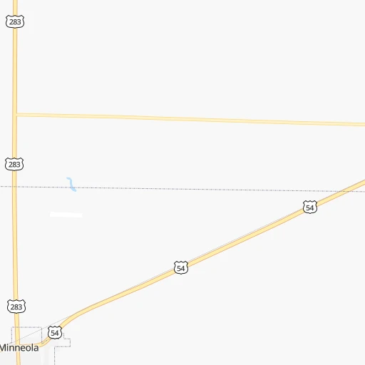
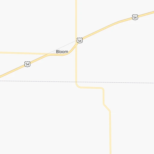
Roadmap (route) to go from Amy Airport to Choctaw detailed above, you can also see the course layout on the map.
While doing trip Amy (airport) - Choctaw by car, the calculated route ends at a distance , or more straight.
Distance and duration of the route between Amy (airport) and Choctaw
Calculation of distance and route from Choctaw to Amy (airport) :
327.9405.7 km5h8mn
Continue onto County Road 7 0h4mn 2.0 kmTurn right onto The Yellow Brick Road 0h2mn 1.8 kmTurn left onto South Oak Street 0h27mn 29.2 kmTurn right onto US 283 1h38mn 41.3 kmTurn left onto US 64, US 283 0h6mn 6.5 kmKeep right onto US 283 0h1mn 796 mTurn slight right onto N1760 Road 0h19mn 20.7 kmTurn left onto US 270, US 412, OK 3 1h33mn 50.6 kmTurn left onto Oklahoma Avenue 0h4mn 3.4 kmTurn right onto 9th Street 1h54mn 68.3 kmContinue onto OK 3, US 270, US 281 1h34mn 47.1 kmTurn right onto South Clarence Nash Boulevard 0h26mn 40.7 kmTurn left and take I 40 East toward Oklahoma City 1h42mn 71.6 kmKeep right onto Representative Opio Toure Memorial Highway and take I 35 North, US 62 East toward Wichita 0h2mn 3.3 kmKeep right onto US 62 and take US 62 East toward Northeast 23rd Street 0h0mn 74 mTurn slight left onto Northeast Grand Boulevard 0h0mn 215 mTurn right onto Northeast 23rd Street 0h16mn 17.5 kmTurn left onto Main Street 0h0mn 156 mAt roundabout, take exit 2 onto Main Street 0h0mn 122 mAt roundabout, take exit 2 onto Main Street 0h0mn 139 mTurn right onto 1st Street 0h0mn 184 mTurn left onto Muzzy Street 0h0mn 91 mArrive at destination 0h0mn 0 m
Travel from Amy (airport) (Oklahoma) to a selection of major cities.
Distances from Amy Airport to biggest cities in Kansas
- Gardner,20,868 inhabitants.469 km
- Liberal,20,746 inhabitants.94 km
- Pittsburg,20,409 inhabitants.468 km
Other major cities in country :
- Charlotte [NC], 827,097 inhabitants. 1,733 km
- Seattle [WA], 684,451 inhabitants. 2,140 km
- Denver [CO], 682,545 inhabitants. 502 km
- El Paso [TX], 681,124 inhabitants. 870 km
- Detroit [MI], 677,116 inhabitants. 1,542 km
- Boston [MA], 667,137 inhabitants. 2,517 km
- Memphis [TN], 655,770 inhabitants. 929 km
- New South Memphis [TN], 641,608 inhabitants. 930 km
- Portland [OR], 632,309 inhabitants. 2,083 km
- Oklahoma City [OK], 631,346 inhabitants. 315 km
- Las Vegas [NV], 623,747 inhabitants. 1,355 km
- Baltimore [MD], 621,849 inhabitants. 2,045 km
- Washington, D.C. [DC], 601,723 inhabitants. 2,010 km
- Milwaukee [WI], 600,155 inhabitants. 1,198 km
- South Boston [MA], 571,281 inhabitants. 2,518 km
- Albuquerque [NM], 559,121 inhabitants. 653 km
- Tucson [AZ], 531,641 inhabitants. 1,155 km
- Nashville [TN], 530,852 inhabitants. 1,186 km
- Fresno [CA], 520,052 inhabitants. 1,754 km
- Sacramento [CA], 490,712 inhabitants. 1,885 km
Route from Choctaw to major cities (United States).
- Distance Choctaw New York City2,112 km
- Distance Choctaw Los Angeles1,921 km
- Distance Choctaw Chicago1,094 km
- Distance Choctaw Brooklyn2,115 km
- Distance Choctaw Houston663 km
- Distance Choctaw Queens2,125 km
- Distance Choctaw Philadelphia2,003 km
- Distance Choctaw Phoenix1,376 km
- Distance Choctaw Manhattan2,116 km
- Distance Choctaw San Antonio686 km
- Distance Choctaw San Diego1,856 km
- Distance Choctaw The Bronx2,126 km
- Distance Choctaw Dallas305 km
- Distance Choctaw San Jose2,209 km
- Distance Choctaw Austin584 km
- Distance Choctaw Jacksonville1,566 km
- Distance Choctaw San Francisco2,254 km
- Distance Choctaw Columbus1,349 km
- Distance Choctaw Fort Worth309 km
- Distance Choctaw Indianapolis1,088 km
Nearest cities to Amy (airport) :
- Oklahoma City, 631,346 inhabitants. 315 km
- Wichita, 389,965 inhabitants. 236 km
- Amarillo, 198,645 inhabitants. 299 km
- Norman, 120,284 inhabitants. 339 km
- Lawton, 96,655 inhabitants. 350 km
- Edmond, 90,092 inhabitants. 303 km
- Moore, 60,451 inhabitants. 327 km
- Midwest City, 57,249 inhabitants. 324 km
- Enid, 51,776 inhabitants. 223 km
- Stillwater, 48,967 inhabitants. 302 km
- Salina, 47,813 inhabitants. 259 km
- Hutchinson, 41,569 inhabitants. 194 km
- Dodge City, 27,912 inhabitants. 32 km
- Garden City, 27,005 inhabitants. 95 km
- Yukon, 25,892 inhabitants. 296 km
- Ponca City, 24,758 inhabitants. 272 km
- Derby, 23,509 inhabitants. 241 km
- Duncan, 23,231 inhabitants. 378 km
- Del City, 22,022 inhabitants. 322 km
- Hays, 21,092 inhabitants. 168 km
- Liberal, 20,746 inhabitants. 94 km
- Mustang, 20,226 inhabitants. 309 km
- Bethany, 19,589 inhabitants. 303 km
- Newton, 19,216 inhabitants. 242 km
- Altus, 19,214 inhabitants. 321 km
- El Reno, 18,516 inhabitants. 283 km
- Pampa, 18,177 inhabitants. 232 km
- Chickasha, 16,488 inhabitants. 327 km
- Great Bend, 15,717 inhabitants. 147 km
- Hereford, 15,021 inhabitants. 366 km
- Dumas, 15,001 inhabitants. 251 km
- Canyon, 14,887 inhabitants. 326 km
- McPherson, 13,144 inhabitants. 228 km
- Woodward, 12,993 inhabitants. 127 km
- Borger, 12,964 inhabitants. 236 km
- Andover, 12,745 inhabitants. 254 km
- Elk City, 12,717 inhabitants. 235 km
- Choctaw, 12,179 inhabitants. 328 km
- Arkansas City, 12,136 inhabitants. 266 km
- Weatherford, 12,126 inhabitants. 245 km
- Guymon, 11,921 inhabitants. 158 km
- Guthrie, 11,270 inhabitants. 290 km
- Haysville, 11,212 inhabitants. 234 km
- Warr Acres, 10,431 inhabitants. 304 km
- Clinton, 9,565 inhabitants. 236 km
- Newcastle, 9,438 inhabitants. 328 km
- The Village, 9,400 inhabitants. 305 km
- Perryton, 9,252 inhabitants. 139 km
- Dalhart, 8,370 inhabitants. 274 km
- Blanchard, 8,280 inhabitants. 334 km
Location Amy (airport) (Kansas) :
| Country flag |  |
| Location | Amy (airport) |
| State | Kansas |
| County | Clark County |
| Country | United States |
| Country code / ISO 2 | US |
| Latitude | 37.4686800 |
| Longitude | -100.0002700 |
| Altitude | 781 meters |
| Time zone | America/Chicago |
Location Choctaw (Oklahoma) :
| Country flag | |
| Location | Choctaw |
| State | Oklahoma |
| County | Oklahoma County |
| Country | United States |
| Country code / ISO 2 | US |
| Latitude | 35.4975600 |
| Longitude | -97.2689200 |
| Altitude | 350 meters |
| Time zone | America/Chicago |