

How to get from Virginia Beach (airport) (Virginia) to West Raleigh (North Carolina)
Calculate route from Virginia Beach (airport) (Virginia, United States) to West Raleigh (North Carolina, United States).
The flight distance (as the crow flies) between Virginia Beach (airport) and West Raleigh is 256.0 km.
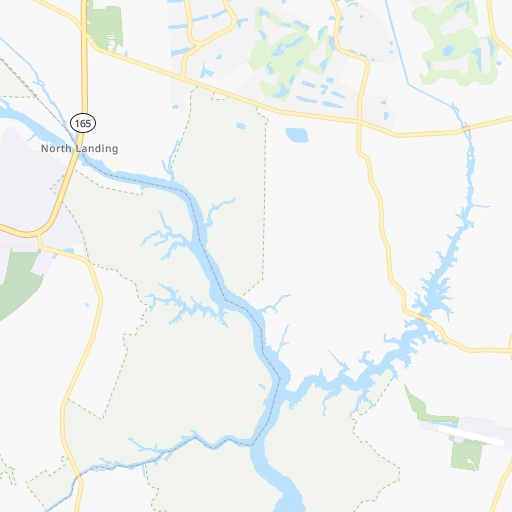
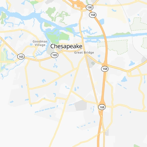
Roadmap (route) to go from Virginia Beach Airport to West Raleigh detailed above, you can also see the course layout on the map.
While doing trip Virginia Beach (airport) - West Raleigh by car, the calculated route ends at a distance , or more straight.
Distance and duration of the route between Virginia Beach (airport) and West Raleigh
Calculation of distance and route from West Raleigh to Virginia Beach (airport) :
256.0304.6 km4h58mn
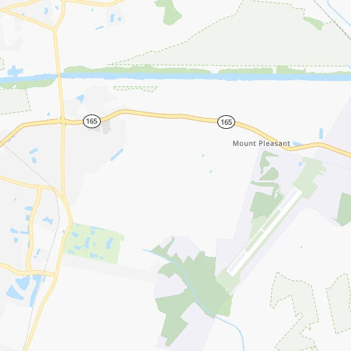
Continue 0h2mn 606 mTurn left onto Princess Anne Road 0h1mn 1.4 kmTurn left onto West Neck Road 0h6mn 4.9 kmTurn left onto Indian River Road 0h8mn 9.3 kmTurn left onto Elbow Road 0h4mn 4.2 kmTurn left onto Indian River Road 0h3mn 3.6 kmKeep right and take I 64 toward Suffolk 0h17mn 23.3 kmKeep right and take US 13, US 58, US 460, VA 191 North toward Suffolk, Military Highway 0h0mn 157 mKeep left 0h7mn 9.8 kmKeep right onto US 13 BUS, US 58 BUS, US 460 BUS and take US 13 Business South, US 58 Business West, US 460 Business West toward Downtown, Suffolk 0h1mn 1.1 kmKeep left onto Portsmouth Boulevard 0h7mn 7.2 kmTurn right onto West Washington Street 0h3mn 3.0 kmTurn left onto Holland Road 0h19mn 22.0 kmContinue onto US 58, VA 189 0h6mn 10.2 kmKeep right and take SR 671 toward Armory Drive, Downtown Franklin 0h0mn 329 mTurn left onto General Thomas Highway 0h22mn 23.6 kmTurn left onto Meherrin Road 0h1mn 1.5 kmTurn right onto Beaton Avenue 1h36mn 40.0 kmContinue onto Sycamore Street 0h0mn 182 mTurn right onto East 1st Street 0h0mn 212 mTurn left onto Elm Street 0h0mn 107 mTurn right onto West 2nd Street 0h1mn 1.2 kmTurn slight right onto Julian R Allsbrook Highway 0h2mn 1.9 kmTurn left 1h32mn 54.6 kmKeep right and take US 64 toward Nashville, Rocky Mount, Raleigh 0h0mn 423 mKeep right and take US 64 West toward Nashville, Raleigh 1h33mn 56.1 kmKeep right and take US 64 Business West toward Knightdale 0h17mn 19.1 kmContinue onto New Bern Avenue 0h5mn 3.7 kmAt roundabout, take exit 1 onto Hillsborough Street 0h1mn 753 mAt roundabout, take exit 2 onto Hillsborough Street 0h0mn 178 mTurn right onto Enterprise Street 0h0mn 13 mArrive at destination 0h0mn 0 m
Travel from Virginia Beach (airport) (North Carolina) to a selection of major cities.
Distances from Virginia Beach Airport to biggest cities in Virginia
- Leesburg,51,209 inhabitants.303 km
- McLean,48,115 inhabitants.271 km
- Charlottesville,46,597 inhabitants.264 km
- Tuckahoe,44,990 inhabitants.169 km
- Blacksburg,44,215 inhabitants.395 km
- Ashburn,43,511 inhabitants.293 km
- Danville,42,082 inhabitants.301 km
- Manassas,41,764 inhabitants.263 km
- Lake Ridge,41,058 inhabitants.250 km
- Burke,41,055 inhabitants.260 km
- Annandale,41,008 inhabitants.261 km
- Mechanicsville,36,348 inhabitants.158 km
- Linton Hall,35,725 inhabitants.269 km
- Oakton,34,166 inhabitants.269 km
- Oak Hill,33,811 inhabitants.278 km
- Petersburg,32,477 inhabitants.136 km
- Springfield,30,484 inhabitants.256 km
- West Falls Church,29,207 inhabitants.266 km
- Jefferson,28,487 inhabitants.264 km
- Fredericksburg,28,118 inhabitants.221 km
Other major cities in country :
- Charlotte [NC], 827,097 inhabitants. 463 km
- Seattle [WA], 684,451 inhabitants. 3,945 km
- Denver [CO], 682,545 inhabitants. 2,544 km
- El Paso [TX], 681,124 inhabitants. 2,844 km
- Detroit [MI], 677,116 inhabitants. 871 km
- Boston [MA], 667,137 inhabitants. 763 km
- Memphis [TN], 655,770 inhabitants. 1,274 km
- New South Memphis [TN], 641,608 inhabitants. 1,276 km
- Portland [OR], 632,309 inhabitants. 3,975 km
- Oklahoma City [OK], 631,346 inhabitants. 1,934 km
- Las Vegas [NV], 623,747 inhabitants. 3,479 km
- Baltimore [MD], 621,849 inhabitants. 295 km
- Washington, D.C. [DC], 601,723 inhabitants. 262 km
- Milwaukee [WI], 600,155 inhabitants. 1,235 km
- South Boston [MA], 571,281 inhabitants. 761 km
- Albuquerque [NM], 559,121 inhabitants. 2,756 km
- Tucson [AZ], 531,641 inhabitants. 3,224 km
- Nashville [TN], 530,852 inhabitants. 964 km
- Fresno [CA], 520,052 inhabitants. 3,868 km
- Sacramento [CA], 490,712 inhabitants. 3,973 km
Route from West Raleigh to major cities (United States).
- Distance West Raleigh New York City683 km
- Distance West Raleigh Los Angeles3,593 km
- Distance West Raleigh Chicago1,030 km
- Distance West Raleigh Brooklyn680 km
- Distance West Raleigh Houston1,698 km
- Distance West Raleigh Queens689 km
- Distance West Raleigh Philadelphia556 km
- Distance West Raleigh Phoenix3,057 km
- Distance West Raleigh Manhattan691 km
- Distance West Raleigh San Antonio1,985 km
- Distance West Raleigh San Diego3,536 km
- Distance West Raleigh The Bronx702 km
- Distance West Raleigh Dallas1,699 km
- Distance West Raleigh San Jose3,835 km
- Distance West Raleigh Austin1,880 km
- Distance West Raleigh Jacksonville668 km
- Distance West Raleigh San Francisco3,872 km
- Distance West Raleigh Columbus601 km
- Distance West Raleigh Fort Worth1,747 km
- Distance West Raleigh Indianapolis794 km
Nearest cities to Virginia Beach (airport) :
- Baltimore, 621,849 inhabitants. 295 km
- Washington, D.C., 601,723 inhabitants. 262 km
- Virginia Beach, 452,745 inhabitants. 20 km
- Raleigh, 451,066 inhabitants. 255 km
- West Raleigh, 338,759 inhabitants. 256 km
- Durham, 257,636 inhabitants. 268 km
- Norfolk, 246,393 inhabitants. 29 km
- Chesapeake, 235,429 inhabitants. 27 km
- Richmond, 220,289 inhabitants. 160 km
- Arlington, 207,627 inhabitants. 263 km
- Fayetteville, 201,963 inhabitants. 314 km
- Newport News, 182,385 inhabitants. 60 km
- Cary, 159,769 inhabitants. 266 km
- Alexandria, 153,511 inhabitants. 253 km
- East Hampton, 147,993 inhabitants. 48 km
- Hampton, 136,454 inhabitants. 48 km
- Wilmington, 115,933 inhabitants. 324 km
- Columbia, 99,615 inhabitants. 294 km
- Portsmouth Heights, 99,049 inhabitants. 34 km
- Portsmouth, 96,201 inhabitants. 30 km
- Greenville, 90,597 inhabitants. 169 km
- Suffolk, 88,161 inhabitants. 50 km
- Germantown, 86,395 inhabitants. 298 km
- South Suffolk, 80,690 inhabitants. 50 km
- Silver Spring, 71,452 inhabitants. 272 km
- Centreville, 71,135 inhabitants. 270 km
- Frederick, 69,479 inhabitants. 328 km
- Waldorf, 67,752 inhabitants. 231 km
- Glen Burnie, 67,639 inhabitants. 281 km
- Gaithersburg, 67,456 inhabitants. 293 km
- Jacksonville, 67,357 inhabitants. 249 km
- Rockville, 66,980 inhabitants. 285 km
- Dale City, 65,969 inhabitants. 245 km
- Ellicott City, 65,834 inhabitants. 296 km
- Dundalk, 63,597 inhabitants. 290 km
- Bethesda, 60,858 inhabitants. 273 km
- Vineland, 60,818 inhabitants. 325 km
- Reston, 58,404 inhabitants. 280 km
- South Vineland, 58,122 inhabitants. 320 km
- Bowie, 58,025 inhabitants. 259 km
- Rocky Mount, 55,806 inhabitants. 178 km
- Towson, 55,197 inhabitants. 307 km
- Harrisonburg, 52,538 inhabitants. 319 km
- Leesburg, 51,209 inhabitants. 303 km
- Wilson, 49,643 inhabitants. 200 km
- South Bel Air, 48,828 inhabitants. 319 km
- Aspen Hill, 48,759 inhabitants. 283 km
- Wheaton, 48,284 inhabitants. 278 km
- McLean, 48,115 inhabitants. 271 km
- Bel Air South, 47,709 inhabitants. 316 km
Location Virginia Beach (airport) (Virginia) :
| Country flag |  |
| Location | Virginia Beach (airport) |
| State | Virginia |
| County | City of Virginia Beach |
| Country | United States |
| Country code / ISO 2 | US |
| Latitude | 36.6787600 |
| Longitude | -76.0307100 |
| Altitude | 4 meters |
| Time zone | America/New_York |
Location West Raleigh (North Carolina) :
| Country flag | |
| Location | West Raleigh |
| State | North Carolina |
| County | Wake County |
| Country | United States |
| Country code / ISO 2 | US |
| Latitude | 35.7868200 |
| Longitude | -78.6638900 |
| Altitude | 122 meters |
| Time zone | America/New_York |


