


How to get from Cottonwood Farm (airport) (Virginia) to Bowie (Maryland)
Calculate route from Cottonwood Farm (airport) (Virginia, United States) to Bowie (Maryland, United States).
The flight distance (as the crow flies) between Cottonwood Farm (airport) and Bowie is 195.9 km.
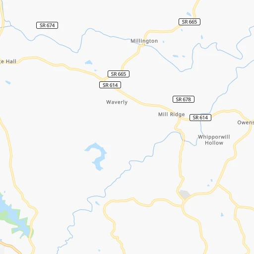
Roadmap (route) to go from Cottonwood Farm Airport to Bowie detailed above, you can also see the course layout on the map.
While doing trip Cottonwood Farm (airport) - Bowie by car, the calculated route ends at a distance , or more straight.
Distance and duration of the route between Cottonwood Farm (airport) and Bowie
Calculation of distance and route from Bowie to Cottonwood Farm (airport) :
195.9227.5 km3h0mn
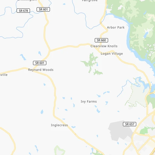
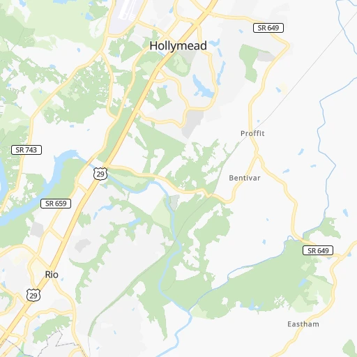
Continue 0h2mn 453 mTurn right onto Thurston Drive 0h1mn 482 mTurn right onto Parkview Drive 0h2mn 1.2 kmTurn left onto Three Notch'd Road 0h13mn 14.3 kmTurn left onto Old Garth Road 0h0mn 97 mTurn right onto Old Ivy Road 0h0mn 250 mTurn left toward US 29 North 0h2mn 2.6 kmKeep right 0h0mn 304 mMake a U-turn onto Emmet Street North 1h9mn 91.4 kmTurn right onto Catlett Road 0h28mn 31.9 kmTurn left onto Hornbaker Road 0h2mn 1.9 kmContinue onto Hornbaker Road 0h2mn 1.5 kmTurn right onto Wellington Road 0h0mn 208 mTurn left onto Prince William Parkway 0h0mn 463 mTurn right onto Sudley Manor Drive 0h3mn 2.9 kmTurn left onto Sudley Road 0h1mn 1.4 kmKeep right and take I 66 East, I 66 Toll East Express Lanes toward Washington 0h0mn 362 mKeep right 0h17mn 27.9 kmKeep right 0h0mn 275 mKeep right 0h10mn 13.5 kmKeep right and drive toward Rosslyn, Key Bridge 0h1mn 1.4 kmTurn left onto North Lynn Street 0h1mn 655 mTurn right onto US 29 toward US 29 North 0h1mn 947 mContinue onto Whitehurst Freeway and take US 29 toward K Street 0h0mn 211 mContinue onto K Street Northwest 0h0mn 239 mKeep right 0h0mn 226 mAt roundabout, take exit 4 onto K Street Northwest 0h0mn 474 mContinue onto K Street Northwest 0h1mn 527 mTurn left onto K Street Northwest 0h0mn 18 mTurn right onto K Street Northwest 0h1mn 1.3 kmTurn right onto 9th Street Northwest 0h0mn 47 mTurn left onto K Street Northwest 0h0mn 182 mTurn left onto 7th Street Northwest 0h0mn 95 mTurn right onto New York Avenue Northwest 0h7mn 7.6 kmKeep right onto John Hanson Highway and take US 50 East toward Annapolis, Richmond, Alexandria, Blandensburg 0h12mn 17.9 kmKeep right and take MD 197 toward Bowie 0h1mn 637 mTurn sharp right onto Collington Road 0h1mn 1.3 kmTurn right onto Evergreen Parkway 0h0mn 257 mContinue 0h0mn 35 mTurn sharp right 0h0mn 79 mTurn slight left 0h0mn 33 mArrive at destination 0h0mn 0 m
Travel from Cottonwood Farm (airport) (Maryland) to a selection of major cities.
Distances from Cottonwood Farm Airport to biggest cities in Virginia
- Leesburg,51,209 inhabitants.152 km
- McLean,48,115 inhabitants.163 km
- Charlottesville,46,597 inhabitants.20 km
- Tuckahoe,44,990 inhabitants.114 km
- Blacksburg,44,215 inhabitants.179 km
- Ashburn,43,511 inhabitants.150 km
- Danville,42,082 inhabitants.178 km
- Manassas,41,764 inhabitants.130 km
- Lake Ridge,41,058 inhabitants.139 km
- Burke,41,055 inhabitants.147 km
- Annandale,41,008 inhabitants.155 km
- Mechanicsville,36,348 inhabitants.128 km
- Linton Hall,35,725 inhabitants.124 km
- Oakton,34,166 inhabitants.151 km
- Oak Hill,33,811 inhabitants.147 km
- Petersburg,32,477 inhabitants.148 km
- Springfield,30,484 inhabitants.153 km
- West Falls Church,29,207 inhabitants.160 km
- Jefferson,28,487 inhabitants.158 km
- Fredericksburg,28,118 inhabitants.111 km
Other major cities in country :
- Charlotte [NC], 827,097 inhabitants. 371 km
- Seattle [WA], 684,451 inhabitants. 3,663 km
- Denver [CO], 682,545 inhabitants. 2,276 km
- El Paso [TX], 681,124 inhabitants. 2,621 km
- Detroit [MI], 677,116 inhabitants. 600 km
- Boston [MA], 667,137 inhabitants. 804 km
- Memphis [TN], 655,770 inhabitants. 1,065 km
- New South Memphis [TN], 641,608 inhabitants. 1,068 km
- Portland [OR], 632,309 inhabitants. 3,694 km
- Oklahoma City [OK], 631,346 inhabitants. 1,700 km
- Las Vegas [NV], 623,747 inhabitants. 3,221 km
- Baltimore [MD], 621,849 inhabitants. 226 km
- Washington, D.C. [DC], 601,723 inhabitants. 171 km
- Milwaukee [WI], 600,155 inhabitants. 954 km
- South Boston [MA], 571,281 inhabitants. 804 km
- Albuquerque [NM], 559,121 inhabitants. 2,511 km
- Tucson [AZ], 531,641 inhabitants. 2,989 km
- Nashville [TN], 530,852 inhabitants. 749 km
- Fresno [CA], 520,052 inhabitants. 3,605 km
- Sacramento [CA], 490,712 inhabitants. 3,703 km
Route from Bowie to major cities (United States).
- Distance Bowie New York City305 km
- Distance Bowie Los Angeles3,722 km
- Distance Bowie Chicago980 km
- Distance Bowie Brooklyn304 km
- Distance Bowie Houston1,988 km
- Distance Bowie Queens314 km
- Distance Bowie Philadelphia175 km
- Distance Bowie Phoenix3,213 km
- Distance Bowie Manhattan313 km
- Distance Bowie San Antonio2,259 km
- Distance Bowie San Diego3,684 km
- Distance Bowie The Bronx324 km
- Distance Bowie Dallas1,932 km
- Distance Bowie San Jose3,917 km
- Distance Bowie Austin2,147 km
- Distance Bowie Jacksonville1,059 km
- Distance Bowie San Francisco3,948 km
- Distance Bowie Columbus550 km
- Distance Bowie Fort Worth1,978 km
- Distance Bowie Indianapolis816 km
Nearest cities to Cottonwood Farm (airport) :
- Charlotte, 827,097 inhabitants. 371 km
- Baltimore, 621,849 inhabitants. 226 km
- Washington, D.C., 601,723 inhabitants. 171 km
- Virginia Beach, 452,745 inhabitants. 276 km
- Raleigh, 451,066 inhabitants. 257 km
- West Raleigh, 338,759 inhabitants. 255 km
- Pittsburgh, 304,391 inhabitants. 286 km
- Greensboro, 285,342 inhabitants. 244 km
- Durham, 257,636 inhabitants. 233 km
- Norfolk, 246,393 inhabitants. 253 km
- Winston-Salem, 241,218 inhabitants. 260 km
- Chesapeake, 235,429 inhabitants. 256 km
- Richmond, 220,289 inhabitants. 123 km
- Arlington, 207,627 inhabitants. 165 km
- Newport News, 182,385 inhabitants. 226 km
- Cary, 159,769 inhabitants. 255 km
- Alexandria, 153,511 inhabitants. 165 km
- East Hampton, 147,993 inhabitants. 239 km
- Hampton, 136,454 inhabitants. 238 km
- High Point, 110,268 inhabitants. 264 km
- Roanoke, 99,897 inhabitants. 142 km
- Columbia, 99,615 inhabitants. 207 km
- Portsmouth Heights, 99,049 inhabitants. 249 km
- Portsmouth, 96,201 inhabitants. 253 km
- Greenville, 90,597 inhabitants. 299 km
- Suffolk, 88,161 inhabitants. 240 km
- Reading, 87,879 inhabitants. 346 km
- Concord, 87,696 inhabitants. 342 km
- Germantown, 86,395 inhabitants. 174 km
- South Suffolk, 80,690 inhabitants. 240 km
- Lynchburg, 79,812 inhabitants. 84 km
- Gastonia, 74,543 inhabitants. 385 km
- Canton, 71,885 inhabitants. 380 km
- Silver Spring, 71,452 inhabitants. 177 km
- Centreville, 71,135 inhabitants. 139 km
- Frederick, 69,479 inhabitants. 186 km
- Waldorf, 67,752 inhabitants. 165 km
- Glen Burnie, 67,639 inhabitants. 217 km
- Gaithersburg, 67,456 inhabitants. 176 km
- Rockville, 66,980 inhabitants. 175 km
- Dale City, 65,969 inhabitants. 136 km
- Ellicott City, 65,834 inhabitants. 211 km
- West Lynchburg, 65,517 inhabitants. 87 km
- Dundalk, 63,597 inhabitants. 230 km
- Bethesda, 60,858 inhabitants. 171 km
- Chapel Hill, 59,568 inhabitants. 243 km
- Lancaster, 59,339 inhabitants. 300 km
- Reston, 58,404 inhabitants. 154 km
- Bowie, 58,025 inhabitants. 196 km
- Rocky Mount, 55,806 inhabitants. 252 km
Location Cottonwood Farm (airport) (Virginia) :
| Country flag |  |
| Location | Cottonwood Farm (airport) |
| State | Virginia |
| County | Albemarle County |
| Country | United States |
| Country code / ISO 2 | US |
| Latitude | 38.0812800 |
| Longitude | -78.6956100 |
| Altitude | 207 meters |
| Time zone | America/New_York |
Location Bowie (Maryland) :
| Country flag | |
| Location | Bowie |
| State | Maryland |
| County | Prince George's County |
| Country | United States |
| Country code / ISO 2 | US |
| Latitude | 38.9427800 |
| Longitude | -76.7302800 |
| Altitude | 42 meters |
| Time zone | America/New_York |


