


How to get from Cox Farm (airport) (Tennessee) to Mableton (Georgia)
Calculate route from Cox Farm (airport) (Tennessee, United States) to Mableton (Georgia, United States).
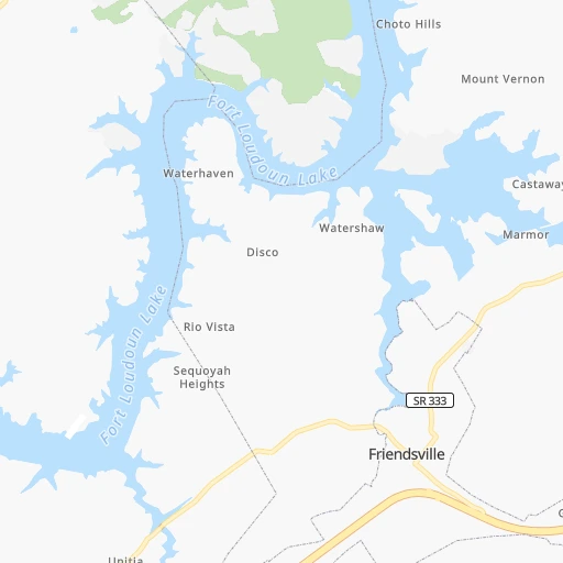
The flight distance (as the crow flies) between Cox Farm (airport) and Mableton is 221.3 km.
Roadmap (route) to go from Cox Farm Airport to Mableton detailed above, you can also see the course layout on the map.
While doing trip Cox Farm (airport) - Mableton by car, the calculated route ends at a distance , or more straight.
Distance and duration of the route between Cox Farm (airport) and Mableton
Calculation of distance and route from Mableton to Cox Farm (airport) :
221.3264.9 km3h15mn
Continue onto Breazale Road 0h4mn 2.0 kmTurn right onto Hotchkiss Valley Road East 0h4mn 2.2 kmTurn left onto Hotchkiss Valley Road East 0h0mn 150 mKeep right 1h47mn 79.7 kmKeep right and drive toward Cleveland 0h1mn 670 mTurn left onto Paul Huff Parkway 0h1mn 537 mTurn right onto Peerless Road Northwest 0h4mn 3.0 kmTurn left onto 25th Street Northwest 0h0mn 417 mKeep right 0h2mn 2.4 kmTurn left onto Harrison Pike 0h0mn 13 mContinue onto Inman Street West 0h1mn 673 mTurn right onto Broad Street Southwest 0h0mn 222 mTurn left onto 3rd Street Southwest 0h0mn 89 mContinue onto 3rd Street Southeast 0h1mn 930 mTurn right onto Wildwood Avenue 1h37mn 45.5 kmTurn right onto East Morris Street 0h1mn 566 mTurn left onto South Thornton Avenue 0h1mn 805 mContinue onto South Dixie Road 0h7mn 8.2 kmKeep right 0h0mn 185 mTurn slight right onto South Bypass 0h1mn 978 mTurn left 1h42mn 71.8 kmKeep right and drive toward Allatoona Road, Emerson 0h0mn 448 mKeep right and drive toward Allatoona Road, Emerson 0h0mn 396 mTurn left onto LakePoint Parkway 0h1mn 460 mTurn right onto Stars Way 0h0mn 305 mTurn left onto Joe Frank Harris Parkway 0h8mn 10.7 kmKeep right onto Mars Hill Road 0h1mn 560 mTurn left onto Mars Hill Church Road Northwest 0h3mn 2.8 kmAt roundabout, take exit 1 onto Acworth Due West Road 0h0mn 56 mTurn slight right onto Acworth Due West Road Northwest 0h6mn 5.6 kmContinue onto Due West Road Northwest 0h2mn 2.1 kmTurn left onto Dallas Highway 0h4mn 4.6 kmKeep right 0h0mn 28 mTurn slight right onto John Ward Road Southwest 0h1mn 871 mAt roundabout, take exit 2 onto Cheatham Hill Road Southwest 0h3mn 3.2 kmKeep right onto Cheatham Hill Road 0h4mn 3.6 kmTurn right onto Hicks Road 0h7mn 7.5 kmTurn right onto Veterans Memorial Highway Southwest 0h0mn 528 mTurn left onto Whispering Pines Road 0h0mn 30 mTurn right 0h0mn 19 mTurn right 0h0mn 28 mArrive at destination 0h0mn 0 m
Travel from Cox Farm (airport) (Georgia) to a selection of major cities.
Distances from Cox Farm Airport to biggest cities in Tennessee
- Spring Hill,36,055 inhabitants.234 km
- La Vergne,34,794 inhabitants.203 km
- Gallatin,34,334 inhabitants.200 km
- Cookeville,32,113 inhabitants.112 km
- Mount Juliet,31,540 inhabitants.201 km
- Brentwood Estates,31,279 inhabitants.221 km
- Lebanon,30,262 inhabitants.181 km
- Morristown,29,478 inhabitants.105 km
- Oak Ridge,29,302 inhabitants.24 km
- Maryville,28,464 inhabitants.34 km
- Bristol,26,666 inhabitants.213 km
- Farragut,21,919 inhabitants.19 km
- Shelbyville,21,317 inhabitants.195 km
- East Ridge,20,979 inhabitants.120 km
Other major cities in country :
- Charlotte [NC], 827,097 inhabitants. 323 km
- Seattle [WA], 684,451 inhabitants. 3,378 km
- Denver [CO], 682,545 inhabitants. 1,864 km
- El Paso [TX], 681,124 inhabitants. 2,093 km
- Detroit [MI], 677,116 inhabitants. 736 km
- Boston [MA], 667,137 inhabitants. 1,358 km
- Portland [OR], 632,309 inhabitants. 3,376 km
- Oklahoma City [OK], 631,346 inhabitants. 1,192 km
- Las Vegas [NV], 623,747 inhabitants. 2,762 km
- Baltimore [MD], 621,849 inhabitants. 785 km
- Washington, D.C. [DC], 601,723 inhabitants. 732 km
- Milwaukee [WI], 600,155 inhabitants. 862 km
- South Boston [MA], 571,281 inhabitants. 1,357 km
- Albuquerque [NM], 559,121 inhabitants. 2,020 km
- Tucson [AZ], 531,641 inhabitants. 2,477 km
- Fresno [CA], 520,052 inhabitants. 3,163 km
- Sacramento [CA], 490,712 inhabitants. 3,287 km
- Kansas City [MO], 475,378 inhabitants. 976 km
- Long Beach [CA], 474,140 inhabitants. 3,087 km
- Mesa [AZ], 471,825 inhabitants. 2,523 km
Route from Mableton to major cities (United States).
- Distance Mableton New York City1,210 km
- Distance Mableton Los Angeles3,095 km
- Distance Mableton Chicago934 km
- Distance Mableton Brooklyn1,209 km
- Distance Mableton Houston1,115 km
- Distance Mableton Queens1,219 km
- Distance Mableton Philadelphia1,080 km
- Distance Mableton Phoenix2,541 km
- Distance Mableton Manhattan1,217 km
- Distance Mableton San Antonio1,405 km
- Distance Mableton San Diego3,022 km
- Distance Mableton The Bronx1,228 km
- Distance Mableton Dallas1,142 km
- Distance Mableton San Jose3,379 km
- Distance Mableton Austin1,302 km
- Distance Mableton Jacksonville476 km
- Distance Mableton San Francisco3,421 km
- Distance Mableton Columbus698 km
- Distance Mableton Fort Worth1,191 km
- Distance Mableton Indianapolis677 km
Nearest cities to Cox Farm (airport) :
- Nashville, 530,852 inhabitants. 224 km
- Atlanta, 463,878 inhabitants. 228 km
- Lexington-Fayette, 314,488 inhabitants. 251 km
- Meads, 288,649 inhabitants. 325 km
- Ironville, 288,649 inhabitants. 330 km
- Louisville, 243,639 inhabitants. 301 km
- Lexington, 225,366 inhabitants. 244 km
- Birmingham, 212,461 inhabitants. 339 km
- Huntsville, 190,582 inhabitants. 236 km
- Knoxville, 185,291 inhabitants. 42 km
- Chattanooga, 176,588 inhabitants. 122 km
- East Chattanooga, 154,024 inhabitants. 116 km
- Murfreesboro, 126,118 inhabitants. 185 km
- Athens, 116,714 inhabitants. 223 km
- Sandy Springs, 105,330 inhabitants. 209 km
- Roswell, 94,501 inhabitants. 198 km
- Macon, 91,351 inhabitants. 336 km
- Asheville, 88,512 inhabitants. 163 km
- Hoover, 84,848 inhabitants. 350 km
- Johns Creek, 83,335 inhabitants. 198 km
- Franklin, 72,639 inhabitants. 228 km
- Johnson City, 66,027 inhabitants. 188 km
- Greenville, 64,579 inhabitants. 206 km
- Alpharetta, 63,693 inhabitants. 192 km
- Bowling Green, 63,616 inhabitants. 230 km
- Marietta, 59,067 inhabitants. 207 km
- Owensboro, 59,042 inhabitants. 331 km
- Smyrna, 56,146 inhabitants. 214 km
- Hendersonville, 56,018 inhabitants. 213 km
- Decatur, 55,437 inhabitants. 275 km
- Kingsport, 53,014 inhabitants. 180 km
- Brookhaven, 51,910 inhabitants. 216 km
- Stonecrest, 50,000 inhabitants. 234 km
- Charleston, 49,736 inhabitants. 372 km
- Dunwoody, 48,733 inhabitants. 206 km
- Huntington, 48,638 inhabitants. 337 km
- Madison, 46,962 inhabitants. 251 km
- Jeffersonville, 46,960 inhabitants. 302 km
- Smyrna, 46,607 inhabitants. 197 km
- Cleveland, 43,898 inhabitants. 86 km
- Augusta, 43,459 inhabitants. 338 km
- Brentwood, 41,763 inhabitants. 222 km
- Peachtree Corners, 40,978 inhabitants. 204 km
- North Atlanta, 40,456 inhabitants. 215 km
- Gainesville, 38,712 inhabitants. 174 km
- Spartanburg, 37,867 inhabitants. 238 km
- Milton, 37,547 inhabitants. 186 km
- Newnan, 37,291 inhabitants. 273 km
- Mableton, 37,115 inhabitants. 222 km
- Columbia, 36,800 inhabitants. 244 km
Location Cox Farm (airport) (Tennessee) :
| Country flag |  |
| Location | Cox Farm (airport) |
| State | Tennessee |
| County | Loudon County |
| Country | United States |
| Country code / ISO 2 | US |
| Latitude | 35.8007900 |
| Longitude | -84.3423300 |
| Altitude | 327 meters |
| Time zone | America/New_York |
Location Mableton (Georgia) :
| Country flag | |
| Location | Mableton |
| State | Georgia |
| County | Cobb County |
| Country | United States |
| Country code / ISO 2 | US |
| Latitude | 33.8187200 |
| Longitude | -84.5824300 |
| Altitude | 298 meters |
| Time zone | America/New_York |


