


How to get from Will A Hildreth Farm (airport) (Tennessee) to Owensboro (Kentucky)
Calculate route from Will A Hildreth Farm (airport) (Tennessee, United States) to Owensboro (Kentucky, United States).
The flight distance (as the crow flies) between Will A Hildreth Farm (airport) and Owensboro is 331.6 km.
Roadmap (route) to go from Will A Hildreth Farm Airport to Owensboro detailed above, you can also see the course layout on the map.
While doing trip Will A Hildreth Farm (airport) - Owensboro by car, the calculated route ends at a distance , or more straight.
Distance and duration of the route between Will A Hildreth Farm (airport) and Owensboro
Calculation of distance and route from Owensboro to Will A Hildreth Farm (airport) :
331.6396.7 km5h55mn
Continue onto Hotchkiss Valley Road East 0h7mn 3.3 kmTurn left onto Old State Highway 95 0h3mn 2.1 kmTurn right onto Old State Highway 95 0h0mn 141 mTurn left onto Lamar Alexander Parkway 0h5mn 6.5 kmTurn left 1h10mn 118.2 kmKeep right and take US 70N toward Cookeville 0h0mn 372 mKeep right and take US 70N toward Cookeville 0h5mn 5.6 kmTurn right onto South Jefferson Avenue 0h0mn 85 mTurn left onto East Broad Street 0h0mn 131 mTurn right onto North Dixie Avenue 0h2mn 1.8 kmTurn left onto West 12th Street 0h14mn 14.0 kmTurn right onto South Grundy Quarles Memorial Highway 0h12mn 13.4 kmTurn left onto Old SR 56 South Main Street 0h1mn 450 mKeep left onto South Union Street 0h1mn 296 mTurn left onto West Hull Avenue 0h1mn 886 mTurn sharp right onto Gladdice Highway 0h10mn 11.4 kmTurn right onto Wartrace Highway 0h29mn 29.1 kmTurn left onto SR 52 0h5mn 6.1 kmTurn right onto Red Boiling Springs Road 0h0mn 381 mTurn right onto Public Square 0h0mn 28 mAt roundabout, take exit 3 onto Public Square 0h0mn 99 mContinue onto Scottsville Road 0h15mn 14.9 kmTurn left onto Isom Bradley Road 0h14mn 13.9 kmTurn left onto Holland Road 0h3mn 3.4 kmTurn left onto East Main Street 0h0mn 496 mTurn right onto Smiths Grove Road 0h0mn 103 mTurn left onto West Cherry Street 0h1mn 1.2 kmTurn right onto Bowling Green Road 0h1mn 1.0 kmTurn slight right onto US 231 0h19mn 24.4 kmTurn left onto KY 9007 toward I 165 1h8mn 116.0 kmKeep right and take US 60 East, US 231 North toward Hawesville 0h1mn 1.8 kmKeep right toward KY 54 0h0mn 439 mTurn left onto Leitchfield Road 0h1mn 837 mTurn left onto Leitchfield Road 0h3mn 2.3 kmTurn left onto East 5th Street 0h1mn 1.4 kmTurn right onto Frederica Street 0h0mn 304 mArrive at destination 0h0mn 0 m
Travel from Will A Hildreth Farm (airport) (Kentucky) to a selection of major cities.
Distances from Will A Hildreth Farm Airport to biggest cities in Tennessee
- Spring Hill,36,055 inhabitants.236 km
- La Vergne,34,794 inhabitants.205 km
- Gallatin,34,334 inhabitants.202 km
- Cookeville,32,113 inhabitants.114 km
- Mount Juliet,31,540 inhabitants.203 km
- Brentwood Estates,31,279 inhabitants.223 km
- Lebanon,30,262 inhabitants.183 km
- Morristown,29,478 inhabitants.103 km
- Oak Ridge,29,302 inhabitants.24 km
- Maryville,28,464 inhabitants.32 km
- Bristol,26,666 inhabitants.211 km
- Farragut,21,919 inhabitants.18 km
- Shelbyville,21,317 inhabitants.197 km
- East Ridge,20,979 inhabitants.122 km
Other major cities in country :
- Charlotte [NC], 827,097 inhabitants. 321 km
- Seattle [WA], 684,451 inhabitants. 3,380 km
- Denver [CO], 682,545 inhabitants. 1,866 km
- El Paso [TX], 681,124 inhabitants. 2,095 km
- Detroit [MI], 677,116 inhabitants. 735 km
- Boston [MA], 667,137 inhabitants. 1,356 km
- Portland [OR], 632,309 inhabitants. 3,378 km
- Oklahoma City [OK], 631,346 inhabitants. 1,194 km
- Las Vegas [NV], 623,747 inhabitants. 2,764 km
- Baltimore [MD], 621,849 inhabitants. 783 km
- Washington, D.C. [DC], 601,723 inhabitants. 730 km
- Milwaukee [WI], 600,155 inhabitants. 863 km
- South Boston [MA], 571,281 inhabitants. 1,356 km
- Albuquerque [NM], 559,121 inhabitants. 2,023 km
- Tucson [AZ], 531,641 inhabitants. 2,479 km
- Fresno [CA], 520,052 inhabitants. 3,165 km
- Sacramento [CA], 490,712 inhabitants. 3,289 km
- Kansas City [MO], 475,378 inhabitants. 978 km
- Long Beach [CA], 474,140 inhabitants. 3,090 km
- Mesa [AZ], 471,825 inhabitants. 2,525 km
Route from Owensboro to major cities (United States).
- Distance Owensboro New York City1,175 km
- Distance Owensboro Los Angeles2,824 km
- Distance Owensboro Chicago456 km
- Distance Owensboro Brooklyn1,178 km
- Distance Owensboro Houston1,173 km
- Distance Owensboro Queens1,188 km
- Distance Owensboro Philadelphia1,063 km
- Distance Owensboro Phoenix2,302 km
- Distance Owensboro Manhattan1,180 km
- Distance Owensboro San Antonio1,404 km
- Distance Owensboro San Diego2,777 km
- Distance Owensboro The Bronx1,190 km
- Distance Owensboro Dallas1,041 km
- Distance Owensboro San Jose3,052 km
- Distance Owensboro Austin1,287 km
- Distance Owensboro Jacksonville969 km
- Distance Owensboro San Francisco3,088 km
- Distance Owensboro Columbus432 km
- Distance Owensboro Fort Worth1,084 km
- Distance Owensboro Indianapolis237 km
Nearest cities to Will A Hildreth Farm (airport) :
- Nashville, 530,852 inhabitants. 226 km
- Atlanta, 463,878 inhabitants. 228 km
- Lexington-Fayette, 314,488 inhabitants. 251 km
- Meads, 288,649 inhabitants. 324 km
- Ironville, 288,649 inhabitants. 329 km
- Louisville, 243,639 inhabitants. 302 km
- Lexington, 225,366 inhabitants. 244 km
- Birmingham, 212,461 inhabitants. 341 km
- Huntsville, 190,582 inhabitants. 238 km
- Knoxville, 185,291 inhabitants. 40 km
- Chattanooga, 176,588 inhabitants. 123 km
- East Chattanooga, 154,024 inhabitants. 117 km
- Murfreesboro, 126,118 inhabitants. 187 km
- Athens, 116,714 inhabitants. 222 km
- Sandy Springs, 105,330 inhabitants. 209 km
- Roswell, 94,501 inhabitants. 198 km
- Macon, 91,351 inhabitants. 335 km
- Asheville, 88,512 inhabitants. 161 km
- Hoover, 84,848 inhabitants. 351 km
- Johns Creek, 83,335 inhabitants. 197 km
- Franklin, 72,639 inhabitants. 230 km
- Johnson City, 66,027 inhabitants. 186 km
- Greenville, 64,579 inhabitants. 204 km
- Alpharetta, 63,693 inhabitants. 192 km
- Bowling Green, 63,616 inhabitants. 232 km
- Marietta, 59,067 inhabitants. 207 km
- Owensboro, 59,042 inhabitants. 332 km
- Smyrna, 56,146 inhabitants. 214 km
- Hendersonville, 56,018 inhabitants. 215 km
- Decatur, 55,437 inhabitants. 276 km
- Kingsport, 53,014 inhabitants. 179 km
- Brookhaven, 51,910 inhabitants. 216 km
- Stonecrest, 50,000 inhabitants. 233 km
- Charleston, 49,736 inhabitants. 371 km
- Dunwoody, 48,733 inhabitants. 206 km
- Huntington, 48,638 inhabitants. 336 km
- Madison, 46,962 inhabitants. 253 km
- Jeffersonville, 46,960 inhabitants. 303 km
- Smyrna, 46,607 inhabitants. 199 km
- Cleveland, 43,898 inhabitants. 87 km
- Augusta, 43,459 inhabitants. 337 km
- Brentwood, 41,763 inhabitants. 224 km
- Peachtree Corners, 40,978 inhabitants. 204 km
- North Atlanta, 40,456 inhabitants. 215 km
- Hickory, 40,374 inhabitants. 269 km
- Gainesville, 38,712 inhabitants. 173 km
- Spartanburg, 37,867 inhabitants. 236 km
- Milton, 37,547 inhabitants. 186 km
- Newnan, 37,291 inhabitants. 273 km
- Mableton, 37,115 inhabitants. 222 km
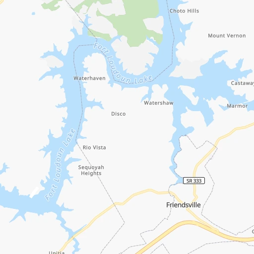
Location Will A Hildreth Farm (airport) (Tennessee) :
| Country flag |  |
| Location | Will A Hildreth Farm (airport) |
| State | Tennessee |
| County | Loudon County |
| Country | United States |
| Country code / ISO 2 | US |
| Latitude | 35.7996900 |
| Longitude | -84.3191200 |
| Altitude | 260 meters |
| Time zone | America/New_York |
Location Owensboro (Kentucky) :
| Country flag | |
| Location | Owensboro |
| State | Kentucky |
| County | Daviess County |
| Country | United States |
| Country code / ISO 2 | US |
| Latitude | 37.7742200 |
| Longitude | -87.1133300 |
| Altitude | 120 meters |
| Time zone | America/Chicago |


