


How to get from Soggy Bottom (airport) (Tennessee) to Maryville (Tennessee)
Calculate route from Soggy Bottom (airport) (Tennessee, United States) to Maryville (Tennessee, United States).
The flight distance (as the crow flies) between Soggy Bottom (airport) and Maryville is 180.6 km.
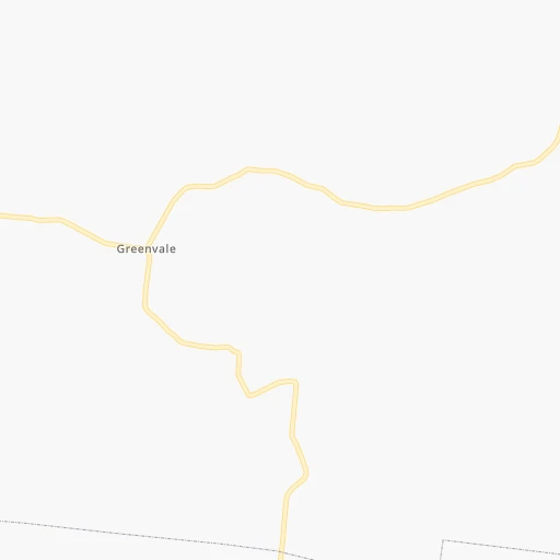
Roadmap (route) to go from Soggy Bottom Airport to Maryville detailed above, you can also see the course layout on the map.
While doing trip Soggy Bottom (airport) - Maryville by car, the calculated route ends at a distance , or more straight.
Distance and duration of the route between Soggy Bottom (airport) and Maryville
Calculation of distance and route from Maryville to Soggy Bottom (airport) :
180.6208.3 km3h49mn
Continue onto Smith Fork Road 0h2mn 1.1 kmTurn right onto East Main Street 0h0mn 109 mTurn left onto College Street 0h1mn 283 mTurn left onto Nashville Highway 1h21mn 89.6 kmKeep right 0h0mn 124 mTurn slight right onto West Avenue 0h2mn 2.2 kmTurn sharp left onto Lantana Road 0h5mn 4.0 kmAt roundabout, take exit 3 onto Peavine Road 0h1mn 600 mTurn right 1h40mn 67.0 kmKeep right and take US 321, TN 73, TN 95 toward Lenoir City, Oak Ridge 0h0mn 471 mKeep right and take US 321, TN 73, TN 95 toward Lenoir City, Oak Ridge 0h0mn 73 mTurn slight right onto Lamar Alexander Parkway 1h36mn 41.9 kmKeep left onto West Broadway Avenue 0h1mn 785 mArrive at destination 0h0mn 0 m
Travel from Soggy Bottom (airport) (Tennessee) to a selection of major cities.
Distances from Soggy Bottom Airport to biggest cities in Tennessee
- Spring Hill,36,055 inhabitants.93 km
- La Vergne,34,794 inhabitants.57 km
- Gallatin,34,334 inhabitants.60 km
- Cookeville,32,113 inhabitants.43 km
- Mount Juliet,31,540 inhabitants.55 km
- Brentwood Estates,31,279 inhabitants.75 km
- Lebanon,30,262 inhabitants.37 km
- Morristown,29,478 inhabitants.240 km
- Oak Ridge,29,302 inhabitants.151 km
- Maryville,28,464 inhabitants.181 km
- Bristol,26,666 inhabitants.343 km
- Farragut,21,919 inhabitants.163 km
- Shelbyville,21,317 inhabitants.76 km
- East Ridge,20,979 inhabitants.129 km
Other major cities in country :
- Charlotte [NC], 827,097 inhabitants. 470 km
- Seattle [WA], 684,451 inhabitants. 3,245 km
- Denver [CO], 682,545 inhabitants. 1,719 km
- El Paso [TX], 681,124 inhabitants. 1,952 km
- Detroit [MI], 677,116 inhabitants. 745 km
- Boston [MA], 667,137 inhabitants. 1,462 km
- Portland [OR], 632,309 inhabitants. 3,239 km
- Oklahoma City [OK], 631,346 inhabitants. 1,046 km
- Las Vegas [NV], 623,747 inhabitants. 2,615 km
- Baltimore [MD], 621,849 inhabitants. 899 km
- Washington, D.C. [DC], 601,723 inhabitants. 850 km
- Milwaukee [WI], 600,155 inhabitants. 799 km
- South Boston [MA], 571,281 inhabitants. 1,462 km
- Albuquerque [NM], 559,121 inhabitants. 1,874 km
- Tucson [AZ], 531,641 inhabitants. 2,334 km
- Fresno [CA], 520,052 inhabitants. 3,016 km
- Sacramento [CA], 490,712 inhabitants. 3,141 km
- Kansas City [MO], 475,378 inhabitants. 834 km
- Long Beach [CA], 474,140 inhabitants. 2,941 km
- Mesa [AZ], 471,825 inhabitants. 2,378 km
Route from Maryville to major cities (United States).
- Distance Maryville New York City1,030 km
- Distance Maryville Los Angeles3,119 km
- Distance Maryville Chicago749 km
- Distance Maryville Brooklyn1,031 km
- Distance Maryville Houston1,257 km
- Distance Maryville Queens1,041 km
- Distance Maryville Philadelphia903 km
- Distance Maryville Phoenix2,579 km
- Distance Maryville Manhattan1,037 km
- Distance Maryville San Antonio1,531 km
- Distance Maryville San Diego3,059 km
- Distance Maryville The Bronx1,048 km
- Distance Maryville Dallas1,225 km
- Distance Maryville San Jose3,373 km
- Distance Maryville Austin1,422 km
- Distance Maryville Jacksonville641 km
- Distance Maryville San Francisco3,412 km
- Distance Maryville Columbus476 km
- Distance Maryville Fort Worth1,273 km
- Distance Maryville Indianapolis486 km
Nearest cities to Soggy Bottom (airport) :
- Nashville, 530,852 inhabitants. 77 km
- Atlanta, 463,878 inhabitants. 291 km
- Lexington-Fayette, 314,488 inhabitants. 262 km
- Louisville, 243,639 inhabitants. 249 km
- Lexington, 225,366 inhabitants. 255 km
- Birmingham, 212,461 inhabitants. 289 km
- Huntsville, 190,582 inhabitants. 155 km
- Knoxville, 185,291 inhabitants. 183 km
- Chattanooga, 176,588 inhabitants. 123 km
- East Chattanooga, 154,024 inhabitants. 124 km
- Clarksville, 149,176 inhabitants. 139 km
- Murfreesboro, 126,118 inhabitants. 44 km
- Evansville, 119,943 inhabitants. 260 km
- Athens, 116,714 inhabitants. 328 km
- Sandy Springs, 105,330 inhabitants. 274 km
- Tuscaloosa, 98,332 inhabitants. 347 km
- Roswell, 94,501 inhabitants. 266 km
- Hoover, 84,848 inhabitants. 302 km
- Johns Creek, 83,335 inhabitants. 273 km
- Franklin, 72,639 inhabitants. 84 km
- Jackson, 66,975 inhabitants. 263 km
- Alpharetta, 63,693 inhabitants. 264 km
- Bowling Green, 63,616 inhabitants. 116 km
- Marietta, 59,067 inhabitants. 264 km
- Owensboro, 59,042 inhabitants. 221 km
- Smyrna, 56,146 inhabitants. 272 km
- Hendersonville, 56,018 inhabitants. 68 km
- Decatur, 55,437 inhabitants. 184 km
- Brookhaven, 51,910 inhabitants. 282 km
- Stonecrest, 50,000 inhabitants. 306 km
- Dunwoody, 48,733 inhabitants. 274 km
- Madison, 46,962 inhabitants. 164 km
- Jeffersonville, 46,960 inhabitants. 252 km
- Smyrna, 46,607 inhabitants. 51 km
- Cleveland, 43,898 inhabitants. 137 km
- Brentwood, 41,763 inhabitants. 75 km
- Peachtree Corners, 40,978 inhabitants. 278 km
- North Atlanta, 40,456 inhabitants. 282 km
- Florence, 40,026 inhabitants. 208 km
- Gainesville, 38,712 inhabitants. 273 km
- Milton, 37,547 inhabitants. 259 km
- Newnan, 37,291 inhabitants. 312 km
- Mableton, 37,115 inhabitants. 275 km
- Columbia, 36,800 inhabitants. 108 km
- New Albany, 36,732 inhabitants. 252 km
- Rome, 36,323 inhabitants. 209 km
- Gadsden, 36,084 inhabitants. 224 km
- Spring Hill, 36,055 inhabitants. 93 km
- East Florence, 35,733 inhabitants. 205 km
- Tupelo, 35,680 inhabitants. 319 km
Location Soggy Bottom (airport) (Tennessee) :
| Country flag |  |
| Location | Soggy Bottom (airport) |
| State | Tennessee |
| County | DeKalb County |
| Country | United States |
| Country code / ISO 2 | US |
| Latitude | 36.0235400 |
| Longitude | -85.9496200 |
| Altitude | 167 meters |
| Time zone | America/Chicago |
Location Maryville (Tennessee) :
| Country flag | |
| Location | Maryville |
| State | Tennessee |
| County | Blount County |
| Country | United States |
| Country code / ISO 2 | US |
| Latitude | 35.7564700 |
| Longitude | -83.9704600 |
| Altitude | 285 meters |
| Time zone | America/New_York |


