


How to get from Elm Creek Farms (airport) (Kansas) to San Antonio (Texas)
Calculate route from Elm Creek Farms (airport) (Kansas, United States) to San Antonio (Texas, United States).
The flight distance (as the crow flies) between Elm Creek Farms (airport) and San Antonio is 887.5 km.
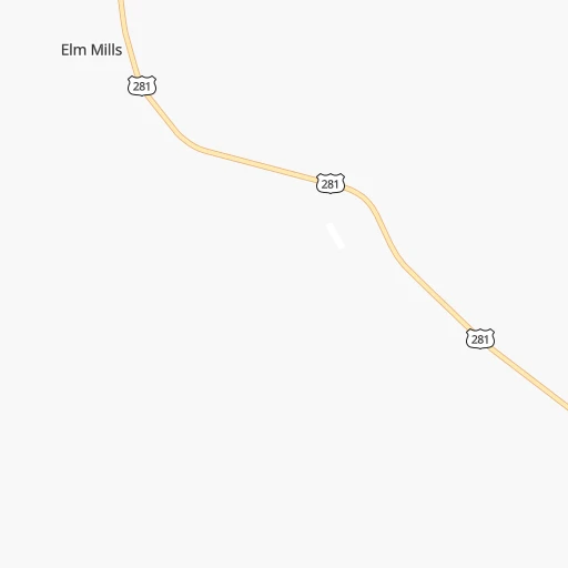
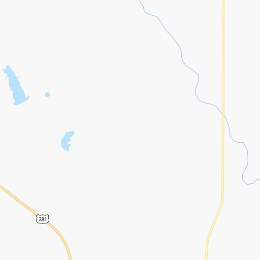
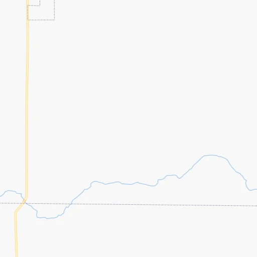
Roadmap (route) to go from Elm Creek Farms Airport to San Antonio detailed above, you can also see the course layout on the map.
While doing trip Elm Creek Farms (airport) - San Antonio by car, the calculated route ends at a distance , or more straight.
Distance and duration of the route between Elm Creek Farms (airport) and San Antonio
Calculation of distance and route from San Antonio to Elm Creek Farms (airport) :
887.5991.0 km13h40mn
Continue onto US 281 0h16mn 17.2 kmTurn right onto West Fowler Avenue 0h1mn 1.0 kmTurn left onto US 281 0h26mn 29.0 kmTurn left onto KS 2 0h7mn 7.3 kmTurn sharp right onto South 4th Street 0h10mn 10.0 kmTurn left onto E0060 Road 0h1mn 1.6 kmTurn right onto CR N2550 0h1mn 1.6 kmTurn left onto E0070 Road 0h1mn 1.6 kmTurn right onto CR N2560 0h1mn 1.2 kmTurn left onto Kraft Lane 0h1mn 962 mTurn left onto OK 8, OK 11 0h1mn 877 mTurn right onto CR N2570 0h4mn 4.8 kmTurn left onto E0110 Road 0h1mn 1.6 kmTurn right onto N2580 Road 0h26mn 28.5 kmKeep right onto OK 8 0h18mn 24.0 kmKeep right onto OK 8 0h0mn 41 mTurn slight right onto US 60, US 412, OK 8 0h3mn 4.8 kmTurn left onto US 60, OK 8 0h20mn 20.7 kmTurn left onto OK 51A 0h23mn 36.3 kmKeep right 0h0mn 64 mTurn slight right onto Clarence Nash Boulevard 0h5mn 6.0 kmContinue onto South Clarence Nash Boulevard 0h26mn 40.7 kmTurn left and take I 40 East toward Oklahoma City 0h15mn 27.4 kmKeep right and take I 40 Business West, US 81 toward El Reno, Chickasaw 0h0mn 452 mKeep right and take US 81 South toward Chickasaw 1h43mn 50.0 kmTurn left onto OK 9, US 62, US 81 0h2mn 2.8 kmTurn right onto North 4th Street 1h19mn 102.6 kmKeep right 0h4mn 5.3 kmKeep left onto OK 79 0h19mn 25.2 kmTurn left onto South Central Avenue 0h16mn 22.7 kmTurn left onto West Omega Street 0h1mn 659 mTurn right onto South Graham Street 1h0mn 66.3 kmTurn left onto North Main Street 0h11mn 13.0 kmKeep right onto US 281 2h48mn 136.5 kmTurn right onto North Walnut Street 1h17mn 104.7 kmContinue onto North Key Avenue 0h3mn 2.5 kmTurn right onto South US Highway 281 1h5mn 101.3 kmKeep right onto North US Highway 281 and drive toward San Antonio 1h37mn 56.0 kmKeep left onto US 281 0h1mn 1.3 kmKeep left onto US 281 0h2mn 3.7 kmKeep left onto US 281 HOV Lane 0h10mn 15.6 kmKeep right and drive toward San Pedro Avenue 0h11mn 12.2 kmAt roundabout, take exit 1 onto Navarro Street 0h0mn 43 mKeep right onto North Main Avenue 0h0mn 471 mTurn right onto West Martin Street 0h0mn 61 mTurn left onto North Flores Street 0h1mn 584 mTurn left onto Dolorosa Street 0h0mn 99 mArrive at destination 0h0mn 0 m
Travel from Elm Creek Farms (airport) (Texas) to a selection of major cities.
Distances from Elm Creek Farms Airport to biggest cities in Kansas
- Gardner,20,868 inhabitants.361 km
- Liberal,20,746 inhabitants.206 km
- Pittsburg,20,409 inhabitants.349 km
Other major cities in country :
- Charlotte [NC], 827,097 inhabitants. 1,613 km
- Seattle [WA], 684,451 inhabitants. 2,237 km
- Denver [CO], 682,545 inhabitants. 609 km
- El Paso [TX], 681,124 inhabitants. 954 km
- Detroit [MI], 677,116 inhabitants. 1,438 km
- Boston [MA], 667,137 inhabitants. 2,409 km
- Memphis [TN], 655,770 inhabitants. 811 km
- New South Memphis [TN], 641,608 inhabitants. 813 km
- Portland [OR], 632,309 inhabitants. 2,187 km
- Oklahoma City [OK], 631,346 inhabitants. 239 km
- Las Vegas [NV], 623,747 inhabitants. 1,475 km
- Baltimore [MD], 621,849 inhabitants. 1,930 km
- Washington, D.C. [DC], 601,723 inhabitants. 1,895 km
- Milwaukee [WI], 600,155 inhabitants. 1,106 km
- South Boston [MA], 571,281 inhabitants. 2,409 km
- Albuquerque [NM], 559,121 inhabitants. 763 km
- Tucson [AZ], 531,641 inhabitants. 1,261 km
- Nashville [TN], 530,852 inhabitants. 1,066 km
- Fresno [CA], 520,052 inhabitants. 1,874 km
- Sacramento [CA], 490,712 inhabitants. 2,003 km
Route from San Antonio to major cities (United States).
- Distance San Antonio New York City2,548 km
- Distance San Antonio Los Angeles1,936 km
- Distance San Antonio Chicago1,693 km
- Distance San Antonio Brooklyn2,550 km
- Distance San Antonio Queens2,560 km
- Distance San Antonio Philadelphia2,425 km
- Distance San Antonio Phoenix1,364 km
- Distance San Antonio Manhattan2,554 km
- Distance San Antonio San Diego1,815 km
- Distance San Antonio The Bronx2,564 km
- Distance San Antonio San Jose2,339 km
- Distance San Antonio Jacksonville1,627 km
- Distance San Antonio San Francisco2,396 km
- Distance San Antonio Columbus1,836 km
- Distance San Antonio Indianapolis1,610 km
- Distance San Antonio Charlotte1,778 km
- Distance San Antonio Seattle2,877 km
- Distance San Antonio Denver1,292 km
- Distance San Antonio Detroit1,995 km
- Distance San Antonio Boston2,844 km
Nearest cities to Elm Creek Farms (airport) :
- Oklahoma City, 631,346 inhabitants. 239 km
- Tulsa, 403,505 inhabitants. 275 km
- Wichita, 389,965 inhabitants. 120 km
- Topeka, 127,265 inhabitants. 317 km
- Norman, 120,284 inhabitants. 266 km
- Broken Arrow, 106,563 inhabitants. 296 km
- Lawton, 96,655 inhabitants. 313 km
- Edmond, 90,092 inhabitants. 222 km
- Moore, 60,451 inhabitants. 253 km
- Midwest City, 57,249 inhabitants. 245 km
- Manhattan, 56,308 inhabitants. 268 km
- Enid, 51,776 inhabitants. 132 km
- Stillwater, 48,967 inhabitants. 202 km
- Salina, 47,813 inhabitants. 183 km
- Hutchinson, 41,569 inhabitants. 96 km
- Bartlesville, 36,595 inhabitants. 248 km
- Owasso, 34,542 inhabitants. 279 km
- Shawnee, 31,286 inhabitants. 278 km
- Dodge City, 27,912 inhabitants. 127 km
- Garden City, 27,005 inhabitants. 206 km
- Yukon, 25,892 inhabitants. 226 km
- Ponca City, 24,758 inhabitants. 159 km
- Bixby, 24,657 inhabitants. 296 km
- Emporia, 24,649 inhabitants. 243 km
- Junction City, 24,621 inhabitants. 240 km
- Derby, 23,509 inhabitants. 123 km
- Duncan, 23,231 inhabitants. 330 km
- Del City, 22,022 inhabitants. 244 km
- Hays, 21,092 inhabitants. 174 km
- Liberal, 20,746 inhabitants. 206 km
- Jenks, 20,740 inhabitants. 285 km
- Sapulpa, 20,579 inhabitants. 275 km
- Mustang, 20,226 inhabitants. 240 km
- Sand Springs, 19,783 inhabitants. 267 km
- Bethany, 19,589 inhabitants. 229 km
- Newton, 19,216 inhabitants. 135 km
- Altus, 19,214 inhabitants. 315 km
- El Reno, 18,516 inhabitants. 218 km
- McAlester, 18,310 inhabitants. 378 km
- Pampa, 18,177 inhabitants. 294 km
- Ada, 17,303 inhabitants. 343 km
- Chickasha, 16,488 inhabitants. 270 km
- Great Bend, 15,717 inhabitants. 107 km
- Glenpool, 13,225 inhabitants. 286 km
- McPherson, 13,144 inhabitants. 138 km
- Woodward, 12,993 inhabitants. 127 km
- Borger, 12,964 inhabitants. 313 km
- El Dorado, 12,931 inhabitants. 164 km
- Andover, 12,745 inhabitants. 138 km
- Elk City, 12,717 inhabitants. 232 km
Location Elm Creek Farms (airport) (Kansas) :
| Country flag |  |
| Location | Elm Creek Farms (airport) |
| State | Kansas |
| County | Barber County |
| Country | United States |
| Country code / ISO 2 | US |
| Latitude | 37.4095600 |
| Longitude | -98.6475500 |
| Altitude | 507 meters |
| Time zone | America/Chicago |
Location San Antonio (Texas) :
| Country flag | |
| Location | San Antonio |
| State | Texas |
| County | Bexar County |
| Country | United States |
| Country code / ISO 2 | US |
| Latitude | 29.4241200 |
| Longitude | -98.4936300 |
| Altitude | 198 meters |
| Time zone | America/Chicago |


