


How to get from El Rancho (airport) (Oregon) to Winnemucca (Nevada)
Calculate route from El Rancho (airport) (Oregon, United States) to Winnemucca (Nevada, United States).
The flight distance (as the crow flies) between El Rancho (airport) and Winnemucca is 169.2 km.
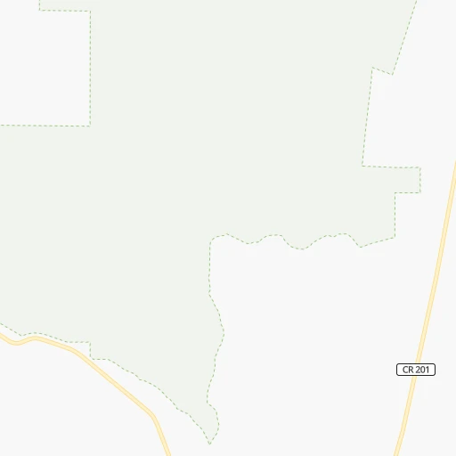
Roadmap (route) to go from El Rancho Airport to Winnemucca detailed above, you can also see the course layout on the map.
While doing trip El Rancho (airport) - Winnemucca by car, the calculated route ends at a distance , or more straight.
Distance and duration of the route between El Rancho (airport) and Winnemucca
Calculation of distance and route from Winnemucca to El Rancho (airport) :
169.2202.6 km3h56mn
Continue onto Fields-Folly Farm Road 0h7mn 5.8 kmContinue onto Fields-Denio Road 1h41mn 40.8 kmContinue onto Denio-Adel Road 2h36mn 105.4 kmKeep right and take US 95 North toward Winnemucca 0h0mn 138 mContinue onto Veterans Memorial Highway 1h32mn 50.5 kmTurn left onto East Winnemucca Boulevard 0h0mn 16 mArrive at destination 0h0mn 0 m
Travel from El Rancho (airport) (Nevada) to a selection of major cities.
Distances from El Rancho Airport to biggest cities in Oregon
- West Linn,26,593 inhabitants.464 km
- Woodburn,25,173 inhabitants.461 km
- Forest Grove,23,897 inhabitants.504 km
- Newberg,22,780 inhabitants.479 km
- Wilsonville,22,729 inhabitants.468 km
- Roseburg,22,114 inhabitants.396 km
- Klamath Falls,21,399 inhabitants.258 km
- Ashland,20,861 inhabitants.335 km
- Milwaukie,20,830 inhabitants.472 km
- Bethany,20,646 inhabitants.493 km
- Lents,20,156 inhabitants.470 km
Other major cities in country :
- Charlotte [NC], 827,097 inhabitants. 3,346 km
- Seattle [WA], 684,451 inhabitants. 654 km
- Denver [CO], 682,545 inhabitants. 1,182 km
- El Paso [TX], 681,124 inhabitants. 1,595 km
- Detroit [MI], 677,116 inhabitants. 2,908 km
- Boston [MA], 667,137 inhabitants. 3,863 km
- Memphis [TN], 655,770 inhabitants. 2,595 km
- New South Memphis [TN], 641,608 inhabitants. 2,597 km
- Oklahoma City [OK], 631,346 inhabitants. 1,977 km
- Las Vegas [NV], 623,747 inhabitants. 749 km
- Baltimore [MD], 621,849 inhabitants. 3,522 km
- Washington, D.C. [DC], 601,723 inhabitants. 3,502 km
- Milwaukee [WI], 600,155 inhabitants. 2,503 km
- South Boston [MA], 571,281 inhabitants. 3,864 km
- Albuquerque [NM], 559,121 inhabitants. 1,316 km
- Tucson [AZ], 531,641 inhabitants. 1,316 km
- Nashville [TN], 530,852 inhabitants. 2,814 km
- Fresno [CA], 520,052 inhabitants. 629 km
- Sacramento [CA], 490,712 inhabitants. 482 km
- Kansas City [MO], 475,378 inhabitants. 2,056 km
Route from Winnemucca to major cities (United States).
- Distance Winnemucca New York City3,643 km
- Distance Winnemucca Los Angeles772 km
- Distance Winnemucca Chicago2,501 km
- Distance Winnemucca Brooklyn3,650 km
- Distance Winnemucca Houston2,373 km
- Distance Winnemucca Queens3,658 km
- Distance Winnemucca Philadelphia3,571 km
- Distance Winnemucca Phoenix976 km
- Distance Winnemucca Manhattan3,645 km
- Distance Winnemucca San Antonio2,164 km
- Distance Winnemucca San Diego921 km
- Distance Winnemucca The Bronx3,651 km
- Distance Winnemucca Dallas2,067 km
- Distance Winnemucca San Jose541 km
- Distance Winnemucca Austin2,158 km
- Distance Winnemucca Jacksonville3,443 km
- Distance Winnemucca San Francisco538 km
- Distance Winnemucca Columbus2,925 km
- Distance Winnemucca Fort Worth2,030 km
- Distance Winnemucca Indianapolis2,667 km
Nearest cities to El Rancho (airport) :
- Reno, 241,445 inhabitants. 327 km
- Boise, 145,987 inhabitants. 245 km
- Sparks, 96,094 inhabitants. 325 km
- Meridian, 90,739 inhabitants. 233 km
- Nampa, 89,839 inhabitants. 217 km
- Bend, 87,014 inhabitants. 289 km
- Caldwell, 51,686 inhabitants. 218 km
- Redmond, 28,654 inhabitants. 297 km
- Paradise, 26,476 inhabitants. 380 km
- Eagle, 23,612 inhabitants. 241 km
- Elko, 20,279 inhabitants. 293 km
- Fernley, 19,418 inhabitants. 308 km
- Sun Valley, 19,299 inhabitants. 319 km
- Kuna, 17,226 inhabitants. 223 km
- Oroville, 16,260 inhabitants. 398 km
- Susanville, 15,247 inhabitants. 271 km
- Spanish Springs, 15,064 inhabitants. 312 km
- Mountain Home, 13,730 inhabitants. 258 km
- La Grande, 13,074 inhabitants. 336 km
- Garden City, 11,550 inhabitants. 243 km
- Magalia, 11,310 inhabitants. 373 km
- Ontario, 10,999 inhabitants. 233 km
- Baker City, 9,752 inhabitants. 280 km
- Prineville, 9,530 inhabitants. 281 km
- Cold Springs, 8,544 inhabitants. 316 km
- Fallon, 8,458 inhabitants. 319 km
- Oroville East, 8,280 inhabitants. 394 km
- Winnemucca, 7,887 inhabitants. 169 km
- Star, 7,797 inhabitants. 232 km
- Payette, 7,380 inhabitants. 239 km
- Middleton, 6,828 inhabitants. 225 km
- Madras, 6,662 inhabitants. 325 km
- Thermalito, 6,646 inhabitants. 400 km
- Emmett, 6,604 inhabitants. 245 km
- South Oroville, 5,742 inhabitants. 399 km
- Palermo, 5,382 inhabitants. 404 km
- Weiser, 5,317 inhabitants. 253 km
- Silver Springs, 5,296 inhabitants. 328 km
- Fruitland, 5,087 inhabitants. 234 km
- Deschutes River Woods, 5,077 inhabitants. 287 km
- Lemmon Valley, 5,040 inhabitants. 317 km
- Battle Mountain, 3,635 inhabitants. 236 km
- Nyssa, 3,175 inhabitants. 218 km
- McCall, 3,106 inhabitants. 353 km
- Three Rivers, 3,014 inhabitants. 283 km
Location El Rancho (airport) (Oregon) :
| Country flag |  |
| Location | El Rancho (airport) |
| State | Oregon |
| County | Harney County |
| Country | United States |
| Country code / ISO 2 | US |
| Latitude | 42.3333100 |
| Longitude | -118.6506900 |
| Altitude | 1262 meters |
| Time zone | America/Los_Angeles |
Location Winnemucca (Nevada) :
| Country flag | |
| Location | Winnemucca |
| State | Nevada |
| County | Humboldt County |
| Country | United States |
| Country code / ISO 2 | US |
| Latitude | 40.9729600 |
| Longitude | -117.7356800 |
| Altitude | 1309 meters |
| Time zone | America/Los_Angeles |


