


How to get from Harold Reynolds (airport) (Kentucky) to Radcliff (Kentucky)
Calculate route from Harold Reynolds (airport) (Kentucky, United States) to Radcliff (Kentucky, United States).
The flight distance (as the crow flies) between Harold Reynolds (airport) and Radcliff is 89.8 km.
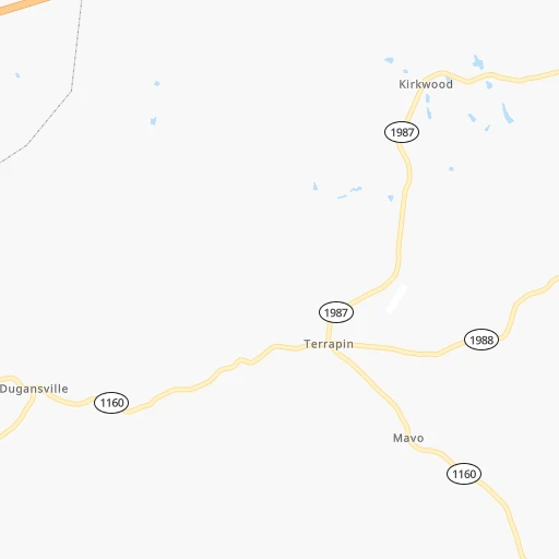
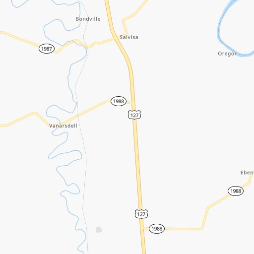
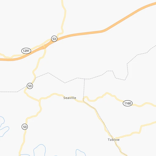
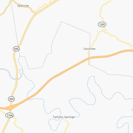
Roadmap (route) to go from Harold Reynolds Airport to Radcliff detailed above, you can also see the course layout on the map.
While doing trip Harold Reynolds (airport) - Radcliff by car, the calculated route ends at a distance , or more straight.
Distance and duration of the route between Harold Reynolds (airport) and Radcliff
Calculation of distance and route from Radcliff to Harold Reynolds (airport) :
89.8111.1 km1h28mn
Continue onto Baxter Road 0h0mn 126 mTurn left onto Kirkwood Road 0h2mn 1.4 kmTurn right onto Talmage Mayo Road 0h9mn 9.3 kmTurn right onto Seaville Road 0h2mn 2.5 kmTurn right onto Lawrenceburg Road 0h4mn 4.2 kmTurn right 0h22mn 37.7 kmKeep right and drive toward Bardstown 0h0mn 462 mKeep right and drive toward Bardstown 0h0mn 29 mTurn slight right onto Springfield Road 0h3mn 3.6 kmAt roundabout, take exit 2 onto Court Square 0h18mn 19.5 kmTurn right onto Lebanon Junction Road 0h6mn 6.5 kmKeep right 0h2mn 3.4 kmKeep right and take KY 313 toward Radcliff, Vine Grove 0h12mn 15.8 kmTurn right onto Dixie Highway South 0h5mn 5.4 kmTurn left onto West Lincoln Trail Boulevard 0h1mn 896 mTurn right onto North Woodland Drive 0h0mn 412 mTurn right onto Elm Road 0h0mn 15 mArrive at destination 0h0mn 0 m
Travel from Harold Reynolds (airport) (Kentucky) to a selection of major cities.
Distances from Harold Reynolds Airport to biggest cities in Kentucky
- Valley Station,22,756 inhabitants.86 km
- Radcliff,22,387 inhabitants.90 km
- Ashland,21,108 inhabitants.211 km
Other major cities in country :
- Charlotte [NC], 827,097 inhabitants. 470 km
- Seattle [WA], 684,451 inhabitants. 3,207 km
- Denver [CO], 682,545 inhabitants. 1,748 km
- El Paso [TX], 681,124 inhabitants. 2,079 km
- Detroit [MI], 677,116 inhabitants. 520 km
- Boston [MA], 667,137 inhabitants. 1,279 km
- Memphis [TN], 655,770 inhabitants. 550 km
- New South Memphis [TN], 641,608 inhabitants. 555 km
- Portland [OR], 632,309 inhabitants. 3,218 km
- Oklahoma City [OK], 631,346 inhabitants. 1,155 km
- Las Vegas [NV], 623,747 inhabitants. 2,680 km
- Baltimore [MD], 621,849 inhabitants. 740 km
- Washington, D.C. [DC], 601,723 inhabitants. 697 km
- Milwaukee [WI], 600,155 inhabitants. 626 km
- South Boston [MA], 571,281 inhabitants. 1,279 km
- Albuquerque [NM], 559,121 inhabitants. 1,965 km
- Tucson [AZ], 531,641 inhabitants. 2,443 km
- Nashville [TN], 530,852 inhabitants. 253 km
- Fresno [CA], 520,052 inhabitants. 3,069 km
- Sacramento [CA], 490,712 inhabitants. 3,177 km
Route from Radcliff to major cities (United States).
- Distance Radcliff New York City1,077 km
- Distance Radcliff Los Angeles2,926 km
- Distance Radcliff Chicago469 km
- Distance Radcliff Brooklyn1,080 km
- Distance Radcliff Houston1,250 km
- Distance Radcliff Queens1,090 km
- Distance Radcliff Philadelphia963 km
- Distance Radcliff Phoenix2,405 km
- Distance Radcliff Manhattan1,082 km
- Distance Radcliff San Antonio1,491 km
- Distance Radcliff San Diego2,880 km
- Distance Radcliff The Bronx1,092 km
- Distance Radcliff Dallas1,135 km
- Distance Radcliff San Jose3,151 km
- Distance Radcliff Austin1,374 km
- Distance Radcliff Jacksonville924 km
- Distance Radcliff San Francisco3,187 km
- Distance Radcliff Columbus348 km
- Distance Radcliff Fort Worth1,179 km
- Distance Radcliff Indianapolis215 km
Nearest cities to Harold Reynolds (airport) :
- Columbus, 850,106 inhabitants. 285 km
- Indianapolis, 829,718 inhabitants. 235 km
- Nashville, 530,852 inhabitants. 253 km
- Lexington-Fayette, 314,488 inhabitants. 45 km
- Cincinnati, 296,943 inhabitants. 142 km
- Meads, 288,649 inhabitants. 203 km
- Ironville, 288,649 inhabitants. 205 km
- Louisville, 243,639 inhabitants. 83 km
- Lexington, 225,366 inhabitants. 41 km
- Knoxville, 185,291 inhabitants. 233 km
- Chattanooga, 176,588 inhabitants. 319 km
- East Chattanooga, 154,024 inhabitants. 316 km
- Clarksville, 149,176 inhabitants. 264 km
- Dayton, 140,599 inhabitants. 218 km
- Murfreesboro, 126,118 inhabitants. 262 km
- Evansville, 119,943 inhabitants. 231 km
- Carmel, 88,713 inhabitants. 254 km
- Asheville, 88,512 inhabitants. 331 km
- Bloomington, 84,067 inhabitants. 199 km
- Fishers, 76,794 inhabitants. 248 km
- Franklin, 72,639 inhabitants. 279 km
- Lafayette, 71,111 inhabitants. 328 km
- Muncie, 70,087 inhabitants. 259 km
- Johnson City, 66,027 inhabitants. 288 km
- Bowling Green, 63,616 inhabitants. 167 km
- Hamilton, 62,407 inhabitants. 171 km
- Terre Haute, 60,825 inhabitants. 278 km
- Springfield, 59,680 inhabitants. 246 km
- Noblesville, 59,093 inhabitants. 257 km
- Owensboro, 59,042 inhabitants. 193 km
- Kokomo, 57,995 inhabitants. 307 km
- Hendersonville, 56,018 inhabitants. 232 km
- Greenwood, 55,586 inhabitants. 217 km
- Kettering, 55,525 inhabitants. 211 km
- Anderson, 55,305 inhabitants. 255 km
- Kingsport, 53,014 inhabitants. 257 km
- Middletown, 48,760 inhabitants. 187 km
- Huntington, 48,638 inhabitants. 225 km
- Newark, 47,986 inhabitants. 326 km
- Lawrence, 47,809 inhabitants. 237 km
- Jeffersonville, 46,960 inhabitants. 83 km
- Mansfield, 46,830 inhabitants. 381 km
- Columbus, 46,690 inhabitants. 170 km
- Smyrna, 46,607 inhabitants. 255 km
- Beavercreek, 46,277 inhabitants. 216 km
- West Lafayette, 45,550 inhabitants. 330 km
- Dublin, 45,098 inhabitants. 292 km
- Cleveland, 43,898 inhabitants. 304 km
- Fairfield, 42,767 inhabitants. 165 km
- Brentwood, 41,763 inhabitants. 265 km
Location Harold Reynolds (airport) (Kentucky) :
| Country flag |  |
| Location | Harold Reynolds (airport) |
| State | Kentucky |
| County | Mercer County |
| Country | United States |
| Country code / ISO 2 | US |
| Latitude | 37.8909100 |
| Longitude | -84.9270000 |
| Altitude | 263 meters |
| Time zone | America/New_York |
Location Radcliff (Kentucky) :
| Country flag | |
| Location | Radcliff |
| State | Kentucky |
| County | Hardin County |
| Country | United States |
| Country code / ISO 2 | US |
| Latitude | 37.8403500 |
| Longitude | -85.9491300 |
| Altitude | 235 meters |
| Time zone | America/New_York |
