


How to get from Poco Loco (airport) (New Mexico) to Safford (Arizona)
Calculate route from Poco Loco (airport) (New Mexico, United States) to Safford (Arizona, United States).
The flight distance (as the crow flies) between Poco Loco (airport) and Safford is 231.7 km.
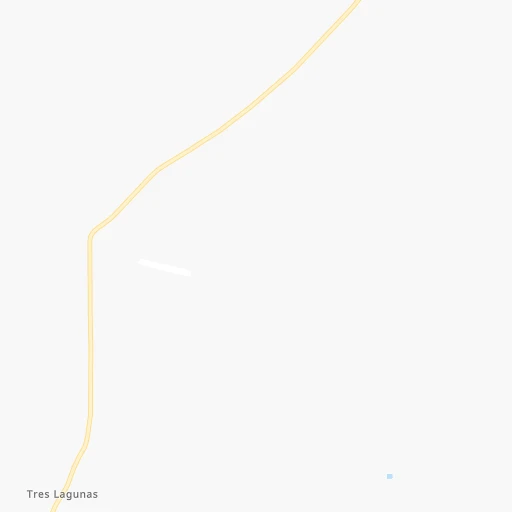
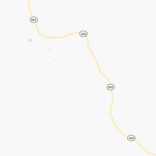
Roadmap (route) to go from Poco Loco Airport to Safford detailed above, you can also see the course layout on the map.
While doing trip Poco Loco (airport) - Safford by car, the calculated route ends at a distance , or more straight.
Distance and duration of the route between Poco Loco (airport) and Safford
Calculation of distance and route from Safford to Poco Loco (airport) :
231.7331.8 km5h7mn
Continue 0h3mn 1.5 kmTurn left 0h14mn 9.4 kmTurn slight left onto NM 603 0h10mn 5.1 kmTurn sharp right onto US 60 1h32mn 35.0 kmTurn left onto NM 32 1h1mn 66.6 kmTurn sharp right onto NM 12 0h18mn 19.6 kmTurn right onto NM 12 0h10mn 11.2 kmTurn left onto US 180 1h7mn 73.4 kmTurn right onto NM 78 1h20mn 93.9 kmTurn right onto US 70, US 191 0h12mn 16.1 kmTurn left onto South 1st Avenue 0h0mn 46 mArrive at destination 0h0mn 0 m
Travel from Poco Loco (airport) (Arizona) to a selection of major cities.
Distances from Poco Loco Airport to biggest cities in New Mexico
Other major cities in country :
- Charlotte [NC], 827,097 inhabitants. 2,482 km
- Seattle [WA], 684,451 inhabitants. 1,889 km
- Denver [CO], 682,545 inhabitants. 653 km
- El Paso [TX], 681,124 inhabitants. 331 km
- Detroit [MI], 677,116 inhabitants. 2,344 km
- Boston [MA], 667,137 inhabitants. 3,320 km
- Memphis [TN], 655,770 inhabitants. 1,648 km
- New South Memphis [TN], 641,608 inhabitants. 1,647 km
- Portland [OR], 632,309 inhabitants. 1,750 km
- Oklahoma City [OK], 631,346 inhabitants. 970 km
- Las Vegas [NV], 623,747 inhabitants. 671 km
- Baltimore [MD], 621,849 inhabitants. 2,840 km
- Washington, D.C. [DC], 601,723 inhabitants. 2,802 km
- Milwaukee [WI], 600,155 inhabitants. 1,990 km
- South Boston [MA], 571,281 inhabitants. 3,321 km
- Tucson [AZ], 531,641 inhabitants. 360 km
- Nashville [TN], 530,852 inhabitants. 1,940 km
- Fresno [CA], 520,052 inhabitants. 1,090 km
- Sacramento [CA], 490,712 inhabitants. 1,286 km
- Kansas City [MO], 475,378 inhabitants. 1,310 km
Route from Safford to major cities (United States).
- Distance Safford New York City3,277 km
- Distance Safford Los Angeles804 km
- Distance Safford Chicago2,186 km
- Distance Safford Brooklyn3,282 km
- Distance Safford Houston1,405 km
- Distance Safford Queens3,291 km
- Distance Safford Philadelphia3,174 km
- Distance Safford Manhattan3,281 km
- Distance Safford San Antonio1,133 km
- Distance Safford San Diego698 km
- Distance Safford The Bronx3,290 km
- Distance Safford Dallas1,206 km
- Distance Safford San Jose1,217 km
- Distance Safford Austin1,170 km
- Distance Safford Jacksonville2,667 km
- Distance Safford San Francisco1,278 km
- Distance Safford Columbus2,510 km
- Distance Safford Fort Worth1,159 km
- Distance Safford Indianapolis2,241 km
- Distance Safford Charlotte2,667 km
Nearest cities to Poco Loco (airport) :
- El Paso, 681,124 inhabitants. 331 km
- Albuquerque, 559,121 inhabitants. 150 km
- Tucson, 531,641 inhabitants. 360 km
- Las Cruces, 101,643 inhabitants. 263 km
- Enchanted Hills, 87,521 inhabitants. 170 km
- Rio Rancho, 87,521 inhabitants. 158 km
- Santa Fe, 84,099 inhabitants. 241 km
- Casas Adobes, 66,795 inhabitants. 358 km
- Catalina Foothills, 50,796 inhabitants. 354 km
- Oro Valley, 43,565 inhabitants. 351 km
- Sierra Vista, 43,355 inhabitants. 380 km
- Farmington, 42,871 inhabitants. 258 km
- South Valley, 40,976 inhabitants. 144 km
- Socorro, 33,222 inhabitants. 349 km
- Alamogordo, 30,753 inhabitants. 258 km
- Socorro Mission Number 1 Colonia, 28,637 inhabitants. 351 km
- Drexel Heights, 27,749 inhabitants. 374 km
- Sahuarita, 25,707 inhabitants. 383 km
- Gallup, 23,240 inhabitants. 138 km
- Green Valley, 21,391 inhabitants. 394 km
- Horizon City, 19,288 inhabitants. 349 km
- Rio Rico, 18,962 inhabitants. 425 km
- Durango, 18,006 inhabitants. 319 km
- Tanque Verde, 16,901 inhabitants. 345 km
- Flowing Wells, 16,419 inhabitants. 361 km
- Sunland Park, 15,940 inhabitants. 323 km
- Los Lunas, 15,336 inhabitants. 130 km
- Sierra Vista Southeast, 14,797 inhabitants. 386 km
- Chaparral, 14,631 inhabitants. 309 km
- Deming, 14,522 inhabitants. 241 km
- Las Vegas, 13,386 inhabitants. 291 km
- Los Alamos, 12,019 inhabitants. 230 km
- North Valley, 11,333 inhabitants. 157 km
- Show Low, 10,860 inhabitants. 181 km
- Espanola, 10,224 inhabitants. 252 km
- Vail, 10,208 inhabitants. 360 km
- Silver City, 10,004 inhabitants. 184 km
- Safford, 9,683 inhabitants. 232 km
- Saddle Brooke, 9,614 inhabitants. 334 km
- Winslow, 9,600 inhabitants. 250 km
- Anthony, 9,293 inhabitants. 301 km
- Grants, 9,239 inhabitants. 84 km
- San Elizario, 8,999 inhabitants. 357 km
- Bernalillo, 8,843 inhabitants. 171 km
- Socorro, 8,722 inhabitants. 116 km
- Cortez, 8,715 inhabitants. 330 km
- Fort Bliss, 8,591 inhabitants. 328 km
- Corrales, 8,502 inhabitants. 162 km
- Shiprock, 8,295 inhabitants. 270 km
- Fabens, 8,257 inhabitants. 370 km
Location Poco Loco (airport) (New Mexico) :
| Country flag |  |
| Location | Poco Loco (airport) |
| State | New Mexico |
| County | Catron County |
| Country | United States |
| Country code / ISO 2 | US |
| Latitude | 34.4136400 |
| Longitude | -108.0735500 |
| Altitude | 2266 meters |
| Time zone | America/Denver |
Location Safford (Arizona) :
| Country flag | |
| Location | Safford |
| State | Arizona |
| County | Graham County |
| Country | United States |
| Country code / ISO 2 | US |
| Latitude | 32.8339500 |
| Longitude | -109.7075800 |
| Altitude | 889 meters |
| Time zone | America/Phoenix |

