


How to get from Metrogro Farm (airport) (Colorado) to Loveland (Colorado)
Calculate route from Metrogro Farm (airport) (Colorado, United States) to Loveland (Colorado, United States).
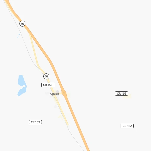
The flight distance (as the crow flies) between Metrogro Farm (airport) and Loveland is 152.5 km.
Roadmap (route) to go from Metrogro Farm Airport to Loveland detailed above, you can also see the course layout on the map.
While doing trip Metrogro Farm (airport) - Loveland by car, the calculated route ends at a distance , or more straight.
Distance and duration of the route between Metrogro Farm (airport) and Loveland
Calculation of distance and route from Loveland to Metrogro Farm (airport) :
152.5200.7 km3h58mn
Continue onto Middle Mist Road 0h1mn 723 mKeep right 0h0mn 47 mTurn slight right onto County Road 178 0h2mn 1.2 kmTurn left 0h15mn 4.9 kmTurn left onto Wardel Road 0h5mn 2.6 kmContinue 0h16mn 5.3 kmKeep right 0h21mn 10.6 kmTurn left onto East Jolly Road 0h21mn 17.6 kmTurn left onto South Price Road 0h1mn 1.1 kmTurn right and take I 70 West toward Denver 1h35mn 62.1 kmKeep right and take E-470 toward Colorado Springs, Fort Collins 0h0mn 489 mKeep right and take E-470 North toward Gun Club Road North, Fort Collins, Denver International Airport 0h0mn 206 mContinue toward E470 Toll North 0h21mn 38.2 kmKeep right and drive toward York Street 0h1mn 791 mTurn right onto York Street 0h1mn 1.1 kmTurn left onto East 160th Avenue 0h2mn 2.2 kmContinue onto East 168th Avenue 0h0mn 178 mKeep right and take I 25 North toward Fort Collins 0h23mn 41.8 kmKeep right and take SH 402 toward Loveland and Greeley Canal 0h0mn 373 mKeep left and take SH 402 toward Loveland and Greeley Canal 0h0mn 65 mAt roundabout, take exit 3 onto East State Highway 402 0h0mn 245 mAt roundabout, take exit 1 onto East State Highway 402 0h3mn 2.9 kmTurn right onto South County Road 9E 0h1mn 1.6 kmTurn left onto East 1st Street 0h1mn 544 mTurn left onto East 1st Street 0h3mn 3.1 kmTurn right onto North Lincoln Avenue 0h1mn 529 mTurn left onto East 6th Street 0h0mn 152 mArrive at destination 0h0mn 0 m
Travel from Metrogro Farm (airport) (Colorado) to a selection of major cities.
Distances from Metrogro Farm Airport to biggest cities in Colorado
- Littleton,46,368 inhabitants.111 km
- Southglenn,42,268 inhabitants.106 km
- Northglenn,39,197 inhabitants.116 km
- Brighton,37,585 inhabitants.108 km
- Englewood,33,082 inhabitants.110 km
- Security-Widefield,32,882 inhabitants.119 km
- Ken Caryl,32,438 inhabitants.119 km
- Wheat Ridge,31,192 inhabitants.120 km
- Pueblo West,29,637 inhabitants.154 km
- Fountain,27,767 inhabitants.124 km
- Lafayette,27,729 inhabitants.129 km
- Castlewood,25,271 inhabitants.101 km
- Columbine,24,280 inhabitants.116 km
- Windsor,21,751 inhabitants.148 km
- Erie,21,420 inhabitants.129 km
- Evans,21,383 inhabitants.128 km
- Louisville,20,396 inhabitants.132 km
- Golden,20,330 inhabitants.131 km
Other major cities in country :
- Charlotte [NC], 827,097 inhabitants. 2,074 km
- Seattle [WA], 684,451 inhabitants. 1,745 km
- El Paso [TX], 681,124 inhabitants. 897 km
- Detroit [MI], 677,116 inhabitants. 1,764 km
- Boston [MA], 667,137 inhabitants. 2,749 km
- Memphis [TN], 655,770 inhabitants. 1,302 km
- New South Memphis [TN], 641,608 inhabitants. 1,305 km
- Portland [OR], 632,309 inhabitants. 1,688 km
- Oklahoma City [OK], 631,346 inhabitants. 708 km
- Las Vegas [NV], 623,747 inhabitants. 1,068 km
- Baltimore [MD], 621,849 inhabitants. 2,324 km
- Washington, D.C. [DC], 601,723 inhabitants. 2,295 km
- Milwaukee [WI], 600,155 inhabitants. 1,379 km
- South Boston [MA], 571,281 inhabitants. 2,750 km
- Albuquerque [NM], 559,121 inhabitants. 555 km
- Tucson [AZ], 531,641 inhabitants. 1,037 km
- Nashville [TN], 530,852 inhabitants. 1,532 km
- Fresno [CA], 520,052 inhabitants. 1,436 km
- Sacramento [CA], 490,712 inhabitants. 1,537 km
- Kansas City [MO], 475,378 inhabitants. 789 km
Route from Loveland to major cities (United States).
- Distance Loveland New York City2,614 km
- Distance Loveland Los Angeles1,362 km
- Distance Loveland Chicago1,468 km
- Distance Loveland Brooklyn2,620 km
- Distance Loveland Houston1,476 km
- Distance Loveland Queens2,629 km
- Distance Loveland Philadelphia2,532 km
- Distance Loveland Phoenix992 km
- Distance Loveland Manhattan2,616 km
- Distance Loveland San Antonio1,360 km
- Distance Loveland San Diego1,376 km
- Distance Loveland The Bronx2,623 km
- Distance Loveland Dallas1,123 km
- Distance Loveland San Jose1,495 km
- Distance Loveland Austin1,308 km
- Distance Loveland Jacksonville2,393 km
- Distance Loveland San Francisco1,524 km
- Distance Loveland Columbus1,873 km
- Distance Loveland Fort Worth1,099 km
- Distance Loveland Indianapolis1,610 km
Nearest cities to Metrogro Farm (airport) :
- Denver, 682,545 inhabitants. 111 km
- Colorado Springs, 456,568 inhabitants. 120 km
- Aurora, 359,407 inhabitants. 98 km
- Fort Collins, 161,175 inhabitants. 168 km
- Lakewood, 152,597 inhabitants. 118 km
- Thornton, 133,451 inhabitants. 114 km
- Arvada, 115,368 inhabitants. 122 km
- Westminster, 113,130 inhabitants. 119 km
- Centennial, 109,741 inhabitants. 99 km
- Pueblo, 109,412 inhabitants. 158 km
- Boulder, 107,349 inhabitants. 144 km
- Greeley, 100,883 inhabitants. 133 km
- Highlands Ranch, 96,713 inhabitants. 107 km
- Longmont, 92,088 inhabitants. 139 km
- Loveland, 75,182 inhabitants. 153 km
- Broomfield, 65,065 inhabitants. 126 km
- Cheyenne, 63,335 inhabitants. 205 km
- Castle Rock, 55,591 inhabitants. 98 km
- Commerce City, 53,696 inhabitants. 109 km
- Parker, 49,550 inhabitants. 89 km
- Littleton, 46,368 inhabitants. 111 km
- Southglenn, 42,268 inhabitants. 106 km
- Northglenn, 39,197 inhabitants. 116 km
- Brighton, 37,585 inhabitants. 108 km
- Englewood, 33,082 inhabitants. 110 km
- Security-Widefield, 32,882 inhabitants. 119 km
- Ken Caryl, 32,438 inhabitants. 119 km
- Laramie, 32,158 inhabitants. 257 km
- Wheat Ridge, 31,192 inhabitants. 120 km
- Pueblo West, 29,637 inhabitants. 154 km
- Fountain, 27,767 inhabitants. 124 km
- Lafayette, 27,729 inhabitants. 129 km
- Garden City, 27,005 inhabitants. 300 km
- Castlewood, 25,271 inhabitants. 101 km
- Columbine, 24,280 inhabitants. 116 km
- North Platte, 24,194 inhabitants. 310 km
- Windsor, 21,751 inhabitants. 148 km
- Erie, 21,420 inhabitants. 129 km
- Evans, 21,383 inhabitants. 128 km
- Liberal, 20,746 inhabitants. 367 km
- Louisville, 20,396 inhabitants. 132 km
- Golden, 20,330 inhabitants. 131 km
- Sherrelwood, 18,287 inhabitants. 116 km
- Canon City, 16,400 inhabitants. 176 km
- Cimarron Hills, 16,161 inhabitants. 110 km
- Greenwood Village, 15,663 inhabitants. 106 km
- Johnstown, 14,896 inhabitants. 138 km
- Welby, 14,846 inhabitants. 112 km
- Scottsbluff, 14,802 inhabitants. 264 km
- Sterling, 14,104 inhabitants. 133 km
Location Metrogro Farm (airport) (Colorado) :
| Country flag |  |
| Location | Metrogro Farm (airport) |
| State | Colorado |
| County | Elbert County |
| Country | United States |
| Country code / ISO 2 | US |
| Latitude | 39.4949600 |
| Longitude | -103.7271100 |
| Altitude | 1599 meters |
| Time zone | America/Denver |
Location Loveland (Colorado) :
| Country flag | |
| Location | Loveland |
| State | Colorado |
| County | Larimer County |
| Country | United States |
| Country code / ISO 2 | US |
| Latitude | 40.3977600 |
| Longitude | -105.0749800 |
| Altitude | 1519 meters |
| Time zone | America/Denver |


