


How to get from Fat Chance (airport) (Colorado) to Windsor (Colorado)
Calculate route from Fat Chance (airport) (Colorado, United States) to Windsor (Colorado, United States).
The flight distance (as the crow flies) between Fat Chance (airport) and Windsor is 156.0 km.
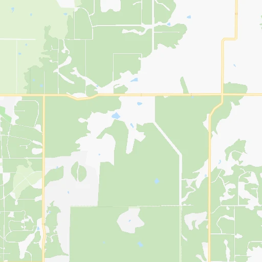
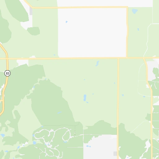
Roadmap (route) to go from Fat Chance Airport to Windsor detailed above, you can also see the course layout on the map.
While doing trip Fat Chance (airport) - Windsor by car, the calculated route ends at a distance , or more straight.
Distance and duration of the route between Fat Chance (airport) and Windsor
Calculation of distance and route from Windsor to Fat Chance (airport) :
156.0185.6 km2h26mn
Continue onto Elbert Road 0h17mn 16.2 kmTurn left onto County Road 106 0h2mn 3.3 kmTurn right onto County Road 21 0h16mn 13.4 kmTurn left onto East Kiowa Avenue 0h12mn 14.9 kmKeep right 0h0mn 136 mContinue onto North State Highway 83 0h28mn 34.3 kmContinue onto South Parker Road 0h4mn 4.5 kmTurn right onto South Quebec Street 0h10mn 9.5 kmTurn left 0h6mn 8.6 kmKeep right and take I 25 North toward Fort Collins 0h6mn 8.8 kmKeep right onto North Valley Highway 1h36mn 63.8 kmKeep right and take CO 392 toward Windsor, Fort Collins 0h0mn 365 mKeep right and drive toward Windsor 0h0mn 212 mTurn slight right onto State Highway 392 0h6mn 7.3 kmTurn right onto 4th Street 0h1mn 301 mTurn left onto Elm Street 0h0mn 96 mArrive at destination 0h0mn 0 m
Travel from Fat Chance (airport) (Colorado) to a selection of major cities.
Distances from Fat Chance Airport to biggest cities in Colorado
- Littleton,46,368 inhabitants.70 km
- Southglenn,42,268 inhabitants.64 km
- Northglenn,39,197 inhabitants.95 km
- Brighton,37,585 inhabitants.101 km
- Englewood,33,082 inhabitants.72 km
- Security-Widefield,32,882 inhabitants.42 km
- Ken Caryl,32,438 inhabitants.72 km
- Wheat Ridge,31,192 inhabitants.87 km
- Pueblo West,29,637 inhabitants.85 km
- Fountain,27,767 inhabitants.48 km
- Lafayette,27,729 inhabitants.110 km
- Castlewood,25,271 inhabitants.62 km
- Columbine,24,280 inhabitants.70 km
- Windsor,21,751 inhabitants.156 km
- Erie,21,420 inhabitants.114 km
- Evans,21,383 inhabitants.143 km
- Louisville,20,396 inhabitants.110 km
- Golden,20,330 inhabitants.93 km
Other major cities in country :
- Charlotte [NC], 827,097 inhabitants. 2,140 km
- Seattle [WA], 684,451 inhabitants. 1,717 km
- El Paso [TX], 681,124 inhabitants. 836 km
- Detroit [MI], 677,116 inhabitants. 1,844 km
- Boston [MA], 667,137 inhabitants. 2,830 km
- Memphis [TN], 655,770 inhabitants. 1,358 km
- New South Memphis [TN], 641,608 inhabitants. 1,360 km
- Portland [OR], 632,309 inhabitants. 1,650 km
- Oklahoma City [OK], 631,346 inhabitants. 742 km
- Las Vegas [NV], 623,747 inhabitants. 988 km
- Baltimore [MD], 621,849 inhabitants. 2,401 km
- Washington, D.C. [DC], 601,723 inhabitants. 2,371 km
- Milwaukee [WI], 600,155 inhabitants. 1,461 km
- South Boston [MA], 571,281 inhabitants. 2,831 km
- Albuquerque [NM], 559,121 inhabitants. 484 km
- Tucson [AZ], 531,641 inhabitants. 958 km
- Nashville [TN], 530,852 inhabitants. 1,597 km
- Fresno [CA], 520,052 inhabitants. 1,361 km
- Sacramento [CA], 490,712 inhabitants. 1,468 km
- Kansas City [MO], 475,378 inhabitants. 861 km
Route from Windsor to major cities (United States).
- Distance Windsor New York City2,598 km
- Distance Windsor Los Angeles1,379 km
- Distance Windsor Chicago1,451 km
- Distance Windsor Brooklyn2,604 km
- Distance Windsor Houston1,473 km
- Distance Windsor Queens2,613 km
- Distance Windsor Philadelphia2,517 km
- Distance Windsor Phoenix1,009 km
- Distance Windsor Manhattan2,600 km
- Distance Windsor San Antonio1,361 km
- Distance Windsor San Diego1,393 km
- Distance Windsor The Bronx2,607 km
- Distance Windsor Dallas1,120 km
- Distance Windsor San Jose1,510 km
- Distance Windsor Austin1,308 km
- Distance Windsor Jacksonville2,382 km
- Distance Windsor San Francisco1,540 km
- Distance Windsor Columbus1,858 km
- Distance Windsor Fort Worth1,096 km
- Distance Windsor Indianapolis1,594 km
Nearest cities to Fat Chance (airport) :
- Denver, 682,545 inhabitants. 80 km
- Colorado Springs, 456,568 inhabitants. 38 km
- Aurora, 359,407 inhabitants. 74 km
- Fort Collins, 161,175 inhabitants. 172 km
- Lakewood, 152,597 inhabitants. 81 km
- Thornton, 133,451 inhabitants. 93 km
- Arvada, 115,368 inhabitants. 91 km
- Westminster, 113,130 inhabitants. 92 km
- Centennial, 109,741 inhabitants. 60 km
- Pueblo, 109,412 inhabitants. 94 km
- Boulder, 107,349 inhabitants. 119 km
- Greeley, 100,883 inhabitants. 148 km
- Highlands Ranch, 96,713 inhabitants. 62 km
- Longmont, 92,088 inhabitants. 128 km
- Loveland, 75,182 inhabitants. 151 km
- Broomfield, 65,065 inhabitants. 102 km
- Cheyenne, 63,335 inhabitants. 228 km
- Castle Rock, 55,591 inhabitants. 40 km
- Commerce City, 53,696 inhabitants. 85 km
- Parker, 49,550 inhabitants. 50 km
- Littleton, 46,368 inhabitants. 70 km
- Southglenn, 42,268 inhabitants. 64 km
- Northglenn, 39,197 inhabitants. 95 km
- Brighton, 37,585 inhabitants. 101 km
- Englewood, 33,082 inhabitants. 72 km
- Security-Widefield, 32,882 inhabitants. 42 km
- Ken Caryl, 32,438 inhabitants. 72 km
- Laramie, 32,158 inhabitants. 262 km
- Wheat Ridge, 31,192 inhabitants. 87 km
- Pueblo West, 29,637 inhabitants. 85 km
- Fountain, 27,767 inhabitants. 48 km
- Lafayette, 27,729 inhabitants. 110 km
- Castlewood, 25,271 inhabitants. 62 km
- Columbine, 24,280 inhabitants. 70 km
- Windsor, 21,751 inhabitants. 156 km
- Erie, 21,420 inhabitants. 114 km
- Evans, 21,383 inhabitants. 143 km
- Louisville, 20,396 inhabitants. 110 km
- Golden, 20,330 inhabitants. 93 km
- Sherrelwood, 18,287 inhabitants. 91 km
- Canon City, 16,400 inhabitants. 95 km
- Cimarron Hills, 16,161 inhabitants. 30 km
- Greenwood Village, 15,663 inhabitants. 67 km
- Johnstown, 14,896 inhabitants. 141 km
- Welby, 14,846 inhabitants. 89 km
- Scottsbluff, 14,802 inhabitants. 317 km
- Sterling, 14,104 inhabitants. 205 km
- Fort Carson, 13,813 inhabitants. 45 km
- Lone Tree, 13,175 inhabitants. 58 km
- Black Forest, 13,116 inhabitants. 16 km
Location Fat Chance (airport) (Colorado) :
| Country flag |  |
| Location | Fat Chance (airport) |
| State | Colorado |
| County | El Paso County |
| Country | United States |
| Country code / ISO 2 | US |
| Latitude | 39.1005300 |
| Longitude | -104.5480200 |
| Altitude | 2181 meters |
| Time zone | America/Denver |
Location Windsor (Colorado) :
| Country flag | |
| Location | Windsor |
| State | Colorado |
| County | Weld County |
| Country | United States |
| Country code / ISO 2 | US |
| Latitude | 40.4774800 |
| Longitude | -104.9013600 |
| Altitude | 1462 meters |
| Time zone | America/Denver |


