

How to get from Sackett Farms Airstrip (New York) to Easton (Pennsylvania)
Calculate route from Sackett Farms Airstrip (New York, United States) to Easton (Pennsylvania, United States).
The flight distance (as the crow flies) between Sackett Farms Airstrip and Easton is 353.7 km.
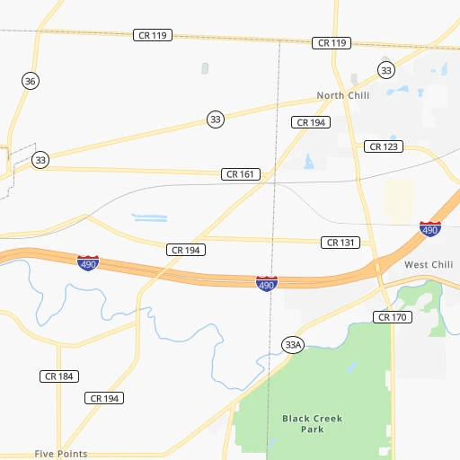
Roadmap (route) to go from Sackett Farms Airstrip to Easton detailed above, you can also see the course layout on the map.
While doing trip Sackett Farms Airstrip - Easton by car, the calculated route ends at a distance , or more straight.
Distance and duration of the route between Sackett Farms Airstrip and Easton
Calculation of distance and route from Easton to Sackett Farms Airstrip :
353.7448.8 km5h26mn
Continue 0h0mn 93 mTurn right onto Townline Road 0h3mn 3.5 kmTurn right onto West Bergen Road 0h6mn 5.0 kmTurn left onto Griswold Road 0h2mn 2.9 kmTurn left onto Lake Street Road 0h0mn 364 mTurn right 0h0mn 382 mKeep left and take I 90 East toward Albany 1h0mn 93.8 kmKeep right and take NY 414 toward Waterloo, Clyde 0h1mn 736 mKeep right 0h0mn 100 mTurn slight right onto State Route 414 0h0mn 475 mTurn left onto NY 318 0h7mn 6.6 kmTurn left onto Auburn Road 0h16mn 18.5 kmTurn right onto State Street 0h0mn 69 mTurn left onto Dill Street 0h0mn 358 mTurn left onto Genesee Street 0h13mn 12.2 kmTurn right onto East Lake Street 1h38mn 41.3 kmTurn right onto North Main Street 0h1mn 649 mTurn left onto Albany Street 0h1mn 930 mKeep right onto Locust Avenue 0h2mn 2.0 kmTurn right onto Clinton Avenue 0h0mn 212 mTurn sharp left toward I 81 South 1h47mn 70.5 kmKeep right onto I 81 and take I 81 South toward Scranton 1h56mn 85.8 kmKeep right onto US 6 and take I 84 East, I 380 South, US 6 East toward Carbondale, Mt Pocono 0h1mn 700 mKeep left onto US 6 and take US 6 East, I 84 East, I 380 South toward Carbondale, Mt Pocono 0h0mn 529 mKeep right and take I 84 East, I 380 South toward Mount Pocono, Milford 0h4mn 5.9 kmKeep right onto I 380 and take I 380 South toward Mount Pocono 0h23mn 38.0 kmKeep left and take I 80 E toward Stroudsburg 0h11mn 15.3 kmKeep right and take PA 33 South toward Snydersville 0h23mn 32.2 kmKeep right and drive toward Tatamy 0h0mn 272 mKeep left and drive toward Tatamy 0h0mn 148 mTurn sharp left onto Tatamy Road 0h1mn 849 mTurn right onto South 8th Street 0h5mn 4.8 kmTurn left onto Hackett Avenue 0h2mn 1.7 kmTurn left onto Wood Avenue 0h1mn 627 mTurn right onto Wood Avenue 0h1mn 632 mTurn right onto North 9th Street 0h1mn 389 mTurn left onto Spruce Street 0h0mn 12 mArrive at destination 0h0mn 0 m
Travel from Sackett Farms Airstrip (Pennsylvania) to a selection of major cities.
Distances from Sackett Farms Airstrip to biggest cities in New York
- East Harlem,115,921 inhabitants.424 km
- Elmhurst,113,364 inhabitants.433 km
- Bushwick,112,620 inhabitants.433 km
- Gravesend,112,229 inhabitants.437 km
- Corona,109,698 inhabitants.433 km
- Richmond Hill,98,984 inhabitants.438 km
- Albany,98,469 inhabitants.353 km
- Fordham,94,678 inhabitants.423 km
- West Albany,93,794 inhabitants.351 km
- Flatbush,93,361 inhabitants.433 km
- Canarsie,87,366 inhabitants.438 km
- Greenburgh,86,764 inhabitants.415 km
- New Rochelle,79,846 inhabitants.427 km
- Cheektowaga,75,178 inhabitants.61 km
- Kings Bridge,75,132 inhabitants.421 km
- Brownsville,74,497 inhabitants.435 km
- Ridgewood,69,317 inhabitants.433 km
- Mount Vernon,68,628 inhabitants.423 km
- Forest Hills,67,714 inhabitants.436 km
- Jackson Heights,67,067 inhabitants.431 km
Other major cities in country :
- Boston [MA], 667,137 inhabitants. 577 km
- Memphis [TN], 655,770 inhabitants. 1,359 km
- New South Memphis [TN], 641,608 inhabitants. 1,364 km
- Portland [OR], 632,309 inhabitants. 3,520 km
- Oklahoma City [OK], 631,346 inhabitants. 1,873 km
- Las Vegas [NV], 623,747 inhabitants. 3,243 km
- Baltimore [MD], 621,849 inhabitants. 438 km
- Washington, D.C. [DC], 601,723 inhabitants. 473 km
- Milwaukee [WI], 600,155 inhabitants. 801 km
- South Boston [MA], 571,281 inhabitants. 578 km
- Albuquerque [NM], 559,121 inhabitants. 2,611 km
- Tucson [AZ], 531,641 inhabitants. 3,114 km
- Nashville [TN], 530,852 inhabitants. 1,072 km
- Fresno [CA], 520,052 inhabitants. 3,593 km
- Sacramento [CA], 490,712 inhabitants. 3,652 km
- Kansas City [MO], 475,378 inhabitants. 1,453 km
- Long Beach [CA], 474,140 inhabitants. 3,613 km
- Mesa [AZ], 471,825 inhabitants. 3,117 km
- Atlanta [GA], 463,878 inhabitants. 1,175 km
- Colorado Springs [CO], 456,568 inhabitants. 2,289 km
Route from Easton to major cities (United States).
- Distance Easton New York City103 km
- Distance Easton Los Angeles3,838 km
- Distance Easton Chicago1,047 km
- Distance Easton Brooklyn107 km
- Distance Easton Houston2,190 km
- Distance Easton Queens117 km
- Distance Easton Phoenix3,345 km
- Distance Easton Manhattan106 km
- Distance Easton San Antonio2,452 km
- Distance Easton San Diego3,809 km
- Distance Easton The Bronx116 km
- Distance Easton Dallas2,110 km
- Distance Easton San Jose4,007 km
- Distance Easton Austin2,338 km
- Distance Easton Jacksonville1,291 km
- Distance Easton San Francisco4,034 km
- Distance Easton Columbus665 km
- Distance Easton Fort Worth2,154 km
- Distance Easton Indianapolis935 km
- Distance Easton Charlotte783 km
Nearest cities to Sackett Farms Airstrip :
- Pittsburgh, 304,391 inhabitants. 335 km
- Buffalo, 258,071 inhabitants. 71 km
- Rochester, 209,802 inhabitants. 36 km
- Syracuse, 144,142 inhabitants. 155 km
- Amherst, 122,366 inhabitants. 62 km
- Allentown, 120,207 inhabitants. 347 km
- Erie, 99,475 inhabitants. 197 km
- Reading, 87,879 inhabitants. 352 km
- Scranton, 77,118 inhabitants. 270 km
- Cheektowaga, 75,178 inhabitants. 61 km
- Bethlehem, 74,892 inhabitants. 352 km
- Youngstown, 64,628 inhabitants. 307 km
- Utica, 61,100 inhabitants. 229 km
- Irondequoit, 51,692 inhabitants. 41 km
- Harrisburg, 49,081 inhabitants. 327 km
- Niagara Falls, 48,916 inhabitants. 82 km
- Binghamton, 46,032 inhabitants. 206 km
- Altoona, 45,344 inhabitants. 286 km
- West Seneca, 44,711 inhabitants. 66 km
- Penn Hills, 44,610 inhabitants. 323 km
- State College, 42,161 inhabitants. 255 km
- Wilkes-Barre, 40,780 inhabitants. 271 km
- Warren, 40,245 inhabitants. 307 km
- Brighton, 36,609 inhabitants. 41 km
- Boardman, 35,376 inhabitants. 314 km
- Norristown, 34,412 inhabitants. 399 km
- Mount Lebanon, 32,730 inhabitants. 345 km
- Rome, 32,573 inhabitants. 211 km
- Bethel Park, 32,118 inhabitants. 348 km
- Ithaca, 30,788 inhabitants. 145 km
- North Tonawanda, 30,785 inhabitants. 66 km
- Jamestown, 30,075 inhabitants. 146 km
- Austintown, 29,677 inhabitants. 314 km
- Williamsport, 29,201 inhabitants. 222 km
- Elmira, 28,213 inhabitants. 150 km
- Monroeville, 28,176 inhabitants. 329 km
- Cranberry Township, 28,098 inhabitants. 316 km
- Plum, 27,505 inhabitants. 319 km
- Auburn, 26,985 inhabitants. 122 km
- Back Mountain, 26,973 inhabitants. 257 km
- Easton, 26,915 inhabitants. 354 km
- Watertown, 26,780 inhabitants. 200 km
- Lebanon, 25,534 inhabitants. 333 km
- Whitehall Township, 24,896 inhabitants. 341 km
- Hazleton, 24,825 inhabitants. 291 km
- Pottstown, 22,664 inhabitants. 373 km
- New Castle, 22,375 inhabitants. 299 km
- Allison Park, 21,552 inhabitants. 322 km
- Grand Island, 20,813 inhabitants. 74 km
- Lockport, 20,624 inhabitants. 53 km
Location Sackett Farms Airstrip (New York) :
| Country flag |  |
| Location | Sackett Farms Airstrip |
| State | New York |
| County | Genesee County |
| Country | United States |
| Country code / ISO 2 | US |
| Latitude | 43.0753400 |
| Longitude | -78.0490900 |
| Altitude | 198 meters |
| Time zone | America/New_York |
Location Easton (Pennsylvania) :
| Country flag | |
| Location | Easton |
| State | Pennsylvania |
| County | Northampton County |
| Country | United States |
| Country code / ISO 2 | US |
| Latitude | 40.6884300 |
| Longitude | -75.2207300 |
| Altitude | 97 meters |
| Time zone | America/New_York |


