
Home
››
San Cristóbal de las Casas National Airport
››
Roadmap from San Cristóbal de las Casas National Airport to Matías Romero
How to get from San Cristóbal de las Casas National (airport) (Chiapas) to Matías Romero (Oaxaca)
Calculate route from San Cristóbal de las Casas National (airport) (Chiapas, Mexico) to Matías Romero (Oaxaca, Mexico).
The flight distance (as the crow flies) between San Cristóbal de las Casas National (airport) and Matías Romero is 267.8 km.
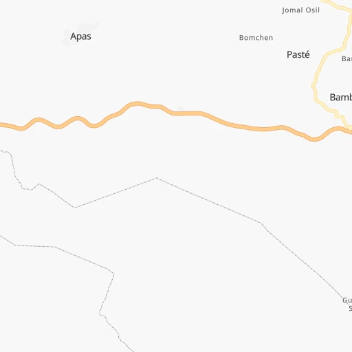
Roadmap (route) to go from San Cristóbal de las Casas National Airport to Matías Romero detailed above, you can also see the course layout on the map.
While doing trip San Cristóbal de las Casas National (airport) - Matías Romero by car, the calculated route ends at a distance , or more straight.
Distance and duration of the route between San Cristóbal de las Casas National (airport) and Matías Romero
Calculation of distance and route from Matías Romero to San Cristóbal de las Casas National (airport) :
267.8356.8 km5h59mn
Continue 0h1mn 540 mTurn slight left 0h2mn 1.1 kmKeep right 0h4mn 4.2 kmKeep right toward MEX 190 0h9mn 10.0 kmTurn left onto Calle Eje Vial Uno 0h2mn 2.1 kmContinue onto Autopista Tuxtla Gutiérrez - San Cristóbal de las Casas 1h33mn 44.5 kmContinue onto Autopista Tuxtla Gutiérrez - San Cristóbal de las Casas 0h5mn 7.4 kmKeep left onto MEX 190 0h2mn 2.5 kmTurn sharp right 0h0mn 33 mTurn sharp left onto Avenida El Palmar 0h1mn 646 mTurn right onto Calle Pensil 0h0mn 111 mTurn left onto Avenida 9a Sur Oriente 0h4mn 3.5 kmTurn right onto 9a. Sur Poniente 0h2mn 1.9 kmKeep right onto Prolongación Periférico 0h1mn 516 mTurn left onto Boulevard Doctor Belisario Domínguez 0h6mn 5.9 kmContinue onto Carretera Tuxtla Gutiérrez-Tonala 0h18mn 21.5 kmKeep left onto Autopista Arriaga - Tuxtla Gutiérrez 0h15mn 22.2 kmKeep right onto MEX 190D 0h0mn 372 mTurn slight right onto MEX 190 1h22mn 96.1 kmKeep right 0h0mn 356 mTurn slight right onto MEX 200 1h15mn 89.3 kmKeep right 0h1mn 888 mContinue onto Matías Romero la Ventosa 0h25mn 26.9 kmKeep left 0h3mn 4.8 kmContinue onto Carretera Transistmica 0h7mn 7.9 kmTurn left 0h1mn 1.3 kmTurn right onto Avenida Morelos Norte 0h0mn 114 mTurn left onto Calle Iturbide 0h0mn 74 mArrive at destination 0h0mn 0 m
Travel from San Cristóbal de las Casas National (airport) (Oaxaca) to a selection of major cities.
Distances from San Cristóbal de las Casas National Airport to biggest cities in Chiapas
Other major cities in country :
- Aguascalientes [01], 658,179 inhabitants. 1,176 km
- Acapulco de Juarez [12], 652,136 inhabitants. 787 km
- Coyoacan [09], 628,063 inhabitants. 762 km
- Santiago de Queretaro [22], 626,495 inhabitants. 935 km
- Saltillo [07], 621,250 inhabitants. 1,311 km
- Tlalpan [09], 607,545 inhabitants. 760 km
- Mexicali [02], 597,099 inhabitants. 2,908 km
- Hermosillo [26], 595,811 inhabitants. 2,337 km
- Morelia [16], 592,797 inhabitants. 974 km
- Veracruz [30], 568,313 inhabitants. 472 km
- Cancun [23], 542,043 inhabitants. 779 km
- Santa Maria Chimalhuacan [15], 525,389 inhabitants. 744 km
- Torreon [07], 524,066 inhabitants. 1,499 km
- Cuauhtemoc [09], 521,348 inhabitants. 764 km
- Ciudad Lopez Mateos [15], 521,034 inhabitants. 780 km
- Toluca [15], 505,881 inhabitants. 808 km
- Reynosa [28], 498,654 inhabitants. 1,203 km
- Tlaquepaque [14], 493,646 inhabitants. 1,217 km
- Cuautitlan Izcalli [15], 475,179 inhabitants. 780 km
- Victoria de Durango [10], 457,140 inhabitants. 1,505 km
Route from Matías Romero to major cities (Mexico).
- Distance Matías Romero Mexico City517 km
- Distance Matías Romero Iztapalapa507 km
- Distance Matías Romero Ecatepec de Morelos522 km
- Distance Matías Romero Guadalajara976 km
- Distance Matías Romero Puebla412 km
- Distance Matías Romero Juarez2,015 km
- Distance Matías Romero Tijuana2,811 km
- Distance Matías Romero Ciudad Nezahualcoyotl506 km
- Distance Matías Romero Gustavo Adolfo Madero520 km
- Distance Matías Romero Monterrey1,122 km
- Distance Matías Romero Leon de los Aldama843 km
- Distance Matías Romero Zapopan978 km
- Distance Matías Romero Naucalpan de Juarez530 km
- Distance Matías Romero Chihuahua1,730 km
- Distance Matías Romero Alvaro Obregon520 km
- Distance Matías Romero Guadalupe1,119 km
- Distance Matías Romero Merida731 km
- Distance Matías Romero Tlalnepantla530 km
- Distance Matías Romero San Luis Potosi856 km
- Distance Matías Romero Culiacan1,556 km
Nearest cities to San Cristóbal de las Casas National (airport) :
- Tuxtla, 481,128 inhabitants. 63 km
- Villahermosa, 362,401 inhabitants. 150 km
- Coatzacoalcos, 230,717 inhabitants. 260 km
- Tapachula, 197,961 inhabitants. 201 km
- Minatitlan, 150,895 inhabitants. 260 km
- Ciudad del Carmen, 141,308 inhabitants. 230 km
- San Cristobal de las Casas, 128,996 inhabitants. 13 km
- Las Margaritas, 103,403 inhabitants. 72 km
- Cardenas, 85,350 inhabitants. 171 km
- Comitan, 79,944 inhabitants. 65 km
- Salina Cruz, 73,648 inhabitants. 290 km
- Juchitan de Zaragoza, 67,637 inhabitants. 267 km
- San Andres Tuxtla, 55,697 inhabitants. 346 km
- Acayucan, 46,990 inhabitants. 290 km
- Comalcalco, 40,992 inhabitants. 190 km
- Las Choapas, 40,304 inhabitants. 215 km
- Santo Domingo Tehuantepec, 37,389 inhabitants. 292 km
- Palenque, 36,669 inhabitants. 108 km
- Agua Dulce, 36,119 inhabitants. 235 km
- Cintalapa de Figueroa, 33,464 inhabitants. 127 km
- Tonala, 32,855 inhabitants. 147 km
- Tenosique, 32,415 inhabitants. 146 km
- Chiapa de Corzo, 32,182 inhabitants. 51 km
- Ocozocoautla de Espinosa, 31,596 inhabitants. 90 km
- Macuspana, 30,409 inhabitants. 119 km
- Huixtla, 29,257 inhabitants. 173 km
- Ocosingo, 28,721 inhabitants. 52 km
- Escarcega, 28,159 inhabitants. 285 km
- Huimanguillo, 26,602 inhabitants. 157 km
- Rio de Teapa, 26,500 inhabitants. 128 km
- Teapa, 26,331 inhabitants. 106 km
- Nanchital de Lazaro Cardenas del Rio, 25,982 inhabitants. 252 km
- Champoton, 24,809 inhabitants. 352 km
- Catemaco, 24,257 inhabitants. 335 km
- Paraiso, 23,830 inhabitants. 204 km
- Ixtepec, 23,150 inhabitants. 275 km
- Arriaga, 22,820 inhabitants. 155 km
- Frontera, 22,621 inhabitants. 207 km
- Allende, 21,398 inhabitants. 256 km
- Matias Romero, 21,064 inhabitants. 268 km
- Berriozabal, 20,952 inhabitants. 80 km
- Cosoleacaque, 20,371 inhabitants. 267 km
- Motozintla, 19,092 inhabitants. 150 km
- Lerdo de Tejada, 18,941 inhabitants. 384 km
- Comalapa, 18,704 inhabitants. 122 km
- Emiliano Zapata, 18,608 inhabitants. 142 km
- Cunduacan, 17,904 inhabitants. 168 km
- Mapastepec, 16,082 inhabitants. 145 km
- Fraccionamiento Ciudad Olmeca, 16,074 inhabitants. 269 km
- Santiago Tuxtla, 15,681 inhabitants. 354 km
Location San Cristóbal de las Casas National (airport) (Chiapas) :
| Country flag |  |
| Location | San Cristóbal de las Casas National (airport) |
| State | Chiapas |
| County | San Cristobal De Casas |
| Country | Mexico |
| Country code / ISO 2 | MX |
| Latitude | 16.6903000 |
| Longitude | -92.5301000 |
| Altitude | 0 meters |
| Time zone | America/Mexico_City |
Location Matías Romero (Oaxaca) :
| Country flag | |
| Location | Matías Romero |
| State | Oaxaca |
| County | Matías Romero Avendaño |
| Country | Mexico |
| Country code / ISO 2 | MX |
| Latitude | 16.8790200 |
| Longitude | -95.0393900 |
| Altitude | 0 meters |
| Time zone | America/Mexico_City |