

How to get from Hilling International (airport) (Pennsylvania) to Pottstown (Pennsylvania)
Calculate route from Hilling International (airport) (Pennsylvania, United States) to Pottstown (Pennsylvania, United States).
The flight distance (as the crow flies) between Hilling International (airport) and Pottstown is 195.9 km.
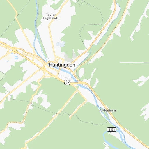
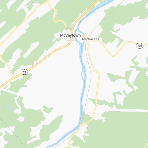
Roadmap (route) to go from Hilling International Airport to Pottstown detailed above, you can also see the course layout on the map.
While doing trip Hilling International (airport) - Pottstown by car, the calculated route ends at a distance , or more straight.
Distance and duration of the route between Hilling International (airport) and Pottstown
Calculation of distance and route from Pottstown to Hilling International (airport) :
195.9266.7 km3h22mn
Continue onto School House Hollow Road 0h2mn 764 mContinue 0h1mn 415 mTurn right onto Sugar Grove Road 0h12mn 9.6 kmTurn left onto William Penn Highway 0h8mn 10.6 kmKeep right 0h0mn 51 mTurn slight right onto Croghan Pike 0h25mn 26.7 kmTurn left onto Neelyton Road 0h16mn 16.5 kmTurn right onto Timmons Road 0h11mn 11.1 kmContinue onto Newburg Road 0h0mn 220 mTurn left onto Cumberland Highway 0h6mn 6.4 kmTurn left toward I 76, PATP 0h0mn 391 mKeep right and take I 76 East toward Harrisburg 2h32mn 155.9 kmKeep right and take I 176, PA 10 toward Morgantown, Reading 0h1mn 750 mKeep right and take PA 10 North toward Beckersville 0h0mn 231 mTurn slight right onto Morgantown Road 0h0mn 199 mTurn right onto Quarry Road 0h1mn 616 mTurn right onto Morgan Way 0h0mn 334 mTurn left onto Main Street 0h15mn 16.5 kmTurn left onto Coventryville Road 0h0mn 71 mTurn right onto Old Ridge Road 0h0mn 46 mTurn left onto Coventryville Road 0h6mn 5.1 kmContinue onto Neiman Road 0h1mn 723 mTurn slight left onto Hanover Street 0h4mn 3.2 kmTurn right onto East High Street 0h0mn 122 mTurn right onto South Penn Street 0h0mn 64 mTurn right 0h0mn 47 mTurn right 0h0mn 39 mArrive at destination 0h0mn 0 m
Travel from Hilling International (airport) (Pennsylvania) to a selection of major cities.
Distances from Hilling International Airport to biggest cities in Pennsylvania
- Mount Lebanon,32,730 inhabitants.180 km
- Bethel Park,32,118 inhabitants.179 km
- Wayne,30,892 inhabitants.223 km
- Radnor,30,878 inhabitants.225 km
- Williamsport,29,201 inhabitants.114 km
- Monroeville,28,176 inhabitants.157 km
- Cranberry Township,28,098 inhabitants.184 km
- Drexel Hill,28,043 inhabitants.233 km
- Plum,27,505 inhabitants.153 km
- Back Mountain,26,973 inhabitants.188 km
- Easton,26,915 inhabitants.231 km
- Pennsport,26,000 inhabitants.246 km
- Lebanon,25,534 inhabitants.131 km
- Whitehall Township,24,896 inhabitants.207 km
- Hazleton,24,825 inhabitants.173 km
- Springfield,23,363 inhabitants.232 km
- Pottstown,22,664 inhabitants.196 km
- New Castle,22,375 inhabitants.211 km
- Allison Park,21,552 inhabitants.171 km
- Chambersburg,20,691 inhabitants.67 km
Other major cities in country :
- Seattle [WA], 684,451 inhabitants. 3,587 km
- Denver [CO], 682,545 inhabitants. 2,295 km
- El Paso [TX], 681,124 inhabitants. 2,730 km
- Detroit [MI], 677,116 inhabitants. 472 km
- Boston [MA], 667,137 inhabitants. 610 km
- Memphis [TN], 655,770 inhabitants. 1,219 km
- New South Memphis [TN], 641,608 inhabitants. 1,223 km
- Portland [OR], 632,309 inhabitants. 3,636 km
- Oklahoma City [OK], 631,346 inhabitants. 1,802 km
- Las Vegas [NV], 623,747 inhabitants. 3,259 km
- Baltimore [MD], 621,849 inhabitants. 176 km
- Washington, D.C. [DC], 601,723 inhabitants. 195 km
- Milwaukee [WI], 600,155 inhabitants. 874 km
- South Boston [MA], 571,281 inhabitants. 610 km
- Albuquerque [NM], 559,121 inhabitants. 2,584 km
- Tucson [AZ], 531,641 inhabitants. 3,077 km
- Nashville [TN], 530,852 inhabitants. 910 km
- Fresno [CA], 520,052 inhabitants. 3,628 km
- Sacramento [CA], 490,712 inhabitants. 3,707 km
- Kansas City [MO], 475,378 inhabitants. 1,430 km
Route from Pottstown to major cities (United States).
- Distance Pottstown New York City149 km
- Distance Pottstown Los Angeles3,804 km
- Distance Pottstown Chicago1,022 km
- Distance Pottstown Brooklyn151 km
- Distance Pottstown Houston2,135 km
- Distance Pottstown Queens161 km
- Distance Pottstown Phoenix3,307 km
- Distance Pottstown Manhattan155 km
- Distance Pottstown San Antonio2,399 km
- Distance Pottstown San Diego3,773 km
- Distance Pottstown The Bronx165 km
- Distance Pottstown Dallas2,060 km
- Distance Pottstown San Jose3,980 km
- Distance Pottstown Austin2,286 km
- Distance Pottstown Jacksonville1,230 km
- Distance Pottstown San Francisco4,008 km
- Distance Pottstown Columbus626 km
- Distance Pottstown Fort Worth2,105 km
- Distance Pottstown Indianapolis897 km
- Distance Pottstown Charlotte722 km
Nearest cities to Hilling International (airport) :
- Philadelphia, 1,567,442 inhabitants. 244 km
- Baltimore, 621,849 inhabitants. 176 km
- Washington, D.C., 601,723 inhabitants. 195 km
- Pittsburgh, 304,391 inhabitants. 174 km
- Buffalo, 258,071 inhabitants. 276 km
- Richmond, 220,289 inhabitants. 331 km
- Rochester, 209,802 inhabitants. 296 km
- Arlington, 207,627 inhabitants. 194 km
- Alexandria, 153,511 inhabitants. 204 km
- Syracuse, 144,142 inhabitants. 320 km
- Amherst, 122,366 inhabitants. 285 km
- Allentown, 120,207 inhabitants. 207 km
- Columbia, 99,615 inhabitants. 169 km
- Erie, 99,475 inhabitants. 255 km
- Reading, 87,879 inhabitants. 171 km
- Germantown, 86,395 inhabitants. 159 km
- Scranton, 77,118 inhabitants. 216 km
- Camden, 76,119 inhabitants. 248 km
- Cheektowaga, 75,178 inhabitants. 275 km
- Bethlehem, 74,892 inhabitants. 218 km
- Wilmington, 71,948 inhabitants. 220 km
- Silver Spring, 71,452 inhabitants. 186 km
- Centreville, 71,135 inhabitants. 190 km
- Cherry Hill, 70,475 inhabitants. 255 km
- Frederick, 69,479 inhabitants. 129 km
- Waldorf, 67,752 inhabitants. 226 km
- Glen Burnie, 67,639 inhabitants. 187 km
- Gaithersburg, 67,456 inhabitants. 164 km
- Rockville, 66,980 inhabitants. 172 km
- Dale City, 65,969 inhabitants. 215 km
- Ellicott City, 65,834 inhabitants. 169 km
- Youngstown, 64,628 inhabitants. 238 km
- Dundalk, 63,597 inhabitants. 185 km
- Utica, 61,100 inhabitants. 366 km
- Bethesda, 60,858 inhabitants. 184 km
- Vineland, 60,818 inhabitants. 273 km
- Lancaster, 59,339 inhabitants. 148 km
- Reston, 58,404 inhabitants. 178 km
- South Vineland, 58,122 inhabitants. 275 km
- Bowie, 58,025 inhabitants. 202 km
- Center City, 57,239 inhabitants. 244 km
- Towson, 55,197 inhabitants. 168 km
- Harrisonburg, 52,538 inhabitants. 242 km
- Irondequoit, 51,692 inhabitants. 303 km
- Leesburg, 51,209 inhabitants. 158 km
- Whitman, 49,732 inhabitants. 245 km
- Wharton, 49,732 inhabitants. 245 km
- Harrisburg, 49,081 inhabitants. 93 km
- Niagara Falls, 48,916 inhabitants. 303 km
- South Bel Air, 48,828 inhabitants. 174 km
Location Hilling International (airport) (Pennsylvania) :
| Country flag |  |
| Location | Hilling International (airport) |
| State | Pennsylvania |
| County | Huntingdon County |
| Country | United States |
| Country code / ISO 2 | US |
| Latitude | 40.5048000 |
| Longitude | -77.9382400 |
| Altitude | 422 meters |
| Time zone | America/New_York |
Location Pottstown (Pennsylvania) :
| Country flag | |
| Location | Pottstown |
| State | Pennsylvania |
| County | Montgomery County |
| Country | United States |
| Country code / ISO 2 | US |
| Latitude | 40.2453700 |
| Longitude | -75.6496300 |
| Altitude | 46 meters |
| Time zone | America/New_York |

