

How to get from Davis (airport) (Pennsylvania) to El Paso (Texas)
Calculate route from Davis (airport) (Pennsylvania, United States) to El Paso (Texas, United States).
The flight distance (as the crow flies) between Davis (airport) and El Paso is 2,630.6 km.
Roadmap (route) to go from Davis Airport to El Paso detailed above, you can also see the course layout on the map.
While doing trip Davis (airport) - El Paso by car, the calculated route ends at a distance , or more straight.
Distance and duration of the route between Davis (airport) and El Paso
Calculation of distance and route from El Paso to Davis (airport) :
2,630.62,933.4 km31h28mn
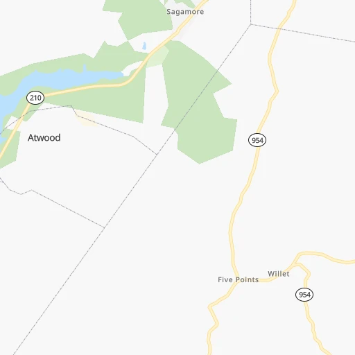
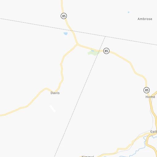
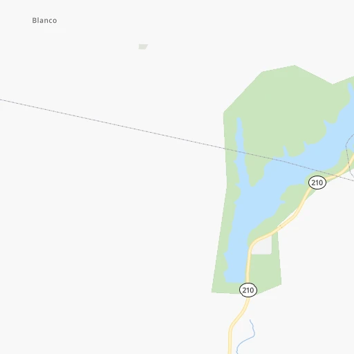
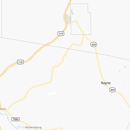
Continue 0h1mn 486 mTurn right onto Davis Road 0h5mn 2.7 kmTurn right onto Chambersville Road 0h4mn 3.6 kmContinue onto PA 954 0h3mn 3.5 kmContinue onto Creekside Road 0h6mn 5.3 kmTurn left onto Five Points Road 0h1mn 1.0 kmTurn right onto Benjamin Franklin Highway 0h2mn 2.6 kmTurn left onto PA 56, PA 156 0h28mn 30.4 kmTurn left onto State Route 66 0h2mn 2.5 kmKeep right 0h8mn 10.2 kmTurn right onto Saltsburg Road 0h6mn 6.4 kmTurn left onto Center Road 0h4mn 4.3 kmKeep right and take I 376 West, US 22 West toward Pittsburgh 0h21mn 27.2 kmKeep right and take PA 121 toward Green Tree, Crafton 0h0mn 37 mKeep right and take PA 121 South toward Green Tree 0h4mn 4.1 kmKeep right 0h0mn 161 mTurn slight right onto Greentree Road 0h2mn 2.4 kmTurn left onto Washington Pike 0h4mn 4.3 kmKeep right onto PA 50 0h0mn 56 mKeep left onto Millers Run Road 0h0mn 380 mTurn left 0h18mn 24.3 kmKeep right and take I 70 West toward Wheeling 0h28mn 43.1 kmKeep left onto USS West Virginia Memorial Highway and take I 470 West toward Columbus OH 5h59mn 490.9 kmKeep right onto I 70 and take I 70 toward St Louis, Indianapolis International Airport 2h22mn 232.1 kmKeep right onto I 70 and take I 70 West toward Saint Louis 1h13mn 123.4 kmKeep left onto I 70 and take I 55 South, I 70 West toward Saint Louis 0h17mn 27.0 kmKeep left onto I 55, US 40 and take I 55 South, I 64, IL 3, US 40 West toward Louisville, Saint Louis 0h2mn 2.8 kmKeep right onto I 55, IL 3 and take IL 3 South toward Cahokia 0h2mn 2.6 kmKeep right onto I 55 and take I 44 West, I 55 South, I 44 East toward Tulsa, Memphis, Kansas City, Walnut Street 0h2mn 2.1 kmKeep right onto Officer David Haynes Memorial Highway 6h59mn 607.7 kmKeep right onto I 44 and take I 44 West, US 412 West, OK 66 West toward Tulsa 0h5mn 8.2 kmKeep left onto Skelly Bypass and take I 44 West, OK 66 West toward Sapulpa, Oklahoma City 0h14mn 20.3 kmKeep left onto Skelly Bypass 0h1mn 2.1 kmKeep left onto Skelly Bypass 1h18mn 140.9 kmKeep left onto I 44 and take I 35 South, I 44 West, OK 66 West toward Dallas, Lawton 0h5mn 7.4 kmKeep right onto Will Rogers Expressway and take I 44 West, OK 66 West toward Lawton, Amarillo 0h8mn 11.4 kmKeep right and take OK 66 West toward Warr Acres, Bethany 0h0mn 272 mKeep left onto Northwest 39th Expressway 0h20mn 21.9 kmTurn left onto North Cimarron Road 0h1mn 645 mTurn right and take I 40 West, US 270 West toward Amarillo 4h37mn 384.3 kmKeep right onto US 287 and take I 27 South, US 87, US 60, US 287 North toward Canyon, Lubbock, Dumas, Pampa, Downtown 0h0mn 143 mKeep left and take I 27 South, US 87 South, US 60 West toward Canyon, Lubbock 0h14mn 22.1 kmKeep right onto Canyon Expressway 0h2mn 3.9 kmKeep right onto US 60 and take US 60 West toward Hereford 0h10mn 16.6 kmTurn slight right onto US 60 1h4mn 88.3 kmContinue onto Gardner Avenue 0h13mn 21.2 kmKeep right 0h0mn 58 mTurn slight right onto Wheeler Avenue 0h3mn 3.0 kmTurn slight right onto US 60, US 70, US 84 0h4mn 4.7 kmTurn slight right onto Mabry Drive 0h4mn 4.6 kmTurn left onto South Norris Street 0h1mn 676 mTurn right onto East Brady Avenue 0h2mn 1.6 kmTurn left onto South Prince Street 3h31mn 177.9 kmKeep right 2h36mn 133.7 kmKeep right 0h23mn 26.5 kmTurn left onto North Bookout Road 0h2mn 2.4 kmTurn left onto US 54, US 70 0h9mn 14.0 kmKeep right onto US 54, US 70 0h6mn 7.9 kmKeep right onto US 70 0h1mn 510 mTurn left onto US Highway 54 South 1h10mn 116.3 kmKeep left onto US 54 0h9mn 13.0 kmKeep right and drive toward Fort Bliss, Pershing Drive 0h1mn 594 mKeep left onto Gateway South Boulevard 0h2mn 1.8 kmTurn right onto Pershing Drive 0h3mn 3.3 kmTurn right onto East Missouri Avenue 0h1mn 607 mKeep left 0h1mn 1.9 kmKeep right and drive toward Missouri Avenue, Downtown 0h1mn 879 mTurn left onto North Mesa Street 0h0mn 427 mArrive at destination 0h0mn 0 m
Travel from Davis (airport) (Texas) to a selection of major cities.
Distances from Davis Airport to biggest cities in Pennsylvania
- Mount Lebanon,32,730 inhabitants.86 km
- Bethel Park,32,118 inhabitants.87 km
- Wayne,30,892 inhabitants.329 km
- Radnor,30,878 inhabitants.331 km
- Williamsport,29,201 inhabitants.190 km
- Monroeville,28,176 inhabitants.64 km
- Cranberry Township,28,098 inhabitants.80 km
- Drexel Hill,28,043 inhabitants.340 km
- Plum,27,505 inhabitants.56 km
- Back Mountain,26,973 inhabitants.274 km
- Easton,26,915 inhabitants.332 km
- Pennsport,26,000 inhabitants.352 km
- Lebanon,25,534 inhabitants.237 km
- Whitehall Township,24,896 inhabitants.309 km
- Hazleton,24,825 inhabitants.269 km
- Springfield,23,363 inhabitants.338 km
- Pottstown,22,664 inhabitants.302 km
- New Castle,22,375 inhabitants.104 km
- Allison Park,21,552 inhabitants.70 km
- Chambersburg,20,691 inhabitants.155 km
Other major cities in country :
- Seattle [WA], 684,451 inhabitants. 3,484 km
- Denver [CO], 682,545 inhabitants. 2,189 km
- El Paso [TX], 681,124 inhabitants. 2,635 km
- Detroit [MI], 677,116 inhabitants. 369 km
- Boston [MA], 667,137 inhabitants. 698 km
- Memphis [TN], 655,770 inhabitants. 1,139 km
- New South Memphis [TN], 641,608 inhabitants. 1,144 km
- Portland [OR], 632,309 inhabitants. 3,531 km
- Oklahoma City [OK], 631,346 inhabitants. 1,708 km
- Las Vegas [NV], 623,747 inhabitants. 3,155 km
- Baltimore [MD], 621,849 inhabitants. 270 km
- Washington, D.C. [DC], 601,723 inhabitants. 274 km
- Milwaukee [WI], 600,155 inhabitants. 768 km
- South Boston [MA], 571,281 inhabitants. 699 km
- Albuquerque [NM], 559,121 inhabitants. 2,484 km
- Tucson [AZ], 531,641 inhabitants. 2,978 km
- Nashville [TN], 530,852 inhabitants. 836 km
- Fresno [CA], 520,052 inhabitants. 3,523 km
- Sacramento [CA], 490,712 inhabitants. 3,601 km
- Kansas City [MO], 475,378 inhabitants. 1,327 km
Route from El Paso to major cities (United States).
- Distance El Paso New York City3,062 km
- Distance El Paso Los Angeles1,127 km
- Distance El Paso Chicago2,013 km
- Distance El Paso Brooklyn3,065 km
- Distance El Paso Queens3,075 km
- Distance El Paso Philadelphia2,952 km
- Distance El Paso Phoenix557 km
- Distance El Paso Manhattan3,066 km
- Distance El Paso San Diego1,011 km
- Distance El Paso The Bronx3,075 km
- Distance El Paso San Jose1,541 km
- Distance El Paso Jacksonville2,368 km
- Distance El Paso San Francisco1,601 km
- Distance El Paso Columbus2,298 km
- Distance El Paso Indianapolis2,035 km
- Distance El Paso Charlotte2,405 km
- Distance El Paso Seattle2,217 km
- Distance El Paso Denver899 km
- Distance El Paso Detroit2,381 km
- Distance El Paso Boston3,332 km
Nearest cities to Davis (airport) :
- Baltimore, 621,849 inhabitants. 270 km
- Washington, D.C., 601,723 inhabitants. 274 km
- Cleveland, 388,072 inhabitants. 229 km
- Pittsburgh, 304,391 inhabitants. 78 km
- Buffalo, 258,071 inhabitants. 241 km
- Rochester, 209,802 inhabitants. 298 km
- Arlington, 207,627 inhabitants. 271 km
- Akron, 197,542 inhabitants. 202 km
- Alexandria, 153,511 inhabitants. 281 km
- Amherst, 122,366 inhabitants. 252 km
- Columbia, 99,615 inhabitants. 258 km
- Erie, 99,475 inhabitants. 173 km
- Germantown, 86,395 inhabitants. 237 km
- Parma, 79,937 inhabitants. 228 km
- Cheektowaga, 75,178 inhabitants. 244 km
- Canton, 71,885 inhabitants. 187 km
- Silver Spring, 71,452 inhabitants. 266 km
- Centreville, 71,135 inhabitants. 258 km
- Frederick, 69,479 inhabitants. 209 km
- Waldorf, 67,752 inhabitants. 302 km
- Glen Burnie, 67,639 inhabitants. 278 km
- Gaithersburg, 67,456 inhabitants. 243 km
- Rockville, 66,980 inhabitants. 251 km
- Dale City, 65,969 inhabitants. 282 km
- Ellicott City, 65,834 inhabitants. 259 km
- Youngstown, 64,628 inhabitants. 132 km
- Dundalk, 63,597 inhabitants. 279 km
- Bethesda, 60,858 inhabitants. 263 km
- Lancaster, 59,339 inhabitants. 254 km
- Reston, 58,404 inhabitants. 251 km
- Bowie, 58,025 inhabitants. 288 km
- Towson, 55,197 inhabitants. 264 km
- Elyria, 53,775 inhabitants. 257 km
- Harrisonburg, 52,538 inhabitants. 256 km
- Irondequoit, 51,692 inhabitants. 305 km
- Leesburg, 51,209 inhabitants. 226 km
- Lakewood, 50,656 inhabitants. 236 km
- Charleston, 49,736 inhabitants. 340 km
- Cuyahoga Falls, 49,146 inhabitants. 201 km
- Harrisburg, 49,081 inhabitants. 199 km
- Niagara Falls, 48,916 inhabitants. 263 km
- South Bel Air, 48,828 inhabitants. 275 km
- Aspen Hill, 48,759 inhabitants. 256 km
- Wheaton, 48,284 inhabitants. 261 km
- McLean, 48,115 inhabitants. 262 km
- Bel Air South, 47,709 inhabitants. 278 km
- Euclid, 47,676 inhabitants. 220 km
- Mentor, 46,901 inhabitants. 210 km
- Charlottesville, 46,597 inhabitants. 307 km
- Altoona, 45,344 inhabitants. 69 km
Location Davis (airport) (Pennsylvania) :
| Country flag |  |
| Location | Davis (airport) |
| State | Pennsylvania |
| County | Indiana County |
| Country | United States |
| Country code / ISO 2 | US |
| Latitude | 40.7342000 |
| Longitude | -79.1597800 |
| Altitude | 416 meters |
| Time zone | America/New_York |
Location El Paso (Texas) :
| Country flag | |
| Location | El Paso |
| State | Texas |
| County | El Paso County |
| Country | United States |
| Country code / ISO 2 | US |
| Latitude | 31.7587200 |
| Longitude | -106.4869300 |
| Altitude | 1133 meters |
| Time zone | America/Denver |


