

How to get from J T Willie (airport) (Pennsylvania) to Las Vegas (Nevada)
Calculate route from J T Willie (airport) (Pennsylvania, United States) to Las Vegas (Nevada, United States).
The flight distance (as the crow flies) between J T Willie (airport) and Las Vegas is 3,105.8 km.
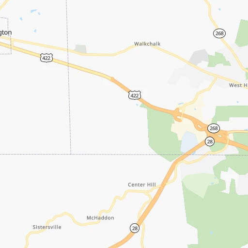
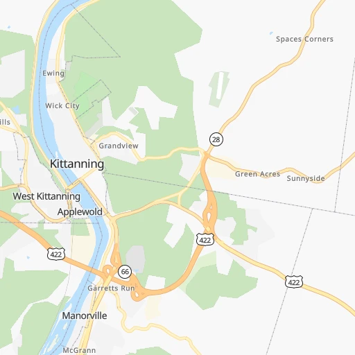
Roadmap (route) to go from J T Willie Airport to Las Vegas detailed above, you can also see the course layout on the map.
While doing trip J T Willie (airport) - Las Vegas by car, the calculated route ends at a distance , or more straight.
Distance and duration of the route between J T Willie (airport) and Las Vegas
Calculation of distance and route from Las Vegas to J T Willie (airport) :
3,105.83,526.5 km35h38mn
Continue 0h1mn 372 mTurn right onto Airport Road 0h2mn 964 mTurn sharp left onto Torry Ireland Road 0h6mn 2.8 kmTurn left onto Moonlight Drive 0h0mn 31 mTurn right onto Mushroom Farm Road 0h2mn 1.7 kmTurn sharp left onto Benjamin Franklin Highway 1h44mn 56.5 kmContinue onto New Butler Road 0h4mn 3.9 kmTurn right onto East Washington Street 0h2mn 1.1 kmTurn right onto North Mill Street 0h0mn 152 mTurn left onto East North Street 0h0mn 244 mTurn right onto North Jefferson Street 0h0mn 122 mTurn left onto West Falls Street 0h1mn 950 mKeep right onto Sampson Street 0h24mn 27.3 kmTurn right onto US 422 0h3mn 4.3 kmKeep right 0h10mn 14.1 kmKeep right onto I 80 toward I 80 West, I 76 East 0h1mn 776 mKeep right onto I 80 and take I 80 West toward Cleveland 6h37mn 569.6 kmKeep right onto I 80 and take I 80 West, I 94, US 6 toward Des Moines 0h1mn 964 mKeep right onto I 80 toward I 94 West, I 80 West, SR 51 0h0mn 166 mKeep left onto I 80 toward I 94 West, I 80 West 0h17mn 22.9 kmKeep right and take US 41 North toward Calumet Avenue, Hammond, Munster 0h0mn 318 mKeep left and drive toward Calumet Avenue South 0h0mn 361 mKeep left 0h10mn 13.4 kmKeep right onto I 80 and take I 80 West toward Iowa 2h22mn 233.4 kmKeep right onto I 80 and take I 80 West toward Davenport 3h47mn 280.3 kmKeep right onto US 6 and take US 6 West, US 65 North, IA 330 North toward Marshalltown, Bondurant 0h1mn 755 mTurn left onto Northeast Hubbell Avenue 0h6mn 6.1 kmContinue onto Hubbell Avenue 0h0mn 240 mTurn slight right onto Hubbell Avenue 0h2mn 2.0 kmTurn right onto Guthrie Avenue 0h1mn 1.0 kmTurn left 2h6mn 209.1 kmKeep left onto I 80 Express and take I 80 West Express toward Council Bluffs, Omaha 5h21mn 570.8 kmKeep right onto I 76 and take I 76 West toward Denver 3h53mn 307.7 kmKeep left onto I 70 8h36mn 800.7 kmKeep left and take I 15 South toward Las Vegas 4h36mn 389.5 kmKeep right and drive toward Washington Avenue, D Street, City Parkway 0h1mn 577 mTurn left onto D Street 0h0mn 110 mKeep left 0h0mn 67 mTurn slight left onto D Street 0h0mn 128 mTurn left onto West Bonanza Road 0h1mn 923 mArrive at destination 0h0mn 0 m
Travel from J T Willie (airport) (Nevada) to a selection of major cities.
Distances from J T Willie Airport to biggest cities in Pennsylvania
- Mount Lebanon,32,730 inhabitants.60 km
- Bethel Park,32,118 inhabitants.62 km
- Wayne,30,892 inhabitants.373 km
- Radnor,30,878 inhabitants.375 km
- Williamsport,29,201 inhabitants.229 km
- Monroeville,28,176 inhabitants.44 km
- Cranberry Township,28,098 inhabitants.39 km
- Drexel Hill,28,043 inhabitants.383 km
- Plum,27,505 inhabitants.35 km
- Back Mountain,26,973 inhabitants.314 km
- Easton,26,915 inhabitants.375 km
- Pennsport,26,000 inhabitants.396 km
- Lebanon,25,534 inhabitants.280 km
- Whitehall Township,24,896 inhabitants.352 km
- Hazleton,24,825 inhabitants.311 km
- Springfield,23,363 inhabitants.382 km
- Pottstown,22,664 inhabitants.346 km
- New Castle,22,375 inhabitants.61 km
- Allison Park,21,552 inhabitants.37 km
- Chambersburg,20,691 inhabitants.196 km
Other major cities in country :
- Seattle [WA], 684,451 inhabitants. 3,442 km
- Denver [CO], 682,545 inhabitants. 2,146 km
- El Paso [TX], 681,124 inhabitants. 2,596 km
- Detroit [MI], 677,116 inhabitants. 328 km
- Boston [MA], 667,137 inhabitants. 737 km
- Memphis [TN], 655,770 inhabitants. 1,106 km
- New South Memphis [TN], 641,608 inhabitants. 1,111 km
- Portland [OR], 632,309 inhabitants. 3,489 km
- Oklahoma City [OK], 631,346 inhabitants. 1,668 km
- Las Vegas [NV], 623,747 inhabitants. 3,111 km
- Baltimore [MD], 621,849 inhabitants. 311 km
- Washington, D.C. [DC], 601,723 inhabitants. 310 km
- Milwaukee [WI], 600,155 inhabitants. 726 km
- South Boston [MA], 571,281 inhabitants. 737 km
- Albuquerque [NM], 559,121 inhabitants. 2,442 km
- Tucson [AZ], 531,641 inhabitants. 2,937 km
- Nashville [TN], 530,852 inhabitants. 807 km
- Fresno [CA], 520,052 inhabitants. 3,479 km
- Sacramento [CA], 490,712 inhabitants. 3,557 km
- Kansas City [MO], 475,378 inhabitants. 1,285 km
Route from Las Vegas to major cities (United States).
- Distance Las Vegas New York City3,588 km
- Distance Las Vegas Los Angeles369 km
- Distance Las Vegas Chicago2,448 km
- Distance Las Vegas Brooklyn3,594 km
- Distance Las Vegas Houston1,975 km
- Distance Las Vegas Queens3,603 km
- Distance Las Vegas Philadelphia3,499 km
- Distance Las Vegas Phoenix413 km
- Distance Las Vegas Manhattan3,591 km
- Distance Las Vegas San Antonio1,726 km
- Distance Las Vegas San Diego428 km
- Distance Las Vegas The Bronx3,599 km
- Distance Las Vegas Dallas1,721 km
- Distance Las Vegas San Jose616 km
- Distance Las Vegas Austin1,745 km
- Distance Las Vegas Jacksonville3,168 km
- Distance Las Vegas San Francisco671 km
- Distance Las Vegas Columbus2,832 km
- Distance Las Vegas Fort Worth1,677 km
- Distance Las Vegas Indianapolis2,563 km
Nearest cities to J T Willie (airport) :
- Washington, D.C., 601,723 inhabitants. 310 km
- Cleveland, 388,072 inhabitants. 186 km
- Pittsburgh, 304,391 inhabitants. 49 km
- Buffalo, 258,071 inhabitants. 240 km
- Rochester, 209,802 inhabitants. 312 km
- Arlington, 207,627 inhabitants. 307 km
- Akron, 197,542 inhabitants. 158 km
- Alexandria, 153,511 inhabitants. 316 km
- Amherst, 122,366 inhabitants. 252 km
- Columbia, 99,615 inhabitants. 298 km
- Erie, 99,475 inhabitants. 151 km
- Germantown, 86,395 inhabitants. 274 km
- Parma, 79,937 inhabitants. 185 km
- Cheektowaga, 75,178 inhabitants. 245 km
- Canton, 71,885 inhabitants. 144 km
- Silver Spring, 71,452 inhabitants. 303 km
- Centreville, 71,135 inhabitants. 291 km
- Frederick, 69,479 inhabitants. 247 km
- Waldorf, 67,752 inhabitants. 337 km
- Gaithersburg, 67,456 inhabitants. 281 km
- Rockville, 66,980 inhabitants. 288 km
- Dale City, 65,969 inhabitants. 315 km
- Ellicott City, 65,834 inhabitants. 299 km
- Youngstown, 64,628 inhabitants. 89 km
- Lorain, 63,647 inhabitants. 223 km
- Bethesda, 60,858 inhabitants. 299 km
- Reston, 58,404 inhabitants. 285 km
- Bowie, 58,025 inhabitants. 326 km
- Elyria, 53,775 inhabitants. 214 km
- Harrisonburg, 52,538 inhabitants. 271 km
- Irondequoit, 51,692 inhabitants. 319 km
- Leesburg, 51,209 inhabitants. 260 km
- Lakewood, 50,656 inhabitants. 194 km
- Charleston, 49,736 inhabitants. 321 km
- Cuyahoga Falls, 49,146 inhabitants. 157 km
- Harrisburg, 49,081 inhabitants. 243 km
- Niagara Falls, 48,916 inhabitants. 259 km
- Aspen Hill, 48,759 inhabitants. 294 km
- Huntington, 48,638 inhabitants. 357 km
- Wheaton, 48,284 inhabitants. 298 km
- McLean, 48,115 inhabitants. 298 km
- Newark, 47,986 inhabitants. 246 km
- Euclid, 47,676 inhabitants. 178 km
- Mentor, 46,901 inhabitants. 169 km
- Mansfield, 46,830 inhabitants. 240 km
- Charlottesville, 46,597 inhabitants. 326 km
- Altoona, 45,344 inhabitants. 112 km
- Potomac, 44,965 inhabitants. 290 km
- Cleveland Heights, 44,962 inhabitants. 177 km
- West Seneca, 44,711 inhabitants. 238 km
Location J T Willie (airport) (Pennsylvania) :
| Country flag |  |
| Location | J T Willie (airport) |
| State | Pennsylvania |
| County | Armstrong County |
| Country | United States |
| Country code / ISO 2 | US |
| Latitude | 40.8086700 |
| Longitude | -79.6697700 |
| Altitude | 365 meters |
| Time zone | America/New_York |
Location Las Vegas (Nevada) :
| Country flag | |
| Location | Las Vegas |
| State | Nevada |
| County | Clark County |
| Country | United States |
| Country code / ISO 2 | US |
| Latitude | 36.1749700 |
| Longitude | -115.1372200 |
| Altitude | 610 meters |
| Time zone | America/Los_Angeles |


