
How to get from Nielsen (airport) (Pennsylvania) to Glen Burnie (Maryland)
Calculate route from Nielsen (airport) (Pennsylvania, United States) to Glen Burnie (Maryland, United States).
The flight distance (as the crow flies) between Nielsen (airport) and Glen Burnie is 309.5 km.
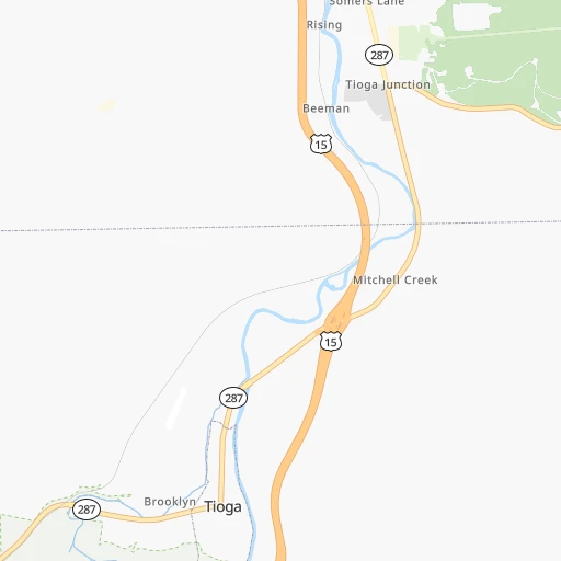
Roadmap (route) to go from Nielsen Airport to Glen Burnie detailed above, you can also see the course layout on the map.
While doing trip Nielsen (airport) - Glen Burnie by car, the calculated route ends at a distance , or more straight.
Distance and duration of the route between Nielsen (airport) and Glen Burnie
Calculation of distance and route from Glen Burnie to Nielsen (airport) :
309.5369.1 km5h40mn
Continue onto Upper Bayer Creek Road 0h1mn 658 mTurn left onto PA 287 0h1mn 1.4 kmKeep right and take US 15 South toward Mansfield 1h58mn 93.7 kmKeep right onto US 15 and take US 15 South toward Lewisburg 0h0mn 289 mKeep right onto US 15 0h2mn 1.5 kmTurn slight left onto Montgomery Pike 1h38mn 47.0 kmTurn sharp right onto Grangers Road 0h1mn 698 mTurn sharp left onto Park Road 0h1mn 1.2 kmTurn right onto Park Road 0h1mn 900 mKeep left onto Fisher Road 0h4mn 3.8 kmAt roundabout, take exit 1 onto Mill Road 0h0mn 157 mAt roundabout, take exit 2 onto Airport Road 0h2mn 1.8 kmKeep right 0h0mn 47 mTurn slight right onto Susquehanna Trail 0h4mn 3.3 kmContinue onto Market Street 1h37mn 48.7 kmKeep right and take US 22 East, US 322 East toward Harrisburg 0h23mn 27.2 kmTurn left onto Paxton Street 0h0mn 332 mTurn right onto South 13th Street 0h0mn 82 mKeep right and take I 83 South toward York 0h2mn 2.7 kmKeep right onto Veterans of Foreign Wars of the United States Memorial Highway and take I 83 South toward York, Baltimore 0h21mn 31.7 kmKeep right toward I 83 Business, PA 181 0h0mn 291 mKeep left toward I 83 Business, PA 181 0h0mn 53 mTurn right onto North George Street 0h7mn 5.2 kmTurn slight right onto South George Street 0h0mn 167 mKeep right onto I 83 BUS 0h2mn 3.1 kmKeep right onto I 83 BUS and take I 83 South toward Baltimore 1h40mn 59.9 kmKeep right onto I 83 and take I 695 West, I 83 West toward Baltimore 0h2mn 2.1 kmKeep right onto I 83 and take I 83 South, MD 25 toward Baltimore, Falls Road 0h0mn 275 mKeep left onto I 83 and take I 83 South toward Baltimore 0h12mn 13.8 kmKeep right and take MD 2 South toward Saint Paul Street 0h0mn 176 mKeep left and take MD 2 South toward Saint Paul Street 0h1mn 1.1 kmKeep right onto Saint Paul Place 0h2mn 1.6 kmTurn right onto East Lee Street 0h0mn 139 mTurn left onto South Charles Street 0h1mn 594 mTurn right onto West Cross Street 0h0mn 102 mTurn left onto South Hanover Street 0h5mn 3.9 kmContinue onto Potee Street and take MD 2 South toward Ritchie Highway 0h9mn 8.8 kmTurn right onto Georgia Avenue Northeast 0h0mn 100 mTurn left onto Crain Highway North 0h1mn 611 mTurn left onto 1st Avenue Southeast 0h0mn 124 mArrive at destination 0h0mn 0 m
Travel from Nielsen (airport) (Maryland) to a selection of major cities.
Distances from Nielsen Airport to biggest cities in Pennsylvania
- Mount Lebanon,32,730 inhabitants.300 km
- Bethel Park,32,118 inhabitants.301 km
- Wayne,30,892 inhabitants.256 km
- Radnor,30,878 inhabitants.257 km
- Williamsport,29,201 inhabitants.77 km
- Monroeville,28,176 inhabitants.278 km
- Cranberry Township,28,098 inhabitants.284 km
- Drexel Hill,28,043 inhabitants.269 km
- Plum,27,505 inhabitants.270 km
- Back Mountain,26,973 inhabitants.115 km
- Easton,26,915 inhabitants.211 km
- Pennsport,26,000 inhabitants.278 km
- Lebanon,25,534 inhabitants.186 km
- Whitehall Township,24,896 inhabitants.196 km
- Hazleton,24,825 inhabitants.145 km
- Springfield,23,363 inhabitants.269 km
- Pottstown,22,664 inhabitants.225 km
- New Castle,22,375 inhabitants.286 km
- Allison Park,21,552 inhabitants.280 km
- Chambersburg,20,691 inhabitants.225 km
Other major cities in country :
- Seattle [WA], 684,451 inhabitants. 3,575 km
- Denver [CO], 682,545 inhabitants. 2,348 km
- El Paso [TX], 681,124 inhabitants. 2,831 km
- Detroit [MI], 677,116 inhabitants. 490 km
- Boston [MA], 667,137 inhabitants. 504 km
- Memphis [TN], 655,770 inhabitants. 1,351 km
- New South Memphis [TN], 641,608 inhabitants. 1,356 km
- Portland [OR], 632,309 inhabitants. 3,636 km
- Oklahoma City [OK], 631,346 inhabitants. 1,905 km
- Las Vegas [NV], 623,747 inhabitants. 3,319 km
- Baltimore [MD], 621,849 inhabitants. 296 km
- Washington, D.C. [DC], 601,723 inhabitants. 337 km
- Milwaukee [WI], 600,155 inhabitants. 892 km
- South Boston [MA], 571,281 inhabitants. 505 km
- Albuquerque [NM], 559,121 inhabitants. 2,666 km
- Tucson [AZ], 531,641 inhabitants. 3,165 km
- Nashville [TN], 530,852 inhabitants. 1,050 km
- Fresno [CA], 520,052 inhabitants. 3,677 km
- Sacramento [CA], 490,712 inhabitants. 3,745 km
- Kansas City [MO], 475,378 inhabitants. 1,506 km
Route from Glen Burnie to major cities (United States).
- Distance Glen Burnie New York City282 km
- Distance Glen Burnie Los Angeles3,729 km
- Distance Glen Burnie Chicago979 km
- Distance Glen Burnie Brooklyn282 km
- Distance Glen Burnie Houston2,007 km
- Distance Glen Burnie Queens292 km
- Distance Glen Burnie Philadelphia153 km
- Distance Glen Burnie Phoenix3,222 km
- Distance Glen Burnie Manhattan290 km
- Distance Glen Burnie San Antonio2,276 km
- Distance Glen Burnie San Diego3,692 km
- Distance Glen Burnie The Bronx301 km
- Distance Glen Burnie Dallas1,947 km
- Distance Glen Burnie San Jose3,921 km
- Distance Glen Burnie Austin2,164 km
- Distance Glen Burnie Jacksonville1,085 km
- Distance Glen Burnie San Francisco3,951 km
- Distance Glen Burnie Columbus554 km
- Distance Glen Burnie Fort Worth1,992 km
- Distance Glen Burnie Indianapolis822 km
Nearest cities to Nielsen (airport) :
- Philadelphia, 1,567,442 inhabitants. 275 km
- Baltimore, 621,849 inhabitants. 296 km
- Pittsburgh, 304,391 inhabitants. 290 km
- Newark, 281,944 inhabitants. 281 km
- Buffalo, 258,071 inhabitants. 179 km
- Rochester, 209,802 inhabitants. 143 km
- Paterson, 147,754 inhabitants. 272 km
- Syracuse, 144,142 inhabitants. 150 km
- Elizabeth, 129,007 inhabitants. 282 km
- Amherst, 122,366 inhabitants. 180 km
- Allentown, 120,207 inhabitants. 201 km
- Edison, 102,548 inhabitants. 277 km
- Columbia, 99,615 inhabitants. 299 km
- Erie, 99,475 inhabitants. 245 km
- Toms River, 88,791 inhabitants. 330 km
- Reading, 87,879 inhabitants. 204 km
- Germantown, 86,395 inhabitants. 306 km
- Clifton, 86,334 inhabitants. 275 km
- Trenton, 84,225 inhabitants. 276 km
- Scranton, 77,118 inhabitants. 135 km
- Camden, 76,119 inhabitants. 280 km
- Cheektowaga, 75,178 inhabitants. 172 km
- Bethlehem, 74,892 inhabitants. 207 km
- Wilmington, 71,948 inhabitants. 277 km
- Silver Spring, 71,452 inhabitants. 326 km
- Cherry Hill, 70,475 inhabitants. 283 km
- Frederick, 69,479 inhabitants. 280 km
- Glen Burnie, 67,639 inhabitants. 310 km
- Gaithersburg, 67,456 inhabitants. 309 km
- Rockville, 66,980 inhabitants. 316 km
- Ellicott City, 65,834 inhabitants. 297 km
- East Orange, 64,949 inhabitants. 277 km
- Dundalk, 63,597 inhabitants. 302 km
- Irvington, 61,323 inhabitants. 277 km
- Utica, 61,100 inhabitants. 204 km
- Bethesda, 60,858 inhabitants. 327 km
- Vineland, 60,818 inhabitants. 324 km
- Lancaster, 59,339 inhabitants. 221 km
- Reston, 58,404 inhabitants. 329 km
- South Vineland, 58,122 inhabitants. 328 km
- Bowie, 58,025 inhabitants. 333 km
- Wayne, 57,915 inhabitants. 263 km
- Center City, 57,239 inhabitants. 275 km
- New Brunswick, 57,035 inhabitants. 276 km
- Union, 56,771 inhabitants. 276 km
- Piscataway, 56,044 inhabitants. 279 km
- Towson, 55,197 inhabitants. 284 km
- Jackson, 54,856 inhabitants. 306 km
- Lakewood, 53,805 inhabitants. 318 km
- Levittown, 52,983 inhabitants. 276 km
Location Nielsen (airport) (Pennsylvania) :
| Country flag |  |
| Location | Nielsen (airport) |
| State | Pennsylvania |
| County | Tioga County |
| Country | United States |
| Country code / ISO 2 | US |
| Latitude | 41.9206200 |
| Longitude | -77.1401000 |
| Altitude | 319 meters |
| Time zone | America/New_York |
Location Glen Burnie (Maryland) :
| Country flag | |
| Location | Glen Burnie |
| State | Maryland |
| County | Anne Arundel County |
| Country | United States |
| Country code / ISO 2 | US |
| Latitude | 39.1626100 |
| Longitude | -76.6246900 |
| Altitude | 17 meters |
| Time zone | America/New_York |


