


How to get from Arraias (airport) (Tocantins) to Itapaci (Goiás)
Calculate route from Arraias (airport) (Tocantins, Brazil) to Itapaci (Goiás, Brazil).
The flight distance (as the crow flies) between Arraias (airport) and Itapaci is 358.3 km.
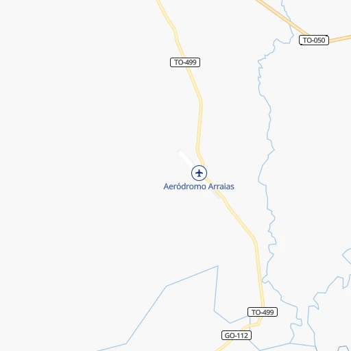
Roadmap (route) to go from Arraias Airport to Itapaci detailed above, you can also see the course layout on the map.
While doing trip Arraias (airport) - Itapaci by car, the calculated route ends at a distance , or more straight.
Distance and duration of the route between Arraias (airport) and Itapaci
Calculation of distance and route from Itapaci to Arraias (airport) :
358.3496.4 km9h33mn
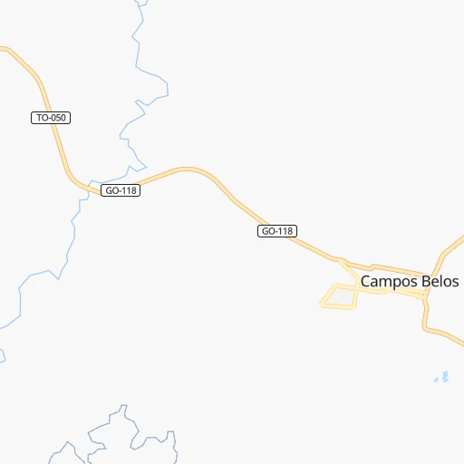
Continue 0h0mn 212 mTurn sharp right onto TO-499 0h19mn 9.7 kmTurn left onto GO-112 1h41mn 21.0 kmTurn right onto GO-118 1h13mn 80.1 kmAt roundabout, take exit 4 onto Avenida Pedro Álvares Cabral 0h0mn 91 mTurn slight right onto Avenida Brasília 1h55mn 66.1 kmKeep right 0h0mn 30 mAt roundabout, take exit 2 onto GO-239 1h59mn 69.4 kmAt roundabout, take exit 2 onto Avenida Doutor Ari Valadão Filho 0h0mn 252 mAt roundabout, take exit 3 onto Avenida Doutor Ari Valadão Filho 0h0mn 147 mTurn sharp left onto Rua Rio Preto 0h0mn 58 mTurn right onto Rua Anhanguera 0h0mn 136 mTurn left onto Rua Treze de Maio 0h0mn 67 mTurn right onto Rua do Progresso 0h0mn 126 mTurn left onto GO-132 0h0mn 218 mKeep left onto GO-132 1h19mn 56.4 kmAt roundabout, take exit 1 0h0mn 80 mTurn slight right onto GO-237 0h25mn 25.0 kmAt roundabout, take exit 2 onto GO-237 0h3mn 2.7 kmTurn right onto Avenida Anapolina 0h5mn 5.2 kmAt roundabout, take exit 2 onto Avenida Anapolina 0h1mn 656 mAt roundabout, take exit 1 onto Avenida Anapolina 0h2mn 1.9 kmAt roundabout, take exit 1 onto GO-237 1h14mn 81.2 kmKeep left onto GO-237 0h0mn 102 mAt roundabout, take exit 2 onto GO-237 0h4mn 4.5 kmTurn left onto Avenida Serra Dourada 0h2mn 1.7 kmTurn slight left onto BR-153 0h8mn 10.1 kmKeep right onto BR-153 0h25mn 30.0 kmKeep right 0h0mn 47 mAt roundabout, take exit 1 onto GO-338 0h3mn 2.8 kmTurn left onto GO-459 1h31mn 25.7 kmTurn left onto GO-459 0h0mn 28 mTurn left onto GO-154 0h1mn 628 mTurn right onto Rua Manoel de Oliveira 0h0mn 222 mArrive at destination 0h0mn 0 m
Travel from Arraias (airport) (Goiás) to a selection of major cities.
Distances from Arraias Airport to biggest cities in Tocantins
Other major cities in country :
- Sao Bernardo do Campo [27], 743,372 inhabitants. 1,188 km
- Campo Grande [11], 729,151 inhabitants. 1,168 km
- Jaboatao [30], 702,621 inhabitants. 1,407 km
- Osasco [27], 677,856 inhabitants. 1,170 km
- Santo Andre [27], 662,373 inhabitants. 1,185 km
- Joao Pessoa [17], 650,883 inhabitants. 1,472 km
- Jaboatao dos Guararapes [30], 630,008 inhabitants. 1,409 km
- Contagem [15], 627,123 inhabitants. 826 km
- Ribeirao Preto [27], 619,746 inhabitants. 913 km
- Sao Jose dos Campos [27], 613,764 inhabitants. 1,135 km
- Uberlandia [15], 563,536 inhabitants. 673 km
- Sorocaba [27], 558,862 inhabitants. 1,168 km
- Cuiaba [14], 521,934 inhabitants. 1,034 km
- Aparecida de Goiania [29], 510,770 inhabitants. 493 km
- Aracaju [28], 490,175 inhabitants. 1,094 km
- Feira de Santana [05], 481,911 inhabitants. 864 km
- Londrina [18], 471,832 inhabitants. 1,231 km
- Juiz de Fora [15], 470,193 inhabitants. 1,043 km
- Belford Roxo [21], 466,096 inhabitants. 1,145 km
- Joinville [26], 461,304 inhabitants. 1,493 km
Route from Itapaci to major cities (Brazil).
- Distance Itapaci Sao Paulo1,005 km
- Distance Itapaci Rio de Janeiro1,110 km
- Distance Itapaci Salvador1,213 km
- Distance Itapaci Fortaleza1,738 km
- Distance Itapaci Belo Horizonte813 km
- Distance Itapaci Brasilia197 km
- Distance Itapaci Curitiba1,167 km
- Distance Itapaci Manaus1,750 km
- Distance Itapaci Recife1,774 km
- Distance Itapaci Belem1,507 km
- Distance Itapaci Porto Alegre1,688 km
- Distance Itapaci Guarulhos999 km
- Distance Itapaci Campinas923 km
- Distance Itapaci Nova Iguacu1,080 km
- Distance Itapaci Maceio1,613 km
- Distance Itapaci Sao Luis1,498 km
- Distance Itapaci Duque de Caxias1,092 km
- Distance Itapaci Natal1,870 km
- Distance Itapaci Teresina1,323 km
- Distance Itapaci Sao Bernardo do Campo1,022 km
Nearest cities to Arraias (airport) :
- Brasilia, 2,207,718 inhabitants. 327 km
- Palmas, 196,272 inhabitants. 355 km
- Planaltina, 189,412 inhabitants. 300 km
- Barreiras, 158,292 inhabitants. 228 km
- Planaltina, 88,853 inhabitants. 282 km
- Formosa, 81,232 inhabitants. 284 km
- Gurupi, 64,789 inhabitants. 278 km
- Goianesia, 47,883 inhabitants. 351 km
- Januaria, 34,811 inhabitants. 387 km
- Sao Francisco, 33,033 inhabitants. 392 km
- Porangatu, 32,758 inhabitants. 250 km
- Jaragua, 30,409 inhabitants. 403 km
- Uruacu, 30,088 inhabitants. 296 km
- Niquelandia, 27,541 inhabitants. 235 km
- Santa Maria da Vitoria, 23,488 inhabitants. 294 km
- Itaberai, 22,129 inhabitants. 459 km
- Posse, 20,003 inhabitants. 131 km
- Ceres, 18,759 inhabitants. 388 km
- Buritis, 16,243 inhabitants. 293 km
- Rubiataba, 16,128 inhabitants. 395 km
- Padre Bernardo, 16,118 inhabitants. 282 km
- Itapaci, 16,117 inhabitants. 359 km
- Campos Belos, 15,582 inhabitants. 12 km
- Formosa do Rio Preto, 14,354 inhabitants. 287 km
- Taguatinga, 13,711 inhabitants. 85 km
- Pirenopolis, 13,615 inhabitants. 386 km
- Correntina, 13,186 inhabitants. 246 km
- Itacarambi, 13,084 inhabitants. 380 km
- Manga, 11,732 inhabitants. 373 km
- Riachao das Neves, 11,236 inhabitants. 258 km
- Uruana, 10,258 inhabitants. 409 km
- Alvorada, 10,232 inhabitants. 251 km
- Arinos, 10,077 inhabitants. 333 km
- Rialma, 9,270 inhabitants. 387 km
- Iaciara, 9,207 inhabitants. 122 km
- Sao Joao da Ponte, 8,373 inhabitants. 448 km
- Barro Alto, 7,633 inhabitants. 308 km
- Sao Desiderio, 7,295 inhabitants. 220 km
- Varzelandia, 6,397 inhabitants. 429 km
- Carmo do Rio Verde, 6,053 inhabitants. 400 km
- Sao Domingos, 4,784 inhabitants. 74 km
- Cavalcante, 3,747 inhabitants. 106 km
Location Arraias (airport) (Tocantins) :
| Country flag |  |
| Location | Arraias (airport) |
| State | Tocantins |
| County | Arraias |
| Country | Brazil |
| Country code / ISO 2 | BR |
| Latitude | -13.0238900 |
| Longitude | -46.8855600 |
| Altitude | 0 meters |
| Time zone | America/Araguaina |
Location Itapaci (Goiás) :
| Country flag | |
| Location | Itapaci |
| State | Goiás |
| County | Itapaci |
| Country | Brazil |
| Country code / ISO 2 | BR |
| Latitude | -14.9508300 |
| Longitude | -49.5494400 |
| Altitude | 0 meters |
| Time zone | America/Sao_Paulo |