
How to get from Cascavel (airport) (Paraná) to Videira (Santa Catarina)
Calculate route from Cascavel (airport) (Paraná, Brazil) to Videira (Santa Catarina, Brazil).
The flight distance (as the crow flies) between Cascavel (airport) and Videira is 323.8 km.
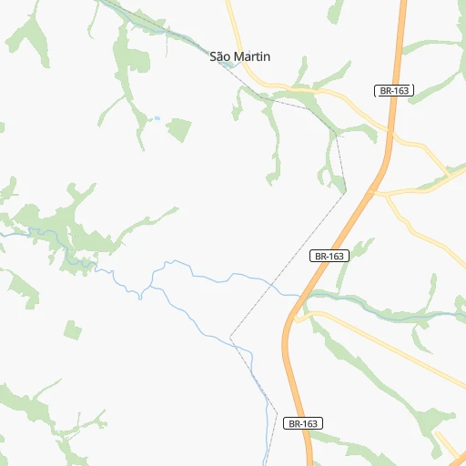
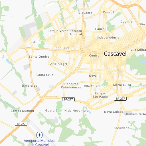
Roadmap (route) to go from Cascavel Airport to Videira detailed above, you can also see the course layout on the map.
While doing trip Cascavel (airport) - Videira by car, the calculated route ends at a distance , or more straight.
Distance and duration of the route between Cascavel (airport) and Videira
Calculation of distance and route from Videira to Cascavel (airport) :
323.8442.8 km6h25mn
Continue 0h3mn 1.3 kmContinue 0h0mn 160 mTurn right onto Avenida Doutor Ezuel Portes 0h0mn 234 mKeep left 0h1mn 999 mTurn sharp left onto BR-277 0h4mn 7.1 kmKeep right and drive toward Capitão Leônidas Marques, Lindoeste, Francisco Beltrão, Retorno 0h22mn 31.2 kmContinue onto BR-163 1h37mn 43.7 kmContinue onto Rodovia Deputado Arnaldo Faiviro Busato 0h16mn 19.3 kmAt roundabout, take exit 2 onto PR-182 1h1mn 76.1 kmAt roundabout, take exit 1 onto PR-180 0h5mn 5.1 kmTurn slight right onto Avenida Alvorada 0h1mn 324 mKeep left onto PRC-280 1h33mn 38.3 kmContinue onto Rodovia Manoel Lustosa Martins and drive toward Clevelândia, Palmas, Xanxerê 2h38mn 133.7 kmTurn right onto SC-150 0h24mn 12.0 kmTurn right 0h0mn 85 mTurn slight left 0h0mn 52 mTurn slight right onto BR-153 0h2mn 2.6 kmTurn left onto Rodovia Coronel Manoel Inácio de Araújo Pimpão 0h15mn 15.3 kmTurn left onto SC-464 0h19mn 19.0 kmTurn left onto Rua João Domingos Cantu 0h0mn 300 mTurn right onto Avenida Pio XII 0h0mn 239 mTurn left onto Rua Saul Brandalise 0h0mn 346 mTurn left onto Rua José Sartorel 0h4mn 4.4 kmTurn right 0h3mn 1.4 kmKeep right 0h2mn 1.2 kmTurn slight right onto Rodovia Waldemar Kleinubing 0h11mn 11.5 kmTurn left onto VDR-070 0h15mn 10.9 kmTurn left onto Rua Luiz Viecelli 0h1mn 857 mTurn sharp right 0h0mn 39 mTurn right onto Rua Luiz Viecelli 0h1mn 493 mTurn left onto Rodovia Waldemar Kleinubing 0h0mn 73 mAt roundabout, take exit 2 onto Rua Severino José Pasqual 0h3mn 3.5 kmKeep left onto Rua Vitória 0h0mn 139 mTurn right onto Praça Nereu Ramos 0h0mn 364 mTurn right onto Rua Coronel Schmidt 0h0mn 410 mTurn sharp right onto Rua Campos Novos 0h0mn 155 mMake a U-turn onto Rua Campos Novos 0h0mn 123 mArrive at destination 0h0mn 0 m
Travel from Cascavel (airport) (Santa Catarina) to a selection of major cities.
Distances from Cascavel Airport to biggest cities in Paraná
- Campo Mourao,75,401 inhabitants.156 km
- Paranavai,72,848 inhabitants.239 km
- Pato Branco,65,754 inhabitants.160 km
- Telemaco Borba,58,880 inhabitants.301 km
- Francisco Beltrao,57,618 inhabitants.128 km
- Cianorte,55,994 inhabitants.174 km
- Rolandia,51,004 inhabitants.287 km
- Uniao da Vitoria,48,741 inhabitants.278 km
- Cornelio Procopio,48,487 inhabitants.354 km
- Irati,45,830 inhabitants.292 km
- Ibipora,44,790 inhabitants.315 km
- Marechal Candido Rondon,43,028 inhabitants.75 km
- Castro,42,091 inhabitants.353 km
- Piraquara,41,161 inhabitants.449 km
- Palmas,39,150 inhabitants.224 km
- Mandaguari,38,238 inhabitants.246 km
- Santo Antonio da Platina,35,260 inhabitants.396 km
- Jacarezinho,35,090 inhabitants.413 km
- Paicandu,34,365 inhabitants.226 km
- Medianeira,34,069 inhabitants.68 km
Other major cities in country :
- Campo Grande [11], 729,151 inhabitants. 521 km
- Jaboatao [30], 702,621 inhabitants. 2,713 km
- Osasco [27], 677,856 inhabitants. 700 km
- Santo Andre [27], 662,373 inhabitants. 722 km
- Joao Pessoa [17], 650,883 inhabitants. 2,810 km
- Jaboatao dos Guararapes [30], 630,008 inhabitants. 2,718 km
- Contagem [15], 627,123 inhabitants. 1,123 km
- Ribeirao Preto [27], 619,746 inhabitants. 721 km
- Sao Jose dos Campos [27], 613,764 inhabitants. 800 km
- Uberlandia [15], 563,536 inhabitants. 865 km
- Sorocaba [27], 558,862 inhabitants. 636 km
- Cuiaba [14], 521,934 inhabitants. 1,081 km
- Aparecida de Goiania [29], 510,770 inhabitants. 1,012 km
- Aracaju [28], 490,175 inhabitants. 2,338 km
- Feira de Santana [05], 481,911 inhabitants. 2,085 km
- Juiz de Fora [15], 470,193 inhabitants. 1,098 km
- Belford Roxo [21], 466,096 inhabitants. 1,058 km
- Joinville [26], 461,304 inhabitants. 489 km
- Niteroi [21], 456,456 inhabitants. 1,083 km
- Sao Joao de Meriti [21], 454,849 inhabitants. 1,059 km
Route from Videira to major cities (Brazil).
- Distance Videira Sao Paulo596 km
- Distance Videira Rio de Janeiro925 km
- Distance Videira Salvador2,044 km
- Distance Videira Fortaleza2,919 km
- Distance Videira Belo Horizonte1,079 km
- Distance Videira Brasilia1,294 km
- Distance Videira Curitiba257 km
- Distance Videira Manaus2,824 km
- Distance Videira Recife2,720 km
- Distance Videira Belem2,859 km
- Distance Videira Porto Alegre337 km
- Distance Videira Goiania1,166 km
- Distance Videira Guarulhos610 km
- Distance Videira Campinas616 km
- Distance Videira Nova Iguacu910 km
- Distance Videira Maceio2,520 km
- Distance Videira Sao Luis2,821 km
- Distance Videira Duque de Caxias920 km
- Distance Videira Natal2,904 km
- Distance Videira Teresina2,596 km
Nearest cities to Cascavel (airport) :
- Londrina, 471,832 inhabitants. 303 km
- Maringa, 311,724 inhabitants. 236 km
- Foz do Iguacu, 293,523 inhabitants. 125 km
- Cascavel, 257,172 inhabitants. 7 km
- Presidente Prudente, 209,502 inhabitants. 386 km
- Dourados, 162,202 inhabitants. 337 km
- Chapeco, 160,157 inhabitants. 249 km
- Guarapuava, 150,850 inhabitants. 210 km
- Toledo, 119,313 inhabitants. 40 km
- Umuarama, 107,319 inhabitants. 139 km
- Apucarana, 107,085 inhabitants. 262 km
- Arapongas, 97,512 inhabitants. 275 km
- Erechim, 96,087 inhabitants. 318 km
- Cambe, 91,080 inhabitants. 296 km
- Sarandi, 84,697 inhabitants. 239 km
- Campo Mourao, 75,401 inhabitants. 156 km
- Paranavai, 72,848 inhabitants. 239 km
- Pato Branco, 65,754 inhabitants. 160 km
- Cacador, 63,726 inhabitants. 318 km
- Santa Rosa, 58,957 inhabitants. 334 km
- Telemaco Borba, 58,880 inhabitants. 301 km
- Francisco Beltrao, 57,618 inhabitants. 128 km
- Cianorte, 55,994 inhabitants. 174 km
- Ponta Pora, 55,763 inhabitants. 356 km
- Concordia, 55,367 inhabitants. 289 km
- Rolandia, 51,004 inhabitants. 287 km
- Uniao da Vitoria, 48,741 inhabitants. 278 km
- Cornelio Procopio, 48,487 inhabitants. 354 km
- Irati, 45,830 inhabitants. 292 km
- Ibipora, 44,790 inhabitants. 315 km
- Marechal Candido Rondon, 43,028 inhabitants. 75 km
- Videira, 42,440 inhabitants. 324 km
- Palmas, 39,150 inhabitants. 224 km
- Paraguacu Paulista, 39,120 inhabitants. 415 km
- Mandaguari, 38,238 inhabitants. 246 km
- Navirai, 36,452 inhabitants. 227 km
- Paicandu, 34,365 inhabitants. 226 km
- Medianeira, 34,069 inhabitants. 68 km
- Xanxere, 32,957 inhabitants. 236 km
- Curitibanos, 32,141 inhabitants. 387 km
- Palmeira das Missoes, 30,954 inhabitants. 323 km
- Porto Uniao, 28,907 inhabitants. 279 km
- Marialva, 26,000 inhabitants. 242 km
- Rancharia, 25,530 inhabitants. 407 km
- Capinzal, 23,795 inhabitants. 322 km
- Joacaba, 23,516 inhabitants. 314 km
- Palotina, 23,059 inhabitants. 87 km
- Dois Vizinhos, 22,766 inhabitants. 93 km
- Campos Novos, 22,563 inhabitants. 351 km
- Pirapozinho, 21,709 inhabitants. 366 km
Location Cascavel (airport) (Paraná) :
| Country flag |  |
| Location | Cascavel (airport) |
| State | Paraná |
| County | Cascavel |
| Country | Brazil |
| Country code / ISO 2 | BR |
| Latitude | -25.0003000 |
| Longitude | -53.5008000 |
| Altitude | 0 meters |
| Time zone | America/Sao_Paulo |
Location Videira (Santa Catarina) :
| Country flag | |
| Location | Videira |
| State | Santa Catarina |
| County | Videira |
| Country | Brazil |
| Country code / ISO 2 | BR |
| Latitude | -27.0083300 |
| Longitude | -51.1516700 |
| Altitude | 0 meters |
| Time zone | America/Sao_Paulo |
