
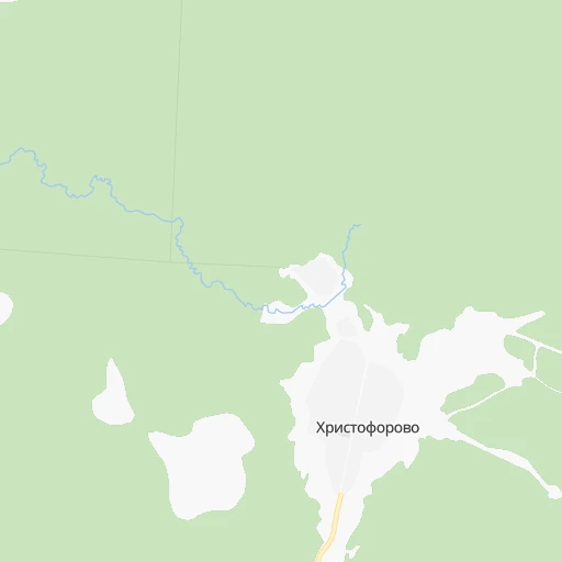


How to get from Stantsiya Khristoforovo (Kirov) to Yarensk (Arkhangelskaya)
Calculate route from Stantsiya Khristoforovo (Kirov, Russia) to Yarensk (Arkhangelskaya, Russia).
The flight distance (as the crow flies) between Stantsiya Khristoforovo and Yarensk is 171.3 km.
Roadmap (route) to go from Stantsiya Khristoforovo to Yarensk detailed above, you can also see the course layout on the map.
While doing trip Stantsiya Khristoforovo - Yarensk by car, the calculated route ends at a distance , or more straight.
Distance and duration of the route between Stantsiya Khristoforovo and Yarensk
Calculation of distance and route from Yarensk to Stantsiya Khristoforovo :
171.3274.7 km5h26mn
Continue 0h0mn 127 mTurn left onto улица В.Козлова 0h1mn 354 mTurn right onto Первомайская улица 0h2mn 1.0 kmKeep left 0h7mn 2.0 kmTurn left 0h26mn 7.0 kmTurn right 0h7mn 1.9 kmKeep right 0h15mn 4.0 kmTurn slight left 0h8mn 2.0 kmTurn slight right 0h4mn 2.0 kmContinue onto 11К-348 0h1mn 631 mTurn slight left onto 11К-348 0h22mn 11.2 kmTurn right onto 11К-331 1h48mn 28.6 kmKeep right 0h0mn 140 mContinue 0h0mn 341 mTurn slight right onto А-123 0h5mn 4.5 kmTurn right onto улица Чиркова 0h23mn 25.9 kmTurn left onto А-123 0h4mn 3.6 kmTurn left onto Складская улица 0h2mn 1.6 kmTurn left onto улица Кутузова 0h6mn 3.3 kmTurn slight right onto 11Р-006 1h14mn 86.8 kmTurn slight left onto 11Р-006 1h9mn 86.7 kmTurn sharp right onto Октябрьская улица 0h1mn 664 mTurn left onto улица Урицкого 0h0mn 188 mArrive at destination 0h0mn 0 m
Travel from Stantsiya Khristoforovo (Arkhangelskaya) to a selection of major cities.
Distances from Stantsiya Khristoforovo to biggest cities in Kirov
Other major cities in country :
- Yaroslavl [88], 606,730 inhabitants. 555 km
- Barnaul [04], 599,579 inhabitants. 2,323 km
- Vladivostok [59], 587,022 inhabitants. 5,668 km
- Irkutsk [20], 586,695 inhabitants. 3,500 km
- Khabarovsk [30], 579,000 inhabitants. 5,366 km
- Khabarovsk Vtoroy [30], 578,303 inhabitants. 5,372 km
- Orenburg [55], 550,204 inhabitants. 1,123 km
- Novokuznetsk [29], 539,616 inhabitants. 2,478 km
- Ryazan' [62], 520,173 inhabitants. 829 km
- Tyumen [78], 519,119 inhabitants. 1,122 km
- Lipetsk [43], 515,655 inhabitants. 1,034 km
- Penza [57], 512,602 inhabitants. 867 km
- Naberezhnyye Chelny [73], 509,870 inhabitants. 649 km
- Kalininskiy [42], 504,641 inhabitants. 929 km
- Astrakhan [07], 502,533 inhabitants. 1,620 km
- Makhachkala [17], 497,959 inhabitants. 1,995 km
- Tomsk [75], 485,519 inhabitants. 2,203 km
- Kemerovo [29], 477,090 inhabitants. 2,327 km
- Tula [76], 468,825 inhabitants. 940 km
- Cheboksary [16], 446,781 inhabitants. 530 km
Route from Yarensk to major cities (Russia).
- Distance Yarensk Moscow969 km
- Distance Yarensk Saint Petersburg1,038 km
- Distance Yarensk Novosibirsk2,087 km
- Distance Yarensk Yekaterinburg877 km
- Distance Yarensk Nizhniy Novgorod711 km
- Distance Yarensk Samara1,000 km
- Distance Yarensk Omsk1,606 km
- Distance Yarensk Kazan710 km
- Distance Yarensk Rostov-na-Donu1,764 km
- Distance Yarensk Chelyabinsk1,055 km
- Distance Yarensk Ufa917 km
- Distance Yarensk Volgograd1,524 km
- Distance Yarensk Perm609 km
- Distance Yarensk Krasnoyarsk2,541 km
- Distance Yarensk Saratov1,197 km
- Distance Yarensk Voronezh1,311 km
- Distance Yarensk Tol'yatti962 km
- Distance Yarensk Krasnodar2,014 km
- Distance Yarensk Ulyanovsk874 km
- Distance Yarensk Izhevsk636 km
Nearest cities to Stantsiya Khristoforovo :
- Kirov, 457,383 inhabitants. 289 km
- Kirovo-Chepetsk, 90,252 inhabitants. 304 km
- Kotlas, 59,180 inhabitants. 52 km
- Koryazhma, 42,627 inhabitants. 47 km
- Velikiy Ustyug, 32,642 inhabitants. 53 km
- Slobodskoy, 32,361 inhabitants. 291 km
- Shar'ya, 29,800 inhabitants. 298 km
- Mirnyy, 29,341 inhabitants. 154 km
- Kotel'nich, 27,600 inhabitants. 295 km
- Manturovo, 18,817 inhabitants. 319 km
- Vetluzhskiy, 13,229 inhabitants. 297 km
- Vychegodskiy, 12,923 inhabitants. 43 km
- Lyangasovo, 12,626 inhabitants. 292 km
- Luza, 11,935 inhabitants. 30 km
- Mikun', 11,502 inhabitants. 220 km
- Raduzhnyy, 10,792 inhabitants. 299 km
- Vakhrushi, 10,330 inhabitants. 291 km
- Zheshart, 9,534 inhabitants. 180 km
- Raduzhnyy, 9,514 inhabitants. 206 km
- Nikol'sk, 8,487 inhabitants. 181 km
- Orlov, 8,400 inhabitants. 278 km
- Murygino, 7,996 inhabitants. 270 km
- Krasavino, 7,912 inhabitants. 43 km
- Orichi, 7,805 inhabitants. 295 km
- Darovskoy, 7,261 inhabitants. 240 km
- Murashi, 7,190 inhabitants. 192 km
- Vizinga, 6,788 inhabitants. 155 km
- Kichmengskiy Gorodok, 6,623 inhabitants. 130 km
- Vakhtan, 6,529 inhabitants. 328 km
- Dem'yanovo, 6,148 inhabitants. 62 km
- Syava, 5,339 inhabitants. 325 km
- Leninskoye, 5,323 inhabitants. 288 km
- Usogorsk, 5,308 inhabitants. 289 km
- Kumeny, 5,090 inhabitants. 345 km
- Oparino, 4,986 inhabitants. 129 km
- Svecha, 4,971 inhabitants. 292 km
- Krasnoborsk, 4,838 inhabitants. 102 km
- Verkhoshizhem'ye, 4,800 inhabitants. 338 km
- Vokhma, 4,663 inhabitants. 221 km
- Ponazyrevo, 4,568 inhabitants. 288 km
- Urdoma, 4,460 inhabitants. 117 km
- Lal'sk, 4,400 inhabitants. 25 km
- Podosinovets, 4,106 inhabitants. 70 km
- Yarensk, 3,929 inhabitants. 172 km
- Strizhi, 3,881 inhabitants. 295 km
- Verkhnyaya Toyma, 3,790 inhabitants. 191 km
- Shipitsyno, 3,780 inhabitants. 58 km
- Kizema, 3,644 inhabitants. 133 km
- Kologriv, 3,605 inhabitants. 283 km
- Mirnyy, 3,508 inhabitants. 269 km
Location Stantsiya Khristoforovo (Kirov) :
| Country flag |  |
| Location | Stantsiya Khristoforovo |
| State | Kirov |
| County | |
| Country | Russia |
| Country code / ISO 2 | RU |
| Latitude | 60.8976000 |
| Longitude | 47.2591000 |
| Altitude | 0 meters |
| Time zone | Europe/Kirov |
Location Yarensk (Arkhangelskaya) :
| Country flag | |
| Location | Yarensk |
| State | Arkhangelskaya |
| County | |
| Country | Russia |
| Country code / ISO 2 | RU |
| Latitude | 62.1675500 |
| Longitude | 49.0916200 |
| Altitude | 0 meters |
| Time zone | Europe/Moscow |