

How to get from Stantsiya Kasnya (Smolensk) to Novozybkov (Bryansk Oblast)
Calculate route from Stantsiya Kasnya (Smolensk, Russia) to Novozybkov (Bryansk Oblast, Russia).
The flight distance (as the crow flies) between Stantsiya Kasnya and Novozybkov is 353.6 km.
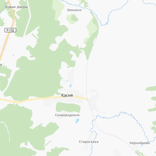
Roadmap (route) to go from Stantsiya Kasnya to Novozybkov detailed above, you can also see the course layout on the map.
While doing trip Stantsiya Kasnya - Novozybkov by car, the calculated route ends at a distance , or more straight.
Distance and duration of the route between Stantsiya Kasnya and Novozybkov
Calculation of distance and route from Novozybkov to Stantsiya Kasnya :
353.6445.4 km7h29mn
Continue 0h1mn 414 mTurn left onto 66Н-0216 0h7mn 3.3 kmTurn left onto «Золотое кольцо» 0h15mn 18.0 kmKeep right 0h0mn 245 mTurn left onto М-1 0h4mn 4.5 kmTurn left onto площадь Ефремова 0h0mn 167 mTurn right onto улица Космонавтов 0h0mn 473 mAt roundabout, take exit 3 onto Советская площадь 0h26mn 27.7 kmTurn slight left onto 66К-12, 66Н-0250 0h25mn 30.7 kmContinue onto 66К-12 0h21mn 15.8 kmTurn left onto 66Н-0610 0h8mn 3.8 kmTurn left 0h1mn 585 mKeep left 0h5mn 2.3 kmTurn left onto 66Н-0603 0h5mn 6.0 kmTurn left onto 66К-16 1h31mn 34.4 kmContinue 0h1mn 1.3 kmTurn right onto Пролетарская улица 0h1mn 1.3 kmTurn left onto Первомайская улица 0h0mn 444 mTurn right onto улица Генерала Калинина 0h0mn 138 mTurn left onto Рославльская улица 0h0mn 480 mTurn right onto Рославльское шоссе 0h1mn 1.3 kmContinue onto 66К-16 1h11mn 71.0 kmKeep left 0h2mn 2.3 kmTurn right onto улица Головлева 0h3mn 2.7 kmAt roundabout, take exit 2 onto Пролетарская улица 0h1mn 958 mTurn left onto улица Ленина 0h1mn 953 mTurn right onto улица Пушкина 1h34mn 33.3 kmContinue onto улица Ленина 0h22mn 22.1 kmTurn right onto 66А-6 0h11mn 9.5 kmTurn right onto 66А-6 0h12mn 14.3 kmTurn right onto Першамайская вуліца 0h0mn 244 mTurn left onto вуліца 50 год СССР 0h1mn 563 mTurn left onto Пралетарская вуліца 0h12mn 15.4 kmTurn slight right 0h1mn 361 mTurn left 0h0mn 146 mTurn right 0h8mn 4.2 kmTurn right 0h2mn 694 mContinue 0h0mn 25 mTurn right onto 15К-2503 1h33mn 32.8 kmTurn right onto улица Ленина 0h1mn 939 mTurn left onto Октябрьская улица 0h2mn 1.7 kmTurn left onto Октябрьская улица 0h1mn 600 mKeep right 0h0mn 55 mTurn slight right onto 15К-1304 1h34mn 33.4 kmTurn left onto улица Свердлова 0h1mn 1.2 kmKeep right onto улица Свердлова 0h0mn 46 mTurn slight right onto улица Дзержинского 0h0mn 342 mTurn left onto Октябрьская улица 0h0mn 372 mAt roundabout, take exit 1 0h7mn 7.9 kmKeep right 0h0mn 102 mTurn slight right onto А-240 0h16mn 18.4 kmKeep right 0h4mn 3.8 kmTurn left 0h0mn 18 mTurn left onto 15К-1814 0h10mn 9.9 kmTurn sharp right onto улица Рошаля 0h0mn 156 mTurn left onto улица Попудренко 0h1mn 492 mTurn sharp right onto Интернациональная улица 0h0mn 103 mTurn left onto Пионерский переулок 0h1mn 602 mTurn left onto Наримановская улица 0h0mn 173 mTurn right onto Красная улица 0h0mn 239 mArrive at destination 0h0mn 0 m
Travel from Stantsiya Kasnya (Bryansk Oblast) to a selection of major cities.
Distances from Stantsiya Kasnya to biggest cities in Smolensk
Other major cities in country :
- Yaroslavl [88], 606,730 inhabitants. 422 km
- Barnaul [04], 599,579 inhabitants. 3,146 km
- Vladivostok [59], 587,022 inhabitants. 6,621 km
- Irkutsk [20], 586,695 inhabitants. 4,412 km
- Khabarovsk [30], 579,000 inhabitants. 6,335 km
- Khabarovsk Vtoroy [30], 578,303 inhabitants. 6,341 km
- Orenburg [55], 550,204 inhabitants. 1,425 km
- Novokuznetsk [29], 539,616 inhabitants. 3,329 km
- Ryazan' [62], 520,173 inhabitants. 353 km
- Tyumen [78], 519,119 inhabitants. 1,922 km
- Lipetsk [43], 515,655 inhabitants. 463 km
- Penza [57], 512,602 inhabitants. 735 km
- Naberezhnyye Chelny [73], 509,870 inhabitants. 1,136 km
- Kalininskiy [42], 504,641 inhabitants. 563 km
- Astrakhan [07], 502,533 inhabitants. 1,389 km
- Makhachkala [17], 497,959 inhabitants. 1,677 km
- Tomsk [75], 485,519 inhabitants. 3,088 km
- Kemerovo [29], 477,090 inhabitants. 3,198 km
- Tula [76], 468,825 inhabitants. 250 km
- Kirov [33], 457,383 inhabitants. 994 km
Route from Novozybkov to major cities (Russia).
- Distance Novozybkov Moscow515 km
- Distance Novozybkov Saint Petersburg830 km
- Distance Novozybkov Novosibirsk3,291 km
- Distance Novozybkov Yekaterinburg1,891 km
- Distance Novozybkov Nizhniy Novgorod887 km
- Distance Novozybkov Samara1,223 km
- Distance Novozybkov Omsk2,700 km
- Distance Novozybkov Kazan1,174 km
- Distance Novozybkov Rostov-na-Donu813 km
- Distance Novozybkov Chelyabinsk1,944 km
- Distance Novozybkov Ufa1,597 km
- Distance Novozybkov Volgograd983 km
- Distance Novozybkov Perm1,647 km
- Distance Novozybkov Krasnoyarsk3,849 km
- Distance Novozybkov Saratov969 km
- Distance Novozybkov Voronezh505 km
- Distance Novozybkov Tol'yatti1,168 km
- Distance Novozybkov Krasnodar980 km
- Distance Novozybkov Ulyanovsk1,107 km
- Distance Novozybkov Izhevsk1,443 km
Nearest cities to Stantsiya Kasnya :
- Bryansk, 427,236 inhabitants. 239 km
- Tver, 400,212 inhabitants. 190 km
- Kaluga, 338,978 inhabitants. 158 km
- Orel, 324,200 inhabitants. 294 km
- Smolensk, 320,991 inhabitants. 160 km
- Zelenograd, 215,727 inhabitants. 191 km
- Odintsovo, 137,041 inhabitants. 189 km
- Obninsk, 107,392 inhabitants. 149 km
- Klin, 80,778 inhabitants. 184 km
- Naro-Fominsk, 72,632 inhabitants. 153 km
- Aleksin, 66,885 inhabitants. 202 km
- Klintsy, 66,336 inhabitants. 323 km
- Rzhev, 62,246 inhabitants. 97 km
- Dubna, 60,604 inhabitants. 231 km
- Solnechnogorsk, 58,891 inhabitants. 189 km
- Roslavl', 56,971 inhabitants. 186 km
- Borovichi, 56,571 inhabitants. 334 km
- Vyaz'ma, 55,500 inhabitants. 21 km
- Vyshniy Volochek, 53,800 inhabitants. 245 km
- Yartsevo, 52,706 inhabitants. 109 km
- Torzhok, 48,546 inhabitants. 188 km
- Mtsensk, 47,609 inhabitants. 278 km
- Safonovo, 46,637 inhabitants. 75 km
- Novozybkov, 42,571 inhabitants. 354 km
- Konakovo, 42,239 inhabitants. 210 km
- Lyudinovo, 41,392 inhabitants. 170 km
- Kirov, 39,319 inhabitants. 148 km
- Troitsk, 37,591 inhabitants. 189 km
- Protvino, 37,329 inhabitants. 194 km
- Staraya Russa, 34,303 inhabitants. 341 km
- Krasnoznamensk, 33,700 inhabitants. 173 km
- Istra, 33,390 inhabitants. 171 km
- Dyat'kovo, 33,200 inhabitants. 200 km
- Maloyaroslavets, 32,669 inhabitants. 143 km
- Desnogorsk, 32,451 inhabitants. 154 km
- Udomlya, 32,373 inhabitants. 280 km
- Nakhabino, 31,715 inhabitants. 187 km
- Mozhaysk, 31,557 inhabitants. 109 km
- Annino, 30,000 inhabitants. 187 km
- Unecha, 29,028 inhabitants. 303 km
- Gagarin, 28,879 inhabitants. 46 km
- Bezhetsk, 28,114 inhabitants. 303 km
- Dedovsk, 27,001 inhabitants. 184 km
- Kubinka, 25,942 inhabitants. 152 km
- Nelidovo, 25,349 inhabitants. 133 km
- Bologoye, 25,142 inhabitants. 277 km
- Volokolamsk, 25,000 inhabitants. 126 km
- Balabanovo, 24,232 inhabitants. 150 km
- Suvorov, 21,059 inhabitants. 199 km
- Vnukovo, 20,000 inhabitants. 189 km
Location Stantsiya Kasnya (Smolensk) :
| Country flag |  |
| Location | Stantsiya Kasnya |
| State | Smolensk |
| County | |
| Country | Russia |
| Country code / ISO 2 | RU |
| Latitude | 55.3947700 |
| Longitude | 34.3170500 |
| Altitude | 0 meters |
| Time zone | Europe/Moscow |
Location Novozybkov (Bryansk Oblast) :
| Country flag | |
| Location | Novozybkov |
| State | Bryansk Oblast |
| County | |
| Country | Russia |
| Country code / ISO 2 | RU |
| Latitude | 52.5396000 |
| Longitude | 31.9275000 |
| Altitude | 0 meters |
| Time zone | Europe/Moscow |