
How to get from Stantsiya Baklanovo (Chernihiv) to Fastiv (Kyiv)
Calculate route from Stantsiya Baklanovo (Chernihiv, Ukraine) to Fastiv (Kyiv, Ukraine).
The flight distance (as the crow flies) between Stantsiya Baklanovo and Fastiv is 184.0 km.
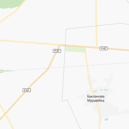
Roadmap (route) to go from Stantsiya Baklanovo to Fastiv detailed above, you can also see the course layout on the map.
While doing trip Stantsiya Baklanovo - Fastiv by car, the calculated route ends at a distance , or more straight.
Distance and duration of the route between Stantsiya Baklanovo and Fastiv
Calculation of distance and route from Fastiv to Stantsiya Baklanovo :
184.0210.6 km3h8mn
Continue onto О-251002 0h1mn 908 mTurn left onto Р-67 0h9mn 10.8 kmTurn left onto Тракторна вулиця 0h0mn 254 mTurn right onto Тракторна вулиця 0h1mn 391 mTurn left onto М-01-02 0h6mn 6.1 kmKeep left onto М-01 0h12mn 17.3 kmTurn right 1h1mn 76.6 kmKeep left onto М-01-01 0h19mn 18.2 kmTurn right onto вулиця Кіото 0h0mn 165 mTurn right onto вулиця Кіото 0h0mn 138 mTurn right onto вулиця Кіото 0h2mn 1.9 kmContinue onto проспект Леоніда Каденюка 0h1mn 489 mContinue onto проспект Леоніда Каденюка 0h0mn 25 mContinue onto проспект Леоніда Каденюка 0h13mn 10.3 kmKeep right and drive toward Одеса, Луганськ, кільцева дорога, Чернігів, Харків, столичне шосе 0h0mn 143 mKeep right 0h1mn 937 mKeep right onto Голосіївська площа 0h0mn 249 mContinue onto Васильківська вулиця 1h32mn 37.4 kmKeep right 0h0mn 272 mKeep left 0h0mn 173 mKeep left 0h1mn 1.1 kmKeep right 0h0mn 202 mKeep right 0h0mn 62 mContinue onto М-05-02 0h0mn 171 mKeep left onto М-05-02 0h23mn 22.2 kmAt roundabout, take exit 2 onto Фастівецька вулиця 0h2mn 2.1 kmTurn left onto вулиця Галафеєва 0h1mn 866 mTurn right onto Соборна вулиця 0h1mn 886 mTurn left onto Заводська вулиця 0h0mn 154 mTurn right 0h0mn 46 mArrive at destination 0h0mn 0 m
Travel from Stantsiya Baklanovo (Kyiv) to a selection of major cities.
Distances from Stantsiya Baklanovo to biggest cities in Chernihiv
Other major cities in country :
- Zhytomyr [27], 282,192 inhabitants. 233 km
- Horlivka [05], 278,550 inhabitants. 586 km
- Rivne [19], 255,106 inhabitants. 375 km
- Kropyvnytskyi [10], 249,454 inhabitants. 330 km
- Kamianske [04], 248,575 inhabitants. 396 km
- Chernivtsi [03], 236,250 inhabitants. 526 km
- Ternopil [22], 235,676 inhabitants. 463 km
- Kremenchuk [18], 227,494 inhabitants. 298 km
- Lutsk [24], 213,661 inhabitants. 432 km
- Ivano-Frankivsk [06], 204,200 inhabitants. 554 km
- Bila Tserkva [13], 199,163 inhabitants. 203 km
- Kramators'k [05], 173,700 inhabitants. 530 km
- Melitopol [26], 158,000 inhabitants. 584 km
- Kerch [11], 148,932 inhabitants. 771 km
- Nikopol [04], 130,500 inhabitants. 479 km
- Syevyerodonets'k [14], 130,000 inhabitants. 573 km
- Sloviansk [05], 124,800 inhabitants. 525 km
- Berdyansk [26], 118,284 inhabitants. 649 km
- Uzhgorod [25], 117,878 inhabitants. 724 km
- Alchevs'k [14], 116,000 inhabitants. 622 km
Route from Fastiv to major cities (Ukraine).
- Distance Fastiv Kyiv60 km
- Distance Fastiv Kharkiv453 km
- Distance Fastiv Dnipro413 km
- Distance Fastiv Donetsk619 km
- Distance Fastiv Odessa405 km
- Distance Fastiv Zaporizhia460 km
- Distance Fastiv Lviv423 km
- Distance Fastiv Kryvyi Rih349 km
- Distance Fastiv Mykolayiv379 km
- Distance Fastiv Mariupol652 km
- Distance Fastiv Luhansk702 km
- Distance Fastiv Sevastopol669 km
- Distance Fastiv Khmelnytskyi222 km
- Distance Fastiv Makiyivka626 km
- Distance Fastiv Vinnytsia140 km
- Distance Fastiv Simferopol651 km
- Distance Fastiv Kherson430 km
- Distance Fastiv Poltava336 km
- Distance Fastiv Chernihiv186 km
- Distance Fastiv Cherkasy170 km
Nearest cities to Stantsiya Baklanovo :
- Kyiv, 2,797,553 inhabitants. 126 km
- Vinnytsia, 352,115 inhabitants. 322 km
- Chernihiv, 307,684 inhabitants. 14 km
- Cherkasy, 297,568 inhabitants. 227 km
- Zhytomyr, 282,192 inhabitants. 233 km
- Kropyvnytskyi, 249,454 inhabitants. 330 km
- Kremenchuk, 227,494 inhabitants. 298 km
- Bila Tserkva, 199,163 inhabitants. 203 km
- Oleksandriya, 103,000 inhabitants. 329 km
- Konotop, 91,798 inhabitants. 125 km
- Brovary, 88,506 inhabitants. 110 km
- Uman, 87,658 inhabitants. 310 km
- Berdychiv, 86,250 inhabitants. 262 km
- Shostka, 85,432 inhabitants. 149 km
- Nizhyn, 75,499 inhabitants. 53 km
- Smila, 67,530 inhabitants. 247 km
- Korosten', 65,000 inhabitants. 202 km
- Pryluky, 62,823 inhabitants. 114 km
- Boryspil', 55,000 inhabitants. 124 km
- Lubny, 52,600 inhabitants. 192 km
- Horishni Plavni, 51,740 inhabitants. 311 km
- Fastiv, 51,143 inhabitants. 184 km
- Romny, 48,570 inhabitants. 161 km
- Svitlovods'k, 47,946 inhabitants. 294 km
- Bucha, 42,279 inhabitants. 130 km
- Myrhorod, 41,377 inhabitants. 223 km
- Irpin, 40,789 inhabitants. 131 km
- Vasylkiv, 39,700 inhabitants. 159 km
- Pereyaslav-Khmel'nyts'kyy, 36,527 inhabitants. 151 km
- Hlukhiv, 35,387 inhabitants. 174 km
- Boyarka, 34,631 inhabitants. 147 km
- Vyshneve, 33,183 inhabitants. 138 km
- Obukhiv, 31,557 inhabitants. 158 km
- Znomenka, 28,318 inhabitants. 315 km
- Zolotonosha, 27,722 inhabitants. 200 km
- Malyn, 27,068 inhabitants. 170 km
- Kaniv, 25,666 inhabitants. 186 km
- Kozyatyn, 25,645 inhabitants. 265 km
- Korostyshiv, 25,099 inhabitants. 208 km
- Slavutych, 25,000 inhabitants. 51 km
- Haisyn, 24,687 inhabitants. 326 km
- Krolevets', 24,115 inhabitants. 136 km
- Bakhmach, 23,379 inhabitants. 101 km
- Yahotyn, 22,779 inhabitants. 130 km
- Hadyach, 22,667 inhabitants. 214 km
- Vyshhorod, 22,080 inhabitants. 115 km
- Ladyzhyn, 21,393 inhabitants. 343 km
- Putyvl', 20,000 inhabitants. 169 km
- Vatutine, 19,407 inhabitants. 270 km
- Kalynivka, 19,315 inhabitants. 301 km
Location Stantsiya Baklanovo (Chernihiv) :
| Country flag |  |
| Location | Stantsiya Baklanovo |
| State | Chernihiv |
| County | |
| Country | Ukraine |
| Country code / ISO 2 | UA |
| Latitude | 51.4259900 |
| Longitude | 31.4360900 |
| Altitude | 0 meters |
| Time zone | Europe/Kiev |
Location Fastiv (Kyiv) :
| Country flag | |
| Location | Fastiv |
| State | Kyiv |
| County | |
| Country | Ukraine |
| Country code / ISO 2 | UA |
| Latitude | 50.0767000 |
| Longitude | 29.9177000 |
| Altitude | 0 meters |
| Time zone | Europe/Kiev |