
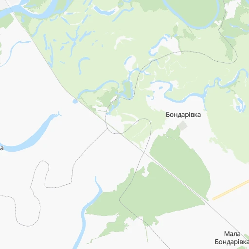
How to get from Stantsiya Bondarivka (Chernihiv) to Nosivka (Chernihiv)
Calculate route from Stantsiya Bondarivka (Chernihiv, Ukraine) to Nosivka (Chernihiv, Ukraine).
The flight distance (as the crow flies) between Stantsiya Bondarivka and Nosivka is 78.8 km.
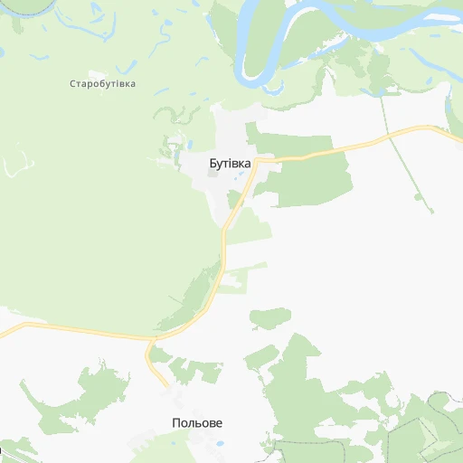
Roadmap (route) to go from Stantsiya Bondarivka to Nosivka detailed above, you can also see the course layout on the map.
While doing trip Stantsiya Bondarivka - Nosivka by car, the calculated route ends at a distance , or more straight.
Distance and duration of the route between Stantsiya Bondarivka and Nosivka
Calculation of distance and route from Nosivka to Stantsiya Bondarivka :
78.8102.7 km2h52mn
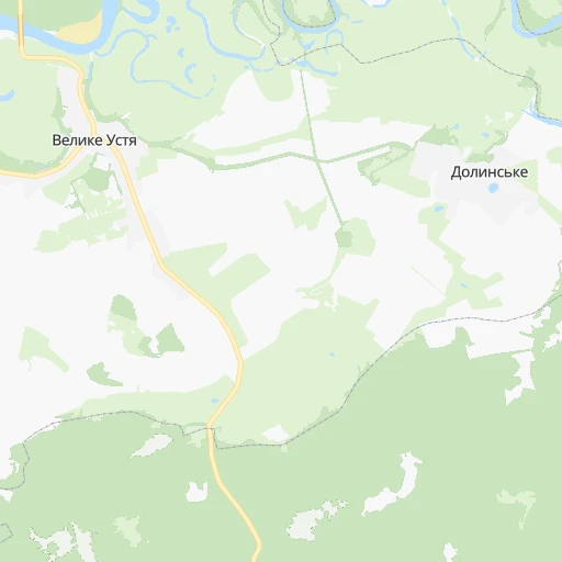
Continue 0h2mn 998 mTurn sharp left 0h0mn 205 mKeep left 0h2mn 797 mKeep right 0h9mn 4.4 kmTurn left onto О-250307 0h1mn 553 mTurn right onto С-250314 0h5mn 4.2 kmTurn left onto С-250314 0h8mn 7.0 kmTurn left 0h5mn 4.0 kmAt roundabout, take exit 2 onto вулиця Семена Палія 0h0mn 178 mTurn right 0h0mn 216 mTurn left onto вулиця Шевченка 0h0mn 205 mTurn right onto вулиця Незалежності 0h1mn 823 mKeep right onto вулиця Незалежності 0h2mn 882 mKeep right onto Покровська вулиця 0h0mn 101 mKeep left onto Покровська вулиця 0h0mn 191 mTurn slight right 0h5mn 2.3 kmTurn right onto М-02 0h23mn 31.2 kmTurn left onto О-251209 0h12mn 9.8 kmTurn left 0h2mn 2.0 kmAt roundabout, take exit 2 onto вулиця Станіслава Прощенка 0h1mn 833 mTurn right onto Широкомагерська вулиця 0h0mn 348 mTurn left onto Чернігівська вулиця 0h1mn 895 mTurn right onto Набережна вулиця 0h1mn 759 mContinue onto вулиця Шевченка 0h2mn 1.4 kmAt roundabout, take exit 2 onto вулиця Шевченка 0h2mn 1.5 kmTurn right onto вулиця Носівський Шлях 0h3mn 3.2 kmKeep left onto Р-67 0h0mn 390 mContinue onto Т-25-26 0h22mn 22.0 kmTurn left onto вулиця Перемоги 0h1mn 423 mTurn left onto Буняківська вулиця 0h1mn 926 mTurn left onto Вокзальна вулиця 0h0mn 45 mArrive at destination 0h0mn 0 m
Travel from Stantsiya Bondarivka (Chernihiv) to a selection of major cities.
Distances from Stantsiya Bondarivka to biggest cities in Chernihiv
Other major cities in country :
- Zhytomyr [27], 282,192 inhabitants. 293 km
- Horlivka [05], 278,550 inhabitants. 528 km
- Rivne [19], 255,106 inhabitants. 443 km
- Kropyvnytskyi [10], 249,454 inhabitants. 322 km
- Kamianske [04], 248,575 inhabitants. 358 km
- Chernivtsi [03], 236,250 inhabitants. 580 km
- Ternopil [22], 235,676 inhabitants. 526 km
- Kremenchuk [18], 227,494 inhabitants. 269 km
- Lutsk [24], 213,661 inhabitants. 500 km
- Ivano-Frankivsk [06], 204,200 inhabitants. 615 km
- Bila Tserkva [13], 199,163 inhabitants. 241 km
- Kramators'k [05], 173,700 inhabitants. 472 km
- Melitopol [26], 158,000 inhabitants. 550 km
- Kerch [11], 148,932 inhabitants. 737 km
- Nikopol [04], 130,500 inhabitants. 450 km
- Syevyerodonets'k [14], 130,000 inhabitants. 511 km
- Sloviansk [05], 124,800 inhabitants. 465 km
- Berdyansk [26], 118,284 inhabitants. 606 km
- Uzhgorod [25], 117,878 inhabitants. 787 km
- Alchevs'k [14], 116,000 inhabitants. 562 km
Route from Nosivka to major cities (Ukraine).
- Distance Nosivka Kyiv92 km
- Distance Nosivka Kharkiv347 km
- Distance Nosivka Dnipro371 km
- Distance Nosivka Donetsk554 km
- Distance Nosivka Odessa500 km
- Distance Nosivka Zaporizhia434 km
- Distance Nosivka Lviv550 km
- Distance Nosivka Kryvyi Rih361 km
- Distance Nosivka Mykolayiv442 km
- Distance Nosivka Mariupol609 km
- Distance Nosivka Luhansk615 km
- Distance Nosivka Sevastopol721 km
- Distance Nosivka Khmelnytskyi368 km
- Distance Nosivka Makiyivka560 km
- Distance Nosivka Vinnytsia291 km
- Distance Nosivka Simferopol691 km
- Distance Nosivka Kherson482 km
- Distance Nosivka Poltava258 km
- Distance Nosivka Cherkasy171 km
- Distance Nosivka Sumy226 km
Nearest cities to Stantsiya Bondarivka :
- Kyiv, 2,797,553 inhabitants. 170 km
- Dnipro, 1,032,822 inhabitants. 377 km
- Poltava, 317,847 inhabitants. 251 km
- Chernihiv, 307,684 inhabitants. 80 km
- Cherkasy, 297,568 inhabitants. 221 km
- Sumy, 294,456 inhabitants. 174 km
- Kropyvnytskyi, 249,454 inhabitants. 322 km
- Kamianske, 248,575 inhabitants. 358 km
- Kremenchuk, 227,494 inhabitants. 269 km
- Bila Tserkva, 199,163 inhabitants. 241 km
- Oleksandriya, 103,000 inhabitants. 308 km
- Konotop, 91,798 inhabitants. 57 km
- Brovary, 88,506 inhabitants. 150 km
- Uman, 87,658 inhabitants. 335 km
- Shostka, 85,432 inhabitants. 88 km
- Nizhyn, 75,499 inhabitants. 55 km
- Novomoskovs'k, 73,100 inhabitants. 368 km
- Smila, 67,530 inhabitants. 246 km
- Pryluky, 62,823 inhabitants. 90 km
- Boryspil', 55,000 inhabitants. 156 km
- Lubny, 52,600 inhabitants. 160 km
- Horishni Plavni, 51,740 inhabitants. 280 km
- Fastiv, 51,143 inhabitants. 230 km
- Okhtyrka, 49,818 inhabitants. 212 km
- Romny, 48,570 inhabitants. 103 km
- Svitlovods'k, 47,946 inhabitants. 268 km
- Bucha, 42,279 inhabitants. 182 km
- Myrhorod, 41,377 inhabitants. 180 km
- Irpin, 40,789 inhabitants. 181 km
- Vasylkiv, 39,700 inhabitants. 201 km
- Pereyaslav-Khmel'nyts'kyy, 36,527 inhabitants. 164 km
- Hlukhiv, 35,387 inhabitants. 107 km
- Boyarka, 34,631 inhabitants. 192 km
- Vyshneve, 33,183 inhabitants. 183 km
- Obukhiv, 31,557 inhabitants. 193 km
- Znomenka, 28,318 inhabitants. 300 km
- Zolotonosha, 27,722 inhabitants. 195 km
- Lebedyn, 27,695 inhabitants. 170 km
- Kaniv, 25,666 inhabitants. 196 km
- Slavutych, 25,000 inhabitants. 119 km
- Krolevets', 24,115 inhabitants. 68 km
- Bakhmach, 23,379 inhabitants. 38 km
- Yahotyn, 22,779 inhabitants. 134 km
- Hadyach, 22,667 inhabitants. 159 km
- Vyshhorod, 22,080 inhabitants. 164 km
- Piatykhatky, 20,459 inhabitants. 345 km
- Putyvl', 20,000 inhabitants. 101 km
- Vatutine, 19,407 inhabitants. 283 km
- Zvenihorodka, 19,161 inhabitants. 279 km
- Korsun-Shevchenkivskyi, 19,000 inhabitants. 236 km
Location Stantsiya Bondarivka (Chernihiv) :
| Country flag |  |
| Location | Stantsiya Bondarivka |
| State | Chernihiv |
| County | |
| Country | Ukraine |
| Country code / ISO 2 | UA |
| Latitude | 51.4032300 |
| Longitude | 32.4280500 |
| Altitude | 0 meters |
| Time zone | Europe/Kiev |
Location Nosivka (Chernihiv) :
| Country flag | |
| Location | Nosivka |
| State | Chernihiv |
| County | |
| Country | Ukraine |
| Country code / ISO 2 | UA |
| Latitude | 50.9315200 |
| Longitude | 31.5828200 |
| Altitude | 0 meters |
| Time zone | Europe/Kiev |