

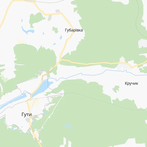


How to get from Huty (Kharkiv) to Pokrovsk (Donetsk)
Calculate route from Huty (Kharkiv, Ukraine) to Pokrovsk (Donetsk, Ukraine).
The flight distance (as the crow flies) between Huty and Pokrovsk is 244.8 km.
Roadmap (route) to go from Huty to Pokrovsk detailed above, you can also see the course layout on the map.
While doing trip Huty - Pokrovsk by car, the calculated route ends at a distance , or more straight.
Distance and duration of the route between Huty and Pokrovsk
Calculation of distance and route from Pokrovsk to Huty :
244.8309.2 km5h13mn
Continue 0h2mn 1.1 kmContinue onto вулиця Миру 0h0mn 291 mTurn left onto Первухінська вулиця 0h13mn 10.9 kmTurn left onto Т-21-06 0h8mn 7.6 kmTurn right onto О-210412 0h8mn 6.5 kmTurn right onto Слобідська вулиця 0h16mn 13.6 kmTurn right onto Привокзальна вулиця 0h1mn 977 mTurn left onto Центральна вулиця 0h11mn 9.5 kmTurn left onto Ков’язька вулиця 0h0mn 111 mTurn right onto Ков’язька вулиця 0h1mn 789 mTurn left onto Григорія Сковороди проспект 0h22mn 20.9 kmTurn sharp left and drive toward Полтава, Київ 0h2mn 3.9 kmTurn right 0h0mn 104 mTurn slight left onto М-18 0h8mn 9.3 kmTurn right onto Р-51 1h45mn 49.5 kmTurn left onto Р-51, Т-21-10 0h1mn 1.1 kmTurn right 0h0mn 42 mTurn right onto Харківська вулиця 0h1mn 1.1 kmAt roundabout, take exit 2 onto Р-51 1h49mn 53.5 kmTurn left onto Івана Середи вулиця 0h6mn 6.2 kmTurn left onto Миру вулиця 0h5mn 4.6 kmTurn right onto Т-21-21 0h0mn 129 mTurn left onto Т-21-21 0h14mn 13.9 kmTurn left onto Свободи вулиця 0h10mn 9.6 kmTurn right onto Т-21-21 0h7mn 6.5 kmKeep right onto С050112 0h9mn 7.1 kmTurn right onto С050112 0h8mn 6.7 kmTurn right onto О0503 0h7mn 5.4 kmContinue 0h11mn 11.1 kmTurn sharp right onto Т-05-15 0h5mn 4.8 kmAt roundabout, take exit 2 onto Т-05-15 0h16mn 15.5 kmTurn right onto О0518 0h4mn 4.5 kmKeep right onto О0518 0h1mn 622 mTurn right 0h21mn 17.9 kmTurn right onto Шмідта вулиця 0h0mn 84 mTurn sharp left onto М-30 0h1mn 1.1 kmTurn left onto Прокоф'єва вулиця 0h3mn 2.3 kmTurn right onto Європейська вулиця 0h0mn 171 mTurn right 0h0mn 19 mArrive at destination 0h0mn 0 m
Travel from Huty (Donetsk) to a selection of major cities.
Distances from Huty to biggest cities in Kharkiv
Other major cities in country :
- Zhytomyr [27], 282,192 inhabitants. 477 km
- Horlivka [05], 278,550 inhabitants. 280 km
- Rivne [19], 255,106 inhabitants. 650 km
- Kropyvnytskyi [10], 249,454 inhabitants. 289 km
- Kamianske [04], 248,575 inhabitants. 190 km
- Chernivtsi [03], 236,250 inhabitants. 715 km
- Ternopil [22], 235,676 inhabitants. 704 km
- Kremenchuk [18], 227,494 inhabitants. 184 km
- Lutsk [24], 213,661 inhabitants. 713 km
- Ivano-Frankivsk [06], 204,200 inhabitants. 781 km
- Bila Tserkva [13], 199,163 inhabitants. 378 km
- Kramators'k [05], 173,700 inhabitants. 224 km
- Melitopol [26], 158,000 inhabitants. 366 km
- Kerch [11], 148,932 inhabitants. 539 km
- Nikopol [04], 130,500 inhabitants. 295 km
- Syevyerodonets'k [14], 130,000 inhabitants. 262 km
- Sloviansk [05], 124,800 inhabitants. 216 km
- Berdyansk [26], 118,284 inhabitants. 390 km
- Uzhgorod [25], 117,878 inhabitants. 961 km
- Alchevs'k [14], 116,000 inhabitants. 312 km
Route from Pokrovsk to major cities (Ukraine).
- Distance Pokrovsk Kyiv539 km
- Distance Pokrovsk Kharkiv201 km
- Distance Pokrovsk Dnipro159 km
- Distance Pokrovsk Odessa525 km
- Distance Pokrovsk Zaporizhia156 km
- Distance Pokrovsk Lviv974 km
- Distance Pokrovsk Kryvyi Rih285 km
- Distance Pokrovsk Mykolayiv415 km
- Distance Pokrovsk Luhansk161 km
- Distance Pokrovsk Sevastopol497 km
- Distance Pokrovsk Khmelnytskyi756 km
- Distance Pokrovsk Vinnytsia646 km
- Distance Pokrovsk Simferopol438 km
- Distance Pokrovsk Kherson388 km
- Distance Pokrovsk Poltava242 km
- Distance Pokrovsk Chernihiv554 km
- Distance Pokrovsk Cherkasy396 km
- Distance Pokrovsk Sumy340 km
- Distance Pokrovsk Zhytomyr655 km
- Distance Pokrovsk Rivne833 km
Nearest cities to Huty :
- Kharkiv, 1,430,885 inhabitants. 66 km
- Dnipro, 1,032,822 inhabitants. 189 km
- Donetsk, 1,024,700 inhabitants. 295 km
- Zaporizhia, 796,217 inhabitants. 258 km
- Kryvyi Rih, 652,380 inhabitants. 288 km
- Makiyivka, 376,610 inhabitants. 298 km
- Poltava, 317,847 inhabitants. 85 km
- Sumy, 294,456 inhabitants. 96 km
- Horlivka, 278,550 inhabitants. 280 km
- Kamianske, 248,575 inhabitants. 190 km
- Kremenchuk, 227,494 inhabitants. 184 km
- Kramators'k, 173,700 inhabitants. 224 km
- Nikopol, 130,500 inhabitants. 295 km
- Sloviansk, 124,800 inhabitants. 216 km
- Pavlohrad, 115,932 inhabitants. 183 km
- Yenakiyeve, 104,101 inhabitants. 297 km
- Oleksandriya, 103,000 inhabitants. 231 km
- Konotop, 91,798 inhabitants. 196 km
- Kostyantynivka, 91,259 inhabitants. 247 km
- Shostka, 85,432 inhabitants. 233 km
- Bakhmut, 80,500 inhabitants. 257 km
- Novomoskovs'k, 73,100 inhabitants. 168 km
- Pokrovsk, 68,263 inhabitants. 245 km
- Khartsyz'k, 64,000 inhabitants. 309 km
- Pryluky, 62,823 inhabitants. 217 km
- Druzhkivka, 62,315 inhabitants. 231 km
- Lozova, 62,311 inhabitants. 155 km
- Energodar, 55,800 inhabitants. 299 km
- Izyum, 53,778 inhabitants. 171 km
- Lubny, 52,600 inhabitants. 170 km
- Horishni Plavni, 51,740 inhabitants. 177 km
- Zhovti Vody, 51,559 inhabitants. 241 km
- Marhanets', 50,443 inhabitants. 284 km
- Okhtyrka, 49,818 inhabitants. 38 km
- Myrnohrad, 49,646 inhabitants. 246 km
- Romny, 48,570 inhabitants. 150 km
- Svitlovods'k, 47,946 inhabitants. 196 km
- Toretsk, 41,758 inhabitants. 265 km
- Myrhorod, 41,377 inhabitants. 127 km
- Yasynuvata, 37,600 inhabitants. 288 km
- Chuhuyiv, 36,519 inhabitants. 101 km
- Dobropillya, 35,977 inhabitants. 225 km
- Avdiyivka, 35,826 inhabitants. 282 km
- Hlukhiv, 35,387 inhabitants. 199 km
- Tokmak, 34,926 inhabitants. 322 km
- Dolyns'ka, 34,267 inhabitants. 295 km
- Kupjansk, 32,449 inhabitants. 168 km
- Synel'nykove, 31,900 inhabitants. 203 km
- Balakliya, 31,156 inhabitants. 131 km
- Pervomays'kyy, 30,000 inhabitants. 104 km
Location Huty (Kharkiv) :
| Country flag |  |
| Location | Huty |
| State | Kharkiv |
| County | |
| Country | Ukraine |
| Country code / ISO 2 | UA |
| Latitude | 50.1407000 |
| Longitude | 35.3658700 |
| Altitude | 0 meters |
| Time zone | Europe/Kiev |
Location Pokrovsk (Donetsk) :
| Country flag | |
| Location | Pokrovsk |
| State | Donetsk |
| County | Krasnoarmiys’ka Mis’krada |
| Country | Ukraine |
| Country code / ISO 2 | UA |
| Latitude | 48.2819800 |
| Longitude | 37.1758500 |
| Altitude | 0 meters |
| Time zone | Europe/Kiev |